
Where Flight Simulation Enthusiasts Gather from Around the World!
AVSIM Library - Search Results

| Category: Prepar3D V1-4 - Scenery | |
| KBNA - Nashville Tennessee USA International Airport |

|
Images related to this file:
File Description:
Nashville Tennessee International Airport for P3D. Originally created for FSX, this airport has been converted to work in P3D. Several improvements have been made to the default airport. The default terminal buildings have been replaced with buildings created in FSDS; there are custom built hangars in the Embraer maintenance area, also created in FSDS; aircraft gates have been correctly coded and named using Airport Design Editor 1.76.6582; a new airport vehicle network has been built; extra fuel trucks have been added throughout the airport; the tower view has been changed to display from the roof of the control tower; all taxiway designators are correct and all taxiway signs are correctly placed and named; there is the option to open all runways to AI traffic; the FedEx and UPS cargo areas are modeled, as well as the Embraer maintenance area; and Jim Dhaenen's excellent ramp lights are also included. Please refer to the README FIRST.txt file to insure proper installation of all files.
| Filename: | KBNA__Nashville_Tennessee_USA_International_Airpor.zip |
| License: | Freeware, limited distribution |
| Added: | 20th April 2018, 23:57:58 |
| Downloads: | 1,292 |
| Author: | Patrick Finch |
| Size: | 5.47 MB |
| Category: Flight Simulator X - Scenery | |
| KVC - King Cove Airport - Alaska, USA |
|
Images related to this file:
File Description:
King Cove Airport (IATA: KVC, ICAO: PAVC, FAA LID: KVC) is a state-owned public-use airport located four miles (6 km) northeast of the central business district of King Cove, a city in the Aleutians East Borough of the U.S. state of Alaska.
King Cove Airport has one runway (7/25) with a gravel surface measuring 3,500 x 75 ft. (1,067 x 23 m). For the 12-month period ending December 31, 2005, the airport had 1,030 aircraft operations: 71% air taxi and 29% general aviation.
Changes: Increased parking apron and turn arounds at both ends of the runway. Also added additional parking and custom models. Changes were based on 2014 construction plans.Created with Airport Design Editor 9x by ScruffyDuck Software using current FAA documentation and Google Earth measurements, this package offers a replacement for FSX's stock airport. All these enhancements are as close to the real airport as I can get with stock library objects and custom buildings.
| Filename: | KVC__King_Cove_Airport__Alaska_USA.zip |
| License: | Freeware |
| Added: | 20th December 2014, 00:02:03 |
| Downloads: | 846 |
| Author: | Wayne Roberts |
| Size: | 446.46 KB |
| Category: Flight Simulator 2004 - AFCAD Files | |
| Seattle-Tacoma International Airport UPGRADE (KSEA) |
|
File Description:
(SEE ZIPDIVE FOR SCREENSHOTS)
This is an upgrade of the default scenery using Airport Design Editor (ADE). I tried making this as close as possible to the real thing with the help of Google Earth and FlightAware, determining which gates are occupied by which airlines, and what aircraft types typically occupied the gate (i.e., having enough space for those jumbos).
You'll find the following additions in this afcad scenery:
-Expanded concourse A to hold up to 14 gates
-Jetways/gates added to concourse D
-The new third runway to the West (with an exclusion to keep trees out of the runway)
-Extra overnight parking
-Many of the default jetways too tall for most of the aircraft arriving at SEA replaced with shorter jetways for small narrowbodies
and 757s (rwy12 jetways I believe, hope there's no problem with using them)
-Updated location of airlines at each gate (to the best of my ability and resources...)
-That lounge building that sits on top of concourse A (using generic buildings).
| Filename: | SeattleTacoma_International_Airport_UPGRADE_KSEA.zip |
| License: | Freeware |
| Added: | 4th August 2017, 13:05:25 |
| Downloads: | 1,572 |
| Author: | Carlos Si |
| Size: | 12.6 MB |
| Category: Flight Simulator X - Scenery | |
| Cedar Rapids Iowa USA Eastern Iowa Airport-KCID |
|
Images related to this file:
File Description:
Cedar Rapids Iowa USA Eastern Iowa Regional Airport for FSX. Several improvements have been made to the default airport. The default terminal buildings have been replaced with buildings created in FSDS; aircraft gates have been correctly coded using Airport Design Editor 1.70.6042; a new airport vehicle network has been built to prevent airport vehicles from entering the taxiways; extra fuel trucks have been added throughout the airport; the tower view has been changed to display from the roof of the control tower; static FedEx and UPS scenery objects have been placed throughout the airport; all taxiway signs are correctly placed and all taxiway designators are correctly named; there is the option to open both runways to AI traffic; optionally, a set of GA flight plans is included using all default FSX aircraft to liven up the GA area; and Jim Dhaenen's excellent ramp lights are also included. Please read the README FIRST.txt and installation.txt files to insure proper installation of all files.
| Filename: | Cedar_Rapids_Iowa_USA_Eastern_Iowa_AirportKCID.zip |
| License: | Check within download |
| Added: | 29th September 2017, 16:54:49 |
| Downloads: | 866 |
| Author: | Patrick Finch |
| Size: | 6.34 MB |
| Category: Flight Simulator X - Scenery | |
| SCIP - Isla de Pascua & Mataveri Intl - Easter Island |
|
Images related to this file:
File Description:
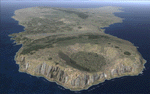
This project rebuilds Easter Island / Isla de Pascua. Mataveri Intl (SCIP) is completely overhauled, and all airport objects are aligned from satellite imagery. Landclass polygons and coastlines were meticulously hand-drawn directly from satellite imagery to provide the most detailed and accurate scenery available for this region. AI road and boat traffic is activated for the region. Accurate coastlines and road data, as well as corrected land and waterclass are provided based on the latest available satellite imagery. GA flights use default aircraft and include an option to add Chilean Air Force planes around the island. Numerous Moai (Easter Island heads) have been placed around the island according to satellite imagery. Scenery was created using Airport Design Editor X v1.61.5298, SBuilderX 3.13, and the FSX Object Placement Tool. Scenery objects were added and modified from stock FSX scenery to resemble as closely as possible the actual airports. The FSX apron lights included are from the terrific set created by Jim Dhaenens.
| Filename: | SCIP__Isla_de_Pascua__Mataveri_Intl___Easter_Islan.zip |
| License: | Freeware |
| Added: | 12th July 2014, 08:17:55 |
| Downloads: | 5,721 |
| Author: | Carlyle Sharpe |
| Size: | 5.33 MB |
| Category: Flight Simulator X - Scenery | |
| Los Roques Archipelago and Airports |
|
Images related to this file:
File Description:
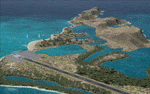
This project rebuilds Venezuela's Los Roques archipelago, adds the Gran Roque (SVRS) and Dos Mosquises (SVDM) airports, and includes AI flight plans, boat traffic, and a custom terrain mesh for Gran Roque. Accurate coastlines and lakes, as well as corrected landclass and waterclass are provided based on the latest available satellite imagery. Although current satellite imagery for this region only exists in relatively low resolution, an abundance of aerial photography was used to add custom features to Gran Roque and Dos Mosquises. Updates were created or rebuilt in a manner which carefully aligned airport data with current satellite imagery, when available. Scenery was created using Airport Design Editor X v1.50.4402, SBuilderX 3.13, and the FSX Object Placement Tool. Scenery objects were added and modified from stock FSX scenery to resemble as closely as possible the actual airports. Thank you to John Hinson and Tiago Besciak for granting permission to adapt their AI flight plans to realistically populate (SVRS) Gran Roque.
| Filename: | Los_Roques_Archipelago_and_Airports.zip |
| License: | Freeware |
| Added: | 27th July 2013, 02:34:10 |
| Downloads: | 1,394 |
| Author: | Carlyle Sharpe |
| Size: | 7.66 MB |
| Category: Flight Simulator X - Scenery | |
| A85 - Kwigillingok Airport - Alaska, USA |
|
Images related to this file:
File Description:
Kwigillingok Airport (IATA: KWK, ICAO: PAGG, FAA LID: GGV, formerly A85) is owned by the Native Village of Kwigillingok and is a public-use airport located one mile (two kilometres) northwest of the central business district of Kwigillingok, in the Bethel Census Area of the U.S. state of Alaska. There is also a nearby seaplane landing area known as Kwigillingok Seaplane Base (FAA LID: KWK).Runway 15/33 was increased from 1,835 feet and 40 feet wide to 3,300 feet and 60 feet wide. Runway 4/22 was added along with custom models. All changes were made based on the 2014 construction plans.
Created with Airport Design Editor 9x by ScruffyDuck Software using current FAA documentation and Google Earth measurements, this package offers a replacement for FSX's stock airport. All these enhancements are as close to the real airport as I can get with stock library objects and custom buildings.
| Filename: | A85__Kwigillingok_Airport__Alaska_USA.zip |
| License: | Freeware |
| Added: | 5th January 2015, 00:26:44 |
| Downloads: | 709 |
| Author: | Wayne Roberts |
| Size: | 358.61 KB |
| Category: Prepar3D V1-4 - Utilities | |
| FS Flight Builder |
|
Images related to this file:
File Description:
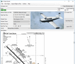
FS Flight Builder is a utility for general aviation flying that will build flight files for FSX (flt), FSX Steam Edition (flt), and Prepar3D (fxml) based on waypoints and other data either entered manually or imported from SkyVector using the Plain Text Link information. Among other things, you can select your starting position, aircraft, and a VFR or IFR flight plan.
One of the most interesting features of the application is that it will include a Briefing file, added to the aircraft's built-in kneedboard, that will include departure and destination airport information (runways, frequencies, weather, and charts) as well as navigation frequencies along the route.
Included is a new destination chooser function that allows you to enter your departure airport and additional criteria, such as min and max distance, tower required, ILS, runway length restrictions.
| Filename: | FS_Flight_Builder.zip |
| License: | Freeware |
| Added: | 30th July 2018, 03:56:07 |
| Downloads: | 148 |
| Author: | Tom Arduini |
| Size: | 28.24 MB |
| Category: Flight Simulator 2004 - AI Aircraft | |
| Kranich II Glider |
|
File Description:
This upload is one of the results of my efforts to get AI-glider traffic into FS2004. Included are an AI-version with three textures of the Kranich II for flights from airfield A to airfield B, and another AI-version of the Kranich II, tweaked in a way that it will take off from an airfield, climb while circling and then keeps endlessly circling to a max altitude of around 3000ft ASL in the surrounding of the airfield. Credits go to Wolfgang Piper for his excellent gliders which inspired me to start experimenting with AI-gliders and for giving me permission to rebuild his gliders to AI-versions. For other examples of his excellent gliders, visit his site http://www.fsglider.de
Also credits go to Alan Kaiser for the stemme.air, which I used to make the AI-versions for the Kranich II.
| Filename: | Kranich_II_Glider.zip |
| License: | Freeware, limited distribution |
| Added: | 21st July 2005, 19:15:25 |
| Downloads: | 801 |
| Author: | Bert de Bruin |
| Size: | 2.13 MB |
| Category: Flight Simulator X - Aircraft Repaints, Textures and Modifications | |
| bm_vs_p36_textpack02 |
|
File Description:
This pack contains 9 separate zip files, that contain individual repaints for the Vertigo Studios P-36 Hawk.
American Schemes:- Curtiss-Wright Hawk H-75B, Prototype, serial X17Y, Wright Field. c.1937, USAAC 23rdCG, USAAC No69, 27th PS, 1st PG,c.1939, Cleveland Air Races, USAAC No. 17 and 27th Pursuit Sqn, 20th Pursuit Group, Albrook Field, Panama Canal Zone, c.1940.
French Schemes:- No85, X8 84, 2nd Esc. GC I/4, Pilot Sgt Chef Joannes Cummel, Reims, c.June 1940, No. 88, 2nd Escadrille GC1/5, Pilot Lt Camille Plubeau, Rabat, c.1942, No. 193, 2nd Escadrille GC1/5, Pilot Cne Max VinCotte, Rabat, c.1942 and No217, 1Esc, GC I/5, Lt. E. Marin la Mesl�©e, Battle of France c.1940.
Finnish Scheme:- 'Yellow 7',CUw-557, HLeLV 32, Finnish AF, c.1941.
| Filename: | bm_vs_p36_textpack02.zip |
| License: | Freeware, limited distribution |
| Added: | 7th June 2010, 08:50:16 |
| Downloads: | 290 |
| Author: | Bruce Martin / Vertigo Studios |
| Size: | 25.74 MB |


© 2001-2026 AVSIM Online
All Rights Reserved
Privacy Policy |