
Where Flight Simulation Enthusiasts Gather from Around the World!
AVSIM Library - Search Results

| Category: Flight Simulator X - Flight Plans | |
| Current Low Altitude Military Training Route in the Southwesternl United States |

|
Images related to this file:
File Description:
FSX Flight Plans for current low altitude military training route in the Southwestern U.S. This package includes 142 individual flight plans for IFR, VFR and Slow Speed Routes. These are great routes for B-52, F-111, B-1B, B-2 A6, A4, Vulcan and any fighter or bomber enthusiasts. Of course you can fly the route with any aircraft of your choice. Also included in this package are two spectacular gauges by Karol Chlebowski for TFR flying and Pave Tack which includes many advanced features for bombing, navigation and reconnaissance. These two gauges will greatly enhance your ability to fly these challenging routes and are a great companion of the flight plans. Another option
is to download Version 2.1 of my mini panel which has all this functionality and more.
| Filename: | Current_Low_Altitude_Military_Training_Route_in_th.zip |
| License: | Freeware |
| Added: | 16th September 2011, 14:14:58 |
| Downloads: | 382 |
| Author: | Bill McClellan |
| Size: | 7.03 MB |
| Category: Flight Simulator X - Flight Plans | |
| Current Low Altitude Military Training Route in the Northeastern United States |
|
Images related to this file:
File Description:
FSX Flight Plans for current low altitude military training route in the Northeastern U.S. This package includes 196 individual flight plans for IFR, VFR and Slow Speed Routes. These are great routes for B-52, F-111, B-1B, B-2 A6, A4, Vulcan and any fighter or bomber enthusiasts. Of course you can fly the route with any aircraft of your choice. Also included in this package are two spectacular gauges by Karol Chlebowski for TFR flying and Pave Tack which includes many advanced features for bombing, navigation and reconnaissance. These two gauges will greatly enhance your ability to fly these challenging routes and are a great companion of the flight plans. Another option is to download Version 2.1 of my mini panel which has all this functionality and more.
| Filename: | Current_Low_Altitude_Military_Training_Route_in_th.zip |
| License: | Freeware |
| Added: | 15th September 2011, 14:02:30 |
| Downloads: | 418 |
| Author: | Bill McClellan |
| Size: | 7.18 MB |
| Category: Flight Simulator 2004 - Scenery | |
| Perrine Bridge, Twin Falls Idaho Updated |
|
Images related to this file:
File Description:
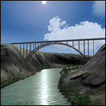
A prominent VFR landmark near Twin Falls Idaho, the Perrine Bridge spans over 1600' and stands 486 feet above the river below. At one time it was the tallest bridge in the world. Perrine Bridge is the only man-made structure in the USA were "base jumping" is allowed without a permit 365 days out of the year. Download includes gmax bridge object, a small photoscenery for the surrounding area, and two saved flight scenarios for exploring the scenery in the default J3 Cub. Bridge surface is landable and crash box has been removed allowing flight beneath the bridge. Scenery is compatible with, and nicely compliments John B. Loney's "Joslin-Magic Valley Regl" airport scenery (ktwf_v1.zip). Requires Ultimate Terrain and freeware mesh product, links provided in the readme.
| Filename: | Perrine_Bridge_Twin_Falls_Idaho_Updated.zip |
| License: | Freeware, limited distribution |
| Added: | 5th July 2011, 04:28:11 |
| Downloads: | 410 |
| Author: | Jim Robinson |
| Size: | 1.52 MB |
| Category: Flight Simulator 2004 - Scenery | |
| Even More Private Strips |
|
File Description:
Even more 'Private Strips' from around England and Wales. When combined with my previous "Private Strips Revisited" upload these will give a total of nearly 500 little airfields, which have been predominantly created to provide a source for GA and microlight ai traffic flights, without having to clutter up the more major airfields. All airfields have parking for (usually) two aircraft and associated taxiways to facilitate their coming and going.
Please note :- these sceneries have been designed for use in FS2004 with the original UK VFR Photographic scenery and mesh. They rely for details on the "usual" collections of library objects, specifically EZ-Scenery, UKVFR and Rwy12 libraries. Whilst other configurations will probably work, to a degree, you'll have to try them and see if they suit you. See the enclosed ReadMe for further details.
| Filename: | Even_More_Private_Strips.zip |
| License: | Freeware |
| Added: | 3rd August 2021, 00:59:25 |
| Downloads: | 139 |
| Author: | Chris Eve |
| Size: | 495.15 KB |
| Category: Flight Simulator 2004 - Scenery | |
| Laguna del Sauce Airport, Punta del Este (SULS), Uruguay |
|
Images related to this file:
File Description:
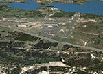
Photorealistic scenery of Laguna del Sauce / Curbelo (SULS) International Airport in Maldonado, Uruguay, version 1. This is the airport that serves the well-known beach resort of Punta del Este. This scenery package includes the airport facilities with the passenger terminal, general aviation area and the naval airbase on the banks of Laguna del Sauce lake. Several buildings and vehicles belonging to the airport have been recreated. Also included is the area around the airport recreated as photorealistic terrain with seasonal variations at a 4. 75 m/pixel resolution. Certain parts of the airport have been recreated with a 2 m/pixel photorealistic terrain. The aim of this scenery is to simulate flying to and around the airport under instrument flight rules (IFR) and also visual flight rules (VFR).
| Filename: | Laguna_del_Sauce_Airport_Punta_del_Este_SULS_Urugu.zip |
| License: | Freeware |
| Added: | 9th June 2010, 02:48:12 |
| Downloads: | 1,471 |
| Author: | "A Vuelo de Pajaro" / "As the Bird Flies" Design Group members: Diego Altgenug, Daniel Gazzano, Alan Pereira Pierce, Juan Pablo Simonet |
| Size: | 13.81 MB |
| Category: Flight Simulator X - Scenery | |
| EIWF Waterford Airport, Ireland |
|
File Description:
EIWF Waterford Airport, Ireland. Waterford Airport is a small regional airport located in the South East of Ireland. The runway is 4,701 feet in length (1,433m) so is only capable of handling GA and small jets. In 2008, Passenger numbers peaked at 144,000 and 29,811 movements were recorded. Aer Arann currently operates a twice daily service to London Southend, 4 flights a week to Luton Airport, services to Manchester and Birmingham, with a seasonal service to Galway and Lorient.
The scenery was designed to be used with vfr photographic scenery but will also work with the default terrain. It includes sound effects, local landmarks, autogen trees and buildings, full night textures, custom buildings with photo textures, custom vehicles, people, aircrew, some animations, vegetation, and the nearby business park. Please enjoy.
| Filename: | EIWF_Waterford_Airport_Ireland.zip |
| License: | Freeware |
| Added: | 15th November 2011, 02:36:44 |
| Downloads: | 2,832 |
| Author: | George Keogh |
| Size: | 40.23 MB |
| Category: Flight Simulator X - Scenery | |
| Bahamas Airfield Package (BAP) |
|
Images related to this file:
File Description:

Get the "full Bahamas"... The "Bahamas Airfield Package" contains ALL 64 airfields and airports in the Bahamas - a complete country especially (re-) designed for VFR pilots!
All required objects libraries are included in the download. Nassau Intl (MYNN) comes as a "free loan" of Menno C. Robert. Big thank you for that, Menno :-)
Look forward to an improved version of ALL Bahamian airfields with a lot of atmosphere, many details and some landclass enhancements.
Since the original FSX didn't contain all existing airfields in the Bahamas, I've added the missing 5 airports. Two of them comes along with a complete new designed island as well. A comprehensive manual is also provided. Requirements: FSX with Acceleration pack and Ultimate Terrain X - The Tropical Americas & Caribbean (= UTX-TAC)!
| Filename: | Bahamas_Airfield_Package_BAP.zip |
| License: | Freeware |
| Added: | 21st June 2013, 07:25:51 |
| Downloads: | 4,933 |
| Author: | Dirk Cremer |
| Size: | 129.09 MB |
| Category: Flight Simulator 2004 - Scenery | |
| US North Cascades Mountains and Northwest Washington Coast |
|
File Description:
The files in this package completely replace the FS default landscape of the North Cascades Mountains and coastal areas of northwestern Washington State. Between Bellingham and Arlington (N-S), Orcas Island and Lake Chelan (W-E) you can now enjoy your VFR flights with accurate locations of coastlines, lakes, rivers, streams, roads, railroads, and power lines, as well as land use type (landclass) and terrain (add-on mesh). Also added are the larger glaciers of the majestic North Cascades volcanoes and peaks as well as several forestry roads and clearcuts outside the National Park and Wilderness areas. Made mostly with Christian Fumey's "Ground2K4" and Jim Keir's "Slartibartfast". Fully compatible with the recent freeware LOD10 add-on meshes of the western US. Mesh and landclass files will work in FS2002 but not the special scenery enhancements.
| Filename: | US_North_Cascades_Mountains_and_Northwest_Washingt.zip |
| License: | Freeware, limited distribution |
| Added: | 18th May 2004, 23:12:57 |
| Downloads: | 14,320 |
| Author: | Holger Sandmann |
| Size: | 12.72 MB |
| Category: Prepar3D V1-4 - Aircraft Repaints, Textures and Modifications | |
| EL AL - Boeing 737-800 v2 (4X-EKT) |
|
Images related to this file:
File Description:

This package is a complete makeover of EL AL's previous paint scheme and updates EL AL's 737-800 fleet according to its revised 787-style livery, made with UTHD photoreal textures using hundreds of Ultra-High resolution photos taken deliberately for this projects, alongside revised cockpit textures made to match EL AL's current cockpit configuration for each specific aircraft according to the date in which this package was uploaded. This package includes EL AL's first aircraft to be painted in the revised livery: 4X-EKT, named also as "Bet Shemesh." This package includes only textures for PMDG's Boeing 737 NGX. Happy landings!
| Filename: | EL_AL__Boeing_737800_v2_4XEKT.zip |
| License: | Freeware, limited distribution |
| Added: | 13th April 2019, 03:49:26 |
| Downloads: | 641 |
| Author: | Yarden Ben-Dor |
| Size: | 29.26 MB |
| Category: Flight Simulator X - Scenery | |
| RAF Fairford 2009 for FSX |
|
File Description:
RAF Fairford 2009 for FSX. Tested on FSX & Accelleration.
An updated version of RAF Fairford 2007 which was designed for FS9 - this has a completely new layout and the 2D scenery has been built from scratch. Most of the buildings are default apart from the B2 hangars so although it pretty faithful to the modern day layout, it cannot be described as Photoreal! Tested with Horizon's GenX V2 photo scenery with which it is carefully aligned and also fits fine with the default scenery - 'CVX' files provided for use with both types of scenery. Please read the readme file for more details.
| Filename: | RAF_Fairford_2009_for_FSX.zip |
| License: | Freeware, limited distribution |
| Added: | 11th November 2009, 01:53:38 |
| Downloads: | 967 |
| Author: | Dave Morgan |
| Size: | 5.47 MB |


© 2001-2026 AVSIM Online
All Rights Reserved
Privacy Policy |