
Where Flight Simulation Enthusiasts Gather from Around the World!
AVSIM Library - Search Results

| Category: Flight Simulator X - Aircraft Repaints, Textures and Modifications | |
| Iberia Express Airbus A320 |

|
File Description:
These are "clean" textures without shadows, highlights or dirt. They are not photoreal. They are in .dds format for FSX. They will not work in FS9. Includes textures and aircraft.cfg entry. I use them as AI aircraft. To install, you will need to download the appropriate Project Airbus base models from avsim.com.
| Filename: | Iberia_Express_Airbus_A320.zip |
| License: | Freeware |
| Added: | 19th October 2013, 13:22:56 |
| Downloads: | 192 |
| Author: | Eric G Hansen |
| Size: | 1.79 MB |
| Category: Flight Simulator 2004 - Aircraft Repaints, Textures and Modifications | |
| Garuda Indonesia Boeing 747-400 PK-GSI PMDG |
|
File Description:
Repaint of the excellent PMDG's Boeing 747-400 model in Garuda Indonesia livery. In order to use this texture set, you'll need to purchase PMDG 747-400 model available at http://www.precisionmanuals.com. The repaint features High Quality textures, photoreal textures, Garuda Indonesia cabin textures and much-much more!. Please enjoy the repaint!
| Filename: | Garuda_Indonesia_Boeing_747400_PKGSI_PMDG.zip |
| License: | Freeware, limited distribution |
| Added: | 25th April 2006, 13:36:18 |
| Downloads: | 1,543 |
| Author: | Jonathan Hartana |
| Size: | 11.2 MB |
| Category: Flight Simulator 2004 - Scenery | |
| Kai Tak Airport, Hong Kong - Part 5of5 - 9Dragons |
|
File Description:
Relive Hong Kong International Airport (Kai Tak VHHX), as it was in the 1990's. Includes the areas of Kowloon, Hong Kong and Chek Lap Kok. Custom autogen and approximately 800 square miles of photoreal terrain - both day and night textures. Also includes the infamous curved IGS 'Checkerboard' Approach. A MileHigh Production.
| Filename: | Kai_Tak_Airport_Hong_Kong__Part_5of5__9Dragons.zip |
| License: | Freeware, limited distribution |
| Added: | 3rd January 2008, 17:37:36 |
| Downloads: | 32,267 |
| Author: | Marcus Thompson, Frabrizio Pascucci, Eddie Chan |
| Size: | 61.43 MB |
| Category: Prepar3D V1-4 - Scenery | |
| Loreto Marche Italy N 43.26.27 E 13.36.36 |
|
File Description:
Loreto Marche Italy (N 43.26.27 E 13.36.36) Loreto is an Italian town in the province of Ancona in the Marche region
and is famous for being the headquarters of the Basilica of the Santa Casa, one of the most important and ancient places
of Marian pilgrimage in the Catholic world. The city rises on the top of a gentle hill, with a wide countryside around
characterized by the cultivation of the olive tree. The shape of the dome and the bell tower of the Basilica, whose
top is the figure of the Madonna, stands out for its height and majesty. The Basilica houses the famous relic of the
"Holy House" of Nazareth where, according to tradition, the Virgin Mary was born and lived where he received the
announcement of the miraculous birth of Jesus. The panorama that can be enjoyed ranges from the Adriatic Sea to Monte
Conero, up to the Umbrian-Marche Apennines. Important VFR point for approaching airport Ancona Falconara. Within the
downloaded package you will find readme files for scenery installation. Good fly VFR. Pasquale Marrulli.
| Filename: | Loreto_Marche_Italy_N_432627_E_133636.zip |
| License: | Freeware |
| Added: | 4th May 2018, 04:42:54 |
| Downloads: | 163 |
| Author: | Pasquale Marrulli |
| Size: | 19.22 KB |
| Category: Prepar3D V1-4 - Scenery | |
| Valdez Alaska USA N61.06.53 W146.19.52 and Tatitlek Alaska USA N6052.00 W146.41.37 |
|
File Description:
Valdez Alaska USA N61.06.53 W146.19.52 The town is positioned at the head of a fjord on the eastern side of the Prince William Strait (at the end of the Valdez bay). It is surrounded by the Chugach mountains with many glaciers and peaks up to 2100 m above sea level. Although the northernmost port in North America is free of ice all year round. It is also the northernmost point of the Pacific coastal forest located in the 107-meter hill southwest of the town called Blueberry Hill. Valdez has an ICAO PAVD airport that in the scenario in addition to the city of Valdez you will also find a small village called Tatitlek Alaska USA N6052.00 W146.41.37 with related ICAO 7KA airport airports infrastructures have been improved with the addition of a port for landing ships and seaplanes on Valdez and Tatitlek. Important VFR point for approaching airport and seairport PAVD and 7KA.
Within the downloaded package you will find readme files for scenery installation. Good fly VFR. Pasquale Marrulli.
| Filename: | Valdez_Alaska_USA_N610653_W1461952_and_Tatitlek_Al.zip |
| License: | Freeware |
| Added: | 21st May 2018, 22:35:56 |
| Downloads: | 230 |
| Author: | Pasquale Marrulli |
| Size: | 3.27 MB |
| Category: Prepar3D V1-4 - Scenery | |
| The island of Capraia N43.3.2 E9.50.13 and City |
|
File Description:
The island of Capraia N43.3.2 E9.50.13 is located in the Corsica Channel (arm of the sea on the border between the Ligurian Sea and the Tyrrhenian Sea), and is an island of volcanic origin, the third largest in the Tuscan Archipelago. It has high and rocky coasts with no beaches (sometimes in the Cala della Mortola there is a small sandy beach [5]) and a small lake basin (called Stagnone or Laghetto [6]) in the most mountainous area, with peaks along a central chain Anticamente called Aigylion Greeks and then Capraria from the Romans, the name derives from the presence of wild goats on the island, but according to another hypothesis the toponym derives from a Mediterranean theme * karpa with the meaning of «rock». It was certainly an Etruscan landing place like the other Tyrrhenian islands in the 7th century, becoming a pirate base when it was occupied by the Romans.Important VFR point for approaching fron Nord airport Isola d'Elba.
Within the downloaded package you will find readme files for scenery installation. Good fly VFR. Pasquale Marrulli.
| Filename: | The_island_of_Capraia_N4332_E95013_and_City.zip |
| License: | Freeware |
| Added: | 2nd January 2018, 17:31:32 |
| Downloads: | 154 |
| Author: | Pasquale Marrulli |
| Size: | 2.8 KB |
| Category: Prepar3D V1-4 - Scenery | |
| Sauze and Val Susa (TO) Italy N45.05.52 E7.20.35 to N45.02.01 E6.50.00 |
|
File Description:
Sauze and Val Susa (TO) Italy Abbey of San Michele della Chiusa, is an architectural complex perched on the summit of the Pirchiriano mountain, at the mouth of the valley of Susa N45.05.52 E7.20.35.
The Fort of Exilles, N45.05.59 E6.56.10 is one of the most important defensive systems in Piedmont. Its position in the middle of a stretch of the high Susa Valley made it a strategic one. Around the Fort were born through the centuries many legends, but perhaps the most famous of all, is that related to a mysterious character the Iron Mask, better described by Alexandre Dumas in the novel of the same name. The village of Sauze d'Oulx N45.02.01 E6.50.00 includes the old alpine village where a large circular hotel built in the 1960's as a holiday center for the FIAT workers in the nearby Turin and higher, the new part formed by villas and hotels. Important VFR points for approching airport airport Torino or Val di Susa.
Within the downloaded package you will find readme files for scenery installation. Good fly VFR. Pasquale Marrulli.
| Filename: | Sauze_and_Val_Susa_TO_Italy_N450552_E72035_to_N450201_E65000.zip |
| License: | Freeware |
| Added: | 4th November 2017, 16:47:39 |
| Downloads: | 175 |
| Author: | Pasquale Marrulli |
| Size: | 15.99 KB |
| Category: Flight Simulator 2002 - Scenery | |
| EGGP Liverpool John Lennon Airport V3.1 |
|
File Description:
This new version has come about as a result of over a month sitting in front of Paint Shop Pro! All the textures have been redone including the night textures (If anyone knows how to light up AI aircraft then I'd love to hear from them!).
Many new macros have been created and hence the airport now has a lot more buildings! The railway bridge has been finished and I've also created my own version of the road bridge.
I've switched tree creation to GroundMaker as this was less frame rate hugging and allowed what I consider to be a more realistic representation of the wooded areas around the airport.
The scenery is aligned to the Visual Flight / Getmapping VFR Scenery published by Just Flight and has been specifically designed to complement the add-on. You do not however need the VFR scenery to use these files!
This scenery forms part of the "UK2002 Scenery Project" co-ordinated by John Woodside - http://fsaviation.net/. Thanks also go to John and to Peter Leadbeater for the information they have supplied to me regarding the airport
| Filename: | EGGP_Liverpool_John_Lennon_Airport_V31.zip |
| License: | Freeware |
| Added: | 22nd March 2003, 02:36:29 |
| Downloads: | 2,824 |
| Author: | Paul Derbyshire |
| Size: | 3.67 MB |
| Category: Navigation and ATC - Navigation | |
| LSZS - Samedan visual approach chart v3 |
|
Images related to this file:
File Description:
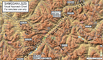
Custom made visual approach chart and pilot's briefing for Engadin (St. Moritz) Samedan LSZS airport in Switzerland, Europe's highest elevation airport (5,600 ft.) situated in the Swiss Alps. This airport is a day VFR operations only and has no instrument approach due to extreme terrain around it. A demanding visual descent into a canyon, in between steep rising terrain, is required to make the visual approaches for both runways with a steep 4.4* degrees final approach portion guided by the PAPI's. Still, executive jets up to Boeing 737(BBJ) size approach the airport often in the winter peak season VFR with these procedures. It is designed as per real operators' pilot briefing for Samedan. Real airport's full pilot briefing document also included. The real airport's excellent briefing (included) intentionally does not contain the maneuvers needed for the approach of jets through the mountains but only reporting points for all and maneuvers for light aircraft only. This gap is what this chart covers. Version 2 chart included better graphics and refined visual procedure for jets and version 3 now includes real pilot's briefing guide.
| Filename: | LSZS__Samedan_visual_approach_chart_v3.zip |
| License: | Freeware, limited distribution |
| Added: | 20th March 2015, 23:35:11 |
| Downloads: | 2,026 |
| Author: | Kyprianos Biris |
| Size: | 7.1 MB |
| Category: Prepar3D V1-4 - Scenery | |
| Beynac France N44.50.49 E1.8.77 |
|
File Description:
Beynac France N44.50.49 E1.8.77 is a small known for its medieval, austere castle, perched on top of a limestone cliff dominating the small town on the right bank of Burgundy. Château de Beynac has the shape of an irregular quadrilateral, south extended by a rocky bastion. The dongion, surmounted by merlature dates back to the 13th century. Protected by a double walled wall, the castle overlooks the Dordogne, which runs 150 meters further down. Important VFR point.
| Filename: | Beynac_France_N445049_E1877.zip |
| License: | Freeware |
| Added: | 4th January 2018, 18:16:50 |
| Downloads: | 149 |
| Author: | Pasquale Marrulli |
| Size: | 1.66 KB |


© 2001-2026 AVSIM Online
All Rights Reserved
Privacy Policy |