
Where Flight Simulation Enthusiasts Gather from Around the World!
AVSIM Library - Search Results

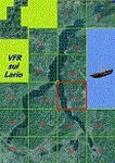
| Category: Miscellaneous Files - Miscellaneous Files | |
| Italian vfr waypoints for Plan-G/Litte Navmap |

|
File Description:
Italian vfr waypoints for Plan-G/Litte Navmap. Last update AIP Italy November 5, 2020.
Modified: A11/A12 Pisa Nord > Pisa Nord.
Canceled: Castiglioncello, Lorenzana and Pescia.
New: Montecarlo, Quiesa, Cecina and Castellina Marittima.
Support:
[email protected]
| Filename: | Italian_vfr_waypoints_for_PlanGLitte_Navmap.zip |
| License: | Freeware |
| Added: | 11th November 2020, 18:31:47 |
| Downloads: | 419 |
| Author: | Lorenzo Guidotti |
| Size: | 144.67 KB |
| Category: Flight Simulator X - Miscellaneous Files | |
| Morocco VFR - HPX (Hydro Polygons) Lakes and Dam |
|
Images related to this file:
File Description:
Natural and artificial lakes as originally created in FSX were drawn basing the drawing on low resolution data, as a result of this they tend to have an extremely approximate visualization and a very approximate and non realistic positioning in relation to the area.
This work places the natural and artificial lakes in the correct location and the elevation updated with the new terrain mesh SRTM 1 Arc Sec Global LOD 11.
Fully compatible with P3D.
| Filename: | Morocco_VFR__HPX_Hydro_Polygons_Lakes_and_Dam.zip |
| License: | Freeware |
| Added: | 19th December 2015, 23:58:02 |
| Downloads: | 951 |
| Author: | Giovanni Miduri |
| Size: | 12.44 MB |
| Category: Flight Simulator X - Scenery | |
| VFR Point San Michele City Puglia (Italy) 750m |
|
Images related to this file:
File Description:
On the promontory of Gargano in Puglia Italy at about 750 m geographic coordinates N 1.42.18 And 15.58.04 the town of Monte Sant'Angelo is known for its church dedicated to the Archangel Michael. This city is a VFR point for flight lovers. In the package you will find instructions to install the scenario on FSX and P3D.
| Filename: | VFR_Point_San_Michele_City_Puglia_Italy_750m.zip |
| License: | Freeware |
| Added: | 30th August 2017, 17:22:18 |
| Downloads: | 358 |
| Author: | Pasquale Marrulli |
| Size: | 1.53 KB |
| Category: Flight Simulator 2004 - Flight Plans | |
| VFR World Tour Lo' & Slo' along the coasts |
|
File Description:
VFR world tour along the coasts of all continents (except Antarctica). Start close to 0 degrees longitude, from London City Airport, and follow the coastlines of all countries and states that have one (sorry for Switzerland, Nepal, Chad, Paraguay and Kansas). The 300 flights take you over a distance of 259.000 Km / 140.000 nM at an average altitude of 4.700 ft. Obviously, you fly with prop planes (GA, classics, amphibians, water planes, flying boats, etc.). The flights are designed with default FS2004 scenery and the default Lockheed Vega 5B. (re-upload)
| Filename: | VFR_World_Tour_Lo__Slo_along_the_coasts.zip |
| License: | Freeware |
| Added: | 25th May 2010, 02:57:59 |
| Downloads: | 625 |
| Author: | Nis Verkijk |
| Size: | 182.69 KB |
| Category: Flight Simulator 2004 - Scenery | |
| VFR of Lario, Area A2 - Como lake, Italy |
|
Images related to this file:
File Description:
This is the seventeenth scenery, THE LAST ONE, of the "VFR of Lario" project.
This scenery covers approximately an area of 7.5x6 kmt, from the mountains over Albese con Cassano/Albavilla (NW) to Segrino small lake (NE), from Verzago/Alzate Brianza (SW) to Tabiago/Cibrone, Costa Masnaga (SE). Inside Verzago area is placed the AVL airport for gliders (LILB - Aeroclub Volovelistico Lariano).
Check video available here: http://youtu.be/r4h5PCVNMJM and https://youtu.be/huKdtYar_uQ
| Filename: | VFR_of_Lario_Area_A2__Como_lake_Italy.zip |
| License: | Freeware |
| Added: | 14th November 2013, 19:15:18 |
| Downloads: | 594 |
| Author: | Aldo Della Vedova, Daniele Lanfranchi, Gian Mario Verga |
| Size: | 16.66 MB |
| Category: Flight Simulator 2004 - Scenery | |
| VFR of Lario, Area A3 - Como lake, Italy |
|
Images related to this file:
File Description:
This scenery, 16th of the project, covers approximately an area of 7.5x6 kmt, from Corneno-Galliano-Carella-Mariaga (NW) to Valmadrera (NE), from Costa Masnaga (SW) to Colle Brianza, Nava (SE); specific buildings are included as overpasses of highway SS36 at inlet of Barro mountain and Cross at Cornizzolo mountain. Have nice flights on Como lake.
Check video available here: http://youtu.be/E4QB-HqlUt4
| Filename: | VFR_of_Lario_Area_A3__Como_lake_Italy.zip |
| License: | Freeware |
| Added: | 19th October 2013, 20:21:51 |
| Downloads: | 622 |
| Author: | Aldo Della Vedova, Daniele Lanfranchi, Gian Mario Verga |
| Size: | 12.47 MB |
| Category: Flight Simulator 2004 - Scenery | |
| VFR of Lario, Area A4 - Como lake, Italy |
|
Images related to this file:
File Description:
This 15th scenery of the project covers approximately an area of 7.5x6 kmt, from Pescate (NW) to Fracchio, Valsecca, Gromo (NE), from mountains around S. Genesio hamlet(SW) to Careggia, Opreno (SE); specific building is included as the Oggiono weir. Nice flights on Lario.
Check video available here: http://youtu.be/rDBA9_W6ci0
| Filename: | VFR_of_Lario_Area_A4__Como_lake_Italy.zip |
| License: | Freeware |
| Added: | 27th September 2013, 01:35:08 |
| Downloads: | 650 |
| Author: | Aldo Della Vedova, Daniele Lanfranchi, Gian Mario Verga |
| Size: | 10.94 MB |
| Category: Flight Simulator 2004 - Scenery | |
| VFR of Lario, Area B3 - Como lake, Italy |
|
Images related to this file:
File Description:

This 13th scenery covers approximately an area of 7.5x6 kmt, from Barni (NW) to the southern Grigna mountain (NE), from Canzo (SW) to Barro mountain (SE); some of specific buildings are included, as the Moto Guzzi rowing club (Mandello), the monument to Antonio Stoppani, the St. Nicolao church and bell tower, the Social theater with Giuseppe Garibaldi's monument, the war Memorial, the Rowing club building and the Kennedy bridge (Lecco); are included two NLC piers (Abbadia Lariana and Lecco) and the motorboat Ninfea of the NLC navigation; from Mandello to St. Martino mountain several sections of the freeway SS36 are included, with overpasses and tunnels. Some other minor boats and docks are placed alongside the lake coast.
Check video available here: http://youtu.be/EPPto_dCkSE
| Filename: | VFR_of_Lario_Area_B3__Como_lake_Italy.zip |
| License: | Freeware |
| Added: | 30th May 2013, 23:34:58 |
| Downloads: | 806 |
| Author: | Aldo Della Vedova, Daniele Lanfranchi, Gian Mario Verga |
| Size: | 24.01 MB |
| Category: Flight Simulator 2004 - Scenery | |
| VFR of Lario, Area B4 - Como lake, Italy |
|
Images related to this file:
File Description:
This 14th scenery covers approximately an area of 7.5x6 kmt, from Grignetta mountain (NW) to Culmine S. Pietro (NE), from S. Michele/Barro mountain (SW) to Fuipiano Imagna valley (SE); some of specific buildings are included (Lecco), as the Meridiana shopping center, the Azzone Visconti old bridge, the Alessandro Manzoni monument, some italian trains in the railway station and several sections of the highway SS36 with overpasses and tunnels.
Check video available here: http://youtu.be/8QPz6E7NS-U
| Filename: | VFR_of_Lario_Area_B4__Como_lake_Italy.zip |
| License: | Freeware |
| Added: | 6th September 2013, 15:27:31 |
| Downloads: | 658 |
| Author: | Aldo Della Vedova, Daniele Lanfranchi, Gian Mario Verga |
| Size: | 18.56 MB |
| Category: Flight Simulator 2004 - Scenery | |
| VFR of Lario, Area C3 - Como lake, Italy |
|
Images related to this file:
File Description:
This is the twelfth scenery of the "VFR of Lario" project, made with
photorealistic terrain (multiseason & night) and with some 3D GMax realistic objects.
This scenery covers approximately an area of 7.5x6 kmt, from Limonta (NW) to the northern Grigna mountain (NE), from Onno (SW) to southern Grigna mountain (SE); some of specific buildings are included, as the small church and Museum of Cycling (Ghisallo), villa at pier (Limonta) and interruption of the freeway overpass (Mandello del Lario ... waiting for the next B3 scenery); are included five NLC piers (Limonta, Onno, Vassena, Lierna and Mandello del Lario) and two small motorboat (Ninfea and Giglio) of the NLC navigation; there are also included six sections of the freeway SS36 with its overpasses and tunnels. Some other minor boats and docks are placed alongside the lake coast.
Check video available here: http://youtu.be/q9I5B6oF4ZY
| Filename: | VFR_of_Lario_Area_C3__Como_lake_Italy.zip |
| License: | Freeware |
| Added: | 30th April 2013, 23:20:59 |
| Downloads: | 827 |
| Author: | Aldo Della Vedova, Daniele Lanfranchi, Gian Mario Verga |
| Size: | 22.95 MB |
© 2001-2026 AVSIM Online
All Rights Reserved
Privacy Policy |