
Where Flight Simulation Enthusiasts Gather from Around the World!
AVSIM Library - Search Results

| Category: Flight Simulator 2004 - Scenery | |
| WIKD/WIOD Tanjung Pandan/Buluh Tumbang/H.A.S. Hanandjoeddin, Indonesia |

|
File Description:
Googly scenery for WIKD/WIOD Tanjung Pandan/Buluh Tumbang/H.A.S. Hanandjoeddin,
Indonesia, based on Google Earth satellite data. It is a small domestic airport
serving the island of Belitung, located about 17 miles from the main town of the
island - Tandjungpandan. The island produces mainly tin and pepper but there are
some beaches that are generating tourist traffic too.
Flight Simulator 2004 has made no provision for any traffic at this airport and
this scenery seeks to redress the situation. The airport sees daily scheduled
traffic operated by Batavia Air and Sriwijaya Air.
The scenery does not purport to be ultra-accurate. Based on poor quality
satellite imagery from Google Earth, the layout is proportionally correct but the
added airport features, such as buildings, are built from default Microsoft objects
and add-on libraries so will not look exactly like the real thing.
You are not obliged to download and install any additional scenery libraries,
but to enjoy this scenery in its entirety, you may wish to. It will work fine,
with or without.
The ICAO code for this airport has recently changed from WIKD to WIOD. The included
files allow you to either retain the old code or optionally change the airport to
use the new one.
| Filename: | WIKDWIOD_Tanjung_PandanBuluh_TumbangHAS_Hanandjoed.zip |
| License: | Freeware |
| Added: | 22nd February 2008, 09:19:27 |
| Downloads: | 1,774 |
| Author: | John Hinson |
| Size: | 64.96 KB |
| Category: Flight Simulator 2004 - Scenery | |
| VGCB Cox's Bazar, Bangladesh |
|
File Description:
Googly scenery for VGCB Cox's Bazar, Bangladesh, a small domestic airport
serving the fishing town of the same name in the Bay of Bengal, to the
south of Chittagong. It boasts extensive sandy beaches which has allowed
tourism development. The unusual name comes from Captain Hiram Cox of the
British East India Company who was appointed Superintendent of the outpost
in the late 1700s. The airport, which was originally a Pakistan Air Force
base, sees domestic flights (mostly to/from Dhaka) operated by Hawker
Siddeley 748s, de Havilland Dash 8s and Fokker Fellowship aircraft of Biman
Bangladesh Airlines, GMG Airlines, United Airways and Zoom Airlines.
Flight Simulator 2004 has made no provision for traffic with only a runway
provided and this scenery seeks to redress the situation.
The scenery does not purport to be ultra-accurate. Based on high quality
satellite imagery from Google Earth, the layout is proportionally correct but the
added airport features, such as buildings, are built from default Microsoft objects
and add-on libraries so will not look exactly like the real thing.
You are not obliged to download and install any additional scenery libraries,
but to enjoy this scenery in its entirety, you may wish to. It will work fine,
with or without.
| Filename: | VGCB_Coxs_Bazar_Bangladesh.zip |
| License: | Freeware |
| Added: | 14th April 2008, 21:13:08 |
| Downloads: | 1,352 |
| Author: | John Hinson |
| Size: | 67.71 KB |
| Category: Flight Simulator 2004 - Original Aircraft | |
| Sukhoi Su-9 'Fishpot-B' |
|
File Description:
The Sukhoi Su-9 'Fishpot-B' was the Su-7's interceptor counterpart, serving exclusively with the Soviet IA-PVO (air defence force). The tailed delta Su-9 was generally similar in configuration to the MiG-21, though larger and heavier.
This aircraft was never exported outside the Soviet Union, and saw
active duty for only a comparitively brief period before other aircraft developments moved the Su-9 into second line service.
The Su-11 all-weather interceptor was a refinement of the Su-9 with a new engine, new radar and improved armament. The Sukhoi 'FISHPOT' was withdrawn from Soviet service around 1980.
The Su-9 prototype was the T-3 experimental aircraft that had its maiden flight on May 26, 1956. About 1,000 Su-9s and a number of training two-seaters were produced until 1962. The Su-9 was added into the Soviet Air Defence Service inventory in October 1960 and remained in service until the end of 1970s.
About 30 air regiments were armed with Su-9, including 3 regiments in the Moscow Air Defence Region.
The Su-9 took part in interceptions of ultra high flying USAF U-2 reconnaissance aircraft in the early 60's.
| Filename: | Sukhoi_Su9_FishpotB.zip |
| License: | Freeware |
| Added: | 8th September 2004, 18:43:30 |
| Downloads: | 4,783 |
| Author: | B.Hoskins |
| Size: | 9.47 MB |
| Category: Flight Simulator 2004 - Scenery | |
| LFBT Tarbes/Lourdes-Pyrenees, France |
|
Images related to this file:
File Description:
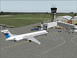
Googly scenery for LFBT Tarbes - a normally quiet airport that just sees a few
domestic flights a day but bursts into life for those of the the Catholic faith to
participate in the pilgrimage to Lourdes. At these times it is served by a
regular stream of charter flights and the airport can handle aircraft as large
as the Boeing 747. The only scheduled flights are between here and Paris, normally operated by Canadair CRJ700 craft worked by Brittany Air International on behalf of Air France, but a huge range of charter operators - mostly from Italy, Ireland, Belgium, the
United Kingdom and Germany - may be seen here at times and although seasonal this
traffic represents 80% of the airport's entire annual activity.
The scenery does not purport to be ultra-accurate. Based on less-than-perfect
satellite imagery from Google Earth, the layout is proportionally correct but the
added airport features, such as buildings, are built from default Microsoft objects
and add-on libraries so will not look exactly like the real thing. You are not obliged to download and install any additional scenery libraries, but to enjoy this scenery in its entirety, you may wish to. It will work fine, with or without.
[File re-uploaded at the request of AVSIM]
| Filename: | LFBT_TarbesLourdesPyrenees_France.zip |
| License: | Freeware |
| Added: | 4th May 2010, 15:02:30 |
| Downloads: | 7,811 |
| Author: | John Hinson |
| Size: | 73 KB |
| Category: Flight Simulator 2004 - Scenery | |
| HCMI Berbera, Somalia |
|
Images related to this file:
File Description:
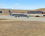
Googly scenery for HCMI Berbera, Somalia - an airport largely overlooked in
Flight Simulator 2004 with just a runway and tower provided at what is actually
the country's largest airport. At one time it had two active runways and a
strong military presence but today activity is limited to occasional
civilian flights. These scenery files add taxiways, aprons, buildings and
other airport features (and remove the non-existent tower that Microsoft
put there) so that you and your "AI" traffic can land, taxi, park and take
off in a realistic manner. This desert-surrounded airport is served three times per week by Douglas DC-9 jets of Kenyan airline African Express Airways.
The scenery does not purport to be ultra-accurate. Based on high-detail satellite
imagery from Google Earth, the layout is proportionally correct but the added
airport features, such as buildings, are built from default Microsoft objects
and add-on libraries so will not look like the real thing.
You are not obliged to download and install any additional scenery libraries,
but to enjoy this scenery in its entirety, you may wish to. It will work fine,
with or without. [File re-uploaded at request of AVSIM]
| Filename: | HCMI_Berbera_Somalia.zip |
| License: | Freeware |
| Added: | 29th May 2010, 09:26:33 |
| Downloads: | 1,317 |
| Author: | John Hinson |
| Size: | 62.07 KB |
| Category: Flight Simulator 2004 - Scenery | |
| Cape Verde Islands Domestic Airports |
|
Images related to this file:
File Description:
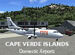
Googlyafcads and simple scenery for five airports in the Cape Verde Islands, all
of which are served by regular domestic flights of TACV - Transportes Aereos de
Cabo Verde. Each of these has been "overlooked" by Microsoft in Flight Simulator
2004 and are provided with nothing other than a runway. These scenery files add
aprons, taxiways, buildings and other airport features to Flight Simulator's bland
representation and allow you and "AI" traffic to land, taxi, park and take off
in a realistic manner.
The airports represented are: GVBA Rabil, GVMA Maio, GVSF Sao Filipe, GVSN Preguica and GVSV Sao Pedro.
The scenery does not purport to be ultra-accurate. Based on high-detail satellite
imagery from Google Earth (except Sao Filipe), the layout is proportianally correct
but the added airport features, such as buildings, are built from default Microsoft
objects and add-on libraries so will not look like the real thing. Sao Filipe is
largely imaginary owing to poor quality of the satellite image, but has been created
to be similar to other airports of like size.
You are not obliged to download and install any additional scenery libraries,
but to enjoy this scenery in its entirety, you may wish to. It will work fine,
with or without.
[File re-uploaded at request of AVSIM]
| Filename: | Cape_Verde_Islands_Domestic_Airports.zip |
| License: | Freeware |
| Added: | 15th June 2010, 01:00:46 |
| Downloads: | 6,997 |
| Author: | John Hinson |
| Size: | 84.1 KB |
| Category: Flight Simulator 2004 - Scenery | |
| SSJA Joaçaba, Brazil |
|
Images related to this file:
File Description:
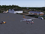
Googly scenery for SSJA Joaçaba - a small domestic airport
in the state of Santa Caterina, Brazil, that is poorly provided for in Flight
Simulator 2004. These scenery files add taxiways, aprons, buildings and other
airport features, so that you and your "AI" traffic can land, taxi, park and
take off in a realistic manner.
The small but prosperous city of Joaçaba was originally established in 1917 as
Cruzeiro and later known as Limeira and Cruzeiro do Sol, but in 1943 adopted
the current name following the introduction of legislation prohibiting cities
in Brazil using the same name - not a bad idea really. Joaçaba has a high
quality medical centre serving the state of Santa Caterina and a renowned
university which both bring traffic to the airport which is served by mainly
by LET410 aircraft of local airline NHT Linhas Aéreas.
The scenery does not purport to be ultra-accurate. Based on high-detail satellite
imagery from Google Earth, the layout is proportionally correct but the added
airport features, such as buildings, are built from default Microsoft objects
and add-on libraries so will not look exactly like the real thing.
[File re-uploaded at request of AVSIM]
| Filename: | SSJA_Joaccedilaba_Brazil.zip |
| License: | Freeware |
| Added: | 14th May 2010, 04:47:22 |
| Downloads: | 1,263 |
| Author: | John Hinson |
| Size: | 65.83 KB |
| Category: Flight Simulator 2004 - Scenery | |
| VGEG Chittagong/Shah Amanat International, Bangladesh |
|
Images related to this file:
File Description:

Googly scenery for VGEG Chittagong/Shah Amanat International (known as M A
Hannan until 2005) - an important airport in Bangladesh that is poorly provided
for in Flight Simulator 2004. These scenery files add taxiways, aprons,
buildings and other airport features, including the military area at the north
end and the general aviation ramps, so that you and your "AI" traffic can land,
taxi, park and take off in a realistic manner.
The city of Chittagong and its port are served regularly by jets ranging in size
from the Fokker 28 to the Douglas DC10 from operators like Air Arabia, Air Asia,
Biman Bangladesh Airlines, Oman Air, Thai Airways International, and turboprops of
GMG Airlines, United Airways and Zoom Airways.
The scenery does not purport to be ultra-accurate. Based on high-detail satellite
imagery from Google Earth, the layout is proportionally correct but the added
airport features, such as buildings, are built from default Microsoft objects
and add-on libraries so will not look like the real thing.
You are not obliged to download and install any additional scenery libraries,
but to enjoy this scenery in its entirety, you may wish to. It will work fine,
with or without.
[File re-uploaded at request of AVSIM]
| Filename: | VGEG_ChittagongShah_Amanat_International_Banglades.zip |
| License: | Freeware |
| Added: | 14th May 2010, 05:10:02 |
| Downloads: | 3,079 |
| Author: | John Hinson |
| Size: | 71.7 KB |
| Category: Flight Simulator 2002 - Original Aircraft | |
| Concept Design BAe C4-SST Aircraft v1.1 |
|
File Description:
Fictitious BAe C4-SST (Super Sonic Transport) operated by
IAT. Fly 10 passengers and 4 crew in idle luxury at Mach 2.0
Many animations including Pilot arms, legs and head/Yokes,
Unfolding Stairs, Working Canards, Ailerons, Elevators,
Elevons, Split Rudder, Gear, Struts, Rolling Wheels.
Full Lighting, all with individual switches. Full panel,
mostly CRT with touchscreen technology (mouse). Over 130 XML
original gauges including auto features (examples, auto
take-off and landing). Panel sounds. 13 Integrated CRT
pop-up windows, including GPS, Radios with memory banks,
Clock/Timer/Alarm, fuel computers and selectors also fuel
dump, FMC, working APU and AIRadar. Day/night HUDs.
Auto smoke, wing fog and wingtip contrails. 3D views and DVC.
Makes use of either default or FS2000 Concorde sounds.
Force Feedback levels. Additional features and custom gauges
by many well known developers.
See C4SST text for full details. Nick Pike. Enjoy.
| Filename: | Concept_Design_BAe_C4SST_Aircraft_v11.zip |
| License: | Freeware, limited distribution |
| Added: | 24th October 2002, 19:43:38 |
| Downloads: | 6,876 |
| Author: | Nick Pike |
| Size: | 9.5 MB |
| Category: Flight Simulator 2004 - Scenery | |
| Diavik Diamond Mine CDK2 |
|
Images related to this file:
File Description:
The Diavik Diamond Mine is located about 200 miles NE of Yellowknife in Canada's Northwest Territory. It a relatively new facility, having been begun production in 2003. The only means of access are by air or ice road. (If you are a James Bondian super villian plotting world domination, Diavik would be a great place for your secret underground headquarters.) This scenery is completely scratch built. In addition to the airstrip itself, I used Google Earth pics to create a photo ground texture of the adjoining facility. The buildings of the main processing complex are very simply modeled, as is the large open pit mine.
This scenery was designed for use with Ultimate Terrain and was not tested in the default scenery. (As far as I can tell, Ulimate Terrain does not affect the area around Diavik, so it should work OK.) It may or may not work in FSX.
| Filename: | Diavik_Diamond_Mine_CDK2.zip |
| License: | Freeware |
| Added: | 4th February 2011, 18:07:48 |
| Downloads: | 581 |
| Author: | Sidney Schwartz & Peter Ham |
| Size: | 994.9 KB |


© 2001-2026 AVSIM Online
All Rights Reserved
Privacy Policy |