
Where Flight Simulation Enthusiasts Gather from Around the World!
AVSIM Library - Search Results

| Category: Flight Simulator 2004 - Scenery | |
| PAIW Wales, Alaska, USA |

|
Images related to this file:
File Description:
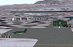
Googly scenery for Wales - a small domestic airport on the western coast of Alaska that is poorly provided for in Flight Simulator 2004. These scenery files add taxiways, aprons, buildings and other airport features, so that you and your "AI" traffic can land, taxi, park and take off in a realistic manner.
Wales is a small village with a population of just over 150 people, so the facilities at this 4000 foot gravel airstrip are fairly limited. The airport is allocated the ICAO code PAIW, although Microsoft has ignored this in Flight Simulator and uses the IATA ticket code IWK. Wales is served by light aircraft from airlines such as Bering Air, Cape Smythe Air, Frontier Flying Service, and Hageland Aviation Services. You might find it a convenient stopping-off point for a quick trip across to Russia - this is about as close as you can get and a nip across the Bering Strait will find you there in no time.
The scenery does not purport to be ultra-accurate. Based on high-detail satellite imagery from Google Earth, the layout is proportionally correct but the added airport features, such as buildings, are built from default Microsoft objects and add-on libraries so will not look like the real thing.
You are not obliged to download and install any additional scenery libraries, but to enjoy this scenery in its entirety, you may wish to. It will work fine, with or without.
[File re-uploaded at request of AVSIM]
| Filename: | PAIW_Wales_Alaska_USA.zip |
| License: | Freeware |
| Added: | 26th June 2010, 13:51:45 |
| Downloads: | 1,266 |
| Author: | John Hinson |
| Size: | 76.81 KB |
| Category: Flight Simulator 2004 - Scenery | |
| Butuan Bancasi Airport, Butuan, Philippines |
|
File Description:
This is a totally new Butuan Scenery Addon for Flight Simulator 2004. This features Multi-Level of Detail (MLOD) which makes a scenery framerate-friendly. At a distance, the objects are on its LOW POLYGON STATE. And while you get closer and closer, the objects become more and more complex, making you landing sequence unaffected by heavy framerate hit due to the High number of Polygons of the Library Objects.
Butuan Bancasi Airport Scenery (RPME) features photorealistic textures. This includes the Main Terminal Building, the Philippine Airlines Cargo warehouse, the Old Butuan Airport Cargo Warehouse, the Air Transportation Office Building, the Old Private Hangar, and the Control Tower. This scenery has full night lighting textures and has night lighting beams that illuminate the ramp from the main terminal building. Other library objects included are: Cebu Pacific baggage carts, Cebu Pacific and Philippine Airlines stairs, Airport and Ramp personnel, cars, trucks, buses, jeeps, cows and horses. But these objects do not interfere with the framerate so much because this is defined in the MLOD feature.This scenery has not been tested with FS2002 but is more likely to work without problem in that version.
Currently, Philippine Airlines serves this destination daily from Manila arriving at 12:15 p.m. and departing for Manila at 01:15 p.m. Cebu Pacific also serves this destination daily from Manila arriving at 10:25 a.m. and departing for Manila at 11:15 a.m. and thrice weekly (Mon-Wed-Sat) from Mactan, Cebu arriving at 11:50 a.m. and departing for Mactan at 12:30 p.m.
| Filename: | Butuan_Bancasi_Airport_Butuan_Philippines.zip |
| License: | Freeware |
| Added: | 24th June 2004, 05:40:52 |
| Downloads: | 6,873 |
| Author: | Ver Walter Gulfan, Philippine Flightsimmers Group |
| Size: | 8.85 MB |
| Category: Flight Simulator 2004 - Scenery | |
| Masbate Airport, Masbate, Philippines |
|
File Description:
This is a totally new Masbate Scenery Addon for Flight Simulator 2004. This features Multi-Level of Detail (MLOD) which makes a scenery framerate-friendly. At a distance, the objects are on its LOW POLYGON STATE. And while you get closer and closer, the objects become more and more complex, making you landing sequence unaffected by heavy framerate hit due to the High number of Polygons of the Library Objects.
In this scenery, you will see a total transformation from the default Masbate City area in FS2004 to a new realistic and alive Masbate City as seen in the included screenshots.
Masbate Airport Scenery (RPVJ) features photorealistic textures. This includes the Main Terminal Building, the Rancho Cuervo Verde Hangar, the Masbate Airport cargo warehouse, the Administration Building, the Crash and Fire Rescue Station, and the Control Tower. This scenery has full night lighting textures and has night lighting beams that illuminate the ramp from the firestation building. Other library objects included are: Animated Baggage Carts, Airport and Ramp personnel, ferry boats, ships, yachts, sailboats, cargo vessels, lighthouse, jeeps, cows and horses. But these objects do not interfere with the framerate so much because this is defined in the MLOD feature.This scenery has not been tested with FS2002 but is more likely to work without problem in that version except that AFCAD for FS2002 should be separately designed.
Currently, Asian Spirit serves this destination daily from Manila arriving at 7:15 a.m. and departing for Manila at 7:35 a.m.
| Filename: | Masbate_Airport_Masbate_Philippines.zip |
| License: | Freeware |
| Added: | 29th June 2004, 02:55:36 |
| Downloads: | 4,247 |
| Author: | Ver Walter Gulfan, Philippine Flightsimmers Group |
| Size: | 4.09 MB |
| Category: Flight Simulator 2004 - Sounds | |
| Realistic Boeing 757 Rolls-Royce RB211-535E4 Sound Pack |
|
File Description:
I am proud to present to you my new realistic and accurate (And probably the most realistic and accurate) Boeing 757 Rolls-Royce RB211-535E4 sound pack for Microsoft Flight Simulator 2004 and X. This is intended for use on Project Opensky's models, but should work decent on other freeware and payware 757s in FS. The interior sounds are from a passenger perspective (As if you were in first class). Once you load your aircraft with these sounds, you'll hear the APU System in the cabin. You hear the famous RB211 whistle sound at idle after you have started the engines. You spool up the engines at takeoff and then hear the buzzsaw-like sound of the RB211 engine's fans at full throttle. As you throttle down for climb power the buzzsaw intensifies like on a real plane! Pretty much every engine sound in this sound pack has been recorded from a real RB211-535E4 engine! Once you lift off and put up the landing gear, you will hear a chime from the cabin. It features realistic cockpit sounds like the autopilot deactivation siren, stall clicker, overspeed siren, gear up warning sound buzzer, flaps, rattles and bumps with tire-roll on takeoff/landing, and rattles on touch-down. I am sure that if you are a frequent Boeing 757 aircraft flyer, or if you're a pilot or flight crew on board a RB211-powered 757 aircraft, that you will be very impressed by these sounds! Give this sound pack a try, I promise you won't be disappointed!
| Filename: | Realistic_Boeing_757_RollsRoyce_RB211535E4_Sound_P.zip |
| License: | Freeware |
| Added: | 18th October 2010, 07:32:49 |
| Downloads: | 8,038 |
| Author: | Adam Murphy - Skyhigh Sound Systems |
| Size: | 101.89 MB |
| Category: Flight Simulator 2004 - Scenery | |
| Thompson CYTH in northern Manitoba, Canada |
|
Images related to this file:
File Description:
Thompson is a city with around 13,000 inhabitants, located in northern Manitoba beside the Burntwood River. It serves as the administration centre for a large area of Manitoba and has industrial activities centred around mining and the processing of mined products. The version of the airport upon which this modification is based is the original posting in 2004 by CanUK Scenery. I would have made new buildings and a totally new scenery but I have the same problem as Sid and Pete in their later Thompson scenery: almost no photos!?! The update modifies the short end of the mainly gravel runway to asphalt (it was upgraded because it is regularly used as a taxiway) and also adds a later (2010?) gravel taxiway. The other ground modifications add allocated parking spots for fire fighting CL415 planes that are in the new AI, plus a lot more ga parking. You should already have some AI that includes Calm Air to see CYTH as it really is, the HQ of Calm Air. There are other additions including car parks and the usual sundry bits and pieces that inhabit every airfield. The CL415's with Manitoba textures are adaptations of what were originally Ontario planes and included with my post of Geraldton, not the most recent post in 2013, the one in 2007. If you don't have the planes get them from my Geraldton post. The AI version was made from the original piloted version which was by Massimo Taccoli. The AI helicopter was included in my post of Alma CYTF.
| Filename: | Thompson_CYTH_in_northern_Manitoba_Canada.zip |
| License: | Freeware, limited distribution |
| Added: | 23rd September 2018, 15:24:22 |
| Downloads: | 224 |
| Author: | Roger Wensley |
| Size: | 6.4 MB |
| Category: Flight Simulator 2004 - Scenery | |
| OSM World: South America |
|
Images related to this file:
File Description:
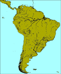
OSM World is a community project! If you wish to help, check the documentation and contact the author!
Welcome to OSM Wold: South America! This is a vector data scenery package covering the South American area. Coastlines, Rivers, lakes, roads, railways, and power lines with detail never before seen! All in an autogen-compatible density! You can see roundabouts, train terminals, harbor areas in a resolution of a point every 10 meters. At this same resolution a vectorial city class places residential (in small and big building variations, depending on surface area) and industrial areas exactly where they are supposed to be. This gives the city areas a resolution far superior to the capacity of FS-2004 default landclass bitmaps, limited to approximately 1 Km x 1 Km squares. OSM World: South America will even give you small roads leading to small towns (even a few houses across)! From big highway intersections, including ramps, to the tiniest rural pathways covering the entire South american area! Wherever in South America you fly, there is something to see!
You can enjoy this scenery near coastlines too! harbor areas and extremely detailed coastal topology (try the southern Chile). This scenery makes sure that the ocean is always flat, you can forget about the climbing water often found around photo-sceneries! This scenery is best paired with a good set of terrain meshes (like the freeware global SRTM mesh by Stephen Rothlisberger , available here: http://simviation.com/1/fs2004terrainmesh).
| Filename: | OSM_World_South_America.zip |
| License: | Freeware |
| Added: | 5th August 2015, 02:31:08 |
| Downloads: | 3,097 |
| Author: | Mario Noriega, Luis Miguel Hernandez |
| Size: | 64.37 MB |
| Category: Flight Simulator 2004 - Scenery | |
| Dawson Creek CYDQ in British Columbia, Canada UPDATED |
|
Images related to this file:
File Description:
This is a revised version of Dawson Creek CYDQ and the floats base CBD3, made primarily to provide one of the parked planes with it's textures but also to improve the apron markings and the AI. The float AI now includes Beavers and I also removed two planes that were not properly showing their textures in my current FS9 installation. The Beavers were included in my post of Nimpo Lake CAF8 and will need to be installed to show up here. This version is complete in itself and can be installed as-is if you do not have the original scenery. Dawson Creek is at 2,148 feet asl just east of the Rocky Mountains, less than 10 miles west of the BC/Alberta border and where the Rockies are at their narrowest. The population grew when the Northern Alberta Railway was extended to Dawsons Creek in 1932, and grew even more more when the Alaska Highway was built in 1942, starting from Dawsons Creek. In the 1950's the town was linked through the Rockies by a railway and a road to the BC interior, and the town grew again. Now it is static at just under 12,000 and once again has become a farming centre, with Fort St John and Grand Prairie winning out for new industry and commerce. The airport is just to the east of the town. The runway is 5,000 feet of wide asphalt (150 feet) aligned 06/24, lit, and with PAPI and approach lights. There is also a water runway for float planes, separately designated as Dawson Creek CBD3. The two effectively operate as one; traffic for both use the mandatory frequency of 122.2 and talk to one controller in one control tower. However, in FS9 the ATC for two separately designated airfields (or float fields) operates as if they are nowhere near each other and takes no notice of near misses between the two lots of planes. As a result I have put them both in un-manned tower mode so you will announce your position and intentions and select your own parking spots, either next to one of the hangars or on the grass. The aprons vary from asphalt, to concrete, onwards to gravel, and then further onwards to some gravel amid the bare dirt; I have replicated this variation as far as FS9 permits.
| Filename: | Dawson_Creek_CYDQ_in_British_Columbia_Canada_UPDAT.zip |
| License: | Freeware, limited distribution |
| Added: | 17th December 2018, 17:50:08 |
| Downloads: | 205 |
| Author: | Roger Wensley |
| Size: | 26.71 MB |
| Category: Miscellaneous Files - General Utilities | |
| P3D FSX FS2004 Flight Analyzer Utility FsQC V6.19 |
|
File Description:
Flight Data Recorder - with Logbook.
Now with a graphical Chart from the entire flight.
Also Prepar3D, FS2004 and FSX Steam supported.
Very easy to use, just make a flight plan in the simulator or in this utility. (But please read the readme.txt file)
What this program does: quickly change the settings of P3D/FSX/FS2004, such as time, date, fuel, weight, traffic etc. Start a failure sytem, such as gear, flaps, engine, etc. runway detecting system to see wich runways are in use.
Quickly look at Airport Info for all possible info such as: ILS, Radio, RW length, Elevation, etc, etc.
This is all fully freeware.
Only Limited demo for: The flight analyzing/data recording, Logbook and the PDF Flightreport.
Flight analysis start recording at the moment when you begin taxiing.
It gives you huge information such as:
- takeoff- and landing-weight.
- takeoff- and landing-roll in m. and ft.
- separate fuel consumption in taxi, climb, cruise and descent.
- maximum banking in flight.
- which speed you using the flaps and gear.
- when autopilot on or off.
- vertical speed on touchdown.
- reverser set after landing.
- wich speed you cancel reverser.
- bouncing at landing.
- graphical landingchart.
- and lots of more.
You can better look the example of the pdf document.
Requirements:
Computer with Windows7 or higher and internet access.(XP also supported look in the help/manual)
Flightsimulator P3D FSX or 2004 and FSUIPC installed.
Note: requires paid activation for full use of the Flight Analyzer.
Register and you have 1 month free.
Program fully works without registration at airport Athens and Iraklion (Greece). By Evander Tholen.
| Filename: | P3D_FSX_FS2004_Flight_Analyzer_Utility_FsQC_V619.zip |
| License: | Shareware, time limited |
| Added: | 29th July 2020, 18:39:49 |
| Downloads: | 79 |
| Author: | Evander Tholen |
| Size: | 3.9 MB |
| Category: Flight Simulator 2004 - Aircraft Repaints, Textures and Modifications | |
| VARIG Boeing 737-341 (PP-VOE) |
|
File Description:
VARIG B.737-341 PP-VOE C/N 24276-1645
Another of the original models B.737-341 builded by Boeing for VARIG(17 exemplaires builded). The 341 is the logic sucessor of the 241, the series 200 model,still in service for some routes. VARIG fleet had differents variant of the Boeing 737'(B.737-2C3Adv,B.737-241,B.737-2K9,B.737-2Q8,B.737-219,B.737-33A,B.737-36N,B.737-3K9,B.737-341,B.737-3Q8,B.737-4YO,etc)and the planes are the workhorse of the route systeme of the airline.The main technical center is located a Rio de Janeiro Antonio
Carlos Jobim(Galeao)with the most big hangar maintenance in South America.
Main hubs are Sao Paulo Guarulhos, Rio de Janeiro A.C.Jobim(Galeao),Porto Alegre Salgado Fihlo.I have included a serie of 90 Flights to the main national and international destinations,all
served with 737 and the timetable and numbers flights are the rights one of this year 2004.
Destinations are revised and actualised like in the reality(Curitiba,Porto Alegre, Ponte aereo=Rio Santos Dumont-Sao Paulo Congonhas,Foz do Iguazú,Manaus,Natal,Recife,Salvador,La Paz,Cordoba,etc.
Many flights are corrected to be acomplished with the 737 and not the Douglas DC-10(out of service by VARIG long time ago and remplaced with the MD-11,this last also to be tasked in the future to fly only cargo).
Today only two DC-10 fly cargo services with VARIG Logistica.
Also included a new complete revised AirFile for the 737-300 type(17-04-04).
| Filename: | VARIG_Boeing_737341_PPVOE.zip |
| License: | Freeware |
| Added: | 17th April 2004, 23:36:37 |
| Downloads: | 572 |
| Author: | Daniel Nole |
| Size: | 464.38 KB |
| Category: Flight Simulator 2004 - Scenery Design | |
| FSDEM 1.1 |
|
File Description:
FSDEM is a graphical tool designed to help on the editing and correction of NASA SRTM (Shuttle Radar Topography Mission) terrain elevation meshes, and to create terrain mesh scenery to be used in Microsoft Flight Simulator 2002/2004.
Program main features:
This version fixes some bugs and adds minor improvements. See the included file history.htm for details.
| Filename: | FSDEM_11.zip |
| License: | Freeware, limited distribution |
| Added: | 4th August 2004, 20:51:02 |
| Downloads: | 5,125 |
| Author: | Emerson de Oliveira |
| Size: | 377.03 KB |


© 2001-2026 AVSIM Online
All Rights Reserved
Privacy Policy |