
Where Flight Simulation Enthusiasts Gather from Around the World!
AVSIM Library - Search Results

| Category: Flight Simulator 2004 - Aircraft Repaints, Textures and Modifications | |
| Air Jamaica Airbus A320-214 (6Y-JMK) "Spirit of Mandeville" with Lighting Effects and Updated FDE |

|
File Description:
Air Jamaica was founded in late 1968 and started operations in April of 1969. It had expansive growth through the 1990's during which time the Jamaican government reduced their ownership share in the company to 25% in an effort to privatize it. However, in 2004 Air Jamaica suffered significant financial losses, so the government interceded to take back 100% ownership of the company. Air Jamaica has argueably one of the brightest, colorful liveries of any airline flying. It had not been that way until the 1990's when Air Jamaica repainted its fleet in this livery. This airframe, registration 6Y-JMK, was delivered to Air Jamaica in July of 2003 and is the newest A320 in thier fleet of 9. She bears the name "Spirit of Mandeville". This aircraft is a frequent visitor to KBOS, KBWI, KFLL, KMIA, and several other aiports in the USA. This full installation package includes the Project Airbus A320 CFM V2 model and air files, a modified FDE (with permission from Peter Binamira of Project Airbus), A320 lighting enhancements and 32-bit textures. Uses default 737-400 panel and sounds. Please see Install.txt for installation details.
| Filename: | Air_Jamaica_Airbus_A320214_6YJMK_Spirit_of_Mandevi.zip |
| License: | Freeware, limited distribution |
| Added: | 14th August 2007, 11:06:03 |
| Downloads: | 2,731 |
| Author: | Project Airbus, Jeffrey S. Bryner |
| Size: | 6.15 MB |
| Category: Flight Simulator 2004 - Aircraft Repaints, Textures and Modifications | |
| Southern Winds Boeing 737-266Adv LV-YBS 'Litoral' |
|
File Description:
Southern Winds B.737-266Adv LV-YBS"Litoral",C/N 21193-453,ex SU-AYJ,PH-TVN,SU-BBX,5Y-BHV,N193GP and LV-PNI
A old Boeing 737-200Adv with a longer career and now in service with the Argentinian Airline Southern Winds. This operator had started services to Cordoba in the year 1996 with CRJ-200ER; in 2002 were taked in service a serie of Boeing 737-200Adv and in the same year were flew the first International destinations with two B-767-200ER.(Madrid and Miami).
Today Southern Winds flight domestic destinations in Argenta(Cordoba,Bariloche,Comodoro Rivadavia,el Calafate,Iguazú,Jujuy,Mendoza,Neuquen,Resistencia,Rio Gallegos,San Martin de los Andes,etc)and only two International destinations(Madrid and Miami)with his two B.767.
I have included a serie of 30 Flights to the main national destinations,all
served with 737 and the timetable and numbers flights are the rights one of this year 2004.
Also included a new complete revised AirFile for the 737-200Adv type(09-04-04)and now you can fly the plane smooth at 35.000 ft with Mach 0.77.
| Filename: | Southern_Winds_Boeing_737266Adv_LVYBS_Litoral.zip |
| License: | Freeware |
| Added: | 13th April 2004, 03:31:34 |
| Downloads: | 170 |
| Author: | Daniel Nole |
| Size: | 355.88 KB |
| Category: Flight Simulator 2004 - Scenery | |
| Houn, Libyan (HLON/HUQ) |
|
File Description:
Googly scenery for HLON Hon, Libya, a small domestic airport serving the oasis town (which is correctly spelt Houn) about 250 miles south-east of Tripoli. It is the capital of the Al Jufrah region. Although the airport holds ICAO and IATA status, as far as I can establish there are
currently no scheduled services to this airport, so present-day traffic is limited to the occasional charter, cargo or private flight. Flight Simulator 2004 has made no provision for traffic with only a runway provided and this scenery seeks to redress the situation so that you and your "AI" traffic can use the airport. The scenery does not purport to be ultra-accurate. Based on high quality satellite imagery from Google Earth, the layout is proportionally correct but the
added airport features, such as buildings, are built from default Microsoft objects
and add-on libraries so will not look exactly like the real thing. You are not obliged to download and install any additional scenery libraries, but to enjoy this scenery in its entirety, you may wish to. It will work fine, with or without.
| Filename: | Houn_Libyan_HLONHUQ.zip |
| License: | Freeware |
| Added: | 18th April 2008, 09:51:02 |
| Downloads: | 842 |
| Author: | John Hinson |
| Size: | 65.71 KB |
| Category: Flight Simulator 2004 - Scenery | |
| DTTG Gabes, Tunisia |
|
File Description:
Googly scenery for Gabes (ICAO: DTTG), a somewhat nondescript airport
shoe-horned into one of Tunisia's largest industrial cities. Famed for
its beaches, the city hosts cement, chemical and brick factories and an
oil refinery, resulting in poor levels of air pollution. The airport is
a joint military and civilian operation although military traffic appears
to be mostly helicopter activity and the civilian traffic consists of an
ATR of Sevenair calling in once in a blue moon.
Microsoft have only provided a runway at this airport in Flight Simulator
2004 and this scenery seeks to redress the situation so that you and your
"AI" traffic can use the airport realistically.
The scenery does not purport to be ultra-accurate. Based on high quality
satellite imagery from Google Earth, the layout is proportionally correct but the
added airport features, such as buildings, are built from default Microsoft objects
and add-on libraries so will not look exactly like the real thing.
You are not obliged to download and install any additional scenery libraries,
but to enjoy this scenery in its entirety, you may wish to. It will work fine,
with or without.
| Filename: | DTTG_Gabes_Tunisia.zip |
| License: | Freeware |
| Added: | 14th October 2008, 13:18:33 |
| Downloads: | 757 |
| Author: | John Hinson |
| Size: | 83.15 KB |
| Category: Flight Simulator 2004 - Aircraft Repaints, Textures and Modifications | |
| Arik Air Boeing 737-322 (5N-MJB) 'EDDINGTON' |
|
Images related to this file:
File Description:

Arik Air is a progressive Nigerian airline incorporated in 2004 and based in Lagos, Nigeria. This was Arik's second Boeing 737, a 322 model, registration 5N-MJB and named 'EDDINGTON' repainted for your flying pleasure in the popular Wilco/FeelThere PIC 737-300 payware model. Arik Air operates a fleet of 11 737's, 2 of them, like this, are 322 models. This and the other were both aquired from United Airlines. This is the older of the 2 Arik 737-300's, manufactured in 1989. This aircraft was registered as N354UA when it flew in the United Airlines livery. The 737-300 was Arik Air's first widebody jet aircraft in their fleet, though they have just taken delivery of an Airbus A340-500 and plan to take delivery of several Boeing 777's. All repainted textures in this package are 32-bit with no mipmaps. Custom engine base textures, night textures and photoreal engine blades. This is a textures only package; you must own the Wilco/Feelthere PIC Boeing 737-300. This is a re-upload of the original file as a result of the AVSIM site compromise.
| Filename: | Arik_Air_Boeing_737322_5NMJB_EDDINGTON.zip |
| License: | Freeware, limited distribution |
| Added: | 10th May 2010, 17:45:19 |
| Downloads: | 929 |
| Author: | Wilco/Feelthere, Jeffrey S. Bryner |
| Size: | 8.93 MB |
| Category: Flight Simulator X - AFCAD Files | |
| ORER - Erbil International airport - Erbil, Iraq |
|
Images related to this file:
File Description:
ORER - Erbil International Airport, Kurdistan, Iraq. The new airport and terminal building opened on March 3, 2010 and is as such not known in FSX. The airport is built next to the old airport, previously a military field. With its short 2,800 meter runway and temporary terminal buildings, there was a great need for a new airport, not just a new terminal. The new airport has one of the world's longest runways. 4,800 meters long, 75 meters wide and equipped for ILS CAT II operations.
Using ADEx 1.51, aeronautical maps all these changes have been built into the default FSX airport now making it on par with the present situation on paper. Right, on paper! Google Earth's images are too old (2004) to offer any help regarding buildings, vegetation and surrounding areas like offices, parkings and roads. With the help of blurry pictures found on the internet this is the best rendition for now. 99% correct.
For those interested a complete technical overview of the airport including approach plates is included in this package. Please read the readme carefully for proper installation!
| Filename: | ORER__Erbil_International_airport__Erbil_Iraq.zip |
| License: | Freeware |
| Added: | 7th August 2012, 20:51:42 |
| Downloads: | 3,913 |
| Author: | Menno C. Robert |
| Size: | 8.28 MB |
| Category: Flight Simulator 2004 - Scenery | |
| MYER Rock Sound International, Eleuthera Island, Bahamas |
|
File Description:
Googly scenery for Rock Sound International (ICAO: MYER), a grand-sounding but
quiet airport located on Eleuthera Island, Bahamas. Eleuthera is a long
and thin island east of Nassau and has three commercial airports, the busiest
being Governor's Harbour. Rock Sound is at the southern end and is served twice
daily by Dash 8 turboprops of Bahamasair, along with occasional flights by
operators such as Southern Air Charter. The airport has seen busier days and
was once even served from Europe by Alitalia.
Microsoft have only provided general aviation facilities at this airport in
Flight Simulator 2004 and this scenery seeks to redress the situation
so that you and your "AI" traffic can use the airport realistically.
The scenery does not purport to be ultra-accurate. Based on high quality
satellite imagery from Google Earth, the layout is proportionally correct but the
added airport features, such as buildings, are built from default Microsoft objects
and add-on libraries so will not look exactly like the real thing.
You are not obliged to download and install any additional scenery libraries,
but to enjoy this scenery in its entirety, you may wish to. It will work fine,
with or without.
| Filename: | MYER_Rock_Sound_International_Eleuthera_Island_Bah.zip |
| License: | Freeware |
| Added: | 13th October 2008, 11:01:56 |
| Downloads: | 1,467 |
| Author: | John Hinson |
| Size: | 61.42 KB |
| Category: Flight Simulator 2004 - Scenery | |
| ISD Milan (Bergamo) Orio al Serio - Update 2013 |
|
Images related to this file:
File Description:

Cari Amici Simmer Dear friends and lovers of the eternal FS2004, thanks to the work carried out by the Bgl Mr. Gianluca Giovannini, the tower by luca Manineti, airport objects of Mr. Andrei Visan, the upgrades from the ISD project, and the new frequency vor Fabio Iaria and the grass in 3d by MrKobbe Farwick. I tried an update of the Milan-Bergamo "Orio al Serio", the undisputed leader of the panorama Low fare in Italy. The scenery is not a new job, but an adaptation and updating of files scanrio isd 2002. In the new work will, therefore, the new tower of the city near the airport, the outline of trees along the surface of the airport, new airport objects, 3D grass, industrial buildings on the highway, night lights and a new reconstruction of the new terminal. I also realizizzato an urban area to recreate the city of Bergamo Orio al Serio and Bergmao and Alta. Compatible with AES latest version.
not assume responsibility for any errors that may occur, for information [email protected] "Fafo's air production."
A greeting and good flights - Fabio Ferrari, Castione della Presolana (BG) Italy.
Long life fs 2004! And Best regards from Italy
| Filename: | ISD_Milan_Bergamo_Orio_al_Serio__Update_2013.zip |
| License: | Freeware, limited distribution |
| Added: | 24th January 2013, 03:06:34 |
| Downloads: | 4,954 |
| Author: | Fabio Ferrari, Gianluca Giovannini, Luca Mainenti |
| Size: | 103.44 MB |
| Category: Online ATC - Software | |
| ServInfo version 2.02 |
|
File Description:
ServInfo is a utility that provides information for the on-line flying activity in the VATSIM, IVAO, FPI or any other network that uses the SquawkBox/ProController environment.
Data are downloaded from the VATSIM, IVAO, FPI or any other network and are presented in a convenient format, allowing users to easily find out details about the current on-line activity worldwide and for specific countries, FIRs, ARTCCs or airports, including details for each flight and controllers ATIS messages. This information can be displayed in both tabular and graphical format on a map display.
Additionally, ServInfo provides the possibility to display response times for all the network servers, display channel and user information for voice servers, retrieve and decode METAR & TAF reports for airports or whole regions and notify you when selected ATC positions open or close.
A ServInfo gauge is also provided, that can be installed your FS2000/2002/2004 aircraft panels and display information about ATC availability while you fly online.
Version 2.02 adds support for IVAO TeamSpeak voice servers, display of ATC bookings for all networks and display of VATSIM prefiled flight plans.
| Filename: | ServInfo_version_202.zip |
| License: | Freeware, limited distribution |
| Added: | 15th December 2003, 05:50:53 |
| Downloads: | 439,730 |
| Author: | Michael Frantzeskakis |
| Size: | 2.86 MB |
| Category: Flight Simulator 2004 - Scenery | |
| Alps LOD10 Topo Mesh - Austria and Italy |
|
Images related to this file:
File Description:
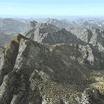
Yet another terrain mesh package of the European Alps? Well, this one is different in that it is NOT primarily based on the Shuttle Radar (SRTM) data with their incomplete coverage of prominent peaks and ridges. Instead, most of the source data for this project were developed over many months by Jonathan de Ferranti using detailed topographic maps. While Jonathan's work is unrelated to flight simulation he kindly gave me permission to compile his data for use in FS. The result is a wonderful improvement in detail and accuracy over any existing SRTM- or DTED-based mesh file, freeware or commercial (a link to an extensive set of screenshot comparisons is included in the read-me file).
I've compiled the source data at LOD10 (38-m) grid resolution because the coverage area is smaller than most existing mesh files. Thus, anyone can use these files without having to first uninstall their current mesh set. Also included are LOD9 and LO8 buffer mesh files. Note: if you own Austria Professional 2004 with its 1:50,000 scale terrain mesh then you don't need this package!
| Filename: | Alps_LOD10_Topo_Mesh__Austria_and_Italy.zip |
| License: | Freeware, limited distribution |
| Added: | 30th May 2010, 09:46:58 |
| Downloads: | 62,953 |
| Author: | Holger Sandmann, Jonathan de Ferranti |
| Size: | 73.32 MB |


© 2001-2026 AVSIM Online
All Rights Reserved
Privacy Policy |