
Where Flight Simulation Enthusiasts Gather from Around the World!
AVSIM Library - Search Results

| Category: Flight Simulator 2004 - AFCAD Files | |
| FS2004 Afcads for the East Europe Part 1 |

|
File Description:
79 afcads for Russia, Tajikistan, Ukraine, Kyrgystan etc.. Microsoft left out or wrongly placed.
Many corrections in ICAO codes and/or positioning (UDYE for instance).
This is part 1, more to come in a few weeks.
| Filename: | FS2004_Afcads_for_the_East_Europe__Part_1.zip |
| License: | Freeware |
| Added: | 28th November 2009, 01:38:53 |
| Downloads: | 691 |
| Author: | Fernand |
| Size: | 424.5 KB |
| Category: Flight Simulator 2004 - Miscellaneous Files | |
| AES configuration files for "The Ultimate 757 Collection" |
|
Images related to this file:
File Description:
These AES configuration files were designed for Qualitywings "The Ultimate 757 Collection". I made Intelliscene files for every single 757 variation included in the package.
To use these files you will need Aerosoft's AES and of course "The Ultimate 757 Collection" by Qualitywings.
| Filename: | AES_configuration_files_for_The_Ultimate_757_Colle.zip |
| License: | Freeware |
| Added: | 8th December 2009, 01:14:12 |
| Downloads: | 2,632 |
| Author: | Nicolas Moellenhoff | Qualitywings |
| Size: | 4.82 KB |
| Category: Flight Simulator 2004 - AFCAD Files | |
| FS2004 AFCAD2 Files For Eastern Europe Part 2 |
|
File Description:
A collection of 50 AFCAD files and 1 correction to EEUafcad_part 1 for Russia, Kyrgyzstan, Ukraine, Tajikistan and other CIS states. Corrections to existing default wrong ICAO codes and/or position (UOHH for instance). New airports Microsoft left out (UHMI). All positions have been checked against Google earth and AIRAC docs.
| Filename: | FS2004_AFCAD2_Files_For_Eastern_Europe_Part_2.zip |
| License: | Freeware |
| Added: | 8th December 2009, 22:26:10 |
| Downloads: | 967 |
| Author: | Fernand Verbraecken |
| Size: | 328.88 KB |
| Category: Flight Simulator 2004 - Miscellaneous Files | |
| AES configuration file for the ATR 72-500 |
|
Images related to this file:
File Description:
AES configuration file designed for the Flight1 ATR 72-500. To use these files you will need Aerosoft's AES and of course the Flight1 ATR 72-500.
| Filename: | AES_configuration_file_for_the_ATR_72500.zip |
| License: | Freeware |
| Added: | 23rd December 2009, 02:25:37 |
| Downloads: | 1,778 |
| Author: | Nicolas Moellenhoff | Flight1 |
| Size: | 1.55 KB |
| Category: Flight Simulator X - Miscellaneous Files | |
| Quick Reference for FSCrew 2010 Default FSX 737 |
|
File Description:
A quick barebones reference for FSCrew's Voice Commander 2010, for the default 737 in FSX, all on one page.
| Filename: | Quick_Reference_for_FSCrew_2010_Default_FSX_737.zip |
| License: | Freeware |
| Added: | 24th January 2010, 21:52:38 |
| Downloads: | 295 |
| Author: | Paul Scholey |
| Size: | 3.88 KB |
| Category: Flight Simulator 2004 - AI Flight Plans | |
| United Airlines - Complete AI traffic package for 1965 |
|
Images related to this file:
File Description:

This is an AI traffic package for United Airlines for the summer of 1965. Includes all repaints to cover the entire fleet, AI schedules, a scan of the July, 1965 United timetable that I used to create the schedules, scans of a few of my slides from the era and a couple of other odds & ends. All AI models are included in the download.
| Filename: | United_Airlines__Complete__AI_traffic_package_for_.zip |
| License: | Freeware, limited distribution |
| Added: | 24th January 2010, 21:59:44 |
| Downloads: | 633 |
| Author: | Dave Jones |
| Size: | 36.31 MB |
| Category: Flight Simulator 2002 - Scenery | |
| Terrain Mesh for Canada's Maritime Provinces (2/2) |
|
File Description:
Re-upload. The files in this package contain a new 76m (LOD09) terrain mesh for Canada's Maritime Provinces. The source data is the Shuttle Radar Topography Mission (SRTM-3, 90m). All data were compiled and edited in MicroDEM 6.02, converted with BIGBSQ and resampled to LOD (Level of Detail) 9, or 76.4 meters horizontal resolution, with the Microsoft Terrain Software Developer's Kit (SDK) utilities. Two parts : Maritimes09a.zip and Maritimes09b.zip.
| Filename: | Terrain_Mesh_for_Canadas_Maritime_Provinces_22.zip |
| License: | Freeware, limited distribution |
| Added: | 29th January 2010, 00:42:41 |
| Downloads: | 237 |
| Author: | Gilles Gauthier |
| Size: | 23.59 MB |
| Category: Flight Simulator 2004 - Scenery | |
| FS2004 WWII era AI package for Midway Islands |
|
File Description:
FS2004 AI package for my Midway Island scenery circa 1942. Aircraft and flightplans to add period aircraft to the Midway naval airbase on Eastern Island. Re-upload of previous files lost in Avsim hack - no changes. Recommend also scenery package (PMDY_J.zip) for full functionality.
| Filename: | FS2004_WWII_era_AI_package_for_Midway_Islands.zip |
| License: | Freeware, limited distribution |
| Added: | 6th February 2010, 02:30:13 |
| Downloads: | 1,732 |
| Author: | John Stinstrom |
| Size: | 9.2 MB |
| Category: Flight Simulator 2004 - Scenery | |
| Tongass Remote Airfield (RATR) - for "Tongass Fjords" (FS9) |
|
Images related to this file:
File Description:
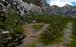
"Tongass Remote Airfield" (RATR) Alaskan scenery (Fictitious)
Tongass Remote Airfield is for Flight Simulator 2004 and for the "Tongass Fjords" (FS9) addon by Holger Sandmann & Bill Womack . You must have "Tongass Fjords" (FS9) for this to work.
Field history and description:
In the early days this area was well known to prospectors and hunters. A small mine was established and later abandoned. Around the late 40���¢��������s a crew was contracted to clear a small landing area to gain easier access for hunters and campers. Due to the extreme remoteness of this area that clearing took several years. The last phase was the approach, clearing by hand a descending glide slope through just the tops of the tall trees. There is now just enough room for a very experienced pilot to get in and out of this field. The airfield is 26 miles north of Petersburg Alaska (PAPG). This is a tricky narrow approach with a left hand dogleg and then an immediate right hand dogleg turn just before the final approach. Not much time to set up your approach, also, it's a very short runway. For experienced pilots only, and make sure that your life insurance is up to date. See enclosed Maps and info. Good luck.
| Filename: | Tongass_Remote_Airfield_RATR__for_Tongass_Fjords_F.zip |
| License: | Freeware, limited distribution |
| Added: | 11th February 2010, 00:49:22 |
| Downloads: | 623 |
| Author: | Jay Langham |
| Size: | 3.51 MB |
| Category: Flight Simulator X - Utilities | |
| Making lightmaps for Ultimate Traffic 2 (UT2) aircraft |
|
File Description:
This is a short set of instructions for how to make lightmaps to use with Ultimate Traffic 2 aircraft.
| Filename: | Making_lightmaps_for_Ultimate_Traffic_2__UT2_aircr.zip |
| License: | Freeware |
| Added: | 9th January 2010, 14:11:03 |
| Downloads: | 461 |
| Author: | Eric G Hansen |
| Size: | 292.72 KB |


© 2001-2026 AVSIM Online
All Rights Reserved
Privacy Policy |