
Where Flight Simulation Enthusiasts Gather from Around the World!
AVSIM Library - Search Results

| Category: Flight Simulator 2004 - Scenery | |
| Tongass Remote Airfield v2 - for Tongass Fjords |

|
Images related to this file:
File Description:
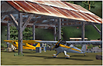
Tongass Remote Airfield v2 - for Tongass Fjords (FS9)
"Tongass Remote Airfield" v2 (RATR) Alaskan bush flying scenery (Fictitious).
This airstrip is for Flight Simulator 2004 and for the "Tongass Fjords" (FS9) addon by Holger Sandmann & Bill Womack; you must have "Tongass Fjords" (FS9) for this to work. Version 2 is a detailed, stand alone, remake of the first version, see PDF file.
Field history and description:
In the early days this area was well known to prospectors and hunters. A small mine was established and later abandoned. Around the late 40s a crew was contracted to clear a small landing area to gain easier access for hunters and campers. Due to the extreme remoteness of this area that clearing took several years. The last phase was the approach, clearing by hand a descending glide slope through just the tops of the tall trees. There is now just enough room for a very experienced pilot to get in and out of this field. The airfield is 26 miles north of Petersburg Alaska (PAPG). This is a tricky narrow approach with a left hand dogleg and then an immediate right hand dogleg turn just before the final approach. Not much time to set up your approach; also, it's a very short runway. For experienced pilots only, and make sure that your life insurance is up to date. Good luck.
| Filename: | Tongass_Remote_Airfield_v2__for_Tongass_Fjords.zip |
| License: | Freeware, limited distribution |
| Added: | 22nd March 2010, 13:16:16 |
| Downloads: | 626 |
| Author: | Jay Langham |
| Size: | 6.18 MB |
| Category: Navigation and ATC - Navigation | |
| Omaha Sectional Chart Chunks for Aerosoft's FSMap |
|
File Description:
Sectional chart chunks made from the August 2009 Sectional charts at the original scale, formatted in the WGS84 lat/long geographic coordinate system for the FSMap, moving map application for flight simulation use. The chart chunks are the full sectional divided by 2 tiles (east/west) and converted to baseline 8bit tiffs with packbits compression applied. The images are about 6,000x6,000 pixels at about 25mb each, also included is the FSMap fsm Calibration file for importing.
| Filename: | Omaha_Sectional_Chart_Chunks_for_Aerosofts_FSMap.zip |
| License: | Freeware |
| Added: | 22nd March 2010, 20:40:14 |
| Downloads: | 323 |
| Author: | David Myers |
| Size: | 29.55 MB |
| Category: Navigation and ATC - Navigation | |
| Chicago Sectional Chart Chunks for Aerosoft's FSMap |
|
File Description:
Sectional chart chunks made from the August 2009 Sectional charts at the original scale, formatted in the WGS84 lat/long geographic coordinate system for the FSMap, moving map application for flight simulation use. The chart chunks are the full sectional divided by 2 tiles (east/west) and converted to baseline 8bit tiffs with packbits compression applied. The images average 6,000x6,000 pixels at about 25mb each, also included is the FSMap fsm Calibration file for importing.
| Filename: | Chicago_Sectional_Chart_Chunks_for_Aerosofts_FSMap.zip |
| License: | Freeware |
| Added: | 22nd March 2010, 20:40:31 |
| Downloads: | 514 |
| Author: | David Myers |
| Size: | 31.9 MB |
| Category: Navigation and ATC - Navigation | |
| Detroit Sectional Chart Chunks for Aerosoft's FSMap |
|
File Description:
Sectional chart chunks made from the August 2009 Sectional charts at the original scale, formatted in the WGS84 lat/long geographic coordinate system for the FSMap, moving map application for flight simulation use. The chart chunks are the full sectional divided by 2 tiles (east/west) and converted to baseline 8bit tiffs with packbits compression applied. The images average 6,000x6,000 pixels at about 25mb each, also included is the FSMap fsm Calibration file for importing.
| Filename: | Detroit_Sectional_Chart_Chunks_for_Aerosofts_FSMap.zip |
| License: | Freeware |
| Added: | 22nd March 2010, 20:40:50 |
| Downloads: | 390 |
| Author: | David Myers |
| Size: | 33.56 MB |
| Category: Navigation and ATC - Navigation | |
| Montreal Sectional Chart Chunks for Aerosoft's FSMap |
|
File Description:
Sectional chart chunks made from the August 2009 Sectional charts at the original scale, formatted in the WGS84 lat/long geographic coordinate system for the FSMap, moving map application for flight simulation use. The chart chunks are the full sectional divided by 2 tiles (east/west) and converted to baseline 8bit tiffs with packbits compression applied. The images average 6,000x6,000 pixels at about 25mb each, also included is the FSMap fsm Calibration file for importing.
| Filename: | Montreal_Sectional_Chart_Chunks_for_Aerosofts_FSMa.zip |
| License: | Freeware |
| Added: | 22nd March 2010, 20:40:58 |
| Downloads: | 436 |
| Author: | David Myers |
| Size: | 35.53 MB |
| Category: Navigation and ATC - Navigation | |
| Halifax Sectional Chart Chunks for Aerosoft's FSMap |
|
File Description:
Sectional chart chunks made from the August 2009 Sectional charts at the original scale, formatted in the WGS84 lat/long geographic coordinate system for the FSMap, moving map application for flight simulation use. The chart chunks are the full sectional divided by 2 tiles (east/west) and converted to baseline 8bit tiffs with packbits compression applied. The images average 6,000x6,000 pixels at about 25mb each, also included is the FSMap fsm Calibration file for importing.
| Filename: | Halifax_Sectional_Chart_Chunks_for_Aerosofts_FSMap.zip |
| License: | Freeware |
| Added: | 22nd March 2010, 22:27:02 |
| Downloads: | 362 |
| Author: | David Myers |
| Size: | 29.08 MB |
| Category: Flight Simulator X - Scenery Design | |
| SBuilderX tutorial for FSX Population Density maps |
|
File Description:
This tutorial demonstrates how SBuilderX can be used to create addon Population Density files for FSX. Population Density files control the number of moving vehicles (except airport) and recreational boats that are autogenerated by FSX.
| Filename: | SBuilderX_tutorial_for_FSX_Population_Density_maps.zip |
| License: | Freeware, limited distribution |
| Added: | 22nd March 2010, 22:51:05 |
| Downloads: | 1,743 |
| Author: | Scott Smart |
| Size: | 1.05 MB |
| Category: Navigation and ATC - Navigation | |
| Seattle Sectional Chart Chunks for Aerosoft's FSMap |
|
File Description:
Sectional chart chunks made from the August 2009 Sectional charts at the original scale, formatted in the WGS84 lat/long geographic coordinate system for the FSMap, moving map application for flight simulation use. The chart chunks are the full sectional divided by 2 tiles (east/west) and converted to baseline 8bit tiffs with packbits compression applied. The images average 6,000x6,000 pixels at about 25mb each, also included is the FSMap fsm Calibration file for importing. No further calibration is needed, just import, save, and enjoy.
| Filename: | Seattle_Sectional_Chart_Chunks_for_Aerosofts_FSMap.zip |
| License: | Freeware |
| Added: | 24th March 2010, 19:40:33 |
| Downloads: | 570 |
| Author: | David Myers |
| Size: | 39.99 MB |
| Category: Navigation and ATC - Navigation | |
| Dawson Sectional Chart Chunks for Aerosoft's FSMap |
|
File Description:
Sectional chart chunks made from the August 2009 Sectional charts at the original scale, formatted in the WGS84 lat/long geographic coordinate system for the FSMap, moving map application for flight simulation use. The chart chunks are the full sectional divided by 2 tiles (east/west) and converted to baseline 8bit tiffs with packbits compression applied. The images average 6,000x6,000 pixels at about 25mb each, also included is the FSMap fsm Calibration file for importing. No further calibration is needed, just import, save, and enjoy.
| Filename: | Dawson_Sectional_Chart_Chunks_for_Aerosofts_FSMap.zip |
| License: | Freeware |
| Added: | 26th March 2010, 00:23:50 |
| Downloads: | 345 |
| Author: | David Myers |
| Size: | 19.88 MB |
| Category: Navigation and ATC - Navigation | |
| Memphis Sectional Chart Chunks for Aerosoft's FSMap |
|
File Description:
Sectional chart chunks made from the August 2009 Sectional charts at the original scale, formatted in the WGS84 lat/long geographic coordinate system for the FSMap, moving map application for flight simulation use. The chart chunks are the full sectional divided by 2 tiles (east/west) and converted to baseline 8bit tiffs with packbits compression applied. The images average 6,000x6,000 pixels at about 25mb each, also included is the FSMap fsm Calibration file for importing. No further calibration is needed, just import, save, and enjoy.
| Filename: | Memphis_Sectional_Chart_Chunks_for_Aerosofts_FSMap.zip |
| License: | Freeware |
| Added: | 26th March 2010, 22:18:40 |
| Downloads: | 374 |
| Author: | David Myers |
| Size: | 29.74 MB |


© 2001-2026 AVSIM Online
All Rights Reserved
Privacy Policy |