
Where Flight Simulation Enthusiasts Gather from Around the World!
AVSIM Library - Search Results

| Category: Navigation and ATC - Navigation | |
| American Samoa and Guam Sectional Chart Chunks |

|
File Description:
Sectional chart chunks made from the August 2009 Sectional charts at the original scale, formatted in the WGS84 lat/lon geographic coordinate system for GPS, moving map application for flight simulation use.
These chart chunks were converted to the JPEG format for compatibility and size. Included is also the projection files and world files.
Note: This type of map is a equal grid and no further calibration is needed, only the two points referenced in the world file.
| Filename: | American_Samoa_and_Guam_Sectional_Chart_Chunks.zip |
| License: | Freeware |
| Added: | 11th March 2010, 21:03:06 |
| Downloads: | 278 |
| Author: | David Myers |
| Size: | 2.98 MB |
| Category: Navigation and ATC - Navigation | |
| Hawaii Sectional Chart Chunks For Moving Map Application |
|
File Description:
Sectional chart chunks made from the August 2009 Sectional charts at the original scale, formatted in the WGS84 lat/lon geographic coordinate system for GPS, moving map application for flight simulation use.
These chart chunks were converted to the JPEG format for compatibility and size. Included is also the projection files and world files. Note: This type of map is a equal grid and no further calibration is needed, only the two points referenced in the world file.
| Filename: | Hawaii_Sectional_Chart_Chunks_For_Moving_Map_Appli.zip |
| License: | Freeware |
| Added: | 11th March 2010, 21:03:45 |
| Downloads: | 228 |
| Author: | David Myers |
| Size: | 6.43 MB |
| Category: Navigation and ATC - Navigation | |
| TAC Anchorage Fairbanks Chart Chunks for Moving Map Application |
|
File Description:
The chart chunks are from the Nov 2009 Terminal Area Charts at the original scale, formatted in the WGS84 lat/long geographic coordinate system for GPS, moving map application for flight simulation use. The chart chunks were converted to the JPEG format for compatibility and size. Included is also the projection files and world files.
Note: This type of map is an equal grid and no further calibration is needed, only the two points referenced in the world file.
| Filename: | TAC_Anchorage_Fairbanks_Chart_Chunks_for_Moving_Ma.zip |
| License: | Freeware |
| Added: | 14th March 2010, 05:12:28 |
| Downloads: | 139 |
| Author: | David Myers |
| Size: | 7.79 MB |
| Category: Navigation and ATC - Navigation | |
| Omaha Sectional Chart Chunks for Aerosoft's FSMap |
|
File Description:
Sectional chart chunks made from the August 2009 Sectional charts at the original scale, formatted in the WGS84 lat/long geographic coordinate system for the FSMap, moving map application for flight simulation use. The chart chunks are the full sectional divided by 2 tiles (east/west) and converted to baseline 8bit tiffs with packbits compression applied. The images are about 6,000x6,000 pixels at about 25mb each, also included is the FSMap fsm Calibration file for importing.
| Filename: | Omaha_Sectional_Chart_Chunks_for_Aerosofts_FSMap.zip |
| License: | Freeware |
| Added: | 22nd March 2010, 20:40:14 |
| Downloads: | 323 |
| Author: | David Myers |
| Size: | 29.55 MB |
| Category: Flight Simulator 2004 - AFCAD Files | |
| Trapani LICT AFCAD2 Jan 2005 with new ILS |
|
File Description:
Default FS2004 Trapani LICT (Italy) AFCAD2 file, with all parkings (commercial and military both) and brand new ILS-DME RWY 31, ILS-DME PAPA RWY 31 chart included, by Gianluca Murella.
| Filename: | Trapani_LICT_AFCAD2_Jan_2005_with_new_ILS.zip |
| License: | Freeware |
| Added: | 27th January 2005, 04:39:09 |
| Downloads: | 2,047 |
| Author: | Gianluca Murella |
| Size: | 471.35 KB |
| Category: Flight Simulator X - AFCAD Files | |
| CZBB Boundary Bay Airport, BC |
|
File Description:
This is a complete redo of the default FSX CZBB Boundary Airport, BC using ADE v1.37, Google Earth satellite image and the latest airport chart effective as of 31 July 2008. The airport center and boundary repositioned. Control tower moved and replaced. Runway 07/25 extended to 5606 ft from 3540 ft and new taxiway E added. VASI Added to Runway 07/25. Taxiway signs added and/or corrected. Airport aprons resized and added where necessary. Taxiways and roads added. Static airport library objects and vegetation added for an improved look. XWind runways activated. Airport views are from the roof of the control tower when in tower view. A fuel truck has been added - Shift-F will bring this truck to your aircraft for refueling and will automatically refuel AI aircraft after landing and before take off. Airport chart and history included.
| Filename: | CZBB_Boundary_Bay_Airport_BC.zip |
| License: | Freeware |
| Added: | 26th March 2009, 08:31:55 |
| Downloads: | 491 |
| Author: | Robert Catherall |
| Size: | 137.2 KB |
| Category: Flight Simulator X - AFCAD Files | |
| CZBB Boundary Bay Airport, BC, Canada |
|
File Description:
This is a complete redo of the default FSX CZBB Boundary Bay Airport, BC using ADE v1.37, Google Earth satellite image and the latest airport chart effective as of 31 July 2008. The airport center and boundary repositioned. Control tower moved and replaced. Runway 07/25 extended to 5606 ft from 3540 ft and new taxiway E added. VASI Added to Runway 07/25. Taxiway signs added and/or corrected. Airport aprons resized and added where necessary. Taxiways and roads added. Static airport library objects and vegetation added for an improved look. XWind runways activated. Airport views are from the roof of the control tower when in tower view. A fuel truck has been added - Shift-F will bring this truck to your aircraft for refueling and will automatically refuel AI aircraft after landing and before take off. Airport chart and history included.
| Filename: | CZBB_Boundary_Bay_Airport_BC_Canada.zip |
| License: | Freeware |
| Added: | 5th November 2009, 02:16:37 |
| Downloads: | 448 |
| Author: | Robert Catherall |
| Size: | 381.61 KB |
| Category: Combat Flight Simulator 1 and 2 - Aircraft | |
| CFS2/FS2004 RAF pilot khaki textures Republic P47D |
|
File Description:
CFS2/FS2004 RAF pilot khaki textures for AlphaSim's Republic P47D (RAF MK.I & Mk.II) Thunderbolt Bubble Top & Razorback. This file puts the pilot in the proper desert RAF khaki flight suit, including the brown leather helmet. This file is for use only with the ALPHASIM model P47D which can be found at: http://www.alphasim3.com/store/advanced_search_result.php?keywords=P-47&x=7&y=9. Repaint by Evan G. Butterbrodt (revev).
| Filename: | CFS2FS2004_RAF_pilot_khaki_textures_Republic_P47D.zip |
| License: | Freeware |
| Added: | 24th August 2008, 03:07:50 |
| Downloads: | 50 |
| Author: | Evan G. Butterbrodt |
| Size: | 66.47 KB |
| Category: Flight Simulator 2004 - Aircraft Repaints, Textures and Modifications | |
| CFS2/FS2004 RAF pilot khaki textures Republic P47D |
|
File Description:
CFS2/FS2004 RAF pilot khaki textures for AlphaSim's Republic P47D (RAF MK.I & Mk.II) Thunderbolt Bubble Top & Razorback. This file puts the pilot in the proper desert RAF khaki flight suit, including the brown leather helmet. This file is for use only with the ALPHASIM model P47D which can be found at: http://www.alphasim3.com/store/advanced_search_result.php?keywords=P-47&x=7&y=9. Repaint by Evan G. Butterbrodt (revev.
| Filename: | CFS2FS2004_RAF_pilot_khaki_textures_Republic_P47D.zip |
| License: | Freeware |
| Added: | 24th August 2008, 03:08:15 |
| Downloads: | 88 |
| Author: | Evan G. Butterbrodt |
| Size: | 66.47 KB |
| Category: Navigation and ATC - Navigation | |
| LSZS - Samedan visual approach chart v3 |
|
Images related to this file:
File Description:
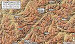
Custom made visual approach chart and pilot's briefing for Engadin (St. Moritz) Samedan LSZS airport in Switzerland, Europe's highest elevation airport (5,600 ft.) situated in the Swiss Alps. This airport is a day VFR operations only and has no instrument approach due to extreme terrain around it. A demanding visual descent into a canyon, in between steep rising terrain, is required to make the visual approaches for both runways with a steep 4.4* degrees final approach portion guided by the PAPI's. Still, executive jets up to Boeing 737(BBJ) size approach the airport often in the winter peak season VFR with these procedures. It is designed as per real operators' pilot briefing for Samedan. Real airport's full pilot briefing document also included. The real airport's excellent briefing (included) intentionally does not contain the maneuvers needed for the approach of jets through the mountains but only reporting points for all and maneuvers for light aircraft only. This gap is what this chart covers. Version 2 chart included better graphics and refined visual procedure for jets and version 3 now includes real pilot's briefing guide.
| Filename: | LSZS__Samedan_visual_approach_chart_v3.zip |
| License: | Freeware, limited distribution |
| Added: | 20th March 2015, 23:35:11 |
| Downloads: | 2,026 |
| Author: | Kyprianos Biris |
| Size: | 7.1 MB |


© 2001-2026 AVSIM Online
All Rights Reserved
Privacy Policy |