
Where Flight Simulation Enthusiasts Gather from Around the World!
AVSIM Library - Search Results

| Category: Flight Simulator 2004 - Miscellaneous Files | |
| Project Opensky Boeing 747 FDE Suite- -Version 9.7, Revision D |

|
File Description:
This file is a *MANDATORY* Update!!! After many point-outs from members of the FS Community, I'm pleased to announce that ***ALL*** of the steering issues and maximum speed issues are fixed. Included Variants are:
747-SP
747-100
747-100SR
747-100SF
747-200
747-200C
747-200F (747-200F-PW-JT9D-70A Included)
747-300
747-300C
747-300F
747-300M
747-400
747-400D
747-400ER
747-400F
747-400LCF
747-400ER/F
747-400M
747-400BCF
VC-25A
E-4B
The supported version of the FDEs is now Version 9.7, Revision D. Now, you can finally turn the big girl when taxiing @ HNL or PAE... ;) Now, for the legal stuff: This package may NOT BE ALTERED, MERGED, REEDITED, REDISTRIBUTED OR UPLOADED AS PART OF ANY PAYWARE OR FREEWARE PACKAGE. LEGAL IMPLICATIONS EXIST with the air carriers which helped develop this package. READ THE MANUAL FOR BEST OPTIMIUM SETTINGS AND FAQ. This new 747 package inclues: - Correct 747 performance and feel based on airline FAA Level D simulators and documentation. - Use of MSFS payload and fuel editor. - Use of MSFS flight planner and Navigation Log for flight/fuel planning. - Use of true 747-100/200/300/400 landing gear footprint as default gear points, many realistic versions of 747 variants. - New physical contact point definitions. - New effects. The FDE included for this series are copyrighted by Project Opensky, Brandon D. Henry, and Warren C. Daniel. They may not be merged, altered and/or used for other uploads to any other aircraft without Authors permission.
| Filename: | Project_Opensky_Boeing_747_FDE_Suite_Version_97_Re.zip |
| License: | Freeware, limited distribution |
| Added: | 9th May 2008, 23:31:48 |
| Downloads: | 3,753 |
| Author: | Brandon D. Henry | Warren C. Daniel |
| Size: | 6.86 MB |
| Category: Flight Simulator 2004 - Scenery | |
| Abruzzo Pescara Italy |
|
File Description:
Abruzzo & Molise, Italy, Photoreal Scenery (26 june 2007).
Freeware scenery for FS2004.
All files of my scenery ABRUZZO & MOLISE; Author: Angelo Lanzillotta
This photoreal scenery is based on aerial photos grabbed at the resolution of 5 meters per pixel (the same used in FS2004- works in FS 2002 too). I worked
hardly on these photos to obtain a final product with the real colours and the real positions for all parts of the landscape: if you have any comments or
suggests, feel free to email me.
Every single part of this scenery can be used also as a standalone product, so it's not necessary to download all 4 parts of my big scenery.
However i strongly suggest to use all parts in order to obtain a complete photoreal look of this beautiful italian landscape, with famous mountains like Gran Sasso and Maiella.
For best results, use this scenery in association with Pietro Mauri Italymesh2004.
DISCLAIMER
This scenery is released as freeware, so nobody can make money with it.
You cannot include this scenery in any software collection or web site without written permission of author.
You can add objects and autogen (i had no time to work on them).
This software can be used only as FSX/FS2004/FS2002 scenery: no other use is allowed.
I accept absolutely no responsibility for your use of this software.
This flie was re-uploaded by me in September 2012, after it was lost because of an haker attack to AVSIM during 2009 - Roberto
| Filename: | Abruzzo_Pescara_Italy.zip |
| License: | Freeware |
| Added: | 10th September 2012, 22:17:13 |
| Downloads: | 1,411 |
| Author: | Angelo Lanzillotta |
| Size: | 94.96 MB |
| Category: Flight Simulator X - Scenery | |
| RAF Wickenby (1940s) |
|
File Description:
RAF Wickenby was a purpose built Royal Air Force station constructed late 1942 and early 1943 it had two T2 type
hangars and one B1 type. The B1 and one of the T2 hangars can still be seen on the airfield site. The T2 near the
threshold of runway 21 was recently acquired by the airfield owners and after many years of industrial use is now,
once more, an aircraft hangar.
The airfield covered about 600 acres (2.4 km2), and had the usual three runway configuration with perimeter track,
hard standings, a brick watchtower and numerous brick and metal buildings for the aircrews and ground staff. A number
of the buildings were to the east (Communal Site, Living Quarters, WAAF Quarters) and stretched to and beyond the
Lissington road - a road travelled many an evening by the airmen and women who visited their favourite watering hole,
the White Hart at Lissington. The Sick Quarters were to the south of the airfield together with a Communal Site and
Living Quarters.
The north part of the former airfield is now known as Wickenby Aerodrome, which is a grass and concrete airfield. A
road from Holton cum Beckering to Snelland runs right over the former airfield. Companies based at the airfield are
Thruster Aircraft who make microlight planes; Fly365 Ltd who fly pleasure flights; and Rase Distribution - a haulage
firm. Planes using the airfield have to make contact first with the control tower at RAF Waddington.
The Watch Office is the home of the RAF Wickenby Memorial Collection and the Wickenby Archive, a museum and collection
of memorabilia and archive dedicated to the memory of the Squadrons who served here.
| Filename: | RAF_Wickenby_1940s.zip |
| License: | Freeware |
| Added: | 10th March 2017, 14:46:25 |
| Downloads: | 136 |
| Author: | Terry Boissel |
| Size: | 15.14 KB |
| Category: Prepar3D V1-4 - Aircraft Repaints, Textures and Modifications | |
| Beechcraft Staggerwing (VH-AFP) |
|
Images related to this file:
File Description:
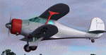
This folder contains a repaint for the Alabeo Beech Staggerwing in the colors of VH-AFP, as it looked in the early sixties. This machine (c/n 357) was originally built as a D17A and registered in the USA as NC20778 to The Armor Institute on 1 November 1939. It took part in their 1940-41 Antarctic Expedition (which I painted as well), following which it was purchased by Connellan Airways in 1941. However, the aircraft was impressed by the RAAF as A39-2 prior to use by Connellan. Post war the aircraft was returned to Connellan where the original 380 hp Jacobs engine was replaced by a 450 hp Pratt & Whitney Wasp Junior, bringing the aircraft up to D17S standard. It was first registered as VH-AFP on 19 March 1947. VH-AFP was withdrawn from service on 6 August 1951, however it was stored and returned to service in 1956, being re-registered on 3 April. The aircraft was once again withdrawn from service in November 1957 and was sold to Tadgell Aviation of Toowomba, Qld and used for crop seeding. It struck a tree and crashed on 22 December 1963 while seeding at Springton, near Dingo, Qld. Sadly the pilot was killed. The burnt out airframe of this Staggerwing was located in April 2007 at the remote crash site and collected by Staggerwing enthusiast Cameron Hanley and trucked to his hangar at Caboolture, Qld where he is rebuilding Beech C17B VH-UXP (for which two repaints are available as well). Repaint by Jan Kees Blom, based on the blank textures by Alabeo.
| Filename: | Beechcraft_Staggerwing_VHAFP.zip |
| License: | Freeware |
| Added: | 14th July 2018, 22:46:19 |
| Downloads: | 88 |
| Author: | Jan Kees Blom |
| Size: | 16.96 MB |
| Category: Flight Simulator 2004 - Scenery | |
| Beaver Creek CYXQ in Yukon Territory, Canada |
|
Images related to this file:
File Description:
Beaver Creek is located at mile 1202 of the Alaska Highway, just east of the Alaska/Yukon border. The populaton is around 100 and the main employment is with the Border Agency, the White River First Nation, or with local tourist lodges. The airfield is a mile north of the town and close to the Canadian border post, which is included in the scenery. It was built by Jack Stalberg in the 1960's, and I have no further information beyond the fact that he loved to fly. The airport serves as an "airport of entry", though it is restricted in hours of opening and in the size of aircraft that it can handle; up to a maximum of only 15 seats. The single runway is 3,745 feet long and 100 feet wide, gravel, aligned 13-31 in FS9, lit, and with vasi at both ends. Righthand circuits for runway 13. There is a 340 feet threshold displacement to runway 31, which is of course unmarked on a gravel runway. The terminal building was recently reclad; I don't like it, but they didn't consult me. The ai reflects the sort of traffic the airfield gets; ie brief paperwork stopovers for GA or small charter flights into Canada from Alaska, usually in the mornings.I have adjusted the local scenery terrain levels to remove adjacent hills that I believe do not exist in real life but are part of the Northern Canada terrain mesh that I have installed. If you do not have this mesh you may find that the scenery works fine for you without the API flatten that is included here. The airfield is at 2,129 feet ASL.
| Filename: | Beaver_Creek_CYXQ_in_Yukon_Territory_Canada.zip |
| License: | Freeware, limited distribution |
| Added: | 28th January 2019, 06:19:20 |
| Downloads: | 174 |
| Author: | Roger Wensley |
| Size: | 4.68 MB |
| Category: Prepar3D V1-4 - Aircraft Repaints, Textures and Modifications | |
| Hawaiian Air 1998 AI Package |
|
File Description:
Hawaiian Air was a shell of itself in the Transpacific market in 1998 compared to today, while it was fiercely competing with Aloha Airlines in the intra-Hawaii market. DC-10-10s preformed all Long Haul flights as well as those to the USA, while a fleet of DC-9-50s competed with Aloha between the islands. At the time, all flights from OGG to the mainland actually originated in Honolulu and made a stop in Maui in each direction on which no tickets were sold between HNL\OGG. LAX was used as a stop over point as well for flights between HNL\OGG and LAS. All mainland flights from HNL were daily while flights to other destinations in the Pacific and between the mainland and OGG were operated only a few days per week. HNL-LAX was the busiest route for the DC-10, with 3 daily flights. The MD-80s, other DC-9 variants, and the DHC-7s were gone by 1998, but the DC-9-50s still served the smaller airports of LNY and MKK(even with some very short flights between the two) at the time which were soon after abandoned until Ohana by Hawaiian was launched in recent years with ATR-42s. AIG DC-9-50 repaint by Christian Gold and Antoine Calleja of APG included. AIM DC-10-10 by Jason King on Avsim as "aim_dc1010_hawaiian_n160aa.zip". Flightplans by Chasen Richardson as part of the 1998 Flight Simulator Project. Follow us on Facebook at facebook.com/flightsim98 and on instagram as @bayviationsim. For more Retro AI, check out the forums at: http://retroai.proboards.com/
| Filename: | Hawaiian_Air_1998_AI_Package.zip |
| License: | Freeware |
| Added: | 21st November 2019, 19:14:09 |
| Downloads: | 170 |
| Author: | Christian Gold, Antoine Calleja, Chasen Richardson\Bayviation |
| Size: | 657.46 KB |
| Category: Flight Simulator 2004 - Scenery | |
| Golden CYGE in British Columbia, Canada |
|
Images related to this file:
File Description:
This airfield is in one of the north-south valleys in the Columbia Mountains (which are part of the Rockies) on the border between BC and Alberta. The town of Golden (population just under 4,000) grew along with the Canadian Pacific Railway and the logging industry, both of which are still the mainstays of the town. Tourism is a more recent development along with the Kicking Horse Mountain Resort, which is only 3 miles to the west of the town. There are occasional flights into CYGE related to the richer echelon of tourist groups for Kicking Horse, particularly at the weekends; three actual such flights are included in the AI. Golden CYGE is immediately to the west of the town beside the Columbia River, with the 4,500 feet of asphalt runway aligned 14-32; right hand circuits for 32. There are no runway lights or landing aids, and no taxiway lights, so this airfield is for daylight use only. There is a helicopter company based on the field (Alpine) and a volunteer search and rescue group, a skydiving operation at the northern end, plus an active club with a long open hangar with a club room. A friendly airfield. The AI helicopter was included in my post of Alma CYTF. The Beaver will not show up unless you have the Aerosoft Beaver installed. I found the other planes without a problem on flightsim or avsim. Due to the surrounding terrain AI aircraft will usually impact high ground before landing and then just show up on their parking spots. A northern wind improves but does not totally solve this.
| Filename: | Golden_CYGE_in_British_Columbia_Canada.zip |
| License: | Freeware, limited distribution |
| Added: | 29th September 2018, 19:26:13 |
| Downloads: | 156 |
| Author: | Roger Wensley |
| Size: | 12.2 MB |
| Category: Prepar3D V5 - Scenery | |
| VOBL_P3Dv5 |
|
File Description:
Kempegowda International Airport (IATA: BLR, ICAO: VOBL) is an international airport serving Bangalore, the capital of the Indian state of Karnataka, in the Southern part of India. Spread over 4,000 acres (1,600 ha), it is located about 30 kilometres (19 mi) north of the city near the suburb of Devanahalli. It is owned and operated by Bengaluru International Airport Limited (BIAL), a public–private consortium. The airport opened in May 2008 as an alternative to increased congestion at HAL Airport, the original primary commercial airport serving the city. It is named after Kempe Gowda I, the founder of Bangalore. Kempegowda International Airport became Karnataka's first fully solar powered airport developed by CleanMax Solar.[5][6] Kempegowda Airport is the third-busiest airport by passenger traffic in the country, behind the airports in Delhi and Mumbai, and is the 29th busiest airport in Asia. It handled around 33.30 million passengers in the calendar year 2018 with 658 aircraft movements a day. The cargo handled by the airport continues to increase steadily, with the airport handling about 386,849 tonnes (426,428 short tons) of cargo between April 2018 and March 2019.[7] The airport consists of two runways and a passenger terminal, which handles both domestic and international operations. The second runway, constructed by Larsen & Toubro, was commissioned on 6 December 2019.[8][9] A second terminal is in the early stages of construction. Also, there is a cargo village and three cargo terminals. The airport serves as a hub for AirAsia India, Alliance Air, and IndiGo and is a focus city for Air India and SpiceJet. Note: All terminal buildings credit goes to thomlinden. It's freeware scenery.
| Filename: | VOBL_P3Dv5.zip |
| License: | Freeware |
| Added: | 31st October 2020, 19:00:11 |
| Downloads: | 854 |
| Author: | Abhishek Banerjee |
| Size: | 16.84 MB |
| Category: Flight Simulator 2004 - Scenery | |
| Galena PAKP in Alaska |
|
Images related to this file:
File Description:
Galena is a village on the Yukon River, around 30 miles east of the corner where the westward running river turns south. The population is just under 500 and the city is noted for its educational facilities that attract residential students from across the state. Adjacent to the city is the Galena Air Force Station that previously shared the use of the Edward G. Pitna Snr. airport until 2007, when the station was closed and the air force personnel left. The station facilities have been taken over by the community and the airport became the largest state-maintained airport in the interior of Alaska. Substantial resurfacing and finishing work was then carried out, and the new asphalt runway is now 6,000 feet long and aligned 7-25, with VASI at both ends and ILS on 25. There is a secondary gravel runway beside part of the main asphalt runway, and this is treated in radio announcements as if it is not a separate runway and landing or take off are on the adjacent asphalt. The airport is serviced by ERA (now called Ravn) and Wrights Air, with cargo flights by the eternal Everts. Included here is a small modification for Allakaket, which deletes a single remaining stock FS9 taxiway light. The AI included here also provided Allakaket with a Saturday Everts delivery flight, but I neglected to mention that before. A note here about my scenery making. There will not be many more to follow this as I am almost at the end of the photos I either took or found for scenery purposes, plus I expect to move on from FS9 at some point during next year.
| Filename: | Galena_PAKP_in_Alaska.zip |
| License: | Freeware, limited distribution |
| Added: | 27th November 2019, 19:14:00 |
| Downloads: | 257 |
| Author: | Roger Wensley |
| Size: | 13.95 MB |
| Category: Flight Simulator 2004 - Scenery | |
| Invermere CAA8 in British Columbia, Canada |
|
Images related to this file:
File Description:
This airfield is in the Columbia Mountains (which are part of the Rockies) on the border between BC and Alberta. Invermere is in the same valley as Golden, 65 miles south and midway between Golden and Cranbrook. The town is at the northern end of Lake Windermere, on the western side, with a population of around 3,400. The main touristic feature of Invermere appears to be the provision of a wide choice of golf courses. These are included in the scenery, as are some of the surrounding commercial buildings including a nearby hotel and retail units. Invermere CAA8 is half a mile northeast of the lake, and is home to the non-profit Canadian Rockies Soaring Club that trains pilots during the summer months. The Invermere Soaring Centre, a separate organisation, provides glider towing services and rides for the general public. During the summer the airfield can only be described as busy, with gliders taking advantage of the terrain for ridge soaring. The AI here includes gliders that will take off and then circle around north of the field. The take off is not a realistic glider style launch, and the wind should be from the north; these gliders do not taxi and then turn around at the far end of a runway too well. Once again, like Golden, there is no runway or taxiway lighting, so daylight use only. There are GA visitors to CAA8 between the gliders, presumably carrying golfers and clubs. Due to the surrounding terrain AI aircraft might impact high ground before landing and then just show up on their parking spot.
| Filename: | Invermere_CAA8_in_British_Columbia_Canada.zip |
| License: | Freeware, limited distribution |
| Added: | 16th October 2018, 02:11:34 |
| Downloads: | 168 |
| Author: | Roger Wensley |
| Size: | 6.11 MB |


© 2001-2026 AVSIM Online
All Rights Reserved
Privacy Policy |