
Where Flight Simulation Enthusiasts Gather from Around the World!
AVSIM Library - Search Results

| Category: Flight Simulator 2004 - Scenery | |
| MESH 2010 SurAmerica - Venezuela, Costa Rica and Panama |

|
Images related to this file:
File Description:
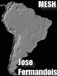
MESH FERMANDOIS 2010 V1.0 / Venezuela, Costa Rica, Panama / index(VE1; VE2) / A highly detailed 30m SRTM mesh for South America (FS2004 and FSX)
| Filename: | MESH_2010_SurAmerica__Venezuela_Costa_Rica_and_Pan.zip |
| License: | Freeware |
| Added: | 2nd December 2009, 04:00:38 |
| Downloads: | 3,488 |
| Author: | Jose Fermandois |
| Size: | 87.06 MB |
| Category: Flight Simulator 2002 - Aircraft Repaints, Textures and Modifications | |
| Scandinavian Airlines System DC-7C and DC-7F |
|
File Description:
FS2002 Scandinavian Airlines System DC-7C and DC-7F. The DC-7C's of SAS became famous for opening the polar route from Europe to Japan, flying from Copenhagen to Tokyo via Anchorage, Alaska. SAS used 15 DC-7C and two DC-7F in 1956-68. Four liveries (early, middle and late) included. Repaint by Jens B Kristensen of original model by Greg Pepper and Tom Gibson, flight dynamics by FS Aviator. Panel and sounds must be downloaded seperately.
| Filename: | Scandinavian_Airlines_System_DC7C_and_DC7F.zip |
| License: | Freeware |
| Added: | 16th July 2003, 14:25:03 |
| Downloads: | 2,527 |
| Author: | Jens B Kristensen |
| Size: | 8.12 MB |
| Category: Flight Simulator 2004 - Gauges | |
| ILH TCAS and Transponder for QualityWings 757 SP2 |
|
Images related to this file:
File Description:

Lee Hetherington TCAS & Transponder addition to QualityWings (www.qwsim.com) 757 SP2 FS9 panel in order to be able to have transponder modes (Standby, Ident, Mode C) and TCAS TA/RA, ABOVE, BELOW modes, radar interrogation light etc. while flying on line on VATSIM network with SquawkBox or FSInn. Jose Oliveira ilhtcaschange.gau which gives ILH TCAS signal for avionics power on/off is also included. The transponder and TCAS logic are already tested and found fully compatible with QualityWings TCAS function inside the HSI (ND) as well as the QualityWings stock radio stack Transponder which indicates same squawk but has no squawk modes.
This is not for FSX version. This is not for FSX.
| Filename: | ILH_TCAS_and_Transponder_for_QualityWings_757_SP2.zip |
| License: | Freeware |
| Added: | 15th December 2011, 12:08:20 |
| Downloads: | 986 |
| Author: | Kyprianos Biris |
| Size: | 667.36 KB |
| Category: Flight Simulator X - Scenery | |
| Flying Cloud Municipal Airport (KFCM) Fix and Update |
|
File Description:
Flying Cloud (KFCM, now with an extended runway at 5000 ft is one of the reliever airports in the Minneapolis metro area. It was once one of the busiest airports in the world, number nine actually, in 1968 with 446,198 takeoffs and landings. Flying Cloud now mosly hosts GA.
Download includes extended runway.
By Gene Harvey
| Filename: | Flying_Cloud_Municipal_Airport_KFCM_Fix_and_Update.zip |
| License: | Freeware |
| Added: | 20th January 2011, 23:37:59 |
| Downloads: | 723 |
| Author: | Gene Harvey |
| Size: | 7.26 MB |
| Category: Flight Simulator X - Miscellaneous Files | |
| BNX Serbia and Montenegro Boundary Airspace - MAY 2014 |
|
Images related to this file:
File Description:
The database FSX, with regard to all airspace is stopped on the 2005 figure. Meanwhile, much has changed in the airspace regulated and non-regulated. This is an update of the vertical and horizontal boundaries of these airspaces.
With these files, you can have directly on the map or your GPS FSX default airspaces updated in the horizontal and vertical boundaries. Source data AIP Serbia and Montenegro (SMATSA llc).
| Filename: | BNX_Serbia_and_Montenegro_Boundary_Airspace__MAY_2.zip |
| License: | Freeware |
| Added: | 21st June 2014, 21:32:00 |
| Downloads: | 156 |
| Author: | Giovanni Miduri |
| Size: | 3.14 MB |
| Category: Navigation and ATC - ATCSimulator | |
| PRO ATC X and Aerosoft Airbus Voice Sets |
|
File Description:
The PRO ATC X voice sets for pilots haven’t been changed / enhanced since its first release. There was never made a difference between the pilot voice used in the aircraft’s cockpit and those of other pilots from AI-traffic. Another annoying thing was when using the Aerosoft Airbus and its checklist feature that those voice sets e. g. the pilots voice differed from the ones used by PRO ATC X pilot. Installation of the included voice sets (recorded by Mike Lean) enhances this situation e. g. there is now only one pilot in the cockpit talking to ATC (without any radio interferences) as well as reading / working the checklists.
| Filename: | PRO_ATC_X_and_Aerosoft_Airbus_Voice_Sets.zip |
| License: | Freeware |
| Added: | 11th December 2016, 17:15:06 |
| Downloads: | 1,477 |
| Author: | Rolf Fritze |
| Size: | 169.68 MB |
| Category: Flight Simulator X - Scenery | |
| SEATTLE X DEMO - the City and the Airports |
|
Images related to this file:
File Description:

SEATTLE X DEMO features an extremely detailed scenery of large area of Seattle, USA, fully compatible with FSX, FSX SE, P3D v1/v2/v3/v4 and FSW by Dovetail.
With Seattle X you are free to fly to any of 5 airports: KSEA Tacoma, KPAE Paine Field, KBFI Boeing Field, KRNT Renton, S50 Auburn, admire some of the world-renowned landmarks, bridges, harbours, heliports, seaplane bases, ships, etc.
This Demo version features both - the City and the Airports packages (commercial poducts) and includes some downtown buildings as well as all airports with terminals but with low resolution textures, non-animated jetways and generally much less details. This ensures no problems with online (VATSIM, IVAO and multiplayer) flying in case some users have the payware scenery and some don't.
It's equipped with an automatic installer, which means that the scenery will be automatically added to the Flight Simulator Scenery Library.
Please uninstall all previous versions of the above-mentioned airports you may have installed before. Please make also sure that no duplicated AFCAD files are installed.
Enjoy your virtual flying with Drzewiecki Design!
| Filename: | SEATTLE_X_DEMO__the_City_and_the_Airports.zip |
| License: | Freeware, limited distribution |
| Added: | 1st May 2018, 15:51:33 |
| Downloads: | 3,869 |
| Author: | Drzewiecki Design |
| Size: | 90.12 MB |
| Category: Flight Simulator 2004 - Scenery Design | |
| Saint Barthelemy and Saint Martin Caribbean Islands (partial) |
|
File Description:
This package DOES NOT contain finished FS scenery products! Instead, the two bitmaps (N17.8-18.2 W62.7-63.1) are meant to be used for FS landscape scenery design with Ground2K4 (by Christian Fumey) or similar utilities. Source data are public domain Landsat 7 ETM+ satellite images, at 15-m and 30-m ground resolution. I used professional GIS software for the geographic transformation to lat/long-WGS84 projection, and photo processing software for channel merging and image enhancements. Each image has been tested in Ground2K4 for accurate placement. Note: these images have been ECW-compressed and need special (free) software for decompressing (instructions included).
| Filename: | Saint_Barthelemy_and_Saint_Martin_Caribbean_Island.zip |
| License: | Freeware, limited distribution |
| Added: | 8th March 2004, 13:54:05 |
| Downloads: | 703 |
| Author: | Holger Sandmann |
| Size: | 404.02 KB |
| Category: Flight Simulator X - Original Aircraft | |
| FA-18E,F and EA-18G Petit-Improvement |
|
Images related to this file:
File Description:

The team has improved FA18 a little. It is not an entire version that has already been released. The flicker of black VC view and a part of texture etc. by FSX have been improved though it is limited models. It roughly suits fsx. By Team FS KBT.
This data is only a changed file. The FA18 that we have already released is necessary.
| Filename: | FA18EF_and__EA18G_PetitImprovement.zip |
| License: | Freeware |
| Added: | 10th June 2010, 00:46:41 |
| Downloads: | 3,012 |
| Author: | Hiroaki Kubota / Team FS KBT |
| Size: | 5.38 MB |
| Category: Flight Simulator X - Utilities | |
| FS Earth 5.2 for Google Earth and FSX |
|
Images related to this file:
File Description:
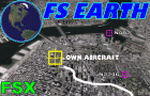
This program acts as a link between Flight Simulator X and Google Earth, letting to follow a flight in real time, over the satellite images generated by Google Earth. Flights can be saved, and many options are available for fine tuning the performance, as well as the map's style (zoom, tilt, orientation). Works on a single computer running FSX and Google Earth all together or, for best experience, can be used on two networked computers running respectively FSX (master) and Google Earth (slave). AI and Multiplayer traffic is also displayed in Google Earth, with course prediction and other information. Requires Flight Simulator X and Google Earth. The program running in trial mode works only around Anchorage, Alaska, (PANC / ANC) for a maximum of five minutes per flight session. Version 5.2 has new aircraft icons & labels and improves the compatibility with Windows Vista. A version for FS2004 is available also.
| Filename: | FS_Earth_52_for_Google_Earth_and_FSX.zip |
| License: | Shareware, time limited |
| Added: | 3rd May 2010, 07:38:23 |
| Downloads: | 2,702 |
| Author: | Luciano Napolitano |
| Size: | 3.46 MB |


© 2001-2026 AVSIM Online
All Rights Reserved
Privacy Policy |