
Where Flight Simulation Enthusiasts Gather from Around the World!
AVSIM Library - Search Results

| Category: Flight Simulator 2004 - Aircraft Repaints, Textures and Modifications | |
| Capital Airlines Douglas DC-3 |

|
File Description:
These textures are made available with the permission of Bill Rambow, and the use of texture template by Mark Beaumont. Capital Airlines was a major regional carrier serving the central and eastern portion of the USA. They opperated a fleet of DC3, DC4, L049, and were the first carrier in the USA to operate the Vickers Viscount. Early in the 1960s they were merged with United Airlines forming the largest airline in the USA, at that time. These textures are by Dale De Luca with help from Wayne Tudor.
| Filename: | Capital_Airlines_Douglas_DC3.zip |
| License: | Freeware, limited distribution |
| Added: | 26th May 2005, 12:50:10 |
| Downloads: | 637 |
| Author: | Dale De Luca / MAAM-SIM |
| Size: | 1.65 MB |
| Category: Flight Simulator 2004 - AI Aircraft | |
| DHL Boeing 757-200F Fleet |
|
File Description:
DHL Fleet for AI, All the paints for Boris DHL flightplans are inside(only the DHL livery's). Paints only, You'll need the model first.
| Filename: | DHL_Boeing_757200F_Fleet.zip |
| License: | Freeware |
| Added: | 20th June 2005, 18:12:23 |
| Downloads: | 3,655 |
| Author: | Dennis de Leeuw, AI Aardvark |
| Size: | 981.8 KB |
| Category: Flight Simulator 2004 - Gauges | |
| Bell UH-1H Italian Army Year 1986 Gauges |
|
File Description:
Sorry i forget included the gauges in my Bell UH-1H Italian Army Year 1986 repaint file
| Filename: | Bell__UH1H___Italian_Army_Year_1986_Gauges.zip |
| License: | Freeware |
| Added: | 13th January 2004, 01:54:14 |
| Downloads: | 1,879 |
| Author: | De Battista Luca/Deane Baunton |
| Size: | 682.97 KB |
| Category: Flight Simulator 2002 - Scenery | |
| Goianesia Airport (swgo) |
|
File Description:
Goianesia-(SWGO) FS2002/2004
Airport of the city of Goianesia, state of Goias, Brazil.
It can be used in FS2002 or FS 2004 .
Read file readme.txt.
| Filename: | Goianesia__Airport_swgo.zip |
| License: | Freeware |
| Added: | 7th December 2003, 22:33:45 |
| Downloads: | 409 |
| Author: | João Alfredo de Campos Pinto |
| Size: | 223.96 KB |
| Category: Fly! II - Scenery | |
| AI_GLIDERS POD |
|
File Description:
This pod file is part of the AI_GLIDERS DLL package:It will not work as a standalone.
| Filename: | AI_GLIDERS_POD.zip |
| License: | Freeware |
| Added: | 5th October 2003, 16:24:29 |
| Downloads: | 305 |
| Author: | Leen de Jager, Laurent Claudet |
| Size: | 137.1 KB |
| Category: Fly! II - Aircraft | |
| Beechcraft B1900C Grand Bahama Island |
|
File Description:
This is a repaint based on the Beechcraft B1900D originally made by Jarno Deken and Henri Werij . Later modified by Tony Cervone and Leen de Jager to the V6 version..
This V6 version is needed , read the readme.txt carefully.
It illustrates a B1900C in the special Grand Bahama Island colors.
| Filename: | Beechcraft_B1900C__Grand_Bahama_Island.zip |
| License: | Freeware, limited distribution |
| Added: | 30th December 2003, 23:42:29 |
| Downloads: | 184 |
| Author: | Repaint by Leen de Jager |
| Size: | 1.36 MB |
| Category: Flight Simulator 2004 - Scenery | |
| "Himalayan Peaks" LOD10 Mesh, Volume 8 - Tirich Mir and Pamir |
|
Images related to this file:
File Description:
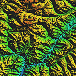
Highly detailed terrain mesh of the Tirich Mir and Pamir areas, N36-39 E71-74. The files in this package are based on Shuttle Radar (SRTM) Version 2 data but with many of the void areas, especially the most significant sections, filled with elevation data generated from topographic maps by Jonathan de Ferranti. While Jonathan's work is unrelated to flight simulation he kindly gave me permission to compile his data for use in FS. The result is a wonderful improvement in detail and accuracy over any existing mesh file, freeware or commercial, based on SRTM or DTED data alone.
Due to the large area of the Himalayas I've compiled the source data as two separate series: the "Himalayan Peaks" series covers prominent mountains and ranges in higher detail and locally overrides any existing LOD9 terrain mesh. In addition, a LOD9 "base mesh" series covering the entire Himalayas will be available for those who do not yet have an add-on terrain mesh of these beautiful mountains.
| Filename: | Himalayan_Peaks_LOD10_Mesh_Volume_8__Tirich_Mir_an.zip |
| License: | Freeware, limited distribution |
| Added: | 29th May 2010, 08:52:47 |
| Downloads: | 9,114 |
| Author: | Holger Sandmann, Jonathan de Ferranti |
| Size: | 47.94 MB |
| Category: Flight Simulator 2004 - Scenery | |
| "Himalayan Peaks" LOD10 Mesh, Volume 4 - Annapurna |
|
Images related to this file:
File Description:
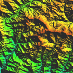
Highly detailed terrain mesh of the Annapurna area, N28-30 E83-85. The files in this package are based on Shuttle Radar (SRTM) Version 2 data but with many of the void areas, especially the most significant sections, filled with elevation data generated from topographic maps by Jonathan de Ferranti. While Jonathan's work is unrelated to flight simulation he kindly gave me permission to compile his data for use in FS. The result is a wonderful improvement in detail and accuracy over any existing mesh file, freeware or commercial, based on SRTM or DTED data alone.
Due to the large area of the Himalayas I've compiled the source data as two separate series: the "Himalayan Peaks" series covers prominent mountains and ranges in higher detail and locally overrides any existing LOD9 terrain mesh. In addition, a LOD9 "base mesh" series covering the entire Himalayas will be available for those who do not yet have an add-on terrain mesh of these beautiful mountains.
| Filename: | Himalayan_Peaks_LOD10_Mesh_Volume_4__Annapurna.zip |
| License: | Freeware, limited distribution |
| Added: | 29th May 2010, 08:59:29 |
| Downloads: | 10,470 |
| Author: | Holger Sandmann, Jonathan de Ferranti |
| Size: | 15.07 MB |
| Category: Flight Simulator 2004 - Scenery | |
| "Himalayan Peaks" LOD10 Mesh, Volume 6 - Jammu and Kashmir |
|
Images related to this file:
File Description:
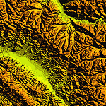
Highly detailed terrain mesh of the Jammu and Kashmir areas, N31-36 E76-78. The files in this package are based on Shuttle Radar (SRTM) Version 2 data but with many of the void areas, especially the most significant sections, filled with elevation data generated from topographic maps by Jonathan de Ferranti. While Jonathan's work is unrelated to flight simulation he kindly gave me permission to compile his data for use in FS. The result is a wonderful improvement in detail and accuracy over any existing mesh file, freeware or commercial, based on SRTM or DTED data alone.
Due to the large area of the Himalayas I've compiled the source data as two separate series: the "Himalayan Peaks" series covers prominent mountains and ranges in higher detail and locally overrides any existing LOD9 terrain mesh. In addition, a LOD9 "base mesh" series covering the entire Himalayas will be available for those who do not yet have an add-on terrain mesh of these beautiful mountains.
| Filename: | Himalayan_Peaks_LOD10_Mesh_Volume_6__Jammu_and_Kas.zip |
| License: | Freeware, limited distribution |
| Added: | 29th May 2010, 08:55:43 |
| Downloads: | 9,675 |
| Author: | Holger Sandmann, Jonathan de Ferranti |
| Size: | 52.19 MB |
| Category: Flight Simulator 2004 - Scenery | |
| "Himalayan Peaks" LOD10 Mesh, Volume 7 - K2 and Karakoram |
|
Images related to this file:
File Description:
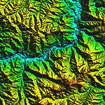
Highly detailed terrain mesh of the Karakoram area, N35-37 E73-77. The files in this package are based on Shuttle Radar (SRTM) Version 2 data but with many of the void areas, especially the most significant sections, filled with elevation data generated from topographic maps by Jonathan de Ferranti. While Jonathan's work is unrelated to flight simulation he kindly gave me permission to compile his data for use in FS. The result is a wonderful improvement in detail and accuracy over any existing mesh file, freeware or commercial, based on SRTM or DTED data alone.
Due to the large area of the Himalayas I've compiled the source data as two separate series: the "Himalayan Peaks" series covers prominent mountains and ranges in higher detail and locally overrides any existing LOD9 terrain mesh. In addition, a LOD9 "base mesh" series covering the entire Himalayas will be available for those who do not yet have an add-on terrain mesh of these beautiful mountains.
| Filename: | Himalayan_Peaks_LOD10_Mesh_Volume_7__K2_and_Karako.zip |
| License: | Freeware, limited distribution |
| Added: | 30th May 2010, 09:56:27 |
| Downloads: | 9,488 |
| Author: | Holger Sandmann, Jonathan de Ferranti |
| Size: | 38.58 MB |


© 2001-2026 AVSIM Online
All Rights Reserved
Privacy Policy |