
Where Flight Simulation Enthusiasts Gather from Around the World!
AVSIM Library - Search Results

| Category: Flight Simulator 2004 - Scenery | |
| ESMM 1963 Malmo Bulltofta |

|
File Description:
FS 2004 scenery for Malmo's Bulltofta airport in Sweden. Bulltofta served as Malmo's civilian airport from 1923 to 1972, with a short spell as a frontline fighter airfield during World War 2. This scenery is an approximation (not 100% accurate) of what the airport would have looked like in the 1960's. Requires fs9_custom_buildings_ss_1.zip and default_terminals_ss.zip by Sidney Schwartz, lens_ez_scenery.zip by Len Hickman, peepslib.zip by Geoff Williams, abw_alphanumericlibraryfinal.zip by Scot Ingram and esdg_ramplight_rwy12.zip by Bill Leaming. Created by Nikko Yaginuma with the help of Tom Gibson.
| Filename: | ESMM_1963_Malmo_Bulltofta.zip |
| License: | Freeware, limited distribution |
| Added: | 20th December 2008, 02:10:26 |
| Downloads: | 2,090 |
| Author: | Nikko Yaginuma and Tom Gibson |
| Size: | 12.05 KB |
| Category: Flight Simulator 2004 - Scenery | |
| PMDY - Midway Island (1970) |
|
Images related to this file:
File Description:

FS2004 scenery for Midway Island (1970). Midway Island has long been a vital stopover for ships and aircraft plying the Central Pacific. Although the islands are a quiet nature preserve today, during the 1970s Midway was a key link in the DEW (Detection Early Warning) radar defense system. Midway Island is actually two islands; Sand Island (the Western Island) with the current airfield and Eastern Island with an airfield dating from World War II which has become an antennae farm. This scenery was designed to accommodate the Vintage Military AI available from CalClassics.com.
| Filename: | PMDY__Midway_Island_1970.zip |
| License: | Freeware, limited distribution |
| Added: | 29th December 2014, 15:25:01 |
| Downloads: | 820 |
| Author: | John Stinstrom |
| Size: | 2.72 MB |
| Category: Flight Simulator X - Scenery | |
| Formosa X RCTP Taiwan Taoyuan International Airport (1/2) |
|
Images related to this file:
File Description:
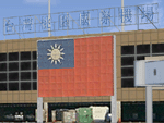
This project improves the default FSX scenery to better represent the appearance of Taoyuan International Airport as it is in 2011. All airport buildings and nearby landmarks were were custom-made using gMax, including animated radars and People Movers. Runways, taxiways, and aprons have been repositioned based on satellite imagery. Aircraft parking had been updated using the latest real-world AIP. A photoreal terrain of the Taoyuan area, plus landclass improvements, is also included. Part 1 of this package contains the airport scenery. Part 2 contains background photoreal textures and landclass files.
| Filename: | Formosa_X_RCTP_Taiwan_Taoyuan_International_Airpor.zip |
| License: | Freeware |
| Added: | 17th May 2011, 02:59:37 |
| Downloads: | 16,735 |
| Author: | Houting Chiang, Rudolf Liu, Jack Su, Mike Huang |
| Size: | 15.39 MB |
| Category: Flight Simulator X - Scenery | |
| Formosa X RCTP Taiwan Taoyuan International Airport (2/2) |
|
Images related to this file:
File Description:
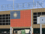
This project improves the default FSX scenery to better represent the appearance of Taoyuan International Airport as it is in 2011. All airport buildings and nearby landmarks were were custom-made using gMax, including animated radars and People Movers. Runways, taxiways, and aprons have been repositioned based on satellite imagery. Aircraft parking had been updated using the latest real-world AIP. A photoreal terrain of the Taoyuan area, plus landclass improvements, is also included. Part 1 of this package contains the airport scenery. Part 2 contains background photoreal textures and landclass files.
| Filename: | Formosa_X_RCTP_Taiwan_Taoyuan_International_Airpor.zip |
| License: | Freeware |
| Added: | 17th May 2011, 03:00:04 |
| Downloads: | 14,103 |
| Author: | Houting Chiang, Rudolf Liu, Jack Su, Mike Huang |
| Size: | 96.79 MB |
| Category: Flight Simulator 2004 - Scenery | |
| FS9 - KGRR - Grand Rapids Airport |
|
Images related to this file:
File Description:
A FS2004 scenery of the “Gerald R. Ford International Airport - KGRR in Grand Rapids, Michigan, USA, original made for FSX by Dillon Rocque. He was so kind to give permission for a conversion that is done by Greg Peters, Greg Putz, Hans Günther Schnell, Claus-Peter Sassen, Kobus van Wyk and Dedl Klemmt – all members of the FS2004-Team-Forum. The scenery has custom made buildings, custom runway and taxiways and a seasonal changing photo texture and lots of “eye candy†(please read the installation instructions).
| Filename: | FS9__KGRR__Grand_Rapids_Airport.zip |
| License: | Freeware |
| Added: | 15th February 2022, 00:28:03 |
| Downloads: | 968 |
| Author: | Dillon Rocque, FS9 conversion: Greg Peters, Greg Putz, Hans Günther Schnell, Claus-Peter Sassen, Kobus van Wyk and Dedl Klemmt |
| Size: | 114.26 MB |
| Category: Flight Simulator 2004 - Scenery | |
| LFBD - Bordeaux Merignac Airport (1961) - Bordeaux, France |
|
Images related to this file:
File Description:
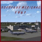
We proudly present this scenery of the airport and air base of Bordeaux Merignac (LFBD) as it was around 1961.
We have produced this scenery to provide taxiways and details as they were around this period.
We have also included new parking to allow the AI aircraft to taxi correctly at the new (old!)
airport. Although we did not always have enough photos and information we tried to come as close as possible.
Our goal was to reflect something of the atmosphere and feel of that period, prior to the all-jet era of today.
| Filename: | LFBD__Bordeaux_Merignac_Airport_1961__Bordeaux_Fra.zip |
| License: | Freeware |
| Added: | 16th December 2014, 14:39:41 |
| Downloads: | 2,554 |
| Author: | Harry Biard, Alejandro Ramirez and Bernard Leuenberger |
| Size: | 19.43 MB |
| Category: Flight Simulator 2004 - Scenery | |
| Zion National Park North, Cedar Breaks National Monument, Cedar City (KCDC), Utah, Photo-Scenery (FS9 & FSX) |
|
Images related to this file:
File Description:
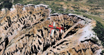
Cedar Breaks National Monument is a large amphitheater cliff in bright colors of red, orange and purple.
It lies east of Cedar City in the northern region of the scenery. The cliff was formed by erosion thru wind,
water and ice. Today erosion continues with a pace of about 2 inches every 5 years. Although it is called
Cedar Breaks, there are no cedars growing there but juniper trees. For a scenic flight to Cedar Breaks
National Monument best depart from Cedar City Regional Airport (KCDC) and head east. The scenery extends
south to Zion National Park and covers a large part of Zion Canyon and the Kolob Canyons area.
Zion National Park is another place where erosion of the Colorado Plateau formed the most beautiful colorful
stone formations of unique and wonderful shapes. There are nine different layers of stone visible in the park.
Most of them consist of sandstone. But there is also limestone, gypsum, siltstone, shale, clay and mudstone.
The Virgin River cut a spectacular and famous canyon thru Zion Park that is as narrow as 20ft and up to 2000ft tall.
High resolution versions of this scenery for FS9 and FSX (much sharper, but larger and multiple downloads)
are available at www.blueskyscenery.com/CNY_South2West5.html . The screenies are taken from the high-res versions,
so expect this version to be slightly more blurry.
Thanks to Joop Mak for providing a custom AFCADs that correct airport layouts so that they align with the photo-textures!
They are available here: www.blueskyscenery.com/AFCADs.html . YourDonation@Work: Dedicated to Richard, P.J. and Felix.
| Filename: | Zion_National_Park_North_Cedar_Breaks_National_Mon.zip |
| License: | Freeware, limited distribution |
| Added: | 14th March 2010, 00:30:28 |
| Downloads: | 1,565 |
| Author: | Gottfried Razek - blueskyscenery.com |
| Size: | 97.13 MB |
| Category: Flight Simulator 2004 - AFCAD Files | |
| AFCAD for FMEE (Saint Denis Gillot) and FMEP (Saint Pierre Pierrefonds) - La Reunion (France VFR scenery) |
|
Images related to this file:
File Description:
New AFCADs for the Reunion airports: FMEE (Saint Denis Gillot) and FMEP (Saint Pierre Pierrefonds) for wonderful "La Reunion" payware by FranceVFR. Might be default scenery compatible as well. Not tested in FSX.
The major changes are introduced to FMEP, including correct runway length (2100m) and width (45m), PAPI lights on both runway sides, added new apron B and taxiway B. Now you can land with your Airbus A3xx or Boeing 737 (these types land at FMEP in the real world).
The changes introduced to FMEE include some minor corrections to parking positions and added runway's asphalt edge.
Modifications are based on the Google Earth and AIP France.
| Filename: | AFCAD_for_FMEE_Saint_Denis_Gillot_and_FMEP_Saint_P.zip |
| License: | Freeware |
| Added: | 18th February 2010, 17:00:54 |
| Downloads: | 1,166 |
| Author: | Gregory Zapart |
| Size: | 15.7 KB |
| Category: Flight Simulator 2004 - Scenery | |
| PAIW Wales, Alaska, USA |
|
Images related to this file:
File Description:
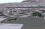
Googly scenery for Wales - a small domestic airport on the western coast of Alaska that is poorly provided for in Flight Simulator 2004. These scenery files add taxiways, aprons, buildings and other airport features, so that you and your "AI" traffic can land, taxi, park and take off in a realistic manner.
Wales is a small village with a population of just over 150 people, so the facilities at this 4000 foot gravel airstrip are fairly limited. The airport is allocated the ICAO code PAIW, although Microsoft has ignored this in Flight Simulator and uses the IATA ticket code IWK. Wales is served by light aircraft from airlines such as Bering Air, Cape Smythe Air, Frontier Flying Service, and Hageland Aviation Services. You might find it a convenient stopping-off point for a quick trip across to Russia - this is about as close as you can get and a nip across the Bering Strait will find you there in no time.
The scenery does not purport to be ultra-accurate. Based on high-detail satellite imagery from Google Earth, the layout is proportionally correct but the added airport features, such as buildings, are built from default Microsoft objects and add-on libraries so will not look like the real thing.
You are not obliged to download and install any additional scenery libraries, but to enjoy this scenery in its entirety, you may wish to. It will work fine, with or without.
[File re-uploaded at request of AVSIM]
| Filename: | PAIW_Wales_Alaska_USA.zip |
| License: | Freeware |
| Added: | 26th June 2010, 13:51:45 |
| Downloads: | 1,266 |
| Author: | John Hinson |
| Size: | 76.81 KB |
| Category: Flight Simulator 2004 - Scenery | |
| VFR of Lario, Area E2 - Como Lake, Italy (Update) |
|
Images related to this file:
File Description:
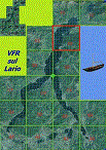
This 8th scenery covers approximately an area of 7.5x6 km, from S.Gregorio/Dongo (NW) to Colico (NE), and S.Siro (SW) to Tremenico/Aveno (SE) and includes six NLC piers: Dervio, Piona, Colico, Dongo, Musso, Pianello del Lario, in addition to the disused Cremia's one; a lot of dedicated buildings are included, as S.Tommaso of Canterbury church and fortification (Corenno), Cistercian abbey (Piona), pier and dock (Colico), S.Stefano church, factory buildings and airpollution control machinery (Dongo), Rezzonico's castle (S.Siro).
This VFR on Lario scenery includes several Dervio's details, and fully revises the previous Dervio scenery; Are included: Boldona's park office and stand, railway station, NLC shiphard, Pontile piers with Concordia steamer, dock bay with small floating pier and compass of the lake, S. Peter and Paul church and houses front of lake, hydro power station, Municipality and some other buildings, Castello's tower, windsurf school, windsurfers and kitesurfers on the lake, cross and Madonna on top of Legnoncino mountain. There are also included two viaducts between the tunnels of the freeway 36, with moted traffic. Catamarans Citta di Como and Tivano at Colico/Dongo piers together with other minor boats and docks alongside the lake coast; a moted regata with catamarans is placed in the lake between Pianello and Dervio.
This scenery SUPERSEDES AND CANCELS the previous "dervio_v2a" one, removed from the library. This is the eighth scenery of the "VFR of Lario" project, made with photorealistic terrain (multiseason & night) and with some 3D GMax realistic objects.
| Filename: | VFR_of_Lario_Area_E2__Como_Lake_Italy_Update.zip |
| License: | Freeware |
| Added: | 25th November 2012, 20:54:39 |
| Downloads: | 1,665 |
| Author: | Aldo Della Vedova, Daniele Lanfranchi, Gian Mario Verga |
| Size: | 39.39 MB |


© 2001-2026 AVSIM Online
All Rights Reserved
Privacy Policy |