
Where Flight Simulation Enthusiasts Gather from Around the World!
AVSIM Library - Search Results

| Category: Flight Simulator 2004 - Scenery | |
| Doha, Qatar - Photoreal and Autogen |

|
Images related to this file:
File Description:
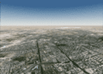
Doha is the capital city of the state of Qatar. Located on the coast of the Persian Gulf, it had a population of 998,651 and is also one of the municipalities of Qatar. The scenery covers the whole city of Doha and the surroundings, with the new airport under construction and "The Pearl", an artificial island built in the bay of Doha which is involved in a huge residential development. The autogen, with buildings, skyscrapers and vegetation, is included in the scenery.
| Filename: | Doha_Qatar___Photoreal_and_Autogen.zip |
| License: | Freeware |
| Added: | 4th June 2013, 21:49:11 |
| Downloads: | 4,172 |
| Author: | Luca Esposito, Fabio Ferrari |
| Size: | 76.26 MB |
| Category: Flight Simulator 2004 - Scenery | |
| New York Kennedy JFK / KJFK, Version 7 |
|
Images related to this file:
File Description:

Thank you for downloading my scenery. This is an update to the default JFK airport in New York. It contains the new American Airlines terminal and roadways through the center of the airport. Also included are refinements to all the other terminals with realistic jetway positioning and more usable gates. Terminal 4 was completely rebuilt from scratch
so as to appear as it does today. All terminals have accurate parking assignments per the Port Authority website. This scenery was built using Abacus' EZ-Scenery program.
Update:
This update contains a brand new, more accurate version of terminal 4, updates to American's terminal 8, and a completely reworked Afcad file with all taxiway signs corrected and in proper position. Also, parking has been updated and made much more accurate.
| Filename: | New_York_Kennedy_JFK__KJFK__Version_7.zip |
| License: | Freeware |
| Added: | 20th May 2010, 09:07:17 |
| Downloads: | 39,053 |
| Author: | William Morgan, FRFSTUDIO.NET |
| Size: | 24.53 MB |
| Category: Flight Simulator 2004 - Scenery | |
| DGSI Kumasi, Ghana |
|
Images related to this file:
File Description:
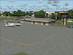
Googly scenery for Kumasi - a small domestic airport in Ghana for which no facilities
are provided in Flight Simulator 2004. These scenery files add taxiways, aprons,
buildings and other airport features, so that you and your "AI" traffic can land,
taxi, park and take off in a realistic manner.
The airport serves the city of Kumasi (capital of the Ashanti region) and sees
regular flights using turboprop airliners operated by Accra based operators
Antrak Air and Citylink.
The scenery does not purport to be ultra-accurate. Based on high-detail satellite
imagery from Google Earth, the layout is proportionally correct but the added
airport features, such as buildings, are built from default Microsoft objects
and add-on libraries so will not look like the real thing.
[File re-uploaded at request of AVSIM]
| Filename: | DGSI_Kumasi_Ghana.zip |
| License: | Freeware |
| Added: | 23rd May 2010, 01:25:23 |
| Downloads: | 1,420 |
| Author: | John Hinson |
| Size: | 80.3 KB |
| Category: Flight Simulator X - Scenery | |
| Nomos Irakliou and Lasithiou |
|
Images related to this file:
File Description:
AS REAL AS IT GETS.
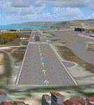
This is a detailed photo-realistic scenery of Nomos Irakliou and Lasithiou.
This upload is the last photo-scenery area containing airports in Greece.
Default FSX airports of Iraklio (LGIR), Sitia (LGST) and Kasteli (LGTL) were completely redone, positioned to their exact location, and many buildings and objects were added in the airport compounds.
New aprons, taxi signs and plenty of aircraft parking.
Also you have the choice of installing the textures of 22 original buildings (sketchup models) of the old Air Base near the town of Gouves. You could see the Base on your left at LGIR final runway 27.
The scenery contains plenty of autogen objects, buildings, vegetation and road traffic near the airports and the surrounding area.
I have also included 3 aircraft traffic files.
| Filename: | Nomos_Irakliou_and_Lasithiou.zip |
| License: | Freeware |
| Added: | 15th October 2011, 02:09:18 |
| Downloads: | 2,958 |
| Author: | Angelo Tassoglou |
| Size: | 245.12 MB |
| Category: Flight Simulator X - Scenery | |
| Rio Vista Municipal Airport, California (O88) |
|
Images related to this file:
File Description:
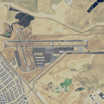
Rio Vista Municipal Airport, is located on the western edge of the city of Rio Vista in the heart of California's San Joaquin River Delta, about 260 mile northeast of San Francisco. Rio Vista Municipal Airport has an 4,200-foot long, 75-foot wide primary runway. There is also a 2,200-foot long, 60-foot wide secondary runway and a helipad. This is a major overhaul of the default airport, dramatically improving accuracy of taxiways, runways, aprons, structures and other scenery details. Designed so that anyone familiar with the actual airport will experience immediate recognition, the project includes several custom buildings and many custom scenery objects modeled on the actual airport. The surrounding area has been extensively modeled. Including, 324 accurately place wind turbines, 3690 houses, and a total count of 4740 scenery objects.
| Filename: | Rio_Vista_Municipal_Airport_California_O88.zip |
| License: | Freeware |
| Added: | 5th December 2011, 21:26:45 |
| Downloads: | 945 |
| Author: | John Hottel |
| Size: | 19.21 MB |
| Category: Flight Simulator 2004 - Scenery | |
| RAF Alconbury |
|
Images related to this file:
File Description:

Scenery for RAF Alconbury. The last flying units to be based here were the A-10A's of the 10th Tactical Fighter Wing and the TR-1's of the 95th Recon Squadron. Alconbury was opened by the RAF in 1938, and taken over by the USAAF in 1942. It is one of two bases that have been continually in U.S. service since World War 2.
There are two options for parking setups in this scenery - it is defaulted to A-10 operations, but you can swap out files to house the RF-4's of the 10th TRW and F-5E's of the 527th TFTAS; the Phantoms are available but there are no F-5 paints available yet.
Scenery is made up from several object libraries, details can be found in the readme.
| Filename: | RAF_Alconbury.zip |
| License: | Freeware, limited distribution |
| Added: | 18th August 2013, 09:19:21 |
| Downloads: | 1,305 |
| Author: | Brian Clarke / Daryl Payne |
| Size: | 487.28 KB |
| Category: Flight Simulator X - Scenery | |
| OPNH - Nawabshah Airport - Nawabshah, Sindh, Pakistan |
|
Images related to this file:
File Description:
First ever freeware Scenery of PSDG/MSK OPNH Nawabshah Airport FsX/P3D. Our projects will range from major to regional airports and we will strive to add realism and detail to flight locations spanning the entire country. With each new project we will aim to enhance the flight simulation experience by providing familiar terrain in the Pakistani air space for both training as well as recreation purposes. We have embarked upon our first project OPNH airport in Nawabshah, which is currently completed and have included screenshots in the pack Scenery Developed by Sarmad Khan (MSK) & Raihan Shahzad along with supported by Ali Kazimi, Irfan Khan, Omais Khan, Ahmed Arif & Mr. Shahid Iqbal. PSDG (Pakistan Scenery Development Group) was established by Pakistan vACC, a VATSIM division in West Asia region.
| Filename: | OPNH__Nawabshah_Airport__Nawabshah_Sindh_Pakistan.zip |
| License: | Freeware |
| Added: | 1st March 2015, 15:41:50 |
| Downloads: | 811 |
| Author: | M Sarmad Khan |
| Size: | 65.88 MB |
| Category: X-Plane - Scenery | |
| WXRA Susi Air Mount Rinjani Airstrip v1.0.0 |
|
Images related to this file:
File Description:
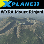
This is an X-Plane 11 scenery for Mount Rinjani Airstrip (WXRA) in the Island of Lombok, Indonesia. This is a fictitious airfield, located in a volcano mouth. This fictitious airfield may serve as a stopover for flights between Java and Papua, for the Susi Air scenery package. This is one of the destinations for "PT ASI Pujiastuti Aviation", operating as Susi Air, an Indonesia airlines established in late 2004 by Mrs. Susi Pudjiastuti. This scenery was tested and is operational (as of January 12, 2017) in "X-Plane 11 Public Beta #5 64 bit", Windows 10 Home. It was also tested and is partially operational (as of January 12, 2017) in "X-Plane 10.51 64 bit", Windows 10 Home. XP10 presents a much higher runway slope given mesh issues.
| Filename: | WXRA_Susi_Air_Mount_Rinjani_Airstrip_v100.zip |
| License: | Freeware |
| Added: | 13th January 2017, 20:09:24 |
| Downloads: | 52 |
| Author: | Rui Mesquita |
| Size: | 2.51 MB |
| Category: Flight Simulator X - Scenery | |
| ENFG_Fagernes/Leirin, Norway for FSX |
|
Images related to this file:
File Description: The airport ENFG is situated about 4 kilometers northeast of the city of Fagernes in the municipal of Nord-Aurdal, Oppland, about 120 miles northeast from Oslo.
The altitude of ENFG is 822 m / 2,697 ft. The airport is very close to the important rocks of Jutunheimen. The senery has a photo background that covers all four seasons: spring, summer, autumn and winter. The surroundings are made via new landclasses which fit mostly the reality. Also all lakes and rivers are updated. The buildings in this scenery are mostly taken from the fantastic XPlane scenery made by Hans Kristian Braaten Olsen, who kindly gave me permission to use his buildings in this scenery. I prepared them for FSX and partly reworked them a bit.
| Filename: | ENFG_FagernesLeirin_Norway_for_FSX.zip |
| License: | Freeware |
| Added: | 5th October 2019, 18:01:05 |
| Downloads: | 489 |
| Author: | Wolfgang Allers |
| Size: | 245.88 MB |
| Category: Prepar3D V1-4 - Scenery | |
| ENFG_Fagernes/Leirin, Norway for P3DV4 |
|
Images related to this file:
File Description: The airport ENFG is situated about 4 kilometers northeast of the city of Fagernes in the municipal of Nord-Aurdal, Oppland, about 120 miles northeast from Oslo.
The altitude of ENFG is 822 m / 2,697 ft. The airport is very close to the imposant rocks of Jutunheimen. The senery has a photo background that covers all four seasons: spring, summer, autumn and winter. The surroundings are made via new landclasses which fit mostly the reality. Also all lakes and rivers are updated. The buildings in this scenery are mostly taken from the fantastic XPlane scenery made by Hans Kristian Braaten Olsen, who kindly gave me permission to use his buildings in this scenery. I prepared them for FSX and partly reworked them a bit.
| Filename: | ENFG_FagernesLeirin_Norway_for_P3DV4.zip |
| License: | Freeware |
| Added: | 5th October 2019, 18:03:21 |
| Downloads: | 480 |
| Author: | Wolfgang Allers |
| Size: | 245.14 MB |


© 2001-2026 AVSIM Online
All Rights Reserved
Privacy Policy |