
Where Flight Simulation Enthusiasts Gather from Around the World!
AVSIM Library - Search Results

| Category: Flight Simulator X - Scenery | |
| LSZN Hausen am Albis, Switzerland for FSX/P3D |

|
Images related to this file:
File Description:
LSZN Hausen am Albis is one of the "white spots" in the FSX/P3D. This airfield does not exist in the standard scenery of FSX/P3D.
Information about the airfield you can find here (only in german):
http://www.fgho.ch/
This scenery is designed in a quite detailled way. All important buildings are made new by myself or converted from old FS9-objects from the FS9-scenery of Andreas Aegi.
The suroundings of the airfield are adapted by new landclasses fitting the real situations according to the satellite photos of GOOGLE Earth.
Also the mesh of the airfield is adapted to the real mesh as it is assigned in the charts..
There are Photobackgrounds for FS-standardscenery and the payware-scenery “Switzerland ProXâ€.
| Filename: | LSZN_Hausen_am_Albis_Switzerland_for_FSXP3D.zip |
| License: | Freeware |
| Added: | 15th October 2017, 04:23:38 |
| Downloads: | 1,421 |
| Author: | Wolfgang Allers |
| Size: | 221.53 MB |
| Category: Prepar3D V1-4 - Scenery | |
| Flying M Ranch - 7TA7 (Reklaw, TX) |
|
Images related to this file:
File Description:
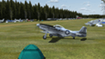
This scenery represents the Flying M Ranch which is a private airfield located in Reklaw, Texas about 123 NM ESE of the Dallas/Fort Worth area. The airfield is known for its annual Fall fly-in and campout and its challenging approaches due to the proximity of trees around the airport. The fly-in has attracted hundreds of aircraft each year and continues to gain popularity. This scenery is not an exact copy of the airport but it does it justice compared to the default scenery which is just a grass strip in the middle of a large blank airfield landclass. The scenery was created with the fantastic Airport Design Editor (ADE) and all objects used are from the default library.
| Filename: | Flying_M_Ranch__7TA7_Reklaw_TX.zip |
| License: | Freeware |
| Added: | 28th May 2020, 19:37:53 |
| Downloads: | 133 |
| Author: | Dylan Phelps |
| Size: | 9.32 MB |
| Category: Flight Simulator 2004 - Scenery | |
| Norfolk Trees pt2 |
|
File Description:
This pack will place trees into the scenery for Norfolk UK for FS9. It is designed to be compliant with VFR Photographic Scenery, VFR Terrain part 1 and the UK2000 scenery. The scenery has been created using GianP's agen_x trees and Tree Planter by George Davison.
Part Two covers the area in an arc approximately 10 miles to the west and south of Norwich and is contiguous with part one.
If you have parts one and two installed you will now have tree cover for over 240 square miles of Norfolk comprising of more than 250,000 trees, the large majority of which have been �¢����hand planted�¢����
| Filename: | Norfolk_Trees_pt2.zip |
| License: | Freeware |
| Added: | 5th May 2010, 22:09:32 |
| Downloads: | 351 |
| Author: | Norman Dean |
| Size: | 1.15 MB |
| Category: Flight Simulator 2004 - AFCAD Files | |
| A&F Data For South Australia airfields v2 |
|
Images related to this file:
File Description:
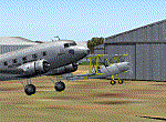
This set of 76 AFCAD2 files are for use with the free add-on scenery from Roger Leupold (fs9sav1.zip) are not suitable for the default FS2004 airfields. They will allow the scenery (designed for FS2002) to become more useable in FS2004. They will allow you to plan routes, and take off and land at some 76 airfields featuring in the scenery, with ATC routing you appropriately.
AI aircraft can now land, taxi, park and take off in the correct locations, and you can introduce your own AI traffic, too, if you wish. Every aifield has at least one parking space (even the tiniest airstips) but airfields featuring hangers and other scenery have more.
[File re-uploaded at request of AVSIM]
| Filename: | AF_Data_For_South_Australia_airfields_v2.zip |
| License: | Freeware |
| Added: | 13th May 2010, 09:58:39 |
| Downloads: | 914 |
| Author: | John Hinson |
| Size: | 84.15 KB |
| Category: Flight Simulator X - AFCAD Files | |
| Matthews Airport (NJ09), NJ |
|
File Description:
Located 03 miles S of Belvidere, New Jersey, Matthews Airport is a private turf strip 2000' in length. No services are offered for transient aircraft. A parking spot is available for users to start on the concrete pad in front of the hangar. Field is not lit, daytime VFR only is recommended.
Scenery constructed with use of satellite images/streetview/aerial photos - the author has not been there in person.
This scenery is meant to be used in conjunction with MegaScenery Earth New York 007. It is not required, but apron use is minimized to allow satellite scenery to show through as much as possible, and objects are placed based on the MSE textures - lack of it may make scenery look out of place.
| Filename: | Matthews_Airport_NJ09_NJ.zip |
| License: | Freeware |
| Added: | 14th June 2011, 06:09:05 |
| Downloads: | 272 |
| Author: | Drew Sikora |
| Size: | 572.92 KB |
| Category: Flight Simulator X - AFCAD Files | |
| Alliance Airport (23NJ), NJ |
|
File Description:
Located 02 miles SE of Pittsgrove, New Jersey on 3 acres of land, Alliance Airport is a privately-owned turf airstrip included in FSX. If you don't plan on making any trips here, then this AFCAD file will remove the runway and prevent it from randomly sticking out on the satellite textures.
Scenery constructed with use of satellite images/streetview, the author has not been there in person.
This scenery is meant to be used in conjunction with MegaScenery Earth New Jersey/Delaware 004. It is not required, but apron use is minimized to allow satellite scenery to show through as much as possible, and objects are placed based on the MSE textures - lack of it may make scenery look out of place.
| Filename: | Alliance_Airport_23NJ_NJ.zip |
| License: | Freeware |
| Added: | 22nd October 2010, 06:03:59 |
| Downloads: | 203 |
| Author: | Drew Sikora |
| Size: | 174.79 KB |
| Category: Flight Simulator X - AFCAD Files | |
| Markle Airport (2NJ6), NJ |
|
File Description:
Located 05 miles N of Phillipsburg, New Jersey, Markle Airport is a private turf strip. No transient services are offered. Trees are summertime ONLY. 30ft trees and some houses surround the runway to the south and the west, the eastern threshold is on the edge of a steep ravine leading down to the Delaware River.
Scenery constructed with use of satellite images/streetview, the author has not been there in person.
This scenery is meant to be used in conjunction with MegaScenery Earth New York 007. It is not required, but apron use is minimized to allow satellite scenery to show through as much as possible, and objects are placed based on the MSE textures - lack of it may make scenery look out of place.
| Filename: | Markle_Airport_2NJ6_NJ.zip |
| License: | Freeware |
| Added: | 29th October 2010, 21:31:35 |
| Downloads: | 172 |
| Author: | Drew Sikora |
| Size: | 329.68 KB |
| Category: Flight Simulator 2004 - Scenery | |
| Wilgrove Airpark (8A6) |
|
Images related to this file:
File Description:
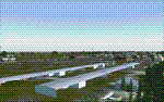
Wilgrove Airpark (8A6) is a small GA airport located just east of Charlotte, NC. It is often forgotten by pilots in Flightsimulator, yet it is a very busy place in the real-world, due to it's huge popularity with student and weekend GA pilots. There has never been a really good, accurate representation of this little gem created for the flightsim, so I decided to try my hand at it. This is my very first scenery project, and I hope you enjoy it. It was designed with ADE9X, and it requires RWY12 and EZ-Scenery objects extensively,(not included) so you will need to download these freeware scenery libraries prior to installation of this package for the Wilgrove Airpark scenery to display properly. - Glenn Mullis
| Filename: | Wilgrove_Airpark_8A6.zip |
| License: | Freeware, limited distribution |
| Added: | 22nd September 2010, 16:59:32 |
| Downloads: | 278 |
| Author: | Glenn Mullis |
| Size: | 4.4 MB |
| Category: Flight Simulator X - Scenery | |
| The Thames Barrier - England |
|
Images related to this file:
File Description:

This scenery adds the Thames Barrier to Orbx EU England Regional scenery package. Compatible with both FSX & P3D. The Thames Barrier is the world's second-largest movable flood barrier (after the Oosterscheldekering in the Netherlands) and is located downstream of central London, United Kingdom. Its purpose is to prevent London from being flooded by exceptionally high tides and storm surges moving up from the sea. It needs to be raised (closed) only during high tide; at ebb tide it can be lowered to release the water that backs up behind it. Not tested with default FSX or any other setup. You must have Orbx EU England regional scenery to use the compiled scenery files as intended. By Bryan Wallis aka fltsimguy.
| Filename: | The_Thames_Barrier__England.zip |
| License: | Freeware, limited distribution |
| Added: | 27th January 2013, 01:08:30 |
| Downloads: | 1,340 |
| Author: | Bryan Wallis |
| Size: | 584.23 KB |
| Category: Flight Simulator X - Scenery | |
| Mayaguana (MYMM) - The Bahamas |
|
Images related to this file:
File Description:
Mayaguana is the easternmost island in the Bahamas with Bahamasair providing Nassau and Inagua air connections. The airport utilizes part of an abandoned 11,000 foot USAF runway. The runway is listed as 7300 foot long, but 2400 feet on the east end is closed indefinitely. A new terminal building was completed, but no apron or taxiway connects it to the runway so it is unoccupied. Construction was started on another terminal, apron and taxiway as well as runway repaving, but the project is currently abandoned. All of the aforegoing is represented by this scenery. The scenery includes custom scenery objects; placement of library objects and landclass changes. Scenery is based on Bing Maps and photos taken locally, and it is optimized for use with UTX-TAC.
| Filename: | Mayaguana_MYMM__The_Bahamas.zip |
| License: | Freeware |
| Added: | 20th April 2013, 20:18:45 |
| Downloads: | 1,124 |
| Author: | Art Poole |
| Size: | 1.04 MB |


© 2001-2026 AVSIM Online
All Rights Reserved
Privacy Policy |