
Where Flight Simulation Enthusiasts Gather from Around the World!
AVSIM Library - Search Results

| Category: Flight Simulator X - Scenery | |
| OERK Photoreal - King Khalid International Airport - Riyadh, Saudi Arabia |

|
File Description:
This is a Photoreal Scenery for Riyadh's King Khalid International Airport. Note that this is only a Photoreal Scenery and not an AFCAD (airport design file). Tested on FSX and P3D. Might work on FS2004 as well, you might want to give it a try. Read "readme.txt" for more information.
| Filename: | OERK_Photoreal__King_Khalid_International_Airport_.zip |
| License: | Freeware, limited distribution |
| Added: | 7th December 2015, 22:08:36 |
| Downloads: | 3,752 |
| Author: | Shafat Hasan |
| Size: | 2.19 MB |
| Category: Flight Simulator X - Scenery | |
| KABE - Lehigh Valley International - Allentown, Pennsylvania, USA |
|
File Description:
The Lehigh Valley International Airport, located in eastern Pennsylvania between Allentown and Bethlehem is a medium-sized regional airport providing air service to airline hubs and Florida. This scenery project updates the default FSX scenery and includes renditions of the terminal, hangars, tower, and surroundings. Version 1.00. By Matthew Derr.
| Filename: | KABE__Lehigh_Valley_International__Allentown_Penns.zip |
| License: | Freeware |
| Added: | 14th February 2015, 19:09:53 |
| Downloads: | 722 |
| Author: | Matthew Derr |
| Size: | 61.37 MB |
| Category: Flight Simulator 2004 - Scenery | |
| Antilles 2004 |
|
File Description:
This scenery package aims at improving the visual depiction of the Caribbean. It covers 17 islands and 16 airports from Montserrat down to Tobago. It provides totally new island coastlines, mesh, landclass, roads, rivers, visual details for VFR flying, animated scenery, custom airports as well as accurate navaids and ATC frequencies.
| Filename: | Antilles_2004.zip |
| License: | Freeware, limited distribution |
| Added: | 9th February 2004, 04:40:22 |
| Downloads: | 25,447 |
| Author: | FS Antilles Group |
| Size: | 10.04 MB |
| Category: Flight Simulator 2004 - Scenery | |
| Jerusalem |
|
File Description:
FS2004 Scenery - Jerusalem. The third part of Israel
scenery covering the mountain range of Samaria, Judea
and the cities of Jerusalem and Bethlehem. The scenery
is made in the highest detail with new terrain textures
and it shows all main roads, secondary roads, junctions,
rail roads, vegetation and residential areas with a
population of 1,000 and above. The scenery is enhanced
with over 300 structures and buildings made in Gmax.
Among them the Old City of Jerusalem with its walls and
gates, Mount Temple, the Wailling Wall, the city Citadel,
the Holy Sepulchre and all other major churches and
monasteries of Jerusalem, including the Church of
Nativity in Bethlehem and the churches on Mount Olive
and Mount Zion. The scenery also covers in high detail
the New City of Jerusalem, with all landmark structures
and buildings such as the Knesset (Israel's parliament),
museums, the Supreme Court, Yad-Vashem (the holocaust
memorial), Hadasa hospital, Teddi soccer stadium, all
hotels and highrise buildings and much more. There are
also landmarks outside Jerusalem such as the Latrun
Trappist monastery and the nearby Armor Corps Memorial.
All major structures are based on real measurements and
photos taken from the ground. The textures are all
specially made for this scenery. The scenery is enhanced
with night lighting to enable easy VFR navigation by
night.
| Filename: | Jerusalem.zip |
| License: | Freeware |
| Added: | 15th April 2004, 15:39:12 |
| Downloads: | 20,046 |
| Author: | Seev Kahn |
| Size: | 4.49 MB |
| Category: Flight Simulator 2004 - Scenery | |
| Joslin-Magic Valley Regl KTWF |
|
File Description:
FS2004 Scenery-Joslin Field - Magic Valley Regl Airport (KTWF) serves Twin Falls, ID and Twin Falls County and is owned by the City & County Of Twin Falls. The airport has more than one runway. The longest is a paved runway extending 8703 feet. The facility is at an elevation of 4151 feet at a distance of about 4 miles from Twin Falls. Created with EZ Scenery, Rwy12 and Lago's FSE with AFCAD2 and Traffic Tools. Textures for custom EZ Scenery objects included. By John B. Loney, Jr.
| Filename: | JoslinMagic_Valley_Regl_KTWF.zip |
| License: | Freeware |
| Added: | 3rd July 2006, 01:48:04 |
| Downloads: | 1,094 |
| Author: | John B. Loney, Jr. |
| Size: | 891.05 KB |
| Category: Flight Simulator X - Scenery | |
| USA West Mountain Landclass |
|
File Description:
The Landclass File is a stand alone scenery, you can use it with the FS Standart Scenery or other Landclass files like Cloud9, FS Genesis etc.
Now you will see rocky mountain Landclasses in the USA.
Green mountains are now past!! You get now the feeling to fly over high mountains and not over green hills.
The best results you get with FS Global or another good mesh like My World X
Installation:
Extract to the folder of FSX and activate the scenery in FSX
| Filename: | USA_West_Mountain_Landclass.zip |
| License: | Freeware |
| Added: | 15th March 2008, 09:51:35 |
| Downloads: | 2,375 |
| Author: | Markus Balz |
| Size: | 148.57 KB |
| Category: Flight Simulator 2004 - Scenery | |
| Mauke Island Airport, Cook Islands. NCMK. |
|
File Description:
Welcome to Mauke Island, in the beautiful Pacific Island paradise of the Cook Islands. The Cook Islands domestic air carrier is Air Rarotonga, serving all the islands in the group using Embraer EMB110 "Bandeirante" and Saab-340 aircraft. This scenery is designed and built to fit the RBE / Sim Pilot Experience "Cook Islands Scenery" (payware),
by Christian Stock. It has not been tested in the freeware Cook Islands Mesh that is available, or in FS9 default. Requires some EZ Scenery Object sets (see INSTALL instructions for details).
| Filename: | Mauke_Island_Airport_Cook_Islands_NCMK.zip |
| License: | Freeware, limited distribution |
| Added: | 17th February 2009, 00:21:21 |
| Downloads: | 797 |
| Author: | Lawrie Roache |
| Size: | 1.68 MB |
| Category: Flight Simulator 2004 - Scenery | |
| Aitutaki Airport, Cook Islands NCAI |
|
File Description:
Welcome to Aitutaki Airport, in the beautiful Pacific Island paradise of the Cook Islands. The Cook Islands domestic air carrier is Air Rarotonga, serving all the islands in the group using Embraer EMB110 "Bandeirante" and Saab-340 aircraft. This scenery is designed and built to fit the RBE / Sim Pilot Experience "Cook Islands Scenery" (payware), by Christian Stock. It has not been tested in the freeware Cook Islands Mesh that is available, or in FS9 default. Requires some EZ Scenery Object Sets (see INSTALL instructions for details).
| Filename: | Aitutaki_Airport_Cook_Islands__NCAI.zip |
| License: | Freeware, limited distribution |
| Added: | 26th February 2009, 13:02:34 |
| Downloads: | 1,155 |
| Author: | Lawrie Roache |
| Size: | 1.7 MB |
| Category: Flight Simulator X - Scenery | |
| Agrinio-Itea |
|
Images related to this file:
File Description:
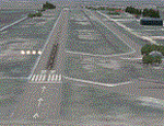
AS REAL AS IT GETS.
This is a detailed photorealistic scenery of Agrinio and the area from Ionio Pelagos in the West, to Itea in the East.
This scenery borders the south part of the Chalkida- Oinoi photoscenery.
See bellow for scenery choices.
Default FSX airports of Agrinio AB (LGAG) and Agrinio (GX01) were completely redone, positioned to their exact location, many buildings and objects were added in the airport compounds.
New aprons with commercial and military parking and 2 aircraft traffic files included.
| Filename: | AgrinioItea.zip |
| License: | Freeware |
| Added: | 13th August 2011, 17:05:04 |
| Downloads: | 2,185 |
| Author: | Angelo Tassoglou |
| Size: | 241.81 MB |
| Category: Flight Simulator 2004 - Scenery | |
| Palermo Airport (LICJ) 2012 ver. 1.1 |
|
Images related to this file:
File Description:
Punta Raisi "Falcone-Borsellino" scenery, version 1.1, for Microsoft Flight Simulator 2004. This scenery was created with gmax, photoshop and AFX, and with assistance of Thomas Lo Gerfo. The scenery includes accurate buildings, hangars, parking bays, safe docking, night texturing and illumination effects.
The Palermo Airport (IATA: PMO, ICAO: LICJ), also known as Falcone-Borsellino Airport or Punta Raisi Airport is located at Punta Raisi, 19 NM (35 km; 22 mi) west northwest of Palermo, the capital city the Sicily island (Italy).
| Filename: | Palermo_Airport_LICJ_2012_ver_11.zip |
| License: | Freeware |
| Added: | 18th February 2012, 21:19:30 |
| Downloads: | 8,900 |
| Author: | Francesco Salsano |
| Size: | 13.43 MB |


© 2001-2026 AVSIM Online
All Rights Reserved
Privacy Policy |