
Where Flight Simulation Enthusiasts Gather from Around the World!
AVSIM Library - Search Results

| Category: Flight Simulator 2004 - Scenery | |
| "Himalayan Peaks" LOD10 Mesh, Volume 7 - K2 and Karakoram |

|
Images related to this file:
File Description:

Highly detailed terrain mesh of the Karakoram area, N35-37 E73-77. The files in this package are based on Shuttle Radar (SRTM) Version 2 data but with many of the void areas, especially the most significant sections, filled with elevation data generated from topographic maps by Jonathan de Ferranti. While Jonathan's work is unrelated to flight simulation he kindly gave me permission to compile his data for use in FS. The result is a wonderful improvement in detail and accuracy over any existing mesh file, freeware or commercial, based on SRTM or DTED data alone.
Due to the large area of the Himalayas I've compiled the source data as two separate series: the "Himalayan Peaks" series covers prominent mountains and ranges in higher detail and locally overrides any existing LOD9 terrain mesh. In addition, a LOD9 "base mesh" series covering the entire Himalayas will be available for those who do not yet have an add-on terrain mesh of these beautiful mountains.
| Filename: | Himalayan_Peaks_LOD10_Mesh_Volume_7__K2_and_Karako.zip |
| License: | Freeware, limited distribution |
| Added: | 30th May 2010, 09:56:27 |
| Downloads: | 9,480 |
| Author: | Holger Sandmann, Jonathan de Ferranti |
| Size: | 38.58 MB |
| Category: Flight Simulator 2004 - AI Aircraft | |
| L-410 UVP-E SOL and Team Linhas Aereas |
|
Images related to this file:
File Description:
Texture for AI L-410 UVP-E SOL AND TEAM Linhas Aereas.
| Filename: | L410_UVPE_SOL_and_Team_Linhas_Aereas.zip |
| License: | Freeware |
| Added: | 25th May 2011, 23:37:48 |
| Downloads: | 319 |
| Author: | Luis Fernando Villani/ Grupo de Trafego |
| Size: | 372.63 KB |
| Category: Flight Simulator 2004 - Scenery | |
| Middle East SRTM Mesh - Lebanon, Israel and Egypt Part2 |
|
File Description:
Middle East SRTM Mesh - Lebanon, Israel and most of Egypt LOD9 Terrain Mesh in 3 parts, created from SRTM 3arc sec spatial data - this is Part 2. Mesh covers area from N25 - N34 and E29 - E36. It gives You possibility to fly above continuous terrain of Lebanon, Israel and Egypt. Holes were cleared using SRTM/DTED0 merger by Martin Domig, MICRODEM and SRTMFill.
| Filename: | Middle_East_SRTM_Mesh__Lebanon_Israel_and_Egypt_Pa.zip |
| License: | Freeware, limited distribution |
| Added: | 23rd April 2004, 12:55:58 |
| Downloads: | 6,645 |
| Author: | Ryszard Winawer |
| Size: | 21.07 MB |
| Category: Flight Simulator X - Scenery | |
| FSX Scenery KSGF Springfield and Branson Area Missouri USA |
|
Images related to this file:
File Description:

Complete new airports for KSGF Springfield National, KBBG Branson, KPLK Clark Downtown Branson,
and KFWB Branson West airports. Custom built hangars, terminals, buildings with interiors and
transparent glass in some. An AI traffic file is included to help populate the new airports.
Includes approaches. Some scenery libraries required.
By Dan French.
| Filename: | FSX_Scenery_KSGF_Springfield_and_Branson_Area_Miss.zip |
| License: | Freeware, limited distribution |
| Added: | 14th July 2023, 01:28:07 |
| Downloads: | 202 |
| Author: | Dan French |
| Size: | 21.7 MB |
| Category: Flight Simulator 2004 - Scenery | |
| Monument Valley UT25 and Oljato 05UT in Utah USA |
|
Images related to this file:
File Description:
Monument Valley is an impressive sight in south Utah but not, unfortunately, in FS9. Unless you invest in a detailed terrain mesh there are no stacks of rocks reaching for the sky and the lasting overall impression is just of a desert. But I had already downloaded the land textures so I ended up making the Monument Valley UT25 airfield and the nearby Oljato 05UT, which has no buildings of any sort. Maybe I was bored. There is a lodge close to the field with dozens of cabins, but I had insufficient information so this is for the airfield only. The 4,000 feet of new tarmac is aligned 16-34 and is single ended with a large chunk of rock at the southern end; 16 is only used for landing and 34 is only for take off. The runway is not lit. Do not be surprised when you ask to select a runway for take off and FS9 only gives you 16 as a choice, even though you know this is the wrong one. When you accept it FS9 will quickly switch it to 34; apart from a possible sense of humour I have no idea why it does this. Nothing much to say about Oljato. What do you need? You actually don't need Ultimate Terrain as there are other land textures used here, so you will definitely need to have downloaded and installed the land textures "cny_south3west_2010 lr" and "cny_south3west2_2010 lr" by Gottfried Razek, as these land textures showed the runways in the correct positions. Look in the scenery library here or at the other place. A note here about my scenery making. There will not be many more to follow this (unless you count 4 as many) as I am almost at the end of the photos I either took or found for scenery purposes, plus I expect to move on from FS9 at some point during next year.
| Filename: | Monument_Valley_UT25_and_Oljato_05UT_in_Utah_USA.zip |
| License: | Freeware, limited distribution |
| Added: | 22nd January 2020, 20:13:54 |
| Downloads: | 219 |
| Author: | Roger Wensley |
| Size: | 2.91 MB |
| Category: Flight Simulator 2004 - Aircraft Repaints, Textures and Modifications | |
| L63 "V-Class"-Zeppelin: Weathered textures and modified panel |
|
File Description:
Weathered textures and modified panel for Zeppelin L63.
Original model "lz-63.zip" needed.
Thanks to Alexander Belov for his very nice rendition of the L63 Airship.
Panel includes side views.
Includes English translation of parts from the original manual.
You can read it on the knee board.
| Filename: | L63_VClassZeppelin_Weathered_textures_and_modified.zip |
| License: | Freeware |
| Added: | 23rd November 2008, 21:18:34 |
| Downloads: | 464 |
| Author: | Jojo Maes |
| Size: | 3.74 MB |
| Category: Flight Simulator 2004 - Scenery | |
| Mountains for the West USA and the European Alps |
|
File Description:
No longer flying over green mountains in the West USA and the European Alps.
| Filename: | Mountains_for_the_West_USA_and_the_European_Alps.zip |
| License: | Freeware |
| Added: | 17th September 2010, 01:53:48 |
| Downloads: | 1,333 |
| Author: | markus balz |
| Size: | 1.86 MB |
| Category: Flight Simulator X - Scenery | |
| California Central Coast with Megascenery Earth and FSGenesis Mesh |
|
Images related to this file:
File Description:
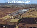
California Central Coast Scenery for FSX with Megascenery Earth and FSGenesis mesh. CCFSXMSG.ZIP covers the California coastal region from N36° 10' (Coalinga) to N34° 25' (Santa Barbara) and from the coast East to W119° 40'. It is a version of my previously created California Central Coast scenery redesigned and expanded to work with FSX MegaScenery Earth and FSGenesis USA Terrain Mesh for FSX V2 by Justin Tyme. Airstrips in the area covered by this scenery have been added for a total of 27 airports and airstrips. 6 imaginary water runways are also added for AI float plane traffic. Several other areas of interest such as the Santa Barbara marina, Morro Bay, etc. are included for a total of 41 points of interest. All airports, airstrips and related structures have been adjusted and realigned to conform to actual positions and dimensions as indicated by the MegaScenery Earth satellite textures. Megascenery Earth California-13, -14 and -15 are required and -12, -28 and -29 are recommended. By Al Wheeler 9/25/09.
| Filename: | California_Central_Coast_with_Megascenery_Earth_an.zip |
| License: | Freeware |
| Added: | 7th January 2010, 19:54:57 |
| Downloads: | 872 |
| Author: | Al Wheeler |
| Size: | 8.13 MB |
| Category: Flight Simulator X - Scenery | |
| Branson Airport KBBG--New Airport, Scenery, and Flight Plans |
|
Images related to this file:
File Description:
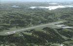
This project adds a new, detailed Branson Airport KBBG (Missouri) to FSX, which opened in May 2009, and is a privately developed commercial airport. The construction of the airport, which involved the flattening of several Ozark Mountains, is claimed to be the largest earthmoving project in Missouri history. As a result, the airport actually sits on a manmade plateau, surrounded by rolling hills. The airport uses the ICAO identifier BBG, however, the airlines use the IATA code BKG. The airport is served by AirTran, Frontier, and ExpressJet (Branson AirExpress), and is located in hilly terrain. Aircraft equipped with a terrain avoidance warning system may experience system activation on final approach. Birds are in the vicinity of the airport. AFCAD with sloping terrain created using Airport Design Editor X v1.47.07, and the hilltops were cleared and flattened and roads were added using SBuilderX 3.13. The terminal, hangar, FBO, and cars were added and modified from stock FSX scenery, using the FSX Object Tool, to resemble as closely as possible the actual airport.
| Filename: | Branson_Airport_KBBGNew_Airport_Scenery_and_Flight.zip |
| License: | Freeware |
| Added: | 5th August 2010, 01:08:33 |
| Downloads: | 2,005 |
| Author: | Carlyle Sharpe |
| Size: | 6.02 MB |
| Category: Flight Simulator X - Scenery | |
| Lukla Airport (Nepal) and flight plan around the Everest |
|
File Description:
Package contains two folders: first folder is the flight plan from Khatmandu over Everest and landing to Lukla and second folder is the reconstruction Lukla airport. I rebuilt the airport in Lukla correctly positioning the parking, the control tower, runway, terminal and building around the airport. The default FSX mesh are not real and it is difficult to land and take off and I recommend the mesh by Taburet downloaded from http://walhalla.mine.nu/fsx/world.html.
Visit my blog at http://fabiusone.blogspot.com/
| Filename: | Lukla_Airport_Nepal_and_flight_plan_around_the_Eve.zip |
| License: | Freeware |
| Added: | 8th December 2010, 08:50:48 |
| Downloads: | 7,333 |
| Author: | Fabiusone |
| Size: | 333.74 KB |


© 2001-2026 AVSIM Online
All Rights Reserved
Privacy Policy |