
Where Flight Simulation Enthusiasts Gather from Around the World!
AVSIM Library - Search Results

| Category: Flight Simulator 2004 - Scenery | |
| Whakatane Airport, New Zealand. NZWK. V2 UPDATE |

|
File Description:
Welcome to Whakatane, a small regional domestic airport south-east of Tauranga City, on the east coast of the North Island of New Zealand.
This is an UPDATE to my previous Whakatane Airport Scenery, and REQUIRES my previous scenery to be installed FIRST. (available from avsim.com, filename...... whakatane_airport_nzwk.zip ).
This update places a custom terminal building at the airport, and a few other small detail changes.
Requires some EZ Scenery Object Sets (see INSTALL instructions for details).
| Filename: | Whakatane_Airport_New_Zealand_NZWK_V2_UPDATE.zip |
| License: | Freeware, limited distribution |
| Added: | 11th October 2008, 08:50:48 |
| Downloads: | 711 |
| Author: | Lawrie Roache / Godfrey Tier |
| Size: | 1.46 MB |
| Category: Flight Simulator 2004 - Scenery | |
| VFR of Lario, Area E1 - Como Lake, Italy |
|
Images related to this file:
File Description:
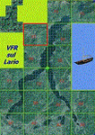
This 11th scenery of the project covers approximately an area of 7.5x6 kmt, from Stabiello mountain (NW) to Germasino (NE), from Mel (SW) to Santa Maria (SE); one dedicated building is included, as the San Bernardo little church (mountain ridge over Musso); GMax object as above and other buildings, with autogen/libraries buildings and trees are fully spreaded on the scenery.
Check video available here: http://youtu.be/5Q7KeoSljPc
| Filename: | VFR_of_Lario_Area_E1__Como_Lake_Italy.zip |
| License: | Freeware |
| Added: | 9th February 2013, 16:21:58 |
| Downloads: | 883 |
| Author: | Aldo Della Vedova, Daniele Lanfranchi, Gian Mario Verga |
| Size: | 11.53 MB |
| Category: Flight Simulator 2004 - Scenery | |
| RAF Northolt |
|
Images related to this file:
File Description:

This station is home to No.32 (The Royal) Squadron, flying BAe 125's, BAe 146's Islanders and Squirrel helicopters. It is the main gateway for officials and high-ranking officers of foreign governments and also for emergency and diplomatically sensitive flights. There is also a static Spitfire gate guardian, many thanks to John Young for allowing us to use his model.
Scenery is made up from several object libraries, details can be found in the readme.
| Filename: | RAF_Northolt.zip |
| License: | Freeware, limited distribution |
| Added: | 17th August 2013, 22:41:26 |
| Downloads: | 1,884 |
| Author: | Brian Clarke - Daryl Payne |
| Size: | 2.37 MB |
| Category: Flight Simulator 2004 - Scenery Design | |
| API Manager |
|
File Description:
API macros are old technology as far as FS scenery design is concerned. The new approach in FS2004 and beyond is quite different. It seems possible that scenery files using macros will not be supported in the next version of FS. Nevertheless there are many scenery designers who still use macros. I am one and I have a large collection of macros. I wanted a way to manage and categorize these macros. I also wanted to be sure that I could credit authors correctly when I use the results of their efforts. I wanted a way to keep information about object footprint and scale and I wanted to know ahead of time if I had missing textures for an object. Hence API Manager.
Please be aware that this is a first release and there are likely to be things wrong. There are also some areas of the program which could be more user friendly. Please note that API Manager only works with api macros
Requires dotNET framework version 2 from Microsoft. Support is available from www.scruffyduck.plus.com
| Filename: | API_Manager.zip |
| License: | Freeware, limited distribution |
| Added: | 3rd December 2005, 21:11:45 |
| Downloads: | 2,112 |
| Author: | Jon Masterson |
| Size: | 530.72 KB |
| Category: Flight Simulator 2004 - Scenery | |
| Elk City Municipal Airport, Ok |
|
File Description:
FS2004 Scenery-Elk City Municipal Airport,Ok (KELK) serves Elk City and Beckham County and is owned by the City Of Elk City. The paved runway extends for 4402 feet. The airport provides servicing of aircraft, aircraft maintenance and hanger facilities. The facility is at an elevation of 2002 feet at a distance of about one mile from Elk City. Scenery has dynamic scenery created with Lago's FSE. Modified AFCAD file. Objects placed using EZ Scenery, Rwy12 and FSDS3. Includes flightplan for AI traffic and textures for FSDS3 segments.
| Filename: | Elk_City_Municipal_Airport_Ok.zip |
| License: | Freeware |
| Added: | 11th February 2006, 23:57:10 |
| Downloads: | 514 |
| Author: | John B. Loney, Jr. |
| Size: | 741.52 KB |
| Category: Flight Simulator 2004 - Scenery | |
| Modesto City-County Airport |
|
File Description:
FS2004 Scenery-Modesto City-County-Harry Sham Field Airport (KMOD) serves Modesto and Stanislaus County and is owned jointly by the City of Modesto and Stanislaus County, and the airport is operated by the City of Modesto. The airport has more than one runway. The longest is a paved runway extending 5911 feet. The facility is at an elevation of 97 feet at a distance of about 2 miles from Modesto. Created with FSDS2, Rwy12, Lago's FSE, AFCAD2 and Traffic Tools. Textures included. By John B. Loney, Jr.
| Filename: | Modesto_CityCounty_Airport.zip |
| License: | Freeware |
| Added: | 29th October 2005, 05:26:38 |
| Downloads: | 1,219 |
| Author: | John B. Loney, Jr. |
| Size: | 1.57 MB |
| Category: Flight Simulator X - Scenery | |
| Oakland International Airport 'KOAK' |
|
File Description:
This scenery if built for FSX and can ONLY BE USED ON FSX. This scenery was created with Abacus EZ Scenery, but you do not need the EZS libraries. On the contrary you will need the RWy12 libraries installed. This scenery adds many GA T-hangars, a large cargo area, a default terminal replacement, parking spots, jetways, lights, and much more. The gates are designed for certain planes. The gates are assigned as the airport's website (http://www.flyoakland.com/index2.cfm) indicates. I used Google Earth Imagery to very accurately place the gates.
| Filename: | Oakland_International_Airport_KOAK.zip |
| License: | Freeware |
| Added: | 15th December 2007, 03:25:09 |
| Downloads: | 2,990 |
| Author: | Brandon DePalo / Watsup Sceneries |
| Size: | 1.29 MB |
| Category: Flight Simulator X - Scenery | |
| Sliac (LZSL) enhanced scenery and ADE file |
|
File Description:
Sliac (LZSL) is a military and civilian airfield in the Slovak Republic.
This scenery replaces the default LZSL with an enhanced version of the
airport. Parking for military aircraft is provided on the ramps and in
numerous hardened shelters. Parking is also provided for general aviation
aircraft. This design was accomplished using ADE, SBuilderX, FSXPlanner
and Whisplacer. Custom hardened shelters created by Juri Masnik.
Default FSX library objects, autogen and RWY12 objects were used
for this creation, This scenery is for FSX only and was tested in
FSX-Acceleration\SP2 on WinXP Pro.
| Filename: | Sliac_LZSL_enhanced_scenery_and_ADE_file.zip |
| License: | Freeware |
| Added: | 3rd February 2008, 13:52:05 |
| Downloads: | 2,421 |
| Author: | Paul Strogen |
| Size: | 2.3 MB |
| Category: Flight Simulator 2004 - Scenery | |
| LIME Bergamo Orio al Serio 2016 |
|
Images related to this file:
File Description: For the proper display of all the objects included in this scenery it is needed to have previously installed the following libraries EZ Scenery Library (AVSIM Library) Rwy12 lib1, lib2, lib3 (http://flyawaysimulation.com/) Small Airstrip Objects SS V1+ [small_airstrip_objects_ss_v1+.zip by Sidney Schwartz] (AVSIM Library)
Bergamo Orio al Serio airport scenery for FS2004 users.
In particular, attention was paid throughout the airport surface
(taxiway, taxi signs, parking and runway) using satellite photos and the latest
existing documentation from ENAV website to make the airport comply with
the current situation.
| Filename: | LIME_Bergamo_Orio_al_Serio_2016.zip |
| License: | Freeware, limited distribution |
| Added: | 24th January 2017, 00:45:32 |
| Downloads: | 918 |
| Author: | Andrea Nardi |
| Size: | 19.44 MB |
| Category: Flight Simulator 2004 - Scenery | |
| Woodward Field Airport KCDN |
|
Images related to this file:
File Description:
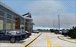
Woodward Field Airport is a county-owned public-use general aviation airport. It is sometimes called Kershaw County Airport, and many people also know it as the Camden Airport. It is located approx. 6.9 miles northeast of the historical city of Camden, South Carolina and currently does not serve scheduled airline flights. It is host to several vintage aircraft events and fly-in's annually. Scenery was designed with ADE9X v1.47 and Google Maps.(for placement references) Requires EZ-Scenery and RWY12 library collections for proper display of scenery objects. ez_1.zip and rwy12_1.zip
| Filename: | Woodward_Field_Airport_KCDN.zip |
| License: | Freeware |
| Added: | 20th November 2011, 00:02:58 |
| Downloads: | 483 |
| Author: | Glenn Mullis |
| Size: | 3.22 MB |


© 2001-2026 AVSIM Online
All Rights Reserved
Privacy Policy |