
Where Flight Simulation Enthusiasts Gather from Around the World!
AVSIM Library - Search Results

| Category: Flight Simulator 2004 - Scenery | |
| Kenmore Village Field CF08 near Ottawa in Ontario, Canada |

|
Images related to this file:
File Description:
Kenmore Village Field is in Ontario, at the northwest corner of the village of Kenmore. Kenmore is around 13 miles southeast of Ottawa airport and 3 miles east of Bank Farm Field. The village doesn't appear in FS as it is too small, but I have recreated it based on the roads that show in Ultimate Terrain. There is a grass runway 09/27 (actually 086/266) that is 3,100 feet long, and the grass is good, and with lights. The field is owned by a gentleman in his mid 70's who sold his plane five years ago and less than two years later discovered that he really didn't want to give up flying; he then went out and bought another slightly older and cheaper version of the one he sold. The house is in a direct line with the runway approach from the east; try to miss it. There is a large hangar and workshop behind the house and to the north of the runway center line, and a second older hangar on the same side a bit further along, both modeled specifically for this.
| Filename: | Kenmore_Village_Field_CF08_near_Ottawa_in_Ontario_.zip |
| License: | Freeware, limited distribution |
| Added: | 9th February 2010, 13:39:57 |
| Downloads: | 396 |
| Author: | Roger Wensley |
| Size: | 10.69 MB |
| Category: Miscellaneous Files - Demos from Commercial Vendors | |
| Germany Airforce, ECR Panavia Tornado |
|
Images related to this file:
File Description:
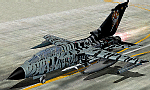
The Panavia Tornado is a family of twin-engine combat aircraft, which was jointly developed by the West Germany, United Kingdom and Italy. There are three primary versions of the Tornado; the Tornado IDS (Interdictor/Strike) fighter-bomber, the suppression of enemy air defences Tornado ECR (Electronic Combat/Reconnaissance) and the Tornado F.3 (only United Kingdom) a air fefence variant. It is one of the world's most sophisticated and capable interdiction and attack aircraft, with a long range, large payload and high survivability. Developed and built by Panavia, a tri-national consortium consisting of MBB of West Germany, British Aerospace, and Alenia Aeronautica of Italy. The Tornado first flew on August 14, 1974, and saw action with the RAF and AMI (Italian Air Force) in the Gulf War (Operation Desert Storm). International co-operation continued after its entry into service within the Tri-National Tornado Training Establishment, a tri-nation training and evaluation unit operating from RAF Cottesmore, England. Including all variants, 992 aircraft were built for the three partner nations and Saudi Arabia (first export customer). Panel, GAUGES, model, sound and textures by www.afs-design.de
| Filename: | Germany_Airforce_ECR_Panavia_Tornado.zip |
| License: | Commercial demo |
| Added: | 26th March 2010, 23:54:57 |
| Downloads: | 160 |
| Author: | Andreas Meyer |
| Size: | 4.37 MB |
| Category: Miscellaneous Files - Demos from Commercial Vendors | |
| Germany Airforce, PANAVIA TORNADO, ECR Luftwaffe, |
|
Images related to this file:
File Description:
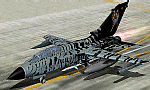
The Panavia Tornado is a family of twin-engine combat aircraft, which was jointly developed by the West Germany, United Kingdom and Italy. There are three primary versions of the Tornado; the Tornado IDS (Interdictor/Strike) fighter-bomber, the suppression of enemy air defences Tornado ECR (Electronic Combat/Reconnaissance) and the Tornado F.3 (only United Kingdom) a air fefence variant. It is one of the world's most sophisticated and capable interdiction and attack aircraft, with a long range, large payload and high survivability.
Developed and built by Panavia, a tri-national consortium consisting of MBB of West Germany, British Aerospace, and Alenia Aeronautica of Italy. The Tornado first flew on August 14, 1974, and saw action with the RAF and AMI (Italian Air Force) in the Gulf War (Operation Desert Storm). International co-operation continued after its entry into service within the Tri-National Tornado Training Establishment, a tri-nation training and evaluation unit operating from RAF Cottesmore, England. Including all variants, 992 aircraft were built for the three partner nations and Saudi Arabia (first export customer).
Panel, GAUGES, model, sound and textures by www.afs-design.de - Author: A.Meyer.
| Filename: | Germany_Airforce_PANAVIA_TORNADO_ECR_Luftwaffe.zip |
| License: | Commercial demo |
| Added: | 22nd May 2010, 21:16:04 |
| Downloads: | 69 |
| Author: | Andreas Meyer |
| Size: | 4.37 MB |
| Category: Flight Simulator 2004 - Aircraft Repaints, Textures and Modifications | |
| CONVIASA Airbus A340-211 (YV1004) |
|
Images related to this file:
File Description:
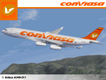
Re-upload. CONVIASA is a Venezuelan state-owned airline based in Porlamar on Venezuela's Margarita Island. This Airbus A340-211, registration YV1004, is the sole A340 in CONVIASA's fleet. CONVIASA uses this aircraft for long-haul international flights and charter flights. This A342 was the 31st built and was originally delivered to Air France in October 1993. It went on to fly in the liveries of Air Tahiti Nui, Air Bourbon and most recently Air Europa. It was the first A340 for Air Europa as well. **PLEASE NOTE** This is a re-upload due to the AVSIM site compromise. However, I decided to update this repaint for the re-upload. So this release contains the following changes/enhancements; current registration (YV1004), the phrase "Simon Bolivar El Libertador" on the port side below the pilot's window, the Venezuela "Ahora es de todos" promotional logo on the aft part of both sides of the fuselage and improved fuselage and engine texture shading. Most of the textures in this repaint are 32-bit. This is a complete package; version 2004.8.5 of the Project Opensky A340-200 model is included.
| Filename: | CONVIASA_Airbus_A340211_YV1004.zip |
| License: | Freeware, limited distribution |
| Added: | 13th June 2010, 02:06:01 |
| Downloads: | 2,130 |
| Author: | Jeffrey S. Bryner, Project Opensky |
| Size: | 8.48 MB |
| Category: Flight Simulator 2004 - Scenery | |
| Hope Field near Ottawa Ontario, Canada |
|
Images related to this file:
File Description:
The field is newly included in the Canada Flight Supplement. Unusually for a grass field the runway has the numbers marked out in white; given that this is a private airfield that does not invite unexpected guests and has only one plane based there, and presuming that the owner can remember his own runway headings, it is unlikely that these will still be there in a year's time. There is no hangar as yet. To the west is highway 416 and to the east is the Rideau River, both of which run north-south. Lke Rockcliffe (which is to the north) the airfield is right on the edge of the Ottawa control zone, so you should already be below 1,500 feet ASL when approaching from the south and talking to Ottawa tower when arriving from the north. The runway is 07/25 and 2,800 feet long, which should be enough for almost anybody, and the field is at 315 feet ASL. Manotick is a mile to the north east on the Rideau River and the Rideau Valley Airpark CPL3 is six miles south in the bend of the Rideau where it turns west.
| Filename: | Hope_Field_near_Ottawa_Ontario_Canada.zip |
| License: | Freeware, limited distribution |
| Added: | 10th July 2010, 19:34:51 |
| Downloads: | 201 |
| Author: | Roger Wensley |
| Size: | 3.15 MB |
| Category: Flight Simulator 2004 - AI Flight Plans | |
| !UPDATED! Enerjet Summer 2010 |
|
Images related to this file:
File Description:

Project: UPDATED Enerjet Summer 2010 Flightplans (2 aircraft)
Date: 14 September 2010 (very late release)
Enerjet is a new charter airline based in Canada. It operates to popular destinations from Canada and their
base at Calgary International Airport, Vancouver - Vancouver International Airport and Toronto - Pearson International Airport.
Currently Enerjet operates two Boeing 737-700w aircraft for Suncor Energy on a long-term contract transporting their employees to the
Oil Sands projects. Also, Sunwing/Signature Vacations flights for summer from Calgary, Edmonton and Vancouver to Puerto Vallarta and
Cancun. To fill out the flight plans I have added some sun destinations which were previously served by now defunct carrier
Skyserice. Enerjet was one of the carriers which was selected to finish out their summer flights.
*** I highly recommend you download and install my "Suncor Energy CRJ 900 Flightplans and Oil Sands Airfields AFCAD2s" found on Avsim - suncorenergycrj900_winter_2008-2009.zip
The flightplans use my AFCAD2s for the following private airfields:
AF2_CFG6 - Fort McKay/Firebag Aerodrome, Firebag River, Alberta
Again a "big" thank you to Darren Belanger for providing the airport charts for these airfields and the repaints for Enerjet - enerjet_737w_dtb.zip
| Filename: | UPDATED_Enerjet_Summer_2010.zip |
| License: | Freeware |
| Added: | 14th October 2010, 03:49:05 |
| Downloads: | 1,118 |
| Author: | Jerel Gregory Hayes |
| Size: | 6.34 KB |
| Category: Flight Simulator X - Aircraft Repaints, Textures and Modifications | |
| P51B #43-7061 'Old 7' |
|
Images related to this file:
File Description:
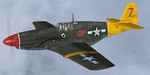
This folder contains a repaint for the P-51B/C model for FSX by Warbirdsim. It shows 'Old 7', 43-7061, which was the pride and joy of the 2nd FS/52nd FG. It flew over 125 operational missions, amassing 778 flying hours and shot down at least 8 enemy aircraft, without suffering a single mechanical failure. It was lovingly maintained at first by S/Sgt Vincent Reagan, and later by S/Sgts James Lynes and C.G. Jones. By december 1944, it was the oldest aircraft in the 2nd FS, and it remained so. The officers and men of the 2nd FS were so proud of 'Old 7' that they tried to have her sent to the US for a warbond tour, but the Air Force was not interested. During its long career, it served as the regular mount for Capt. Arthur Johnston (who named it Marie and flew it as QP-M), Capt. William DeForest (when it was changed to Myrtle and QP-7) and Lt. Thomas Hoover, as well as several other pilots. Repaint by JanKees Blom, based on the warbirdsim paintkit.
| Filename: | P51B__437061_Old_7.zip |
| License: | Freeware |
| Added: | 6th November 2010, 17:01:53 |
| Downloads: | 195 |
| Author: | Jan Kees Blom |
| Size: | 7.72 MB |
| Category: Flight Simulator 2004 - Original Aircraft | |
| United Airlines, Boeing 747-422 (N194UA) - 'Last OOC' |
|
Images related to this file:
File Description:

N194UA- The Last United 744 wearing the Old livery- Brought back into service in June-2010 and to be sent to storage in Late November*** 2010- was mainly used on the Chicago- San Francisco route for the Summer Season. but has occasionally done the odd Long-haul flight- mainly being sent to Shanghai and Incheon Int.
Project Opensky 747-400 V4. Model Features include fully animated control surfaces, fully independent suspension, main gear steering, trim animation, opening passenger doors, opening cargo doors, dynamic flexing wings, animated tilting bogies, rolling wheels, animated thrust reversers, fully reflective textures ( each part has different degree of reflection based on material ), accurate flight dynamics ( accurate FDE with full profiles for wheels, tires, struts, leading/trailing struts, engine types ... Tested by real pilots.), newly re-defined individual part damage profiles, accurate spoiler animation, detailed textures, full night lighting, visible landing lights from the cockpit, reflective cockpit windows, crash effects, transparent nav light lenses, newly re-defined individual part damage profiles.
Model Designer Hiroshi Igami. Flight Dynamics Designer Warren C. Daniel. Tested by Project Open Sky Members. Master textures by Corey Ford/Yosuke Ube. Repaint by Ryan Chadwick
| Filename: | United_Airlines_Boeing_747422_N194UA__Last_OOC.zip |
| License: | Freeware |
| Added: | 14th November 2010, 20:17:34 |
| Downloads: | 1,318 |
| Author: | Ryan Chadwick, Project Opensky |
| Size: | 11.81 MB |
| Category: Flight Simulator X - AFCAD Files | |
| Weiss Farm Airport (JY24), NJ |
|
File Description:
Located 02 miles W of Allamuchy, New Jersey on 264 acres of land, Weiss Farm Airport is a private turf strip 1800' in length. The published width is 50' but you really have closer to 100' to play with. There are no services offered to transient aircraft but you can start parked next to the barn if you wish to taxi out to the runway. No hard surfaced runway is used to have your terrain mesh set as high as possible the start of Runway 23 is a bit slanted and bumpy so you may want to aim long on your approach. The airport is unlit so daytime VFR operations only are recommended.
Scenery constructed with use of satellite images/streetview/aerial photos - the author has not been there in person. This scenery is meant to be used in conjunction with MegaScenery Earth New York 007. It is not required, but apron use is minimized to allow satellite scenery to show through as much as possible, and objects are placed based on the MSE textures - lack of it may make scenery look out of place.
| Filename: | Weiss_Farm_Airport_JY24_NJ.zip |
| License: | Freeware |
| Added: | 21st April 2011, 10:09:59 |
| Downloads: | 192 |
| Author: | Drew Sikora |
| Size: | 593.91 KB |
| Category: Flight Simulator 2004 - Scenery | |
| Embrun CPR2 in Ontario Canada 2012 Revision |
|
Images related to this file:
File Description:
Embrun is in Ontario a few miles southeast of Ottawa, and southwest of my posted strips Russel Farm, Russellet Strip, and Indian Creek. It is a real airfield, used by Embrun Flying Club, and there is now fuel since the owner built a house on the field and moved in, and more hangars than there used to be. All in all a nice airfield with a grass runway 2,260 feet long, and in this REVISED version with a new windsock. There are electric cables strung along the road at the eastern end of the runway, marked by visibility balls; watch out for those. At the western end there are some old grain silos; these shouldn't be a problem, and if you are flying a taildragger give you something to aim at until the tail comes up. I did my first grass field landing and take off there when I was learning to fly, and it is just the right distance from Rockcliffe for a nice afternoon training flight. Look out for geese taking off from the fields to the west when you use 26; that departure from Embrun along with 50 geese was more entertaining than most.
| Filename: | Embrun_CPR2_in_Ontario_Canada_2012_Revision.zip |
| License: | Freeware, limited distribution |
| Added: | 9th February 2012, 01:31:31 |
| Downloads: | 303 |
| Author: | Roger Wensley |
| Size: | 3.8 MB |


© 2001-2026 AVSIM Online
All Rights Reserved
Privacy Policy |