
Where Flight Simulation Enthusiasts Gather from Around the World!
AVSIM Library - Search Results

| Category: Flight Simulator 2004 - AI Flight Plans | |
| Flightplans for Hex'Air Embraer 135 and 145 - on a 52-week period |

|
File Description:
Fictional flightplans for Hex'Air's Embraer 135 and 145 ad-hoc charter aircraft. The flightplans are in 52 BGLs, one per week of the year. You can either select one week's plan and use it long-term, choose a different plan manually from time-to-time, or use an automatic swapper routine (now available on Project AI and Avsim) to change plans on a weekly basis. It really depends how much variety you want.
| Filename: | Flightplans_for_HexAir_Embraer_135_and_145__on_a_5.zip |
| License: | Freeware |
| Added: | 14th January 2009, 13:17:50 |
| Downloads: | 269 |
| Author: | Morello Ciliegia |
| Size: | 1.04 MB |
| Category: Flight Simulator 2004 - AI Flight Plans | |
| Air Engiadina Dornier 328Jet HB-AEU - 52-weeks |
|
File Description:
Fictional flightplans for Air Engiadina's Dornier 328Jet ad-hoc charter aircraft. The flightplans are in 52 BGLs, one per week of the year. You can either select one week's plan and use it long-term, choose a different plan manually from time-to-time, or use an automatic swapper routine (now available on Project AI and Avsim) to change plans on a weekly basis. It really depends how much variety you want.
| Filename: | Air_Engiadina_Dornier_328Jet_HBAEU__52weeks.zip |
| License: | Freeware |
| Added: | 14th January 2009, 13:18:15 |
| Downloads: | 320 |
| Author: | Morello Ciliegia |
| Size: | 634.46 KB |
| Category: Flight Simulator 2004 - Original Aircraft | |
| Virgin Atlantic Airbus A350 (DEMO) |
|
Images related to this file:
File Description:

This file is a Commercial Demo - THIS IS free Trialware, with black advert-banners.
The A350 XWB (Xtra Wide-Body) is Airbus response to market demand for a medium capacity long range wide-body family. Designed with airlines priorities in mind, the A350 XWB confronts the challenges of high fuel prices, rising passenger expectations and increasing environmental concerns. Panel, GAUGES, model, sound and textures by www.afs-design.de - Author: A.Meyer.
| Filename: | Virgin_Atlantic_Airbus_A350_DEMO.zip |
| License: | Commercial demo |
| Added: | 19th December 2009, 02:39:36 |
| Downloads: | 588 |
| Author: | Andreas Meyer |
| Size: | 3.22 MB |
| Category: Civil Flight Simulators - Looking Glass Flight Unlimited 3 | |
| Boeing 747-400 Excalibur |
|
Images related to this file:
File Description:
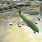
This package will transform the outstanding Boeing 747-400 to "Excalibur flight 522 heavy", with proper livery and call sign. Now you can fly those long routes in professional style! Since the B747 is very big (both in real life and as FU3 RES file), only the changed parts are in this package. Detailed instructions and ResViewer script are included.This file needs Resviewer 1.32 and Boeing 747-400 ver. 1.13 in addition for use.
| Filename: | Boeing_747400_Excalibur.zip |
| License: | Freeware |
| Added: | 15th February 2010, 11:01:11 |
| Downloads: | 756 |
| Author: | Jouko Huovinen |
| Size: | 277.7 KB |
| Category: Navigation and ATC - Navigation | |
| Green Bay Sectional Chart Chunks for Aerosoft's FSMap |
|
File Description:
Sectional chart chunks made from the August 2009 Sectional charts at the original scale, formatted in the WGS84 lat/long geographic coordinate system for the FSMap, moving map application for flight simulation use. The chart chunks are the full sectional divided by 2 tiles (east/west) and converted to baseline 8bit tiffs with packbits compression applied. The images average 6,000x6,000 pixels at about 25mb each, also included is the FSMap fsm Calibration file for importing.
| Filename: | Green_Bay_Sectional_Chart_Chunks_for_Aerosofts_FSM.zip |
| License: | Freeware |
| Added: | 22nd March 2010, 20:40:23 |
| Downloads: | 326 |
| Author: | David Myers |
| Size: | 28.25 MB |
| Category: Navigation and ATC - Navigation | |
| Chicago Sectional Chart Chunks for Aerosoft's FSMap |
|
File Description:
Sectional chart chunks made from the August 2009 Sectional charts at the original scale, formatted in the WGS84 lat/long geographic coordinate system for the FSMap, moving map application for flight simulation use. The chart chunks are the full sectional divided by 2 tiles (east/west) and converted to baseline 8bit tiffs with packbits compression applied. The images average 6,000x6,000 pixels at about 25mb each, also included is the FSMap fsm Calibration file for importing.
| Filename: | Chicago_Sectional_Chart_Chunks_for_Aerosofts_FSMap.zip |
| License: | Freeware |
| Added: | 22nd March 2010, 20:40:31 |
| Downloads: | 512 |
| Author: | David Myers |
| Size: | 31.9 MB |
| Category: Navigation and ATC - Navigation | |
| Lake Huron Sectional Chart Chunks for Aerosoft's FSMap |
|
File Description:
Sectional chart chunks made from the August 2009 Sectional charts at the original scale, formatted in the WGS84 lat/long geographic coordinate system for the FSMap, moving map application for flight simulation use. The chart chunks are the full sectional divided by 2 tiles (east/west) and converted to baseline 8bit tiffs with packbits compression applied. The images average 6,000x6,000 pixels at about 25mb each, also included is the FSMap fsm Calibration file for importing.
| Filename: | Lake_Huron_Sectional_Chart_Chunks_for_Aerosofts_FS.zip |
| License: | Freeware |
| Added: | 22nd March 2010, 20:40:41 |
| Downloads: | 337 |
| Author: | David Myers |
| Size: | 32.26 MB |
| Category: Navigation and ATC - Navigation | |
| Detroit Sectional Chart Chunks for Aerosoft's FSMap |
|
File Description:
Sectional chart chunks made from the August 2009 Sectional charts at the original scale, formatted in the WGS84 lat/long geographic coordinate system for the FSMap, moving map application for flight simulation use. The chart chunks are the full sectional divided by 2 tiles (east/west) and converted to baseline 8bit tiffs with packbits compression applied. The images average 6,000x6,000 pixels at about 25mb each, also included is the FSMap fsm Calibration file for importing.
| Filename: | Detroit_Sectional_Chart_Chunks_for_Aerosofts_FSMap.zip |
| License: | Freeware |
| Added: | 22nd March 2010, 20:40:50 |
| Downloads: | 388 |
| Author: | David Myers |
| Size: | 33.56 MB |
| Category: Navigation and ATC - Navigation | |
| Montreal Sectional Chart Chunks for Aerosoft's FSMap |
|
File Description:
Sectional chart chunks made from the August 2009 Sectional charts at the original scale, formatted in the WGS84 lat/long geographic coordinate system for the FSMap, moving map application for flight simulation use. The chart chunks are the full sectional divided by 2 tiles (east/west) and converted to baseline 8bit tiffs with packbits compression applied. The images average 6,000x6,000 pixels at about 25mb each, also included is the FSMap fsm Calibration file for importing.
| Filename: | Montreal_Sectional_Chart_Chunks_for_Aerosofts_FSMa.zip |
| License: | Freeware |
| Added: | 22nd March 2010, 20:40:58 |
| Downloads: | 435 |
| Author: | David Myers |
| Size: | 35.53 MB |
| Category: Navigation and ATC - Navigation | |
| New York Sectional Chart Chunks for Aerosoft's FSMap |
|
File Description:
Sectional chart chunks made from the August 2009 Sectional charts at the original scale, formatted in the WGS84 lat/long geographic coordinate system for the FSMap, moving map application for flight simulation use. The chart chunks are the full sectional divided by 2 tiles (east/west) and converted to baseline 8bit tiffs with packbits compression applied. The images average 6,000x6,000 pixels at about 25mb each, also included is the FSMap fsm Calibration file for importing.
| Filename: | New_York_Sectional_Chart_Chunks_for_Aerosofts_FSMa.zip |
| License: | Freeware |
| Added: | 22nd March 2010, 20:56:39 |
| Downloads: | 528 |
| Author: | David Myers |
| Size: | 34.43 MB |
© 2001-2026 AVSIM Online
All Rights Reserved
Privacy Policy |