
Where Flight Simulation Enthusiasts Gather from Around the World!
AVSIM Library - Search Results

| Category: Flight Simulator 2004 - Aircraft Repaints, Textures and Modifications | |
| Piaggio P-166 All Versions New Flight Dynamics + HTML Handbook Reference |

|
File Description:
Thanks to Andrew Spring of www.p166.com!!
This is a massive update for the Piaggio P-166 Series aircraft. This Package contains a whole update for ALL the models,(P-166A\M\S\BL2\CL2\DL3\DL3-SEM\DP1) and a pilot handbook in html format. You can read it in the full large version or in the reduced size version re-adapted for the electronic FS2004 kneeeboard as "Reference". All aircraft refer to the same file, so after the introdution to the P-166 and her main characteristics, individual links to the single P-166 versions are included (only "Kneeboard" version). The main improvements in the FDEs are a nice stability making the plane just fly strigght-and-leveled easily, re-calibrated flap and fuselage drags, wich makes for better max speed and landing characteristics. Also flaps and landing gear pitch moments are lots reduced. Now the plane respects the Specs of the real thing completly, even matching the changes from version to version!! in newer versions, engine power output has been recalculated, as well as new payloads and fuel capacities: you can litterally load the passangers and baggage you wish...but don't try to exaggerate, going overweight is not that complex...for instance, try placing a 9999 pounds copilot and guess what happens...
Happy Flights!!
| Filename: | Piaggio_P166_All_Versions_New_Flight_Dynamics__HTM.zip |
| License: | Freeware |
| Added: | 5th August 2004, 16:57:33 |
| Downloads: | 1,724 |
| Author: | Mario Noriega |
| Size: | 3.14 MB |
| Category: Flight Simulator X - Scenery | |
| NZGA- Galatea Aerodrome (VectorLandClass, New Zealand) |
|
Images related to this file:
File Description:
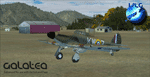
Welcome to Galatea (ICAO: NZGA), a gateway to exploring the Urewera ranges and the east coast of New Zealand. Galatea is a small and basic airstrip with only one old hanger, a public toilet and a small clubhouse on a wide plain surrounded by native bush and pine plantation near Murupara in the Bay of Plenty of New Zealand. It is a grass strip of 1025m length and 60m width and aligned 01/19 with a group rating of 8. No night lighting or fuel is available.
The FSX model includes custom textures and models placed on an aerial image. It makes extensive use of items from the free VLC object libraries which are required to be installed (download from www.vectorlandclass.co.nz downloads menu). This scenery and the VLC libraries have been funded
by sales of VectorLandClass and although you do not need VLC to use it, your purchase helps further development.
To the south west of Murupara township and sawmill is the LakeLand Helicopters base which just fits onto the photo-real coverage. Library objects have been placed here although they may not be accurate as the site was not visited when taking reference photos. This airfield makes a great stop over when flying between Rotorua, Mount Tarawera, Whakatane or Gisborne.
We hope you enjoy exploring the area!
| Filename: | NZGA_Galatea_Aerodrome_VectorLandClass_New_Zealand.zip |
| License: | Freeware, limited distribution |
| Added: | 15th November 2012, 23:35:42 |
| Downloads: | 1,127 |
| Author: | Tim Barnes / VectorLandClass |
| Size: | 45.7 MB |
| Category: Flight Simulator 2004 - Scenery Design | |
| WBGT/WBTM Long Banga, Tanjung Manis, Malaysia |
|
Images related to this file:
File Description:
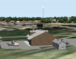
Googly scenery for WBGT Long Banga, Tanjung Manis (sometimes also referred to
under the ICAO code WBTM) - a small domestic airport in Malaysia that it seems
Microsoft forgot to provide in in Flight Simulator 2004. These scenery
files create the airport and add taxiways, aprons, buildings and other airport
features, so that you and your "AI" traffic can land, taxi, park and take off in
a realistic manner. Also added is the missing TMS non-directional beacon at
this airport (on frequency 264.0).
The airport serves the township of Sarikei, capital of the Sarekei district in
the Sarekei Division (are you following this?) of Sarawak in Eastern Malaysia.
Flights are provided by MASwings, a subsidiary of Malaysian Airlines, with De
Havilland Twin Otter aircraft calling here a few times per week.
The scenery does not purport to be ultra-accurate. Based on high-detail satellite
imagery from Google Earth, the layout is proportionally correct but the added
airport features, such as buildings, are built from default Microsoft objects
and add-on libraries so will not look exactly like the real thing.
You are not obliged to download and install any additional scenery libraries,
but to enjoy this scenery in its entirety, you may wish to. It will work fine,
with or without.
[File re-uploaded at request of AVSIM]
| Filename: | WBGTWBTM_Long_Banga_Tanjung_Manis_Malaysia.zip |
| License: | Freeware |
| Added: | 23rd May 2010, 01:23:38 |
| Downloads: | 964 |
| Author: | John Hinson |
| Size: | 51.04 KB |
| Category: Flight Simulator 2004 - Scenery | |
| Jerusalem |
|
File Description:
FS2004 Scenery - Jerusalem. The third part of Israel
scenery covering the mountain range of Samaria, Judea
and the cities of Jerusalem and Bethlehem. The scenery
is made in the highest detail with new terrain textures
and it shows all main roads, secondary roads, junctions,
rail roads, vegetation and residential areas with a
population of 1,000 and above. The scenery is enhanced
with over 300 structures and buildings made in Gmax.
Among them the Old City of Jerusalem with its walls and
gates, Mount Temple, the Wailling Wall, the city Citadel,
the Holy Sepulchre and all other major churches and
monasteries of Jerusalem, including the Church of
Nativity in Bethlehem and the churches on Mount Olive
and Mount Zion. The scenery also covers in high detail
the New City of Jerusalem, with all landmark structures
and buildings such as the Knesset (Israel's parliament),
museums, the Supreme Court, Yad-Vashem (the holocaust
memorial), Hadasa hospital, Teddi soccer stadium, all
hotels and highrise buildings and much more. There are
also landmarks outside Jerusalem such as the Latrun
Trappist monastery and the nearby Armor Corps Memorial.
All major structures are based on real measurements and
photos taken from the ground. The textures are all
specially made for this scenery. The scenery is enhanced
with night lighting to enable easy VFR navigation by
night.
| Filename: | Jerusalem.zip |
| License: | Freeware |
| Added: | 15th April 2004, 15:39:12 |
| Downloads: | 20,043 |
| Author: | Seev Kahn |
| Size: | 4.49 MB |
| Category: Prepar3D V1-4 - AI Aircraft | |
| AI Eurus Aviation AIM Embraer ERJ-145LR XA-JNR |
|
Images related to this file:
File Description:
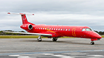
This is the newest mexican air taxi airliner called Eurus Aviation, the aircraft for now of this new airline is a Embraer ERJ-145LR with the registration XA-JNR, the files contain normal paint and No Tail Titles paint. You can choose any type of texture that you want to add to your air traffic, it does not affect anything in the chronology of the aircraft as it is a charter aircraft, it is not necessary to add all the textures that I am including in this package, I simply choose to that there is variety, the logos on the aircraft are real and have been on the aircraft since it recently began operations. Eurus Aviation is a Mexican luxury airline company dedicated to providing personalized VIP charter services. With extensive experience in air operations and in managing clients with the highest demands, we design personalized flights and charter trips for our clients. Since 2017 we offer private flight service Our clients include leading national and multinational companies, entertainment businesses, sports teams, and individual users who are looking for a totally personalized transportation alternative tailored to their particular needs with an unmatched service. This is my website: https://el-mundo-de-los-aviones-ai-traffic.jimdosite.com The model is Ai Malcontent (AIM) Embraer ERJ-145 Basepack. I hope enjoy it!.Â
| Filename: | AI_Eurus_Aviation_AIM_Embraer_ERJ145LR_XAJNR.zip |
| License: | Freeware |
| Added: | 24th July 2023, 20:03:20 |
| Downloads: | 35 |
| Author: | Jesús Gibran Soriano Solleiro |
| Size: | 13.36 MB |
| Category: Flight Simulator 2004 - Scenery | |
| HLLQ El Beida/Labraq |
|
Images related to this file:
File Description:
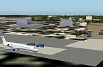
Googly scenery for HLLQ El Beida/Labraq - a joint civilian and military airport
near the north coast of Libya that is poorly provided for in Flight Simulator
2004. These scenery files add taxiways, aprons, buildings and other airport
features, so that you and your "AI" traffic can land, taxi, park and take off
in a realistic manner.
The city of Al Beida, or Al Bayda' or El Beda or Al Baidhah (depending on who
you are) has achieved its own airport status by using the end of a dead runway
at Labraq Air Base. In turn the airbase has contracted to use the opposite end
of the runway as its base of activity. The city is served by jets of Libyan
Airways and turboprop craft of Air One Nine and Ghadames Air Transport.
The scenery does not purport to be ultra-accurate. Based on high-detail satellite
imagery from Google Earth, the layout is proportionally correct but the added
airport features, such as buildings, are built from default Microsoft objects
and add-on libraries so will not look like the real thing.
You are not obliged to download and install any additional scenery libraries,
but to enjoy this scenery in its entirety, you may wish to. It will work fine,
with or without. [File re-uploaded at request of AVSIM]
| Filename: | HLLQ_El_BeidaLabraq.zip |
| License: | Freeware |
| Added: | 28th May 2010, 20:42:26 |
| Downloads: | 1,286 |
| Author: | John Hinson |
| Size: | 73.79 KB |
| Category: Flight Simulator 2004 - Scenery | |
| FTTN Am-Timan, Chad |
|
File Description:
Googly scenery for Am-Timan (ICAO: FTTN, ICAO: ANC), also known as Am
Timan, Am Timane, Am Timmane, Umm Timman - take your pick! It is a small
airport serving a small city of the same name in South-Eastern Chad,
almost exactly centred in the continent of Africa.
The airport was upgraded in 1971 by the French Foreign Legion to allow
military transport craft to land, but it still retains a sand/dirt
strip. The airport is served today by a couple of flights a week using
Fokker Fellowship jets of Toumai Air Tchad.
The entire area is very dry and sandy but for some reason it is depicted
in Flight Simulator as green and lush. Microsoft have only provided a runway
at this airport and this scenery seeks to redress the situation so that you
and your "AI" traffic can use the airport realistically.
The scenery does not purport to be ultra-accurate. Based on high quality
satellite imagery from Google Earth, the layout is proportionally correct but the
added airport features, such as buildings, are built from default Microsoft objects
and add-on libraries so will not look exactly like the real thing.
You are not obliged to download and install any additional scenery libraries,
but to enjoy this scenery in its entirety, you may wish to. It will work fine,
with or without.
| Filename: | FTTN_AmTiman_Chad.zip |
| License: | Freeware |
| Added: | 24th December 2008, 13:31:36 |
| Downloads: | 883 |
| Author: | John Hinson |
| Size: | 83.66 KB |
| Category: Flight Simulator 2004 - Scenery | |
| MRAO Turtuguero, Costa Rica |
|
Images related to this file:
File Description:
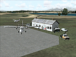
Googly scenery for MRAO Turtuguero, Costa Rica - another one that Microsoft
forgot in FS2004. It is a small domestic airport located on a long spit of
land that almost seems like an island. Turtuguero is just a village but the
airport also serves the lush Tortuguero National Park (rain falls all the
year round here) which draws thousands of visitors each year. The airport
is served daily by DHC-6 Twin Otters of Nature Air.
These scenery files create the airport and add taxiways, aprons, buildings and other airport features, so that you and your "AI" traffic can land, taxi, park and take
off in a realistic manner.The scenery does not purport to be ultra-accurate. Based on less-than-perfect satellite imagery from Google Earth, the layout is as good as I can get it, but some imagination has been used as I cannot tell what buildings exist. The
buildings and other features I have provided are built from default Microsoft
objects and add-on libraries so will not look exactly like the real thing.
You are not obliged to download and install any additional scenery libraries,
but to enjoy this scenery in its entirety, you may wish to. It will work fine,
with or without. [File re-uploaded at request of AVSIM]
| Filename: | MRAO_Turtuguero_Costa_Rica.zip |
| License: | Freeware |
| Added: | 28th May 2010, 20:40:00 |
| Downloads: | 1,174 |
| Author: | John Hinson |
| Size: | 65.12 KB |
| Category: Flight Simulator 2004 - Scenery | |
| Ontario Small Fields in Canada: #05 Pelee Island (CYPT) |
|
Images related to this file:
File Description:
This is the fifth in a series of small airfields in southern Ontario Canada, Pelee Island CYPT, an airfield on the island in Lake Erie and the southernmost airfield in Canada. The airfield has an asphalt runway of 3,300 feet, aligned 09/27 in FS9 while today in real life it is 10/28 due to the wandering magnetic pole. There is also a second runway, 36/18 and around 1,500 feet of gravel. There is a small terminal building which now has blue cladding; here it is still in the dirty yellow of the original colour scheme.
This version is based upon what appears to be a "lost" 2005 scenery of Pelee Island. When I started to make Pelee Island I discovered that in fact I already had a version installed; my memory can be excused, as I installed it in 2005. I modified the scenery to include parking, taxiways that connected, revised runway markings, new windsocks, new signage, larger apron, parked cars and planes, revised landclass, AI, etc. My intention was to instruct you to download and install the original and then incorporate my changes. Problem: it does not appear to exist for download; perhaps it was washed away when the Avsim site crashed. I have included it in this post. If anyone knows who made it please let me know.
| Filename: | Ontario_Small_Fields_in_Canada_05_Pelee_Island_CYP.zip |
| License: | Freeware, limited distribution |
| Added: | 5th August 2015, 18:52:25 |
| Downloads: | 171 |
| Author: | Roger Wensley |
| Size: | 4.39 MB |
| Category: Flight Simulator 2004 - AFCAD Files | |
| Airports used by MATVA |
|
File Description:
The MATVA Group offer you another package of Af2 files to replace the default ones for those airfields they visit, they do not have allocated gates. The 55 airfields in this package are in: Mongolia; (ZMUB) Ulaanbaatar, (ZMBN) Bulgan, (ZMMN) Moron, (ZMBH) Bayanhongor, (ZMAT) Altay, (ZMUL) Olgiy and (ZMCD) Choybalsan. Canada; (CYOA) Ekati, (CYHY) Hay River, (CYQT) Thunder Bay and (CYZF) Yellowknife. China; (ZHCC) Zhengzhou, (ZBHH) Hohhot and (ZHHH) Wuhan. Japan (RJNK) Komatsu and (RJOM) Matsuyama. S. Korea; (RKJJ) Gwangju, (RKNN) Gangneung , (RKNY) Yangyang, (RKPK) Pusan, (RKPU) Ulsan, (RKSS) Seoul/Gimpo and (RKTN) Daegu. Russia; (UIBB) Bratsk, (ULAA) Arkhangel'sk, (UMMS) Minsk2, (UNOO) Omsk, (URWA) Astrakhan, (URWW) Volgograd, (USSS) Yekaterinburg, (UUDD) Moscow/Domededovo, (UWGG) Nizhny Novgorod and (UWWW) Samara. (UKBB) Kiev, Ukraine. (ZKPY) Pyongyang, N. Korea. (ROAH) Naha, Okinawa. (RPVM) Cebu, Philippines. (EETN) Talinn, Estonia. (EGHH) Bournemouth, UK. (EVRA) Riga(LKPR) Prague. (OOMS) Muscat, Oman. (PTRO) Koror, Micronesia. (SLLP) La Paz, Bolivia. (VGZR) Dhaka, Bangladesh. (VYYY) Yangon, Myanmar. (WBSB) Brunei. (LIBD) Bari, Italy. (ESGG) Goteburg, Sweden. Also included are reworks of our previously released (EGPE) Inverness, (EIDW) Dublin, (OIII) Tehran, (ZSPD) Shanghai, (ULLI) St. Petersburg, and (SVMI) Maiquetia, Venezuela. These AFCADS are in no way intended to resemble their real world counterparts. They have been created to allow AI and flyable aircraft to do their thing, any problems get in touch at www.matva.org.uk :O) enjoy!!!!
| Filename: | Airports_used_by_MATVA.zip |
| License: | Freeware, limited distribution |
| Added: | 3rd January 2007, 00:59:49 |
| Downloads: | 8,578 |
| Author: | Louie Maclennan MATVA |
| Size: | 232.02 KB |


© 2001-2026 AVSIM Online
All Rights Reserved
Privacy Policy |