
Where Flight Simulation Enthusiasts Gather from Around the World!
AVSIM Library - Search Results

| Category: Flight Simulator X - Utilities | |
| FS Earth 5.0 for Google Earth |

|
File Description:
This program acts as an interface between Flight Simulator X and Google Earth, letting to follow a flight in real time, over the satellite images generated by Google Earth. Flights can be saved, and many options are available for fine tuning the performance, as well as the map's style (zoom, tilt, orientation). Works on a single computer running FSX and Google Earth all together or, for best experience, can be used on two networked computers running respectively FSX (master) and Google Earth (slave). AI and Multiplayer traffic is also displayed in Google Earth, with course prediction and other information. Requires Flight Simulator X and Google Earth. The program running in trial mode works only around Anchorage, Alaska, (PANC / ANC) for a maximum of five minutes per flight session. Version 5.0 has improved compatibility with latest releases of Google Earth and several additional improvements. A version for FS2004 is available also.
| Filename: | FS_Earth_50_for_Google_Earth.zip |
| License: | Shareware, time limited |
| Added: | 19th July 2007, 00:46:27 |
| Downloads: | 1,104 |
| Author: | Luciano Napolitano |
| Size: | 2.44 MB |
| Category: Flight Simulator 2004 - Aircraft Repaints, Textures and Modifications | |
| Repaints and Panel Updates for YAK-18T |
|
File Description:
This package contains 2 different textures and a panel modification.
-1st repaint: RA44400, (I corrected some small issues from my previous upload)
this repaint is from a real Yak-18T. Check http://www.russianaeros.com/yak18Tproduct.htm.
-2nd repaint: N416RG, this is a new repaint from a Yak-18T flown by Ross Granley in aerobatic airshows in Canada and USA.
I have fixed the manifold pressure gauge, added a "post-it" with some useful flight data, and added sub panels to access some gauges/switches without leaving the VC.
You need the following files prior using these repaints and panel modification:
* Original Aircraft: yak-18t.zip (FlightSim) or yakovlev_yak-18t.zip (AVSIM) - from the original Design Team Alexey Yuzefov, George Sukhykh, Alexander Aphonin, Dmitry Shvetsov and Mike Maarse.
* 2.2 Yak-18T Update: yak18a22.zip - from Wolfram Beckert & Nick Schreger (MeatWater), who updated this great Freeware airplane.
| Filename: | Repaints_and_Panel_Updates_for_YAK18T.zip |
| License: | Freeware |
| Added: | 12th January 2008, 04:08:59 |
| Downloads: | 3,078 |
| Author: | Steffen Moessner |
| Size: | 11.82 MB |
| Category: Flight Simulator 2004 - Aircraft Repaints, Textures and Modifications | |
| Air Malta Airbus A320-214 "Factory Colors" |
|
File Description:
F-WIJJ later 9H-AEQ (cn 3068) (Version 1.0). Always want to do some testflying at Toulouse? Or maybe you want to simulate a real delivery flight in Flightsimulator? Here is you're chance. This is the first Factory Colors A320-214 in the AVSIM Database. Anyway, here she is : A hand drawn recreation of Air Malta's A320-214 in Factory colors straight from the factory in France, Toulouse. This particular plane was delivered to Air Malta on march 22, 2007. This repaint is an exact copy including the serial numbers, taped windows and primer colors wich I have been used. The nighttextures are made by my good friend and fellow repainter Zacherius Acht wich i'm thankfull for doing it. These are textures only and intended for use on the Project Airbus A320 package. Installation notes are included. Fly safe, land safe and enjoy the paint!
| Filename: | Air_Malta_Airbus_A320214_Factory_Colors.zip |
| License: | Freeware, limited distribution |
| Added: | 17th February 2008, 19:57:13 |
| Downloads: | 1,114 |
| Author: | Kevin Prak / McPhat Studios |
| Size: | 10.25 MB |
| Category: Flight Simulator 2004 - Scenery | |
| HSMK Rumbek, Sudan |
|
File Description:
Googly scenery for HSMK Rumbek, a small airport serving the city of the same
name, capital of the Buhayrat (or Lakes) state in southern Sudan. The airport
is served daily by Beech 1900 aircraft operating for Delta Connection, a
Kenyan airline.
Flight Simulator 2004 has completely omitted this airport and this scenery
seeks to redress the situation so that you and your "AI" traffic can use the
airport.
The scenery does not purport to be ultra-accurate. Based on high quality
satellite imagery from Google Earth, the layout is proportionally correct but the
added airport features, such as buildings, are built from default Microsoft objects
and add-on libraries so will not look exactly like the real thing.
You are not obliged to download and install any additional scenery libraries,
but to enjoy this scenery in its entirety, you may wish to. It will work fine,
with or without.
| Filename: | HSMK_Rumbek_Sudan.zip |
| License: | Freeware |
| Added: | 19th April 2008, 20:33:09 |
| Downloads: | 754 |
| Author: | John Hinson |
| Size: | 78 KB |
| Category: Flight Simulator 2004 - Utilities | |
| FS Earth 5.2 for Google Earth and FS2004 |
|
File Description:
This program acts as a link between Flight Simulator 2004 and Google Earth, letting to follow a flight in real time, over the satellite images generated by Google Earth. Flights can be saved, and many options are available for fine tuning the performance, as well as the map's style (zoom, tilt, orientation). Works on a single computer running FS2004 and Google Earth all together or, for best experience, can be used on two networked computers running respectively FS2004 (master) and Google Earth (slave). AI and Multiplayer traffic is also displayed in Google Earth, with course prediction and other information. Requires Flight Simulator 2004 and Google Earth. The program running in trial mode works only around Anchorage, Alaska, (PANC / ANC) for a maximum of five minutes per flight session. Version 5.2 has new aircraft icons & labels and improves the compatibility with Windows Vista. A version for FSX is available also.
| Filename: | FS_Earth_52_for_Google_Earth_and_FS2004.zip |
| License: | Shareware, time limited |
| Added: | 4th September 2008, 19:11:30 |
| Downloads: | 1,241 |
| Author: | Luciano Napolitano |
| Size: | 3.59 MB |
| Category: Flight Simulator 2004 - AFCAD Files | |
| Manchester (EGCC/MAN) Ground Improvements (v1.0) |
|
File Description:
Includes: Ocean Sky ramp, ROMPA light aircraft park, TATON light aircraft park, Access to Western Maintenance, Re-designation of runways to current format (ILS etc. also changed to suit), Re-designation of taxiways, Frequency changes, Added some hold points (more in later version), Other general taxiway adjustments. The inspiration came from a recent VATSIM session from EGCC. I was flying my Tomahawk but had no scenery for TATON, ROMPA, or the Ocean Sky GA areas there. So I've used my real-world charts and Google Earth to add these three areas to the default AFCAD. Also note that the runways have been re-numbered to 23/05(L/R), and I have made the Western Maintenance area accessible. My other objective was to insert and change the taxiway designators, so many of these have been cleaned up and changed too. See Readme file for more details...enjoy!
| Filename: | Manchester_EGCCMAN_Ground_Improvements_v10.zip |
| License: | Freeware, limited distribution |
| Added: | 10th October 2008, 20:27:16 |
| Downloads: | 1,126 |
| Author: | David Hunter |
| Size: | 8.87 KB |
| Category: Flight Simulator 2004 - Scenery | |
| WION Ranai, Indonesia |
|
File Description:
Googly scenery for Ranai, a domestic airport located on Natuna Besar,
the main island of the 272 islands comprising the Natuna archipeligo in
Indonesia. The airport is served by daily flights of Riau Airlines using
Fokker 50 turboprop aircraft.
Flight Simulator 2004 has only provided a runway at this airport and this scenery
seeks to redress the situation so that you and your "AI" traffic can use the
airport.
The scenery does not purport to be ultra-accurate. Based on high quality
satellite imagery from Google Earth, the layout is proportionally correct but the
added airport features, such as buildings, are built from default Microsoft objects
and add-on libraries so will not look exactly like the real thing.
You are not obliged to download and install any additional scenery libraries,
but to enjoy this scenery in its entirety, you may wish to. It will work fine,
with or without.
| Filename: | WION_Ranai_Indonesia.zip |
| License: | Freeware |
| Added: | 11th October 2008, 13:12:55 |
| Downloads: | 1,246 |
| Author: | John Hinson |
| Size: | 60.07 KB |
| Category: Flight Simulator X - Scenery | |
| KLCI - Laconia Municipal Airport - Laconia, NH |
|
File Description:
Here is an improved version of the stock Laconia Municipal Airport. This airport had a lot of issues with
buildings on roads or in the water, boundary fences in the water, etc. I fixed those issues and adjusted and
added aprons,roads and taxiways to more closely match reality. I replaced most default buildings and added
additional buildings. I added the parking lot and static vehicles, aircraft, light poles, and other filler objects.
The runway at Laconia was lengthened in real life and I corrected the length in FSX. It was lengthened
primarily to accomodate biz jets of race teams and others attending the NASCAR events at nearby Loudon, NH.
Laconia Airport is located on scenic Lake Winnipesaukee and not far from Weirs Beach. Laconia hosts a
week-long motorcycle rally each June, usually a week after the Americade Rally in Lake George, NY.
| Filename: | KLCI__Laconia_Municipal_Airport__Laconia_NH.zip |
| License: | Freeware |
| Added: | 22nd January 2009, 03:28:31 |
| Downloads: | 764 |
| Author: | Jim Cook |
| Size: | 10.18 KB |
| Category: Flight Simulator 2004 - AFCAD Files | |
| Denver with Active Crosswind Runways v2 |
|
Images related to this file:
File Description:
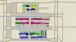
This is an AFCAD2 file for the freeware Denver Int'l Airport (KDEN) scenery by Harald Krause (dia2k4v1.zip). It is built from scratch using the latest FAA charts and information from the Denver airport website. All taxiways and gates are named and numbered as per real life and feature assigned airline parking. Parking areas for United Express, Great Lakes and Frontier Jet Express can also be found in their correct locations. A Tower view is now provided for the airport also. Using the crosswind runway technique, all runways can now be used simultaneously for takeoffs and landings at this airport. This file will not work properly if used with any other addon scenery, or the default airport. This file is an update to the AFCAD that was released in 2005, and provides up to date gate assignments as of April 2010. Previous Version had 2779 downloads. Enjoy!
| Filename: | Denver_with_Active_Crosswind_Runways_v2.zip |
| License: | Freeware |
| Added: | 17th April 2010, 13:53:12 |
| Downloads: | 800 |
| Author: | Lee Brompton |
| Size: | 218.98 KB |
| Category: Flight Simulator X - AFCAD Files | |
| Redwing Airport (2N6), NJ |
|
File Description:
Located 01 miles S of Jobstown, New Jersey on 53 acres of land, Redwing Airport is a small dual turf strip that hosts both single engine craft and gliders. No services are provided to transient aircraft, you can park over near the hangars (no visible tie downs). The Runway 11/29 edge lights are adjustable low-high in real life but for the sim I've set them at medium. Trees are summer ONLY.
Scenery constructed with use of satellite images/streetview, the author has not been there in person.
This scenery is meant to be used in conjunction with MegaScenery Earth New Jersey/Delaware 002. It is not required, but apron use is minimized to allow satellite scenery to show through as much as possible, and objects are placed based on the MSE textures - lack of it may make scenery look out of place.
| Filename: | Redwing_Airport_2N6_NJ.zip |
| License: | Freeware |
| Added: | 15th October 2010, 15:34:10 |
| Downloads: | 329 |
| Author: | Drew Sikora |
| Size: | 527.92 KB |


© 2001-2026 AVSIM Online
All Rights Reserved
Privacy Policy |