
Where Flight Simulation Enthusiasts Gather from Around the World!
AVSIM Library - Search Results

| Category: Flight Simulator 2004 - Scenery | |
| Modified SRTM relief 76 m for Slovakia |

|
File Description:
This Slovak terrain mesh 76 m (LOD9) is made from the 3arc-sec SRTM. The voids in the source data were filled by the interpolation. Both the primary processing of the 3arc-sec data and the rendering of the terrain in the FS cause flattening and simplifying of the real shape of the terrain. This phenomenon was partially compensated by the sharpening of the source data.
Made by the programs Surfer (Golden Software) and MS Terrain SDK 2000 and 2002. The relief covers the area N49.9219 E016.1719 to N47.4609 E022.9687 in the boundaries of the LOD9 quadrants. This scenery contains only the elevation data. The other elements of the basic terrain as the landclass, locally used airborne photos, vector roads, rivers and lakes are available in different sceneries by other authors and they are continuously developed.
| Filename: | Modified_SRTM_relief_76_m_for_Slovakia.zip |
| License: | Freeware, limited distribution |
| Added: | 28th May 2010, 19:40:13 |
| Downloads: | 4,615 |
| Author: | Vladimir Stoje |
| Size: | 19.36 MB |
| Category: Flight Simulator 2004 - AI Aircraft | |
| Paintkit for GA Piper PA46 Malibu Mirage |
|
Images related to this file:
File Description:

Re-upload following Avsim hack. Layered paintkit for my 4_GA_Piper_PA46_Malibu_Mirage.zip file here at Avsim. It will only be of use to you if you know how to handle layers. There is a kit in XCF format for The Gimp users, and PSD format for Photoshop and PaintShopPro users. Please refer to the included Readme text.
| Filename: | Paintkit_for_GA_Piper_PA46_Malibu_Mirage.zip |
| License: | Freeware, limited distribution |
| Added: | 31st August 2010, 23:54:58 |
| Downloads: | 751 |
| Author: | Mike Cronin |
| Size: | 575.44 KB |
| Category: Flight Simulator X - Utilities | |
| FsGeoNavi (Geography Navigation for FS2004/FSX) V1.0 |
|
Images related to this file:
File Description:

Don't you get bored when in cruise flight you have nothing to do and don't know where you are?
Then study world geography with FsGeoNavi program!
It provides POI(Point of Interest) information text display in FS screen. POI includes countries, cities, mountains around your aircraft.
Display example : "Largest City : [2 o'clock, 75 NM] Seoul (Korea) - 10349312 people", "Nearest Mountain : [9 o'clock, 50NM] Mount RAINIER (Washington (USA)) - 4393m".
Works with both FS2004 and FSX.
| Filename: | FsGeoNavi_Geography_Navigation_for_FS2004FSX_V10.zip |
| License: | Freeware |
| Added: | 3rd March 2012, 19:11:20 |
| Downloads: | 2,529 |
| Author: | Dongjin Shin |
| Size: | 2.09 MB |
| Category: Flight Simulator X - Sounds | |
| Cockpit Sounds for ND Chinook CH-47 |
|
Images related to this file:
File Description:

Add sound on each switch, button and lever of the Nemeth Design Chinook CH-47 to make the cockpit alive. By Daniel Gauthier.
| Filename: | Cockpit_Sounds_for_ND_Chinook_CH47.zip |
| License: | Freeware |
| Added: | 24th March 2014, 07:18:50 |
| Downloads: | 273 |
| Author: | Daniel Gauthier |
| Size: | 281.03 KB |
| Category: Flight Simulator X - Miscellaneous Files | |
| Plan-G data files for North America |
|
File Description:
Plan-G data files for Orbx/North America Sceneries in terms of following FSX Orbx payware Sceneries:
-Pacific North West (PNW)
-Pacific Fjords (PFJ)
-Northern Rocky Mountains (NRM)
-Central Rocky Mountains (CRM).
My PlanG data displays spots of all objects which are provided with the above mentioned software (Points of interest like unlisted airfields, dams, windfarms, firetowers, etc.) and which are not inserted automatically into PlanG during database re-built.
Pick the data that applys to your particular installation and import them into PlanG.
For further instructions see the included "readme"
| Filename: | PlanG_data_files_for_North_America.zip |
| License: | Freeware |
| Added: | 25th March 2012, 12:10:39 |
| Downloads: | 557 |
| Author: | Dieter Linde |
| Size: | 14.22 KB |
| Category: Flight Simulator X - Miscellaneous Files | |
| How to use multiple folders for FIP |
|
File Description:
This tutorial explains how to use multiple folders to store the FIP files instead of using the standard Gauges folder.
This provides an easy way to manage all your FIP files without the risk to delete a wrong file or to modify a file that is valid for more than one FIP.
| Filename: | How_to_use_multiple_folders_for_FIP.zip |
| License: | Freeware |
| Added: | 16th February 2013, 18:06:04 |
| Downloads: | 198 |
| Author: | Philippe Verhaege |
| Size: | 323.18 KB |
| Category: Flight Simulator X - Miscellaneous Files | |
| Quality Wings 787 - Additional maps for MEXICO |
|
Images related to this file:
File Description:

This package included 5 airports for mexico displayed on Qualitywings 787 Navigation Display ND
MMMX, MMMY, MMUN, MMTJ and MMPR
| Filename: | Quality_Wings_787__Additional_maps_for_MEXICO.zip |
| License: | Freeware |
| Added: | 17th February 2018, 05:02:36 |
| Downloads: | 630 |
| Author: | Mohamed Fawzi |
| Size: | 168.17 KB |
| Category: Flight Simulator X - Miscellaneous Files | |
| North Atlantic Waypoints for FSX and FS2004 |
|
File Description:
As a virtual pilot and Instructor to budding Oceanic Controllers for IVAO (www.ivao.aero) I am frustrated by the fact that Microsoft have never included the Oceanic Waypoints required to fly North Atlantic Tracks (NATs).
| Filename: | North_Atlantic_Waypoints_for_FSX_and_FS2004.zip |
| License: | Freeware |
| Added: | 28th October 2006, 10:14:00 |
| Downloads: | 4,287 |
| Author: | Andrew Brown |
| Size: | 3.8 KB |
| Category: Flight Simulator X - Miscellaneous Files | |
| level flight for fsx/fs9 b378,b7474 |
|
File Description:
this file makes the defalt b7378 and the b7474 in both fsx and fs9 look level in flight
| Filename: | level_flight_for_fsxfs9_b378b7474.zip |
| License: | Freeware |
| Added: | 20th October 2007, 15:04:43 |
| Downloads: | 1,103 |
| Author: | vaughn W |
| Size: | 69.89 KB |
| Category: Flight Simulator X - Miscellaneous Files | |
| AITT2 for FSX rel 1.5.5 full setup |
|
Images related to this file:
File Description:
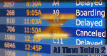
AI TimeTable is a software simulation of an airport time table for MS-FSX, where the airport location is just where your aircraft is positioned. With the rel.1.5.5, it is completed with a TTS for speaking flights announcements, optionally.
It is able to display also user flight (and its "monitor" state) and give a good rate in displaying the correct flights numbers wheras FSX is not able to do.Requires MS-FSX SP1 and Simconnect.dll
| Filename: | AITT2_for_FSX_rel_155_full_setup.zip |
| License: | Shareware, limited functionality |
| Added: | 22nd July 2010, 18:24:02 |
| Downloads: | 699 |
| Author: | V.Mercolino - geniX Software |
| Size: | 11.9 MB |


© 2001-2026 AVSIM Online
All Rights Reserved
Privacy Policy |