
Where Flight Simulation Enthusiasts Gather from Around the World!
AVSIM Library - Search Results

| Category: Flight Simulator X - Scenery | |
| Kopaida Airfield, Greece |

|
Images related to this file:
File Description:
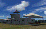
"Kopaida" airfield is a grass private strip, 105km NW of Athens located in the Kopaida drained lake plains between the towns of Aliartos, Kastro and Orchomenos and west of Yliki lake. It is a pure general aviation field and a hub of activity for numerous sport planes, gliders and motor gliders. The field includes a small tower and canteen and several owners of GA aircraft house them in the roomy hangar and also keep a mobile home or RV in the premises. The scenery includes a region and landclass bgl that will force a large area of the Kopaida plains around the airport to display US field textures. This was done because the US fields textures are rectangular and aligned N-E and W-E, in a similar way as the actual fields around the airport. A small photo background is used for the airfield itself. The photo background includes seasonal variations with slight colour variances as well as some autogen trees and shrubs. Custom GA traffic is also included. There is one trike doing circuits and TnGs and a Turbo Porter flying the circuit, simulating a skydiving sortie. The Turbo Porter used is the great freeware one created by Tim (Piglet) Conrad. I have also included a repaint for the F-GHVH, the Porter used by the GFFC, which sports a flashy "Alien" graffiti scheme.
*For FSX SP2 / Acceleration / P3D v1.00*
| Filename: | Kopaida_Airfield_Greece.zip |
| License: | Freeware |
| Added: | 3rd June 2014, 21:23:30 |
| Downloads: | 1,472 |
| Author: | Vassilios Dimoulas |
| Size: | 25.01 MB |
| Category: Flight Simulator X - Scenery | |
| 52F North West Regional Airport (DFW TX) |
|
Images related to this file:
File Description:
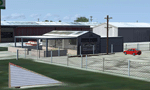
This airport scenery does not require any other software other than Microsoft Flight Sim X SP1 (minimum) - SP2 required for mission and display of some of the scenery items. However, it could help with performance on your PC if you install any accurate photo scenery for DFW. One such scenery is MEGASCENERY DFW photo scenery from http://www.megascenery.com/.
This is a custom developed scenery for airport, 52F - Northwest Regional, Roanoke, TX. 52F is next to Fort Worth Alliance in the Dallas Fort Worth Metroplex. It's a nice little airport.
This scenery package also includes a Mission called "52Foxtrot - Approach to Rwy 35 - Thermals". It is more of a free flight than the traditional FSX missions. The ones who fly for real at 52F-Northwest regional knows the quirks when coming into land at runway 35 on a hot day. The thermals at the cleared land and the sinking feeling when flying over the wooded area nearing the approach to 35. These thermal lifts and sinks have been modeled here. However, the only way to experience these thermals in FSX is via Missions. Once you select the mission "52Foxtrot - Approach to Rwy 35 - Thermals" and by selecting option "Enable changes in selected Mission", you could fly around like you would under "free flight". Except this time, you would have these thermal effects around 52F and get to experience what it's really like to fly and land at 52F.
| Filename: | 52F_North_West_Regional_Airport_DFW_TX.zip |
| License: | Freeware, limited distribution |
| Added: | 24th March 2010, 01:23:59 |
| Downloads: | 3,335 |
| Author: | Manny Mahadevan |
| Size: | 19.06 MB |
| Category: Prepar3D V1-4 - Scenery | |
| Mount Diablo Summit Museum |
|
Images related to this file:
File Description:
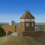
The museum and visitor center house a diorama of the parks ecosystems, complete with the sounds found in nature, and a topographic model of the mountain. On one wall, an instructional video and lighted display case describes the geologic forces that created the mountain. On anther wall, cultural history is chronicled with splendid photographs. The lower level of the summit building contains panels describing the Native American history of the region and an audio-visual room. Rotating displays of art and photography complement the permanent exhibits. In addition to the exhibits, there is a small gift center within the building.
| Filename: | Mount_Diablo_Summit_Museum.zip |
| License: | Freeware, limited distribution |
| Added: | 13th June 2016, 20:46:13 |
| Downloads: | 185 |
| Author: | Rick Keller |
| Size: | 1.08 MB |
| Category: Civil Flight Simulators - Micro Flight | |
| Micro Flight 5 |
|
File Description:
Micro Flight is a state of the art flight simulator specializing in simulating ultralight flying vehicles and micro meteorological conditions.
Unlike other flight simulators, Micro Flight simulates the intricate flow of air over the ground and the effects of thermals created by the sun, making it ideal for simulating gliders of all types.
Micro Flight also simulates types of vehicles not simulated by other general aviation programs, such as: Hanggliders, Paragliders, Gyroplanes, Helicopters, Trikes, Balloons and more.
Flight instrumentation and navigational aids were made to resemble real ones, this includes the hand held GPS, standard flight instruments, head up display and more.
The whole enviroment which the user interacts with is three dimentional, even operating the instruments in the cockpit is made by manipulating them with the mouse and not just by pressing keys.
The terrain model used is detailed and optimized, giving the terrain a photorealistic look while still maintaing a high frame rate during run.
The program supports a wide variety of scenery formats, and can import aerial photography and USGS digital elevation data directly.
The program includes flight recording and anaylis, giving the user the ability to study the flight in detail and export it's path in digital form for any purpose.
The program has netplay mode which enables users to fly and communicate with each other.
All this and more make the program a unique and valueable tool for flight simulation.
Copyright Ilan Papini 1999 - 2004 ©
| Filename: | Micro_Flight_5.zip |
| License: | Commercial demo |
| Added: | 16th December 2004, 04:03:44 |
| Downloads: | 543 |
| Author: | Ilan Papini |
| Size: | 6.46 MB |
| Category: Flight Simulator 2004 - Scenery | |
| Bear Creek Winery & Lodging (v2.0.9) - "Diamond Edition" |
|
Images related to this file:
File Description:

Bear Creek Winery & Lodging Enhanced v2.0.9 "Diamond Edition".
An all new Flight Simulator experience awaits you at Bear Creek. This is a completely re-vamped "Extreme Make Over" of the previous Bear Creek Winery & Lodging. Some additions include: Scenery Changer Utility, Custom Textures, Festive Events (Christmas, Balloon Festival Etc.) Also added enhanced AI Traffic to the whole of Bear Creek. If you are a previous user of the original Bear Creek scenery this one that awaits you will indeed replace the original!!
No need to keep the previous version 1.0 that you may have downloaded this 2.0 version is a whole new interface that utilizes different install criteria.
Some of the Extra additions that are used with the new 2.0 version are: Runway12 3 Part Library, the Abacus Scenery Creator default libraries, Lago FSE, AI Schweizer 300C Helicopter, Gerrish Grey Tree Library Version 3. The direct links to these downloads are provided to you to download to display the scenery in its entirety. Not all of the above mentioned are required, like Lago, as it is a payware addition. All others mentioned are freely distributed at various download sites.
Please unzip (using folders option) to a temporary location and follow the installation instructions very carefully. Do not attempt to install this scenery with a "scenery manager" - for proper installation please use the built in installation routine.
Enjoy the newest edition: Airport Code: BCWL near Homer, Alaska.
| Filename: | Bear_Creek_Winery__Lodging_v209__Diamond_Edition.zip |
| License: | Freeware |
| Added: | 2nd February 2010, 10:50:06 |
| Downloads: | 4,947 |
| Author: | Mike Woolsey & David "Opa" Marshall |
| Size: | 58.49 MB |
| Category: Flight Simulator 2004 - Miscellaneous Files | |
| Nick's LightFix |
|
File Description:
The concept and the base textures for this package are from Mark Poole and his original light replacement releases. Mark's original Nav Light package has a really good concept and uses light textures which create sharp lens flairs or bursts. I found the lens flair in his packages to be a bit too large and out of scale for my display and taste. Also, I wanted to have an easy way to replace all the FS9 lights in one shot with little or no configuration file editing. With that in mind, this package was created. This release will automatically replace ALL the Flight Simulator aircraft and airport lights with more realistic ones along with better distance visuals of slower flashing radio tower/smoke stack and ground beacons. It also includes replacement lights in scale for the PMDG 737, 747 and for all Project Opensky aircraft offered on their site. It works automatically with Ultimate Traffic and other AI add-ons which use the default Microsoft aircraft lights. I added a diffused halo effect to Mark's original airport_lighting_v2 texture which gives a more realistic look in cloudy or weather conditions and enhances the dynamic directional brightness of the lights. In addition to the navigation lights, I have also created aircraft beacons and strobes which will also install automatically . A restore package is included allowing to you to revert back to default FS9 texture and FX files.
ENJOY!
From Nick Needham
[email protected]
| Filename: | Nicks_LightFix.zip |
| License: | Freeware, limited distribution |
| Added: | 4th April 2006, 21:47:56 |
| Downloads: | 19,325 |
| Author: | Nick Needham |
| Size: | 1.55 MB |
| Category: Flight Simulator 2004 - Scenery | |
| Tok Junction 6K8 in Alaska, USA |
|
Images related to this file:
File Description:
Tok Junction is a village, or small town, on the Alaska Highway some 180 miles east of Fairbanks and 60 miles west of the Alaska-Canada border. The town is spread over a wide area on the flat terrain and barely registers among the trees, and as such is not shown in FS9 except as a grid of roads as there is no town terrain texture like it used in FS9. The airfield is at the eastern end of the town and adjacent to the Alaska Highway and I have included some surrounding houses, workshops, shops, lodges, etc. The single runway is 3,000 feet of 50 feet wide asphalt aligned 07-25 and lit. There is a small airline based on the airfield called 40-Mile Air. Their hangar is red and the name written large and 100LL fuel is available beside it at all times. Jet A-1 is available by a telephoned pre-arangement. They are, I believe, no longer flying scheduled flights but they do still function as an air taxi and they have a contract to deliver mail to surrounding villages that are not served by all-weather roads. The airfield now has a new icao "PFTO" but in FS9 it remains as the original FAA LID, 6K8. The FS9 roads are not accurately placed, and the grass airfield background is not really appropriate as the reality is more like gravel mixed with earth; it is however difficult to replicate this with the available textures and still prevent bushes or trees appearing. But, in the winter and with snow on the ground it looks as it should. A note here about my scenery making. There will not be many more to follow this as I am almost at the end of the photos I either took or found for scenery purposes, plus I expect to move on from FS9 at some point during next year.
| Filename: | Tok_Junction_6K8_in_Alaska_USA.zip |
| License: | Freeware, limited distribution |
| Added: | 14th January 2020, 17:49:21 |
| Downloads: | 176 |
| Author: | Roger Wensley |
| Size: | 25.47 MB |
| Category: Online ATC - Software | |
| Network Launcher Client |
|
Images related to this file:
File Description:

Ready to take your flight simulation hobby to the next level of realism and entertainment? Try flying online alongside your fellow flight simmers in this friendly online community! The POSCON Launcher enables users to download, install, launch, and auto-update all other software required to connect to the Positive Control Network. The Launcher auto-updates itself when a new version is released, so after the initial download from AVSIM, you will not need to download it again from here. /// WHAT IS POSCON? /// The Positive Control (POSCON) Network is a massively multiplayer online network that connects users of various flight simulator platforms (FSX, P3D, MSFS, and X-Plane) together with virtual air traffic controllers in an interactive, immersive, and realistic environment. Our team of highly skilled aviation professionals have developed a common error-based training system so that everyone, regardless of skill and knowledge level, can engage cooperatively together on the network. Consistency is ensured by gamification through a web-based point system solution where users compete for status. POSCON was designed to cater to both newbies and experienced flight simmers. This is a judgement free community, come try us out! /// NETWORK FEATURES /// - 15 Hz refresh rate multiplayer server - fast enough for precision formation flying - Voice over IP (VoIP) technology that allows users to realistically simulate Very High Frequency (VHF) radio communications - Custom model matching will draw other pilots' aircraft in your sim - ATC software that simulates the FAA En Route Automation Modernization (ERAM) radar system - Realistic ICAO flight plan (FPL) filing system that allow you file flight plans up to 5 days in advance of your flight - A live map that allows you to track your flight and other online activity (updates every second) - Statistics tracking - Passenger and cargo role-play system to give your flights purpose (Trips System) - Realistic Controller Pilot Data Link Communications (CPDLC) system - Weekly online events
| Filename: | Network_Launcher_Client.zip |
| License: | Freeware |
| Added: | 12th February 2022, 02:06:13 |
| Downloads: | 60 |
| Author: | POSCON |
| Size: | 76 MB |
| Category: Flight Simulator 2004 - Scenery | |
| PABA - Barter Island (Kaktovik) - Alaska North Slope 8 |
|
Images related to this file:
File Description:
The town of Barrow is in the far north of Alaska, and these are coastal villages or radar installations to the west, south, and now east of Barrow. There will be further additions. Barter Island is a DEW station Air Force base 310 miles east of Barrow and 75 miles east of Bullen Point. The runway is just under 5,000 feet of gravel and aligned 06-24 on a spit of land at the northeast corner of the island. The big hangar is still there on the apron. Most of the DEW buildings have now been removed but this scenery is dated around 2005 when there were more of them still there. Between the DEW station and the airstrip is the village of Kaktovik, with a population of some 300 mainly traditional Inupiat. The village was first pioneered when the DEW station was built in the 1950's and grew as the years passed. The FS9 error discovered when making this scenery was that FS9 had mistakenly "placed" Kaktovik at Bullen Point (not physically, it was just wrongly stated as the local town); this is now only partly corrected as FS9 refused to accept my Bullen Point revision but allowed me to associate Kaktovik with Barter Island. Kaktovik is definitely on Barter Island. I could also mention that the runway was in the sea, but there isn't much point in that as Bill would say it was all the fault of Ultimate Terrain, so I won't bother. The next DEW station to the east is in Canada and called Komakuk; this has already been made and posted. The next in this series will be far to the west. The AI has daily flights by ERA, plus Northern Air Cargo, and some GA.
| Filename: | PABA__Barter_Island_Kaktovik__Alaska_North_Slope_8.zip |
| License: | Freeware, limited distribution |
| Added: | 19th July 2016, 17:49:16 |
| Downloads: | 208 |
| Author: | Roger Wensley |
| Size: | 3.42 MB |
| Category: Flight Simulator 2004 - Scenery | |
| Alaska North Slope 9; Point Hope PAPO |
|
Images related to this file:
File Description:
The town of Barrow is in the far north of Alaska, and these are coastal villages or radar installations to the west, south, and east of Barrow on the North Slope. There will be further additions. Point Hope is a village on a spit of land that is one of the oldest and continuously inhabited places in all of North America, not just the polar regions. The "Point" is what brought this about, migrating whales passing close to land as they rounded the point, and the traditional way of life continues to this day. The population is now around 670. The airport surpassed all my expectations of FS9. Go look at the area before you install this. The first thing you will notice is that FS9 does not list Point Hope PAPO. The town is there (way too big and in totally the wrong place) and the airport background is there (wrong place of course) but there is no airport! Some buildings, but no runway, no apron, nothing that can be used by a plane?!? In real life the town is 3 miles east of the point, the runway is situated between town and point and, unusually in the north, is asphalt. This is presumably possible because of the gravel make-up of the point itself, with very little vegetable content and the warming sea restricting permafrost movements. 4,000 feet of 75 feet wide asphalt, lit, PAPI at both ends, and aligned 01-19. The building that appears to be wrongly situated away from the apron is like that intentionally; it is a helicopter hangar (not used in winter?) and they presumably did not want the apron traffic to get in their way. The AI has daily flights by ERA, plus Northern Air Cargo, and some GA.
| Filename: | Alaska_North_Slope_9_Point_Hope_PAPO.zip |
| License: | Freeware, limited distribution |
| Added: | 25th July 2016, 20:20:35 |
| Downloads: | 254 |
| Author: | Roger Wensley |
| Size: | 3.02 MB |


© 2001-2026 AVSIM Online
All Rights Reserved
Privacy Policy |