
Where Flight Simulation Enthusiasts Gather from Around the World!
AVSIM Library - Search Results

| Category: Flight Simulator 2004 - Aircraft Repaints, Textures and Modifications | |
| Fuerza Aerea Venezolana C-47A FAV-1840 |

|
File Description:
Fuerza Aerea Venezolana C-47A-5-DK FAV-1840,C/N 12386 builded by the Oklahoma City production plant for the USAAF as 42-92571.Ex RAF KG377,G-AJAV,N19D,YV-E-EPO and YV-T-RTC.FAV-1840 was the last operative C-47 of the FAV,retired in 2003,after his reactivation for display purposes in the 80s.He was also the only FAV C-47 to wear a operational camouflage.The first 20 C-47s were delivered to the FAV, Escuadrón de Transporte No.1, in 1947 together with the presidencial DC-4 and retired of service by 1971. The base textures for repainting are by Mark Beaumont, original textures are by Jan Visser.Repainted by Daniel Nole.In order to use these textures, you must already have the MAAM-SIM payware DC3 and the MAAM-SIM D-Day C-47 'Skytrain'and Dakota Mk III Expansion Pack installed in your FS2004 aircraft folder.
| Filename: | Fuerza_Aerea_Venezolana_C47A_FAV1840.zip |
| License: | Freeware |
| Added: | 25th October 2005, 19:33:56 |
| Downloads: | 188 |
| Author: | Daniel Nole |
| Size: | 7.27 MB |
| Category: Flight Simulator X - Scenery | |
| Denver International Airport |
|
File Description:
This is a redesign of the default FSX Denver International Airport. Here are the changes which have been made: Several jetways have been added throughout the airport; Concourse B, the United Airlines terminal, has been expanded, and the United Express commuter terminal has been added; numerous fuel trucks have been added to make a total of 30 in order to service aircraft faster; The vehicle roads have been rebuilt so as not to access taxiways, which can cause aircraft backups; the crosswind runways have been activated, ultimately allowing all six runways to be used simultaneously; accurate parking assignments have been created for AI aircraft; and settings have been changed so that as long as scenery complexity in FSX is set at Normal or higher, all of the jetways will display. In addition, as an option, a flyover of the completed airport has been created using the FSX Mission Editor. Please consult the Readme file for more information.
| Filename: | Denver_International_Airport.zip |
| License: | Freeware, limited distribution |
| Added: | 31st December 2007, 21:49:35 |
| Downloads: | 10,983 |
| Author: | Patrick Finch |
| Size: | 3.47 MB |
| Category: Flight Simulator 2004 - Scenery | |
| Airport Rostock - Laage, Germany |
|
File Description:
NEW VERSION, Modern, service-orientated, professional - that’s how passengers and visitors see the airport in Mecklenburg-Western Pommerania.
Quality and customer care are matters of course for 60 airport employees. Day after day they’re mastering their complex work flows (almost) with perfection.
Every business section of the airport like ground traffic service, passage, or traffic control is subject to a permanent quality management following Lufthansa standards. Not least it’s due to the German Air Force that the airport meets international standards.
Rostock-Laage is a popular airport. Both business travellers and tourists appreciate the individual atmosphere and the extensive service which is improved every day.
The Airport Rostock - Laage ( ETNL ) product features the following:
- NEW: static display of Eurofighter, Eurocopter Tiger
and Airbus A380
- accurate simulation of Fliegerhorst German
Bundeswehr: " Jagdgeschwader 73 Steinhof "
- 200 authentic objects
- with shelter for the Eurofighters, forest, streets,
hangars for civils and military air traffic
- new airport terminal and many more,
objects and textures by www.afs-design.de - Author: A.Meyer.
| Filename: | Airport_Rostock__Laage_Germany.zip |
| License: | Freeware, limited distribution |
| Added: | 23rd January 2009, 10:41:25 |
| Downloads: | 4,627 |
| Author: | Andreas Meyer |
| Size: | 5.15 MB |
| Category: Flight Simulator X - Panels | |
| NEW Realistic HUD for the FSX F/A-18 Hornet |
|
Images related to this file:
File Description:

A realistic head-up display (HUD) for the FSX Acceleration F/A-18 Hornet. The HUD is an enhanced version of the original HUD for the F/A-18 by Scott Printz. The original functionality Scott built into it is preserved, and the following new features are added: 1) Precise ILS and TACAN navigation for aircraft carriers (including moving carriers) that allow carrier landings in low visibility and at night. 2) The HUD symbology is conformal to the outside world: The horizon bar stays on the horizon, velocity vector shows actual flight path as read against the outside world (if you keep your vector pointed at a certain spot on the runway, this is exactly where you will land). 3) Caged mode with ghost vector for use in heavy side wind conditions. 4) Elements repositioned to make the HUD look as close as possible to the real Hornet HUD. By Jivko Rusev.
| Filename: | NEW_Realistic_HUD_for_the_FSX_FA18_Hornet.zip |
| License: | Freeware, limited distribution |
| Added: | 29th November 2009, 22:08:20 |
| Downloads: | 1,675 |
| Author: | Jivko Rusev |
| Size: | 208.5 KB |
| Category: Flight Simulator 2004 - Scenery | |
| Santa's Sleigh & 8 Reindeer- AI Version |
|
Images related to this file:
File Description:
Santa's Sleigh & 8 Reindeer - AI Version.
It is rumored that Rudolph is ill and may not be able to lead the Reindeer this Christmas so Santa is making some test flights with just the original eight reindeer. He has chosen a remote airfield near Steamboat Springs, Colorado (81CO) named Mesa 1. Of course you can place this AI version at the location of your choice. I have taken the original flyable model by Dundee Prototypical Simulations (available here as santa.zip) and tweaked it for use as an AI craft, using parameters usually associated with Helicopters to let Santa practice shorter takeoffs and landings.
ALL necessary files are included. Please unzip to a temporary folder and follow the simple installation instructions. As a bonus, there is also a set of instructions showing how to set this up as a continuously running display on your screen - a nice option for the Holidays. Compiled for Kids of all ages by David "Opa" Marshall.
| Filename: | Santas_Sleigh__8_Reindeer_AI_Version.zip |
| License: | Freeware |
| Added: | 2nd December 2009, 13:43:26 |
| Downloads: | 995 |
| Author: | David "Opa" Marshall |
| Size: | 1.05 MB |
| Category: Prepar3D V1-4 - Scenery | |
| KDSM - Des Moines Iowa USA International Airport For Prepar3D |
|
Images related to this file:
File Description:
Des Moines Iowa International Airport for P3D. Originally created for FSX, this airport has been converted to work in P3D. Several improvements have been made to the default airport. The default terminal buildings have been replaced with buildings created in FSDS; aircraft gates have been correctly coded using Airport Design Editor 1.76.6715; a new airport vehicle network has been built; extra fuel trucks have been added throughout the airport; the tower view has been changed to display from the roof of the control tower; all taxiway designators are correct and all taxiway signs are correctly placed and named; there is the option to open both runways to AI traffic; A large cargo area for FedEx and UPS is included, as well as an area for the 132nd Fighter Wing of the Iowa Air National Guard; and Jim Dhaenen's excellent ramp lights are also included. Please refer to the README FIRST.txt file to insure proper installation of all files.
| Filename: | KDSM__Des_Moines_Iowa_USA_International_Airport_Fo.zip |
| License: | Freeware, limited distribution |
| Added: | 24th June 2018, 01:00:08 |
| Downloads: | 934 |
| Author: | Patrick Finch |
| Size: | 4.66 MB |
| Category: Prepar3D V1-4 - Scenery | |
| KBNA - Nashville Tennessee USA International Airport |
|
Images related to this file:
File Description:
Nashville Tennessee International Airport for P3D. Originally created for FSX, this airport has been converted to work in P3D. Several improvements have been made to the default airport. The default terminal buildings have been replaced with buildings created in FSDS; there are custom built hangars in the Embraer maintenance area, also created in FSDS; aircraft gates have been correctly coded and named using Airport Design Editor 1.76.6582; a new airport vehicle network has been built; extra fuel trucks have been added throughout the airport; the tower view has been changed to display from the roof of the control tower; all taxiway designators are correct and all taxiway signs are correctly placed and named; there is the option to open all runways to AI traffic; the FedEx and UPS cargo areas are modeled, as well as the Embraer maintenance area; and Jim Dhaenen's excellent ramp lights are also included. Please refer to the README FIRST.txt file to insure proper installation of all files.
| Filename: | KBNA__Nashville_Tennessee_USA_International_Airpor.zip |
| License: | Freeware, limited distribution |
| Added: | 20th April 2018, 23:57:58 |
| Downloads: | 1,295 |
| Author: | Patrick Finch |
| Size: | 5.47 MB |
| Category: Flight Simulator X - Scenery | |
| Cedar Rapids Iowa USA Eastern Iowa Airport-KCID |
|
Images related to this file:
File Description:
Cedar Rapids Iowa USA Eastern Iowa Regional Airport for FSX. Several improvements have been made to the default airport. The default terminal buildings have been replaced with buildings created in FSDS; aircraft gates have been correctly coded using Airport Design Editor 1.70.6042; a new airport vehicle network has been built to prevent airport vehicles from entering the taxiways; extra fuel trucks have been added throughout the airport; the tower view has been changed to display from the roof of the control tower; static FedEx and UPS scenery objects have been placed throughout the airport; all taxiway signs are correctly placed and all taxiway designators are correctly named; there is the option to open both runways to AI traffic; optionally, a set of GA flight plans is included using all default FSX aircraft to liven up the GA area; and Jim Dhaenen's excellent ramp lights are also included. Please read the README FIRST.txt and installation.txt files to insure proper installation of all files.
| Filename: | Cedar_Rapids_Iowa_USA_Eastern_Iowa_AirportKCID.zip |
| License: | Check within download |
| Added: | 29th September 2017, 16:54:49 |
| Downloads: | 867 |
| Author: | Patrick Finch |
| Size: | 6.34 MB |
| Category: Flight Simulator X - Scenery | |
| Caribbean SeaPlane Tours, Bahamas |
|
File Description:
Part 3 of a 5 part series cover the Caribbean with custom airports and Seaplane Docks. "Caribbean SeaPlane Tours, Florida Operations" and Caribbean SeaPlane Tours, Caribbe West" are required for the scenery to display correctly. Please read the "Read-Me" files of all sceneries for installation information and hints. This scenery pack includes the following airports and seaplane docks: The airports - Nassau International, Walker's Cay, Deep Water Cay, Grand Bahamas International, Spanish Cay, Treasure Cay, Marsh Harbor Airport, Castaway Cay, Little Whale Cay, Exuma International, Hog Cay, Arthur's Town, Cutlass Bay, Rum Cay, Deadman's Cay, Duncan Town, Colonel Hill, Pittstown Point, Parrot Cay, Pine Cay, Conch Bay, Salt Cay, Mayaguna Island and a hidden Smuggler's scenery near Crooked Island. SeaPlane Docks - Nassau Lakeside, Nassau Oceanside, Paradise Island, Walker's Cay, Grand Bahamas, Treasure Cay, Castaway Cay, Hog Cay, Cutlass Bay, Rum Cay, Deadman's Cay, Parrot Cay, Pine Cay, Conch Bay, and Salt Cay. There are navigational aids included....Make sure you read the "Read-Me" File!
| Filename: | Caribbean_SeaPlane_Tours_Bahamas.zip |
| License: | Freeware, limited distribution |
| Added: | 24th November 2007, 17:16:16 |
| Downloads: | 5,461 |
| Author: | Chris Carel |
| Size: | 47.12 MB |
| Category: Flight Simulator X - Aircraft Repaints, Textures and Modifications | |
| Consolidated PBY-5 TEAL ZK-AMP |
|
Images related to this file:
File Description:
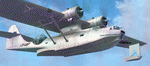
This folder contains a repaint for the Aerosoft PBY Catalina for FSX. Repaint by Jan Kees Blom, based on the repaint kit by Aerosoft. The Royal New Zealand Air Force had 56 Catalina's in all between 1943 and 1953. They were registered NZ4001-4056 inclusive and included 22 PBY-5s (mostly MklVAs) with the remainder being PB2B-1 s. All were flying boats, with no amphibian models being taken on charge.After the war only half a dozen or so of the best aircraft were maintained in service with No 5 Sqn (squadron code became KN-) and fitted with the latest search radar which had a large radome behind the cockpit. The remainder were put into storage. Two PB2B-ls were loaned to Tasman Empire Airways (TEAL) for short periods after the war, one (which became ZK-AMI) as a crew trainer, the other (ZK-AMP, former NZ4036) to survey a flying boat route from Fiji to Tahiti, later to become known as "The Coral Route" and used by TEAL's Solent flying boats. These two aircraft were eventually returned to the RNZAF before being scrapped.
| Filename: | Consolidated_PBY5_TEAL_ZKAMP.zip |
| License: | Freeware |
| Added: | 13th July 2018, 20:41:04 |
| Downloads: | 158 |
| Author: | Jan Kees Blom |
| Size: | 8.55 MB |


© 2001-2026 AVSIM Online
All Rights Reserved
Privacy Policy |