
Where Flight Simulation Enthusiasts Gather from Around the World!
AVSIM Library - Search Results

| Category: Prepar3D V1-4 - Original Aircraft | |
| Base Package V.2.0 for SMS-Overland MD-11 |

|
Images related to this file:
File Description:

Base Package V.2.0 of the McDonnell Douglas MD-11 Native Prepar3D v4 model. This package contains the passenger version of the MD-11 in a fictional paint in Overland livery. This Freeware model once was created for FS2004 by SMS Overland. You can now pilot this aircraft on Prepar3D v4.5+ with a virtual cockpit, Panel 2D, custom sounds from a real MD-11. All textures have been converted to 32-bit. Panel.cfg and Aircraft.cfg have also been upgraded for P3D. More SMS-Overland MD-11 repaints for P3D and also a Paintkit, you will find on http://www.adrastea.de/md11.html
| Filename: | Base_Package_V20_for_SMSOverland_MD11.zip |
| License: | Freeware |
| Added: | 10th May 2020, 18:43:22 |
| Downloads: | 656 |
| Author: | Joerg Zeitschel, SMS-Overland |
| Size: | 69.43 MB |
| Category: Flight Simulator 2004 - AI Aircraft | |
| McDonnell Douglas DC-9-20 & Thales v3 Base Files |
|
File Description:
The Alpha India Group is proud to release the McDonnell Douglas DC-9-20 for AI traffic. Standard and Thales features include XML coded flaps for takeoff/landing, animated flaps/slats/spoilers, as well as compressing landing gear. Also included are including lights configurations. This package contains the DC-9-20 model and FDE. Model & FDE by Andy Carroll, Model Modification by David Rivera. With Authorization by Andy Carroll Visit https://www.alpha-india.net/forums/index.php for more information
| Filename: | McDonnell_Douglas_DC920__Thales_v3_Base_Files.zip |
| License: | Freeware, limited distribution |
| Added: | 12th April 2019, 03:19:00 |
| Downloads: | 309 |
| Author: | Andy Carroll, David Rivera & Alpha India Group |
| Size: | 599.61 KB |
| Category: Flight Simulator 2004 - Scenery | |
| Coal Harbour CAQ3 float base in British Columbia, Canada |
|
Images related to this file:
File Description:
This is number eight in a series of new and renovated float bases in BC. Coal Harbour is in a sheltered cove off Holberg Inlet on the northwest coast of Vancouver Island, close to the village and 10 miles southwest of the Port Hardy float base. There is 100LL fuel and oil available. Due to the deep fjords that run into Vancouver Island from the west coast Coal Harbour is actually closer to the east coast than it is to the west coast. The tortuous route in through Quatsino Sound and Rupert Sound shelters the waters of Holberg Inlet from the stormy seas of the west coast, and fishing boats take advantage of this. The floatplane dock is to the south of the large (and old) hangar, adjacent to the southern end of the fixed dock where the ramp bridge descends to the floating docks. The video makes it clearer. The AI is a further adaptation of the CF36 AI and involves Beavers and Otters as listed in the AI folder. Due to the surrounding hills there may be some interference with AI aircraft, depending on the wind direction, though I have watched succesful Beaver and Otter landings. Amid the hills there is a very large hole in the ground to the east. The village name suggests it may have been for coal but though in fact there was a coal mine, that was a much smaller and unsuccesful venture; this particular scene of enthusiastic digging was for copper, until 1996. The main claim to fame of Coal Harbour was that it was the last whaling station in North America, using the buildings that were part of the RCAF float plane patrol base during WW2. One downloader reported a texture problem with Port McNeill, to which we found a solution. As he was the only person to email me I am going to presume that nobody else had the problem.
| Filename: | Coal_Harbour_CAQ3_float_base_in_British_Columbia_C.zip |
| License: | Freeware, limited distribution |
| Added: | 25th January 2017, 00:29:05 |
| Downloads: | 225 |
| Author: | Roger Wensley |
| Size: | 7.79 MB |
| Category: Flight Simulator 2004 - Scenery | |
| Knight Inlet CF36 float base in British Columbia, Canada |
|
Images related to this file:
File Description:
Knight Inlet is a floating lodge that organises "nature experiences", ranging from close encounters with local grizzly bears to fishing. Knight Inlet is to the north of "the narrows" where the Inside Passage gets squeezed between the mainland and Vancouver Island, and there is a chart section attached with a pointer to the location. At the bottom of the chart is Campbell River floatbase, and to the west is Port Hardy. Knight Inlet initially runs east-west, and the lodge is tucked into a smaller north-south offshoot, close to where the main inlet turns north. The water runway here is in the middle of the north-south offshoot, though of course in reality the "runway" is wherever the wind dictates it to be. The names highlighted in green on the chart are float bases to be renovated and posted with working AI. The buoyed log boom next to the lodge is to keep escaped logs from drifting in and colliding with boats; float plane pilots keep their eyes peeled too. Because of large hills adjacent to the lodge the landing of the AI may or may not take place, depending on wind direction and whether or not they fly into rock before landing. Take off and departure are far more reliable, particularly if the wind is from the south. Most of the AI is from Vancouver Harbour, Harbour Air Otters and West Coast Air Beavers, plus a SeAir Beaver from Campbell River and a private Cessna from the nearby Minstrel Island. This is the second in a series of new and renovated float bases in BC (the first being Sproat Lake) and to cope with the AI demands FSAddon have authorised the inclusion here of a bunch of AI Otters and Beavers that were originally part of a payware scenery for the area. Thanks are due there.
| Filename: | Knight_Inlet_CF36_float_base_in_British_Columbia_C.zip |
| License: | Freeware, limited distribution |
| Added: | 23rd December 2016, 08:16:24 |
| Downloads: | 219 |
| Author: | Roger Wensley |
| Size: | 16.95 MB |
| Category: Flight Simulator 2004 - Scenery | |
| Chitose Air Base (RJCJ) and New Chitose Airport (RJCC) |
|
Images related to this file:
File Description:
This project represents Chitose Air Base (RJCJ) and New Chitose airport (RJCC), a double airport on the island of Hokkaido Japan. Chitose is home to the 201st and 203rd Tactical Fighter Squadrons of the JASDF as well as the 701st Squadron who fly the Japanese head of state 747s. New Chitose is the third busiest airport in Japan.
| Filename: | Chitose_Air_Base_RJCJ_and_New_Chitose_Airport_RJCC.zip |
| License: | Freeware |
| Added: | 18th October 2015, 13:17:57 |
| Downloads: | 2,302 |
| Author: | Tony Dalton & Brent Newman |
| Size: | 1.15 MB |
| Category: Flight Simulator X - Scenery | |
| KRND - Randolph Air Force Base - San Antonio, Texas (USA) |
|
Images related to this file:
File Description:

Randolph Air Force Base, San Antonio, Texas. Fifth version for MSFS - incredibly detailed, with night and seasonal ground textures. Nearly all major buildings, including housing, are in the package. All structures custom made. Complete package includes AI aircraft doing touch-and-gos in
the pattern.
| Filename: | KRND__Randolph_Air_Force_Base__San_Antonio_Texas_U.zip |
| License: | Freeware |
| Added: | 12th April 2013, 17:02:35 |
| Downloads: | 1,701 |
| Author: | James Shaddox |
| Size: | 62.07 MB |
| Category: Flight Simulator 2004 - Scenery | |
| Himalayas LOD9 Base Mesh, Volume 4 - Kashmir and Jammu |
|
File Description:
Detailed terrain mesh of the Kashmir and Jammu Ranges, N30-39 E76-78. The files in this package are based on Shuttle Radar (SRTM) Version 2 data but with many of the void areas, especially the most significant sections, filled with elevation data generated from topographic maps by Jonathan de Ferranti. While Jonathan's work is unrelated to flight simulation he kindly gave me permission to compile his data for use in FS. The result is a wonderful improvement in detail and accuracy over any existing mesh file, freeware or commercial, based on SRTM or DTED data alone.
Due to the large area of the Himalayas I've compiled the source data as two separate series: the "Himalayan Peaks" series covers prominent mountains and ranges in higher detail and locally overrides any existing LOD9 terrain mesh. In addition, the LOD9 "base mesh" series, with LOD8 and LOD7 "buffer" mesh files, covering the entire Himalayas, is meant for those who do not yet have an add-on terrain mesh of these beautiful mountains.
| Filename: | Himalayas_LOD9_Base_Mesh_Volume_4__Kashmir_and_Jam.zip |
| License: | Freeware, limited distribution |
| Added: | 22nd February 2006, 20:32:50 |
| Downloads: | 7,504 |
| Author: | Holger Sandmann, Jonathan de Ferranti |
| Size: | 29.24 MB |
| Category: Flight Simulator 2004 - AI Aircraft | |
| McDonnell Douglas DC-9-40 Base Files *Update v1.098231* |
|
File Description:
An update for the Alpha India Group Douglas DC-9-40. A number of issues have now been fixed (apart from the modelers' drink habit), and you may well see a performance boost with the update installed. Many thanks to Arnaud Solvay and Craig Ritchie.
| Filename: | McDonnell_Douglas_DC940_Base_Files_Update_v1098231.zip |
| License: | Freeware, limited distribution |
| Added: | 19th April 2009, 18:08:08 |
| Downloads: | 1,395 |
| Author: | Andy Carroll & Alpha India Group |
| Size: | 562.52 KB |
| Category: Flight Simulator X - Scenery | |
| Mesh for Northern Africa, Base Grid 0603 - Part 2 |
|
Images related to this file:
File Description:

Highly detailed 76m SRTM mesh for Africa using the latest release of STRM Data V2.1. This file covers the Africa Area of base file 0603 (N01 and E00), North of the Equator. You need to download all two parts to restore the mesh bgl file. DO NOT DISABLE THE DEFAULT DEM 603 FILE.
| Filename: | Mesh_for_Northern_Africa_Base_Grid_0603__Part_2.zip |
| License: | Freeware |
| Added: | 8th February 2014, 22:03:46 |
| Downloads: | 2,157 |
| Author: | Martin du Preez, Hannes Steyn, Aeroworx |
| Size: | 296.72 MB |
| Category: Flight Simulator X - Scenery | |
| Mesh for Northern Africa, Base Grid 0603 - Part 1 |
|
Images related to this file:
File Description:
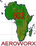
Highly detailed 76m SRTM mesh for Africa using the latest release of STRM Data V2.1. This file covers the Africa Area of base file 0603 (N01 and E00), North of the Equator. You need to download all two parts to restore the mesh bgl file. DO NOT DISABLE THE DEFAULT DEM 603 FILE.
| Filename: | Mesh_for_Northern_Africa_Base_Grid_0603__Part_1.zip |
| License: | Freeware |
| Added: | 8th February 2014, 22:03:34 |
| Downloads: | 2,530 |
| Author: | Martin du Preez, Hannes Steyn, Aeroworx |
| Size: | 307.22 MB |


© 2001-2026 AVSIM Online
All Rights Reserved
Privacy Policy |