
Where Flight Simulation Enthusiasts Gather from Around the World!
AVSIM Library - Search Results

| Category: Flight Simulator 2004 - Sounds | |
| SGA A300B4-200 Sounds for CF6-50c2 Engines |

|
File Description:
Hello there. I'm proud to present you my new engine soundpack for the A300B4 Series. I made this especially for the CF6-50c2 powered A300s. DC-10s have the same engines, so it can also be used on a DC-10 with GE engines.
This one contains (many months of work :-D ) real and high quality recordings from videos, nice spoolup-sounds and much more. It's quite realistic! Give it a try :-)
| Filename: | SGA_A300B4200_Sounds_for_CF650c2_Engines.zip |
| License: | Freeware |
| Added: | 4th May 2005, 22:04:21 |
| Downloads: | 2,452 |
| Author: | Dennis Vormberge |
| Size: | 17.15 MB |
| Category: Flight Simulator 2004 - Aircraft Repaints, Textures and Modifications | |
| Air North 'Yukon Livery' Boeing 737-201 (C-GNAU) |
|
File Description:
I am proud to present this realistic, detailed repaint of Air North's Boeing 737-201, registration C-GNAU, in the newer "Yukon livery". This aircraft has a distinct orange tail with the name of the territory which gives this airline its name; Yukon. Air North is a Canadian Airline based in Whitehorse, Yukon, and is 100% owned by Yukoners. This project has been fun for a significant reason; the people of Air North. I contacted them with a request for their logos to use in this repaint, and they were gracious and professional in granting my request. So I dedicate this repaint to Air North their kind personnel; especially Josh Clark. For this as with all of the aircraft I paint, I paid attention to detail and realism as much as possible and generated this repaint with realistic but not overstated details. The textures in this repaint are 32-bit. All Air North logos used in this repaint are copyrighted property of Air North and are used on this repaint with permission from Air North. This is a textures only package; you must have the Tinmouse 737-200adv v2 base package available here at AVSIM.
| Filename: | Air_North_Yukon_Livery_Boeing_737201_CGNAU.zip |
| License: | Freeware, limited distribution |
| Added: | 22nd August 2008, 02:12:46 |
| Downloads: | 955 |
| Author: | Jeffrey S. Bryner | Tinmouse II Project |
| Size: | 8.85 MB |
| Category: Flight Simulator 2004 - Scenery | |
| Alps LOD10 Topo Mesh - Austria and Italy |
|
Images related to this file:
File Description:
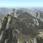
Yet another terrain mesh package of the European Alps? Well, this one is different in that it is NOT primarily based on the Shuttle Radar (SRTM) data with their incomplete coverage of prominent peaks and ridges. Instead, most of the source data for this project were developed over many months by Jonathan de Ferranti using detailed topographic maps. While Jonathan's work is unrelated to flight simulation he kindly gave me permission to compile his data for use in FS. The result is a wonderful improvement in detail and accuracy over any existing SRTM- or DTED-based mesh file, freeware or commercial (a link to an extensive set of screenshot comparisons is included in the read-me file).
I've compiled the source data at LOD10 (38-m) grid resolution because the coverage area is smaller than most existing mesh files. Thus, anyone can use these files without having to first uninstall their current mesh set. Also included are LOD9 and LO8 buffer mesh files. Note: if you own Austria Professional 2004 with its 1:50,000 scale terrain mesh then you don't need this package!
| Filename: | Alps_LOD10_Topo_Mesh__Austria_and_Italy.zip |
| License: | Freeware, limited distribution |
| Added: | 30th May 2010, 09:46:58 |
| Downloads: | 62,954 |
| Author: | Holger Sandmann, Jonathan de Ferranti |
| Size: | 73.32 MB |
| Category: Flight Simulator 2004 - Scenery | |
| Alps LOD10 Topo Mesh - Switzerland and France |
|
Images related to this file:
File Description:
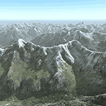
Yet another terrain mesh package of the European Alps? Well, this one is different in that it is NOT primarily based on the Shuttle Radar (SRTM) data with their incomplete coverage of prominent peaks and ridges. Instead, most of the source data for this project were developed over many months by Jonathan de Ferranti using detailed topographic maps. While Jonathan's work is unrelated to flight simulation he kindly gave me permission to compile his data for use in FS. The result is a wonderful improvement in detail and accuracy over any existing SRTM- or DTED-based mesh file, freeware or commercial (a link to an extensive set of screenshot comparisons is included in the read-me file).
I've compiled the source data at LOD10 (38-m) grid resolution because the coverage area is smaller than most existing mesh files. Thus, anyone can use these files without having to first uninstall their current mesh set. Also included are LOD9 and LO8 buffer mesh files. Note: if you own Switzerland Professional with its high-resolution terrain mesh then you don't need this package, at least not the Switzerland files!
| Filename: | Alps_LOD10_Topo_Mesh__Switzerland_and_France.zip |
| License: | Freeware, limited distribution |
| Added: | 30th May 2010, 09:51:03 |
| Downloads: | 58,994 |
| Author: | Holger Sandmann, Jonathan de Ferranti |
| Size: | 50.03 MB |
| Category: Flight Simulator 2004 - AFCAD Files | |
| CYUL AI Traffic to All Runways Including Non-Parallel 10/28 |
|
File Description:
The BIG BIG improvment in this AFCAD file is the use of ALL the runways for AI traffic (even non parallel runway 10|28 over 06L|24R). The only limitation i put is not to have departing aircraft on runway 10 (you can remove that limitation using AFCAD). I did it that way because ATC is not handling the traffic correctly with departing 06L and 10 at the same time - it is creating a nightmare on taxi to take off and hold shorts. However the landing on both 06L and 10 are working fine.
This is an AFCAD file for the default FS2004 CYUL airport. Lots of parking (similar to real life with some adjusments to parkings and taxiways to comply with the limited default scenery). It is sadly not compatible with CYUL2004 from Pilotes Virtuels du Quebec - but if someone from that team want it i could create a similar addon for you guys. Parking numbers are not accurate as in real life - same limitation here with the default scenery.
| Filename: | CYUL_AI_Traffic_to_All_Runways_Including_NonParall.zip |
| License: | Freeware |
| Added: | 28th September 2004, 16:08:47 |
| Downloads: | 1,174 |
| Author: | Rejean Boudreau |
| Size: | 10.19 KB |
| Category: Flight Simulator 2004 - AFCAD Files | |
| Newark Liberty Int'l Airport (KEWR) with active Crosswind Runway |
|
Images related to this file:
File Description:
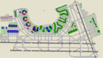
A high spec AFCAD2 for the FS2004 Newark Liberty Int'l Airport (KEWR) scenery by Steve Whalin. This afcad has been built using FAA Charts and information from the Airport Website. All taxiways are named and all aprons are reworked to be as real as possible according to photos. All gates are named as per real life and have airlines assigned to them. The Fedex and UPS aprons are represented and can accomodate many cargo aircraft. The final addition is random GA parking and the CO maintenance area to the north of the airport. Overflow parking is also available for rush hour periods (Ball Park). This airport features a tower view and also night and approach lighting. Finally, by using the crosswind runway technique, runways 04L/22R, 04R/22L and 11/29 can all be used simultaniously for take-off and landing. Runway 11/29 will be mainly used by CO Express flights. Enjoy!!
This afcad works with the Steve Whalin scenery only (Requires: kewr.zip).
| Filename: | Newark_Liberty_Intl_Airport_KEWR_with_active_Cross.zip |
| License: | Freeware |
| Added: | 2nd March 2010, 19:26:13 |
| Downloads: | 1,355 |
| Author: | Lee Brompton |
| Size: | 259.8 KB |
| Category: Flight Simulator 2004 - Scenery | |
| VEAT Argatala, India |
|
Images related to this file:
File Description:
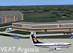
Googly scenery for VEAT Argatala, India - one of the airports that Microsoft seem to have, um, "forgotten" in FS2004. In the real world it is regularly served by Boeings and Airbii of Alliance Air, Indian Airlines, Jet Airways and Kingfisher Airlines (and smaller aircraft), using the 6000 foot runway with little room for manoevre. These scenery files add aprons, taxiways, buildings and other airport features to Flight Simulator's bland representation and allow you, and "AI" traffic, to land, taxi, park and take off realistically. The scenery does not purport to be ultra-accurate. Based on high-detail satellite imagery from Google Earth, the layout is proportianally correct but the added airport features, such as buildings, are built from default Microsoft objects and add-on libraries so will not look like the real thing. You are not obliged to download and install any additional scenery libraries, but to enjoy this scenery in its entirety, you may wish to. It will work fine, with or without. Details of optional additional scenery library downloads are provided within.
[File re-uploaded at request of AVSIM]
| Filename: | VEAT_Argatala_India.zip |
| License: | Freeware |
| Added: | 14th May 2010, 04:49:05 |
| Downloads: | 1,658 |
| Author: | John Hinson |
| Size: | 65.16 KB |
| Category: Flight Simulator 2004 - Scenery | |
| WIOO Pontianak/Supadio, Kalimantan, Indonesia |
|
Images related to this file:
File Description:
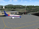
Googly scenery for WIOO Pontianak/Supadio, Kalimantan, Indonesia. In Flight Simulator
2004 only a general aviation parking is provided at this important Indonesian domestic
airport, but in the real world it is served over fifteen times
a day by jets and smaller aircraft of Adam Air, Airfast Service, Batavia Air, Deraya
Air Taxi, Indonesia Air Transport, Sriwijaya Air and Tri-MG Intra Asia Airlines. These
scenery files add aprons, taxiways, buildings and other airport features to Flight
Simulator's limited representation and allow "AI" traffic to land, taxi, park and
take off in a realistic manner.
The scenery does not purport to be ultra-accurate. Based on high-detail satellite
imagery from Google Earth, the layout is proportionally correct but the added
airport features, such as buildings, are built from default Microsoft objects
and add-on libraries so will not look like the real thing.
You are not obliged to download and install any additional scenery libraries,
but to enjoy this scenery in its entirety, you may wish to. It will work fine,
with or without.
[File re-uploaded at request of AVSIM]
| Filename: | WIOO_PontianakSupadio_Kalimantan_Indonesia.zip |
| License: | Freeware |
| Added: | 15th May 2010, 01:10:01 |
| Downloads: | 1,962 |
| Author: | John Hinson |
| Size: | 64.96 KB |
| Category: Flight Simulator 2004 - Scenery | |
| VEPT Patna, India |
|
Images related to this file:
File Description:
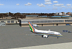
Googly scenery for VEPT Patna, India. In Flight Simulator 2004, the airport is
depicted at a pretty waterside location but only a small ramp for general aviation
aircraft is provided. In the real world it is served around six times a day by
Boeing jets on domestic flights by Alliance Air, Indian Airlines, Jet Airways, and
Sahara Airlines. These scenery files add aprons, taxiways, buildings and other
airport features to Flight Simulator's bland representation and allow "AI" traffic,
to land, taxi, park and take off in a realistic manner.
The scenery does not purport to be ultra-accurate. Based on high-detail satellite
imagery from Google Earth, the layout is proportionally correct but the added
airport features, such as buildings, are built from default Microsoft objects
and add-on libraries so will not look like the real thing.
You are not obliged to download and install any additional scenery libraries,
but to enjoy this scenery in its entirety, you may wish to. It will work fine,
with or without.
[File re-uploaded at request of AVSIM]
| Filename: | VEPT_Patna_India.zip |
| License: | Freeware |
| Added: | 7th May 2010, 11:02:44 |
| Downloads: | 1,704 |
| Author: | John Hinson |
| Size: | 65.91 KB |
| Category: Flight Simulator 2004 - Scenery | |
| WAML Palu/Mutiara, Indonesia |
|
Images related to this file:
File Description:
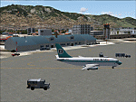
Googly scenery for WAML Palu/Mutiara, Indonesia. In Flight Simulator 2004 little
is provided other than a runway at this small domestic airport, although in the
real world it sees regular jet flights from airlines such as Batavia Air, Bouraq
Indonesia Airlines, Garuda Citylink, Lion Airlines and Merpati Nusentara and
smaller aircraft from operators like Airfast Service and Indonesia Air Transport.
These scenery files add aprons, taxiways, buildings and other airport features
to Flight Simulator's limited representation and allow "AI" traffic to land,
taxi, park and take off in a realistic manner.
The scenery does not purport to be ultra-accurate. Based on high-detail satellite
imagery from Google Earth, the layout is proportionally correct but the added
airport features, such as buildings, are built from default Microsoft objects
and add-on libraries so will not look exactly like the real thing.
You are not obliged to download and install any additional scenery libraries,
but to enjoy this scenery in its entirety, you may wish to. It will work fine,
with or without.
| Filename: | WAML_PaluMutiara_Indonesia.zip |
| License: | Freeware |
| Added: | 15th May 2010, 01:11:30 |
| Downloads: | 1,770 |
| Author: | John Hinson |
| Size: | 140.88 KB |


© 2001-2026 AVSIM Online
All Rights Reserved
Privacy Policy |