
Where Flight Simulation Enthusiasts Gather from Around the World!
AVSIM Library - Search Results

| Category: Flight Simulator 2004 - Scenery | |
| Chesterfield Inlet CYCS in Nunavut, Canada |

|
Images related to this file:
File Description:
Chesterfield Inlet is a small village on the west coast of Hudson Bay, with a population of 340 or so. It is the oldest community in Nunavut and was established around a Hudson Bay Company post in 1911, 55 miles north of Rankin Inlet (Sid and Pete's post). The airfield is close to the village and has a gravel runway 3,600 feet long aligned 124T/304T (true, not magnetic). Fuel is available with 2 hours prior notice, and the visiting AI airlines are First Air and Calm Air.
| Filename: | Chesterfield_Inlet_CYCS_in_Nunavut_Canada.zip |
| License: | Freeware, limited distribution |
| Added: | 6th December 2011, 20:27:39 |
| Downloads: | 379 |
| Author: | Roger Wensley |
| Size: | 2.21 MB |
| Category: Flight Simulator 2004 - Scenery | |
| Shepherd Bay CWSB in Nunavut, Canada |
|
Images related to this file:
File Description:
This was a DEW line Auxiliary Station on the western shore of the lower reaches of the Boothia Peninsula, 50 miles south of Taloyoak and 60 miles east of Gjoa Haven. The station was closed in 1989 but is almost intact except for a diesel tank or two. There are also other buildings nearby, and others on the beach landing area. A NWS automated station was opened in the same year as the Dew station was closed. The runway is also still there and is around 4,500 feet of gravel 100' wide, aligned 027T/207T. There are no lights, signage, or windsock, but the usual large hangar which was built at all Auxiliary Stations still survives. This is one of the more interesting DEW line stations to visit and walk around.
| Filename: | Shepherd_Bay_CWSB_in_Nunavut_Canada.zip |
| License: | Freeware, limited distribution |
| Added: | 22nd November 2012, 16:28:45 |
| Downloads: | 223 |
| Author: | Roger Wensley |
| Size: | 2 MB |
| Category: Flight Simulator 2004 - Scenery | |
| Simpson Lake CWSL in Nunavut, Canada |
|
Images related to this file:
File Description:
This was a DEW line I Station in the lower reaches of the Boothia Peninsula, 80 miles south of Taloyoak and 40 miles east of Shepherd Bay. The station was closed in 1963 and the buldings and other items have been removed apart from the garage and some diesel tanks. A NWS automated station was opened there in 1991. The runway is still there and is just over 3,500 feet of gravel 100' wide, aligned 044T/224T, and at 790 feet ASL. There are no lights, signage, or windsock. This is one of the less interesting DEW line stations to visit and walk around.
| Filename: | Simpson_Lake_CWSL_in_Nunavut_Canada.zip |
| License: | Freeware, limited distribution |
| Added: | 24th November 2012, 02:53:06 |
| Downloads: | 209 |
| Author: | Roger Wensley |
| Size: | 929.41 KB |
| Category: Flight Simulator 2004 - Scenery | |
| Medicine Hat CYXH in Alberta Canada |
|
Images related to this file:
File Description:
Medicine Hat is a town in south Alberta, beside the South Saskatchewan River, and around 180 miles southeast of Calgary. Originally a railroad town, and in fact still served by the railway and now also by the Trans-Canada Highway, it is currently mainly known for the large natural gas fields in the area. As Rudyard Kipling said, Medicine Hat has "all hell for a basement". The name of the city is a translation of the Blackfoot tribal name for the eagle tail feather headdress worn by tribal medicine men, and it was curiosity about the name that first got my attention.
The date of this scenery is not 2010, as is usual for my scenery; it is more like 2015. The terminal building has been extended and improved, the apron around the two large southern hangars and the large rental hangars behind them is still visibly new, and the tie-down parking places on the grass accessed off one side of the old taxiway are in place and in use. The airport is now (2015) not in the busy usage that it experienced in the second half of the 1900's and old taxiways and a runway have been left to decay and large old hangars have been demolished. Hence the visible remains. The current runways were rebuilt (on top of the existing as foundations) and are 03-21 with 4,990 feet of lit asphalt 150 feet wide with PAPI at both ends, and 09-27 with 2,885 feet of lit asphalt 100 feet wide.
The two newish hangars to the south are a helicopter operating and maintenance company with a flight training school based in the adjoining offices (light grey buildings) and an FBO in hangar and offices (dark grey). Further buildings have been erected since then, and some existing ones have been reclad (eg. light grey now, in 2021, has a light blue roof).
I have cheated in one respect. In reality, the edges of the airport have been gradually utilised for various purposes, such as workshops, storage sheds, factories, etc, with access from the surrounding urban roads. As I have almost no information regarding their appearance I decided to leave the airport area as it was originally built, rather than incorporating buildings that I know are false. I admit that this was also the laziest solution.
The scenery includes a grass strip 3 miles to the south of Medicine Hat, namely Schlenker CFZ3. It is the only airfield I have come across where the fences are not around the edge of the airfield, they are instead around the runways and apron. I presume this is so animals can be left to feed off the grass in summer.
The AI includes flights by Air Canada Jazz.
| Filename: | Medicine_Hat_CYXH_in_Alberta_Canada.zip |
| License: | Freeware, limited distribution |
| Added: | 23rd January 2022, 20:11:10 |
| Downloads: | 142 |
| Author: | Roger Wensley |
| Size: | 19.15 MB |
| Category: Flight Simulator 2004 - Scenery | |
| Metro Field MTF in Fairbanks Alaska |
|
Images related to this file:
File Description:
Metro Field is more of a float plane "pond" than a field, close to and northeast of Fairbanks International Airport in Alaska. There is a gravel strip alongside the water, but the "strip" is actually a gravel road that functions as a runway when required. And if that sounds familiar it is also pretty much the description for nearby Chena Marina, though Metro is nowhere near as busy. This is one of four float plane bases around Fairbanks. You will definitely need Ultimate Terrain Alaska Canada.
| Filename: | Metro_Field_MTF_in_Fairbanks_Alaska.zip |
| License: | Freeware, limited distribution |
| Added: | 21st August 2010, 03:27:58 |
| Downloads: | 373 |
| Author: | Roger Wensley |
| Size: | 986.7 KB |
| Category: Flight Simulator 2004 - Scenery | |
| Grande Cache CEQ5 in Alberta, Canada |
|
Images related to this file:
File Description:
Grande Cache is at 4,117 feet above sea level, just under 90 miles south of Grande Prairie and 220 miles west of Edmonton. It is among the eastern foothills of the Rockies. The town was established to accommodate employees of a coal mine and their families in the early 1970's. There was a financial roller coaster ride for the coalmine during the next few years and despite the opening of a wood chip plant and a federal prison the town was eventually downgraded to a hamlet by a vote in 2018, as it was essentially bankrupt and had a population of less than 4,500. The airport, some 10 miles east of the town, had two aprons, one for GA and scheduled flights and another, the eastern one, for fire fighting planes. I say "had" as it was closed in January 2017. However, the fire fighting area appears to have been maintained (tanks repainted, for instance) and is presumably able to support operations if required. The date for this scenery is 2009.
| Filename: | Grande_Cache_CEQ5_in_Alberta_Canada.zip |
| License: | Freeware, limited distribution |
| Added: | 29th September 2021, 03:59:20 |
| Downloads: | 89 |
| Author: | Roger Wensley |
| Size: | 7.49 MB |
| Category: Flight Simulator 2004 - Scenery | |
| Sydney CYQY in Nova Scotia Canada |
|
Images related to this file:
File Description:
Sydney is a maritime port on the east coast of Canada, on the eastern corner of Cape Breton Island. It was founded in 1785 and grew in size emormously from 1900 as a steel mill was founded that prospered along with local coal mines until 1950 or so. After that date and following the final closure of the mill in 2001 the population declined to the current 29,000 or so. The airport is 3 or 4 miles southwest and inland of a coastal urban area which stretches from New Waterford in the north through Lingan, Dominion, Reserve Mines, and Glace Bay, to Port Caledonia, and 5 miles east of the town of Sydney which is beside a sheltered deep water harbour area. This version is not from a fixed date as although I had video of some of the buildings from 2010 I inadvertently constructed part of the apron layout from 2018 information, and then decided to keep it like that either because I liked it or perhaps was too lazy to redo it. The terminal building and the garages to the east of the terminal are original and old, though renovated and maintained to a fairly good standard. The other buildings on the airport are "hangars" in the expected form, with steel frames, insulated cladding, and pitched roofs. The airport publicises it's ability to cater for all the needs of visiting aircraft, with a large FBO hanger just beside the terminal. There are (or were, before the virus came along) scheduled flights by Westjet, Air Canada Jazz, and Air North, which are included in the AI along with GA flights. The runways are 07-25 at 7,000 feet and with PAPI on 25 and ILS on 07, and 01-19 at 6,000 feet with PAPI on 01 and ILS on 19. You will see once the scenery is installed that there are two folders in Sydney CYQY called "Scenery summer" and "scenery winter". Editing the folder name down from "scenery summer" to just "scenery" results in FS9 loading the summer ground textures and parked planes etc. In February you would edit down the "scenery winter" folder to just "scenery" and the unused and unswept taxiways, runway, and aprons will be invisible under the snow, the open-topped cars will not be parked in the open, and privately-owned planes will be in the hangars. If FS9 decides that there is snow on the ground then you need the winter textures, if not then the summer textures. The winter textures are not the full-snowdrift-middle-of-Winter-gale type and are more like early or late winter. One thing you must NOT DO is to edit both folders down at the same time.
| Filename: | Sydney_CYQY_in_Nova_Scotia_Canada.zip |
| License: | Freeware, limited distribution |
| Added: | 22nd August 2020, 00:07:58 |
| Downloads: | 276 |
| Author: | Roger Wensley |
| Size: | 29.42 MB |
| Category: Flight Simulator X - Scenery | |
| Santa Lucia airport (MMSM) in Mexico |
|
Images related to this file:
File Description:
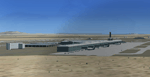
Santa Lucia airport is a new facility serving Mexico City, opened in 2022. The FSX scenery of this airport was built with the Airport Design Editor program, based on satellite images from Google Earth and on actual Jeppesen charts. The buildings are made with GMAX.
| Filename: | Santa_Lucia_airport_MMSM_in_Mexico.zip |
| License: | Freeware |
| Added: | 23rd December 2022, 21:34:40 |
| Downloads: | 740 |
| Author: | Winfried Orthmann |
| Size: | 5.49 MB |
| Category: Flight Simulator X - AFCAD Files | |
| Gulu airport (ICAO: HUGU) in Uganda |
|
File Description:
The airport of Gulu in Uganda now very close to real!
Only day/time flights because the airport has not light system.
| Filename: | Gulu_airport_ICAO_HUGU_in_Uganda.zip |
| License: | Freeware |
| Added: | 18th November 2017, 16:04:48 |
| Downloads: | 313 |
| Author: | Giannis Dedes |
| Size: | 3.02 KB |
| Category: Flight Simulator 2004 - Scenery | |
| Terrace CYXT in BC Canada Updated |
|
Images related to this file:
File Description:
This version of Terrace has night textures that work, good news for the 319 downloaders who did not tell the author that the ones already posted did not work. Why? Terrace is fifteen miles east and inland from Prince Rupert, which is 500 miles north of Vancouver up the BC coast. It is at the point in the mountains where two fjords meet, one coming from Prince Rupert and the other from Kitimat. There are two runways, the main one is a recently-extended 7,500 feet long and lighted 33/15 and the second is 5,373 feet of unlit 03/21. The apron has been enlarged to be able to accomodate a Boeing 737; though I don't think there is an airline using a 737 for flights to Terrace I have parked an Air Canada jet and the pics show the planes that do fly to Terrace, Air Canada and Hawk Air Dash 8-300's. The aircraft and the textures are down-loadable and and can be used for AI.
| Filename: | Terrace_CYXT_in_BC_Canada_Updated.zip |
| License: | Freeware, limited distribution |
| Added: | 3rd July 2010, 03:28:31 |
| Downloads: | 1,065 |
| Author: | Roger Wensley |
| Size: | 3.72 MB |


© 2001-2026 AVSIM Online
All Rights Reserved
Privacy Policy |