
Where Flight Simulation Enthusiasts Gather from Around the World!
AVSIM Library - Search Results

| Category: Flight Simulator X - Scenery | |
| ZUGU Ngari Gunsa Airport |

|
File Description:
The Ngari Gunsa Airport in northwest Tibet's Ngari Prefecture is set to open in July 2010 At an altitude of 4,274 meters, the airport, the fourth of its kind in Tibet, will have a 4,500-m runway and a 51,000-sq-m parking apron.
Upon completion, it will be able to accommodate four planes.
| Filename: | ZUGU_Ngari_Gunsa_Airport.zip |
| License: | Freeware |
| Added: | 4th July 2010, 22:40:47 |
| Downloads: | 703 |
| Author: | Anwar Gonzalez |
| Size: | 4.58 KB |
| Category: Flight Simulator 2004 - Scenery | |
| Richmond Municipal Airport KRID |
|
Images related to this file:
File Description:
FS2004 Scenery - Richmond Municipal Airport (KRID), Richmond, IN serves Richmond and Wayne County and is owned by Richmond Boac. The airport has more than one runway. The longest is a paved runway extending 5200 feet. The facility is at an elevation of 1140 feet at a distance of about 5 miles from Richmond. Created for your flying pleasure with Instant Scenery 2 by John B. Loney, Jr.
| Filename: | Richmond_Municipal_Airport_KRID.zip |
| License: | Freeware, limited distribution |
| Added: | 3rd August 2010, 22:22:45 |
| Downloads: | 396 |
| Author: | John B. Loney, Jr. |
| Size: | 5.09 MB |
| Category: Flight Simulator X - Scenery | |
| Richmond Municipal Airport KRID |
|
Images related to this file:
File Description:
FSX Scenery - Richmond Municipal Airport (KRID), Richmond, IN serves Richmond and Wayne County and is owned by Richmond Boac. The airport has more than one runway. The longest is a paved runway extending 5200 feet. The facility is at an elevation of 1140 feet at a distance of about 5 miles from Richmond. Created for your flying pleasure with Instant Scenery 2 by John B. Loney, Jr.
| Filename: | Richmond_Municipal_Airport_KRID.zip |
| License: | Freeware, limited distribution |
| Added: | 3rd August 2010, 22:22:55 |
| Downloads: | 675 |
| Author: | John B. Loney, Jr. |
| Size: | 5.1 MB |
| Category: Flight Simulator 2004 - Scenery | |
| Aurangabad Domestic Airport [VAAU] |
|
Images related to this file:
File Description:
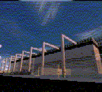
Aurangabad Airport is about 135nm East of Mumbai. Recently a New Apron has been added to the airport which has also been amended in the scenery. One of the runways i.e. Rwy 27 has ILS CAT II, Vor, Ndb - every basic requirement is available.Quick Short Flights to Mumbai is what one might enjoy . The other reason to fly in-out of this airport. ...well ... these screen shots might ....just...help you decide. 2 tiny mini terminal buildings and landscape gives a good frame rate.
| Filename: | Aurangabad_Domestic_Airport_VAAU.zip |
| License: | Freeware |
| Added: | 12th August 2010, 00:38:05 |
| Downloads: | 1,050 |
| Author: | Ashish Singh |
| Size: | 19.88 MB |
| Category: Flight Simulator X - AFCAD Files | |
| 94K Cassville Municipal Airport |
|
Images related to this file:
File Description:
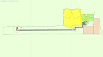
This is my home airport; 94K in Cassville, MO. It isn't a big airport, but they have any fuel you want (as long as it's 100LL) and plenty of parking (if no one beat you to it)! I've fixed the apron, added a parking spot for medium GA, cleaned up the west (RWY9) turn-around, adjusted the fencing, added some hangars and some treats, moved the beacon tower and the east windsock to a more realistic location, edited the tower view to provide a good view of the airport, added some trees and birds, etc. Nothing over the top, just some corrections and homey touches. Please read the READ ME file. Enjoy!
| Filename: | 94K_Cassville_Municipal_Airport.zip |
| License: | Freeware |
| Added: | 1st September 2010, 08:27:55 |
| Downloads: | 202 |
| Author: | Jeremy G. Burch |
| Size: | 161.52 KB |
| Category: Flight Simulator X - Scenery | |
| Kenneth Copeland Airport - 4TA2 |
|
Images related to this file:
File Description:
FSX AFCAD/Scenery for 4TA2 Kenneth Copeland Airport, Fort Worth, Texas, USA V1 for default scenery. Redoes runways, adds aprons and buildings and other objects. An Aussie FS release.
| Filename: | Kenneth_Copeland_Airport__4TA2.zip |
| License: | Freeware, limited distribution |
| Added: | 10th September 2010, 03:13:08 |
| Downloads: | 503 |
| Author: | Alexander Czarnecki (Aussie FS) |
| Size: | 109.83 KB |
| Category: Flight Simulator X - AFCAD Files | |
| Buck's Airport (00N), NJ |
|
File Description:
Located 03 miles NE of Bridgeton, New Jersey on 63 acres of land, Buck's Airport is a small turf field privately owned by J. Di Orio and open to the public. The field in FSX has room for 8 small GA aircraft to park on the square of grass north of the greenhouses. Be careful of the trees to the north and south of the runway.
Scenery constructed with use of Google Maps images, the author has not been there in person.
This scenery is meant to be used in conjunction with MegaScenery Earth New Jersey/Delaware 004. It is not required, but apron use is minimized to allow satellite scenery to show through as much as possible - lack of it may make scenery look out of place.
| Filename: | Bucks_Airport_00N_NJ.zip |
| License: | Freeware |
| Added: | 3rd October 2010, 23:47:29 |
| Downloads: | 233 |
| Author: | Drew Sikora |
| Size: | 566.5 KB |
| Category: Flight Simulator X - AFCAD Files | |
| Trinca Airport (13N), NJ |
|
File Description:
Located 03 miles SW of Andover, New Jersey on 12 acres of land, Trinca Airport is a small turf field publicly owned by Green Township. Parking is available on the turf patch around the hangars. Field is unlit, hence the airport is closed Sunset to sunrise.
Scenery constructed with use of Google Maps images, the author has not been there in person.
This scenery is meant to be used in conjunction with MegaScenery Earth New York 007. It is not required, but apron use is minimized to allow satellite scenery to show through as much as possible - lack of it may make scenery look out of place.
| Filename: | Trinca_Airport_13N_NJ.zip |
| License: | Freeware |
| Added: | 4th October 2010, 02:02:00 |
| Downloads: | 238 |
| Author: | Drew Sikora |
| Size: | 902.17 KB |
| Category: Flight Simulator X - AFCAD Files | |
| Blairstown Airport (1N7), NJ |
|
File Description:
Located 02 miles SW of Blairstown, New Jersey on 151 acres of land, Blairstown Airport is privately owned by J.D. Air Inc. and is home to a moderate number of small GA planes and gliders. This scenery is not completely up to date, as the MegaScenery Earth textures themselves are outdated. Missing are the added taxiway/parking lot north of the existing north taxiway as well as the second hangar area to the north that it leads to. Parking is available on the south tarmac but if that's all taken there is room just to the west in the taxiway offshoot. Also room on the grass, although stay south of the windsock to avoid interfering with glider operations. Glider pilots that wish to start on the grass, select either Runway East or Runway West. Fuel is available by stopping near the gas tank on the south tarmac.
Scenery constructed with use of satellite images/streetview, the author has not been there in person.
This scenery is meant to be used in conjunction with MegaScenery Earth New York 007. It is not required, but apron use is minimized to allow satellite scenery to show through as much as possible, and objects are placed based on the MSE textures - lack of it may make scenery look out of place.
| Filename: | Blairstown_Airport_1N7_NJ.zip |
| License: | Freeware |
| Added: | 8th October 2010, 20:22:59 |
| Downloads: | 247 |
| Author: | Drew Sikora |
| Size: | 576.39 KB |
| Category: Flight Simulator 2004 - Scenery | |
| Bolivar Airport (SAZI), Argentina |
|
Images related to this file:
File Description:
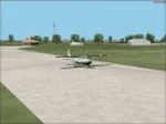
This scenery consists of small airfield Bolivar in Argentina. Based on real photographs and satellite map view.
| Filename: | Bolivar_Airport_SAZI_Argentina.zip |
| License: | Freeware |
| Added: | 9th October 2010, 11:23:25 |
| Downloads: | 388 |
| Author: | Martin Hrabeta |
| Size: | 855.42 KB |


© 2001-2026 AVSIM Online
All Rights Reserved
Privacy Policy |