
Where Flight Simulation Enthusiasts Gather from Around the World!
AVSIM Library - Search Results

| Category: Flight Simulator 2004 - AFCAD Files | |
| A&F Data For South Australia airfields v2 |

|
Images related to this file:
File Description:
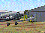
This updated set of 76 AFCAD2 files are for use with the free add-on scenery from Roger Leupold (fs9sav1.zip) are not suitable for the default FS2004 airfields. Version 2 incorporates corrected ICAO codes using the excellent listing made available by Mal Lloyd. The files will allow the scenery (designed for FS2002) to become more useable in FS2004. They will allow you to plan routes, and take off and land at some 76 airfields featuring in the scenery, with ATC routing you appropriately. AI aircraft can now land, taxi, park and take off in the correct locations, and you can introduce your own AI traffic, too, if you wish. Every airfield has at least one parking space (even the tiniest airstips) but airfields featuring hangers and other scenery have more. [File re-uploaded at request of AVSIM]
| Filename: | AF_Data_For_South_Australia_airfields_v2.zip |
| License: | Freeware |
| Added: | 26th May 2010, 19:14:18 |
| Downloads: | 435 |
| Author: | John Hinson |
| Size: | 84.15 KB |
| Category: Flight Simulator X - Missions | |
| Western Cape VFR, South Africa, Flight 1 and 2 |
|
File Description:
You are the chief pilot of the South African Air Force Caravan 41 Squadron, based on
AFB Swartkops in Pretoria. You have been given the task by the Chief of the Air Force (CAF) to assist in a public relations exercise with the US Navy, who have an aircraft carrier docked just outside Saldanha Bay in the Western Cape, South Africa. The admiral on board with a few high ranking officers are to be entertained during their visit at Naval Base Saldanha. You are cleared to fly to AFB Langebaanweg and plan a VFR flight to show off our beautiful Western Cape country side, you are cleared to fly at any altitude you feel necessary. After consulting with the local pilots on the base you have planned the following low level route, over 2 days, which was approved by the CAF.
| Filename: | Western_Cape_VFR_South_Africa_Flight_1_and_2.zip |
| License: | Freeware |
| Added: | 12th August 2010, 00:36:02 |
| Downloads: | 870 |
| Author: | Robbie Albers |
| Size: | 4.39 MB |
| Category: Miscellaneous Files - General Utilities | |
| Wx2pfpx v2.6.4 |
|
Images related to this file:
File Description:
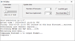
A simple weather data provider for the discontinued Professional Flight Plan X software. The script fetches raw weather data, METAR and TAF data from the NOAA, US national weather service, which is then compiled to a single file that can be imported in PFPX. More than 15000 reference stations (airports) from PFPX are used and wind/temperature data is provided for each of them. When available, METAR and TAF data is also provided for more than 5000 airports. The original data source is updated 4 times a day, and can provide forecasts for every 3 following hours up to 16 days. *** A new script can trigger antivirus analysis as it's unknown, you can ignore it.*** V2: Great precision improvement, possibility of importing the whole NOAA dataset grid, a bit of documentation. V2.6: Repaired due to API change.
| Filename: | Wx2pfpx_v264.zip |
| License: | Freeware, limited distribution |
| Added: | 27th September 2025, 15:55:08 |
| Downloads: | 90 |
| Author: | John Smith |
| Size: | 21.97 MB |
| Category: X-Plane - Aircraft Repaints, Textures and Modifications | |
| Hanse Aviation Robin DR400-140B (D-EHAA) |
|
Images related to this file:
File Description:
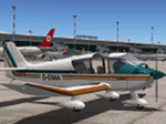
This is a fictional livery for the xpfr.org DR400-140B. The outside is
based on the HB-KFQ livery and the inside on the default livery, both are
included with the plane.
I changed the fuselage and wing colors to teal and orange, replaced the flag
at the tail with the flag of Mecklenburg (a region in Germany), and changed
the registration number on fuselage, wings, and inside the cockpit to D-EHAA
(which stands for Hanse Aviation, no. A).
I also changed the book covers in the cockpit; the blue-yellow one is the
cover of an ADAC travel guide for the federal state Mecklenburg-Vorpommern.
Finally, the map you can open in the cockpit shows the region near the old
hanseatic town Rostock, the biggest city in Mecklenburg-Vorpommern. The map
is OpenStreetMap as shown in Plan-G.
| Filename: | Hanse_Aviation_Robin_DR400140B_DEHAA.zip |
| License: | Freeware |
| Added: | 22nd August 2013, 21:14:49 |
| Downloads: | 123 |
| Author: | Mario Donick |
| Size: | 16.75 MB |
| Category: Flight Simulator 2004 - Scenery | |
| Biggs Field KBIF |
|
Images related to this file:
File Description:
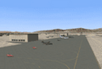
This AI-Package contains several beautiful airplanes: Boeing: B-52H, C-17 Globemaster,
E-3A NATO and F-18E Super-Hornet, British Aerospace: Eurofighter EF-2000 Typhoon and
Hawk MkT1, Hamburger Flugzeugbau: C-160 Transall, Lockheed: C-5A Galaxy, C-130 Hercules
and F-117 Stealth, and last not least Lockheed-Martin: F-16C Falcon. These aircraft
perform "Touch and Goes" in the local traffic pattern at Biggs-Field per attached
flight plan in order to get prepared for the upcoming Biggs-Field Airshow.
All the attached outstanding airplanes have been created by well known designers
(see briefing). My part was just to prepare them in order to work in an artificial
intelligent (AI) environment as good as possible.
The excellent El-Paso scenery "elp_photo.zip" from Kevin Burns, available here at the
Avsim library, is required to enjoy this package!
| Filename: | Biggs_Field_KBIF.zip |
| License: | Freeware |
| Added: | 14th April 2011, 02:29:22 |
| Downloads: | 1,032 |
| Author: | Klaus Jone |
| Size: | 20.03 MB |
| Category: Flight Simulator X - Scenery | |
| KLAW - Fort Sill Regional / Lawton Muni - Oklahoma, USA |
|
Images related to this file:
File Description:
FSX Scenery - Lawton Fort Sill Regional Airport (IATA: LAW[2], ICAO: KLAW, FAA LID: LAW) is a city owned airport two miles south of Lawton, in Comanche County, Oklahoma. It is used for military aviation from nearby Fort Sill and Sheppard Air Force Base and is served by American Eagle. Allegiant Air runs occasional charters to various destinations in the western United States. The National Plan of Integrated Airport Systems for 2011-2015 categorized it as a primary commercial service airport. Federal Aviation Administration records say the airport had 77,533 passenger boardings (enplanements) in calendar year 2008, 71,389 in 2009 and 68,054 in 2010. The 2013 Federal sequester will result in the closure of the airport's control tower and will require pilots to rely on air traffic controllers from other area airports. For your flying pleasure by John B. Loney, Jr.
| Filename: | KLAW__Fort_Sill_Regional__Lawton_Muni__Oklahoma_US.zip |
| License: | Freeware, limited distribution |
| Added: | 19th August 2015, 20:58:38 |
| Downloads: | 598 |
| Author: | John B. Loney, Jr. |
| Size: | 12.61 MB |
| Category: Flight Simulator 2002 - Flight Plans | |
| 35RTWest |
|
File Description:
An FS2002 GPS flight Plan. The 35th in a series of Round the World flight plans for the FS2002 default scenery. Depart Paro (VQPR) runway 33, Bhutan and arrive 1 hour 02 minutes later at Tribhuvan International (VNKT) runway 02, Nepal. A steep takeoff to avoid the banking around the runway is followed by a climb up a valley before passing through a gap in the snow capped mountain peaks at FLl90. An optional flight situation file is provided to assist inexperienced pilots with this very tricky departure. At the highest point in the flight, FL280, you will still be overlooked as you pass the snow capped peak of Everest. The flight briefing (Word and text) is for a B737-400, it contains climb, cruise, top of descent and fuel loading details, waypoint timings and destination details.
| Filename: | 35RTWest.zip |
| License: | Freeware |
| Added: | 13th July 2002, 18:23:40 |
| Downloads: | 1,390 |
| Author: | The Ancient Brit |
| Size: | 56.92 KB |
| Category: Flight Simulator 2002 - Flight Plans | |
| 53RTWest |
|
File Description:
An FS2002 GPS flight Plan by the Ancient Brit. The 53rd in a series of Round the World flight plans for the FS2002 default scenery. Depart Kulusuk (BGKK) runway 11, Greenland and arrive 2 hours 9 minutes later at Kangerlussuaq (BGSF) runway 10 Greenland. The direct distance is 337 nm, but I have gone the ‘pretty way’ taking 621 nm and using 1,340 custom waypoints in the process. The departure takes you for a low level tour (500 ft) along Fjords and between mountains, climbs to cruise then descends for another low level tour (500 ft) along Fjords and between mountains, before finishing with a VFR landing (Hand holding instructions given). The flight briefing (Word and text) is for the default B737-400; it contains climb, cruise, top of descent and fuel loading details, waypoint timings and destination details.
| Filename: | 53RTWest.zip |
| License: | Freeware |
| Added: | 22nd March 2003, 10:47:54 |
| Downloads: | 556 |
| Author: | Denis Egan |
| Size: | 33.07 KB |
| Category: Orbiter - Spaceships | |
| Surveyor Lunar Lander 1.0 |
|
File Description:
The Surveyor program consisted of seven unmanned lunar missions that were launched between May 1966 and January 1968. Five of these spacecraft, Surveyor 1, 3, 5, 6, and 7 successfully soft-landed on the lunar surface. In addition to demonstrating the feasibility of lunar surface landings, the Surveyor missions obtained lunar and cislunar photographs and both scientific and technological information needed for the Apollo manned landing program. Four spacecraft, Surveyor 1, 3, 5, and 6, returned data from selected mare sites from Apollo program support, and Surveyor 7 provided data from a contrasting rugged highland region.
The Orbiter version brings to you the historical flight of this unmanned lunar landing probe. The flight plan should bring you within 10,000 km of the Lunar surface. With one mid course correction, and enough practice, you can land it the moon.
| Filename: | Surveyor_Lunar_Lander_10.zip |
| License: | Freeware |
| Added: | 8th December 2004, 14:57:05 |
| Downloads: | 872 |
| Author: | James Williams |
| Size: | 1.97 MB |
| Category: Civil Flight Simulators - Looking Glass Flight Unlimited 3 | |
| Seattle Expansion Toolkit |
|
File Description:
Conversion of the Seattle Region from .cpd to .bin for FU3
This experimental toolkit is for region builders, its not a new full game !
If you want expand the region with new material to the north and the east then
conversion to .bin is a must.
Do not convert if you don't plan to expand or modify texture of the tiles.
Then the only results are a larger game folder :-(
The quality of the original tiles will not change !
The Seattle region is converted from 10x10 tiles area into a 16x16 tiles area but just 2 new tiles are made north of Coupeville Nolf as sample, so 154 tiles are then still missing and replaced by the blank tile (new full water tile). As elevation the new NASA-SRTM-V2 model is used. Backup your Seattle region before starting the experiment.
| Filename: | Seattle_Expansion_Toolkit.zip |
| License: | Freeware, limited distribution |
| Added: | 17th February 2007, 22:24:07 |
| Downloads: | 121 |
| Author: | Andre Meystre |
| Size: | 41.8 MB |


© 2001-2026 AVSIM Online
All Rights Reserved
Privacy Policy |