
Where Flight Simulation Enthusiasts Gather from Around the World!
AVSIM Library - Search Results

| Category: Flight Simulator 2004 - Scenery | |
| Union Island TVSU in the Grenadines |

|
Images related to this file:
File Description:
Union Island is in the southern tail of the chain of islands known as St Vincent and the Grenadines, between Canouan and Carriacou. Union is another small island, 3.5 miles long and at its widest 1.5 miles wide; the resident population is around 3,000, mostly in the two towns Clifton and Ashton.
The airport is at the eastern end of the island, and has been extended into the sea on landfill. The runway is now around 2,480 feet long, aligned 08 (and with the southeast trade winds it is unlikely that you will find yourself using 26) and with a displaced threshold of 530 feet due to the hill to the west. The terminal is adjacent to a rather small apron; there is parking on the grass north of the taxiway. There are connecting flights by SVG to Barbados and the other islands and these are reflected in the AI. The airport has no lighting, and flights are obliged to land and depart in daylight hours only, outside of which the airport is closed.
| Filename: | Union_Island_TVSU_in_the_Grenadines.zip |
| License: | Freeware, limited distribution |
| Added: | 11th June 2013, 23:26:50 |
| Downloads: | 435 |
| Author: | Roger Wensley |
| Size: | 2.02 MB |
| Category: Flight Simulator X - Flight Plans | |
| Springfields in the US VFR Tour |
|
File Description:
As a tribute to the animated "Simpsons" TV series, I decided to plan and fly (virtually via FSX) VFR to a Springfield in each state that had one. There are over 40 Springfields in the US with some states having none and some greedy states having multiples. Not counting the multiples, this leaves by my count 33 Springfields. Pretending we have deep pockets and lots of time, we will fly a Cessna 172 to the airports closest to each Springfield in a circuitous route beginning and ending in North Carolina. The flights assume you understand VORs and flying them inbound and outbound as well as utilizing NDBs. The GPS is handy for positional awareness, but using it to get from waypoint to waypoint takes out the fun.
| Filename: | Springfields_in_the_US_VFR_Tour.zip |
| License: | Freeware |
| Added: | 24th November 2013, 20:29:59 |
| Downloads: | 166 |
| Author: | Matt Vitale |
| Size: | 49.26 KB |
| Category: Online ATC - Software | |
| VAT-Spy adding airports in ASIA |
|
File Description:
VATSpy addition covers areas:
1) Airports by ICAO code: O
OA - Afghanistan
OB - Bahrain
OE - Saudi Arabia
OI - Iran<
OJ - Jordan
OK - Kuwait
OL - Lebanon
OM - United Arab Emirates
OO - Oman
OP - Pakistan
OR - Iraq
OS - Syria
OT - Qatar
OY - Yemen
2) Airports by ICAO code: R
RC - Taiwan
RJ RO - Japan
RK - South Korea
3) Airports by ICAO code: V
VA VE VI VO - India
VA - Mumbai Center (VABF)
VE - Kolkata Center (VECF)
VI - Delhi Center (VIDF)
VO - Chennai Center (VOMF)
VC - Sri Lanka
VD - Cambodia
VG - Bangladesh
VH - Hong Kong
VL - Laos
VM - Macau
VN - Nepal
VQ - Bhutan
VR - Maldives
VT - Thailand
VV - Vietnam
VY - Myanmar (Burma
4) Airports by ICAO code: Z
Mainland China
ZB -
ZG -
ZH -
ZJ -
ZL -
ZP -
ZS -
ZU -
ZW -
ZY -
ZK - North Korea
ZM - Mongolia
| Filename: | VATSpy_adding_airports_in_ASIA.zip |
| License: | Freeware |
| Added: | 1st July 2014, 15:16:36 |
| Downloads: | 157 |
| Author: | Porutchikov Fedor |
| Size: | 1.06 MB |
| Category: Flight Simulator 2004 - AI Aircraft | |
| Zlin Z-137T in Slovak services |
|
Images related to this file:
File Description:

This is repaint of Agroplne Z-137T in Slovak services:
OM-TOP, OM-VIA, OM-NRP, OM-VIB, OM-NRM, OM-NRK, OM-CAA, OM-CAB, OM-VIG.
| Filename: | Zlin_Z137T_in_Slovak_services.zip |
| License: | Freeware |
| Added: | 13th April 2015, 17:12:57 |
| Downloads: | 88 |
| Author: | Pavol Augustin |
| Size: | 2.57 MB |
| Category: Flight Simulator 2004 - AI Aircraft | |
| Zlin Z-37 in Slovak services |
|
Images related to this file:
File Description:

This is repaint of Agroplne Z-37 in Slovak services:
OM-DJU, OM-OJN, OM-OJQ, OM-CJF, OM-FJA, OM-NJS, OM-KJR, OM-HJO, OM-HJX, OM-CJA, OM-FJC, OM-HJT, OM-OJS, OM-OJP, OM-HVJ, OM-HJN, OM-FJV, OM-OJR.
| Filename: | Zlin_Z37_in_Slovak_services.zip |
| License: | Freeware |
| Added: | 13th April 2015, 17:13:46 |
| Downloads: | 88 |
| Author: | Pavol Augustin |
| Size: | 9.23 MB |
| Category: Flight Simulator X - Scenery | |
| RAF Kirton in Lindsey - Lincolnshire, England |
|
File Description:
It appears to have been an RAF habit (inherited from the RFC to name its bases after the nearest railway station, possibly to simplify the process of issuing Rail Warrants to personnel posted there. By that token, the site should be RAF Kirton Lindsey, Kirton Lindsey being the name of the nearby railway station constructed in 1849. No.255 Squadron's Operations Record Book (ORB) consistently uses that version of the name. So does the airfield's separate ORB, from the date of the site's WWII creation (15 May 1940) through to May 1941. After mid-1941 and the departure of No.255 Squadron, use of RAF Kirton-in-Lindsey. Kirton in Lindsey begins to appear in the site's own records – eventually dominating.
On 25 March 2013 it was announced to dispose of the airfield and technical facilities with only accommodation remaining. The airfield used to host No. 1 Air Control Centre (1ACC), the RAF’s only deployable ground-based early warning and air control radar unit, which was parented by RAF Scampton
The Station has had a varied selection of personnel occupying it, the RFC, RAF, USAAF, and before becoming an RAF Station for the last time it was the home of the Royal Artillery Regiment responsible for operating the Rapier sam. The Station finally closed in 2013.
| Filename: | RAF_Kirton_in_Lindsey__Lincolnshire_England.zip |
| License: | Freeware |
| Added: | 29th October 2015, 23:44:17 |
| Downloads: | 161 |
| Author: | Terry Boissel |
| Size: | 19 KB |
| Category: Flight Simulator X - Scenery | |
| Ship in Distress near Kodiak, Alaska |
|
File Description:
This cargo vessel was created by Johan Kotze using Gmax.
The vessel is simulating a ship in distress and has smoke coming out several places, suggesting a fire on board.
The crew have launched one of the life rafts, floating to the stern of the vessel and have requested urgent assistance and require airlift to safety.
The ship has a helipad at the stern and has lights.
The ship is 150nm NE of Kodiak, Alaska at N58 23.05 W147 53.09 .
FS2004 and FSX files included.
| Filename: | Ship_in_Distress_near_Kodiak_Alaska.zip |
| License: | Freeware |
| Added: | 12th September 2015, 18:13:58 |
| Downloads: | 247 |
| Author: | Johan Kotze |
| Size: | 1001.43 KB |
| Category: Flight Simulator X - Scenery | |
| Roros Airport (ENRO) in Roros, Norway |
|
Images related to this file:
File Description:
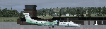
Roros Airport (IATA: RRS, ICAO: ENRO; Norwegian: Roros lufthavn) is a regional airport located 2 kilometers (1.2 mi) from the town of Roros, Norway. The asphalt runway has the physical dimensions 1,740 by 40 meters (5,710 by 130 ft) and is aligned 14/32. Scheduled services are provided to Oslo by Wideroe. The main general aviation user is Rørosfly, a pilot school, and the aviation club Roros Flyklubb. (Source of information: Wikipedia August 20, 2016)
| Filename: | Roros_Airport_ENRO_in_Roros_Norway.zip |
| License: | Freeware |
| Added: | 20th August 2016, 15:40:59 |
| Downloads: | 683 |
| Author: | Hans Christian Knudsen and Knudsenair Simulations |
| Size: | 121.82 KB |
| Category: Flight Simulator X - Aircraft Repaints, Textures and Modifications | |
| Dornier 228-100 in Olympic colors |
|
Images related to this file:
File Description:
Carenado Dornier 228-100 in Olympic Airlines-Airways colors
| Filename: | Dornier_228100_in_Olympic_colors.zip |
| License: | Freeware |
| Added: | 3rd October 2016, 01:45:29 |
| Downloads: | 1,169 |
| Author: | Stavros Palatsidis |
| Size: | 28.08 MB |
| Category: Flight Simulator 2004 - Scenery | |
| Lucky Lake CKQ5 in Saskatchewan, Canada |
|
Images related to this file:
File Description:
The village of Lucky Lake is 80 miles south of Saskatoon, with a small population of less than 300, most of whom are dependant on agriculture for income, either directly or indirectly. Marijuana is a recently introduced crop after the failure of a government-financed potato growing operation called SPUDCO. The village was previously known as Devil's Lake (don't ask me, I don't know). The airfield is half a mile north of the village, with an asphalt runway just over 3,000 feet long, lit, and aligned 07-25 in FS9; this has now changed to 08-26 with the wandering magnetic north. Circuits on 25 are right handed to avoid over-flying the village. 100LL fuel is available.
| Filename: | Lucky_Lake_CKQ5_in_Saskatchewan_Canada.zip |
| License: | Freeware, limited distribution |
| Added: | 25th May 2017, 17:53:36 |
| Downloads: | 138 |
| Author: | Roger Wensley |
| Size: | 5.36 MB |


© 2001-2026 AVSIM Online
All Rights Reserved
Privacy Policy |