
Where Flight Simulation Enthusiasts Gather from Around the World!
AVSIM Library - Search Results

| Category: Flight Simulator 2004 - Scenery Design | |
| Makexml - Object In Airport3 Environment |

|
File Description:
Program allows using standard FS2004 objects in scenery created in Airports version 3. Includes also pictorial dictionary applicable objects with their GUID.
| Filename: | Makexml__Object_In_Airport3_Environment.zip |
| License: | Freeware |
| Added: | 5th January 2004, 17:59:47 |
| Downloads: | 1,371 |
| Author: | Vladimir Svoboda (Cesmina) |
| Size: | 1.23 MB |
| Category: Flight Simulator 2004 - Scenery | |
| Gander CYQX in Newfoundland Canada |
|
Images related to this file:
File Description:
Gandeer is on the east coast of Canada and is the closest North American airport to Europe on the great circle route. In the early days of transatlantic flight, and in fact into the 1960's, this made it very important as a refueling stop either before the ocean hop or just after. Since then it's importance as an airport has faded somewhat as planes now fly directly to the larger city destinations. It is still an active air force base for ocean patrol and search and rescue planes, and military flights are around half of the total flights into and out of the airport. The main attractions of the airport now are the long runways and the cheaper landing fees, and there are some cargo flights and cheap charter passenger flights. This version of Gander is based upon a forgotten-about video taken in October 2010. By then the two longer runways, 13-31 at 8,900 feet and 03-21 at 10,200 feet (though in FS9 this is still designated 04-22, as it had been in 2003) had been closed (one at a time) and totally resurfaced. The third runway 09-27 (3,500 feet in 2003) was closed and starting the process of being broken up, along with associated aprons. This was part of a long process of demolition of some of the older buildings, aprons, and taxiways as they became unused with the fall in the number of daily flights. I have made it clear which of the 2010 taxiways and aprons were still in use by showing them as asphalt, while those in the process of decaying disuse or removal are in the darker tarmac texture; this is somewhat realistic as when asphalt aprons are "ploughed" for removal the darker underside becomes visible. In the renovation process of taxiway repairs only the centre strip of the taxiways was repaired and this is marked by new and closer edge lines. One end of the closed runway was still being used in 2010 for access and parking. There is a warning note in the April 2010 edition of the NAV CANADA Flight Supplement that states "surface rut on Gander Flight Training's private taxiway" (written with extremely shortened words). The Gander layout page is included here, showing that in the Spring of 2010 a much-shortened version (1,875 feet) of the 09-27 runway was still in use; my version is for late 2010 and after that runway was closed. The older buildings (and some of them are now 70 years old or more) are built in concrete and flat roofed with bitumen water proofing; hence the almost black roofs. The terminal building is one of these, though it has been enlarged by the inclusion of a hangar that is now used as the main terminal space. Almost all of the buildings are correctly replicated here. The main GA parking area is to the east of 03-21 where there are two large hangar buildings. One of them is for maintenance and the other is for a large FBO called Gander Aviation. There are other FBO's on the airport, closer to the terminal. These are Irving and Woodward, both to the west, and Allied to the south. There is a further FBO at the eastern end of the apron, name unknown. Shell, who only did refueling, were next to Woodward in 2010 but left, I believe, in 2012. The large red building behind Woodward and Shell is for the maintenance of all airport equipment (from luggage trolleys, snow clearers, de-icing trucks etc to air conditioning, radar, and radios). Most of the remaining buildings are for the air force base, though there are some private companies (such as Universal Helicopters) and even a small private cottage.
| Filename: | Gander_CYQX_in_Newfoundland_Canada.zip |
| License: | Freeware, limited distribution |
| Added: | 29th April 2020, 19:15:01 |
| Downloads: | 670 |
| Author: | Roger Wensley |
| Size: | 29.37 MB |
| Category: Flight Simulator 2004 - Aircraft Repaints, Textures and Modifications | |
| Westland MERLIN in SFOR scheme |
|
Images related to this file:
File Description:
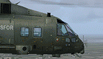
Re-uploaded SFOR scheme for the Alphasim Westland MERLIN
| Filename: | Westland_MERLIN_in_SFOR_scheme.zip |
| License: | Freeware |
| Added: | 13th May 2010, 21:08:35 |
| Downloads: | 245 |
| Author: | Repaints by pierre lheureux - Plane by Alphasim |
| Size: | 2.66 MB |
| Category: Flight Simulator 2004 - AI Flight Plans | |
| Ansett back in the skies |
|
File Description:
For now a small schedule of Ansett Australia flying from sydney to Auckland and los Angelos and to Bangkok. Also flights between Melbourne and Sydney using the Ansett A320 and the B747 from Avsim.
| Filename: | Ansett_back_in_the_skies.zip |
| License: | Shareware, honor system |
| Added: | 1st October 2005, 17:32:32 |
| Downloads: | 825 |
| Author: | Ron de Leeuw |
| Size: | 4.63 KB |
| Category: Flight Simulator 2004 - Scenery | |
| Mustique TVSM in the Grenadines |
|
Images related to this file:
File Description:
Mustique island is one of the northernmost of the group of islands known as the Grenadines, just south of Bequia. Mustique is a small island, less than 3 miles long and even at its widest less than a mile wide; as a result the resident population is less than 500. The island is unique in that it is owned by a company. The company is owned, in its turn, by the owners of the 100 or so private villas on the island. The Queen of England is one owner; her participation is balanced out by Jeremy Clarkson.
The airport is at the northern end of the island; the runway is around 3,240 feet long, aligned 09 (and with the southeast trade winds it is most unlikely that you will ever find yourself using 27) and with a steep and displaced threshold of over 900 feet. The displaced threshold is shown but unfortunately FS9 is not capable of coping with anything other than a prefectly flat airport. The terminal is a steel-framed shed with cladding, but is "quaintly" transformed with a palm frond roof etc. There are connecting flights by SVG to Barbados and the other islands and these are reflected in the AI. The airport has no lighting, and flights are obliged to land and depart in daylight hours only, outside of which the airport is closed.
| Filename: | Mustique_TVSM_in_the_Grenadines.zip |
| License: | Freeware, limited distribution |
| Added: | 11th June 2013, 22:57:37 |
| Downloads: | 512 |
| Author: | Roger Wensley |
| Size: | 2.07 MB |
| Category: Flight Simulator 2004 - Scenery | |
| Fogo CDY3 in Newfoundland Canada |
|
Images related to this file:
File Description:
Fogo is an island off the north coast of Newfoundland, around 50 miles north of Gander. The airfield is the right sort of distance from Gander for a short flight on Sunday afternoon at 4pm when the weather is nice and nobody is in a hurry. There is a hangar and a parking apron for locally owned planes and visitors. The runway is lit and 3,000 feet of asphalt aligned 11-29, with the eastern end almost in a lake.
| Filename: | Fogo_CDY3_in_Newfoundland_Canada.zip |
| License: | Freeware, limited distribution |
| Added: | 22nd August 2020, 21:28:21 |
| Downloads: | 108 |
| Author: | Roger Wensley |
| Size: | 5.64 MB |
| Category: Flight Simulator 2004 - Scenery | |
| Kugluktuk CYCO in Nunavut, Canada |
|
Images related to this file:
File Description:
Kugluktuk is on the coast of northern mainland Canada on the mouth of the Coppermine River. It is around 250 miles west of Cambridge Bay and 200 miles south of Ulukhaktok. Tuktoyaktuk is 450 miles west. Kugluktuk used to be called Coppermine as copper was mined along the banks of the river and used for spear and arrow heads, and this attracted a semi-permanent population. The population now numbers around 1,450. The airfield is inland from the village and the 5,500 feet of 100 feet wide gravel runway is aligned 121T/3301T where T stands for "true" as opposed to magnetic in the Northern Domestic Airspace. Both JETA-1 and 100LL are available, dispensed by a truck as the storage tanks are just off the northern edge of the field. There are flights by First Air and Canadian North and the AI includes a daily flight of each, plus a cargo visit by Buffalo; the closest large city is Yellowknife, 375 miles south. I should have mentioned a long time ago that to see the apron lights working requires you to have the "lights_ss_v2" by Sidney Schwartz installed.
| Filename: | Kugluktuk_CYCO_in_Nunavut_Canada.zip |
| License: | Freeware |
| Added: | 10th November 2012, 04:03:35 |
| Downloads: | 429 |
| Author: | Roger Wensley |
| Size: | 3.04 MB |
| Category: Flight Simulator 2004 - Scenery | |
| Edson CYET in Alberta, Canada |
|
Images related to this file:
File Description:
Edson is 120 miles west of Edmonton in Alberta, on Highway 16. It was originally named Heatherwood, but that was changed to honour the vice president of the Grand Trunk Pacific Railway when it was made the local railway centre. It thrived, and when Highway 16 was upgraded it thrived even more. Coal mining and industry connected with timber are the main employers of a population of around 8,500. The airport is at the western edge of the town at 3,041 feet asl, with a single lit runway 6,000 feet long and 100 feet wide aligned 07-25, with displaced thresholds and VASI at each end. The two joined aprons are at the eastern end of the airfield, with fire fighting chemical tanks beside the western one which is reserved in the summer months for the Lockheed Electra Air Spray planes; these are included in the AI. The eastern apron is for visiting charters and GA planes, next to a small terminal building. There is further parking on the grass for resident planes next to a large gravel car parking area and clubhouse. As the Air Spray planes would not be fighting fires in the winter there are in fact two editions of the AI, one for the summer fire fighting season and the other for the winter freeze. Use whichever one is appropriate for your flight time; I never strayed far from Ottawa in the winter so for me it is the summer one only. While making this I came across something new in the shape of some incorrectly installed edge lights in the stock fs9 version that refused to be deleted. There is still an "Edson TOP" folder which would normally be used to delete all unwanted taxiway edge lights, but in this case it deletes only some of them. Apologies, but there is nothing more that I can do and so I suggest you use this in daylight only.
| Filename: | Edson_CYET_in_Alberta_Canada.zip |
| License: | Freeware, limited distribution |
| Added: | 10th February 2019, 23:59:04 |
| Downloads: | 148 |
| Author: | Roger Wensley |
| Size: | 7.14 MB |
| Category: Flight Simulator X - AI Aircraft | |
| Piper PA28 - Aeroclubs in Corsica |
|
Images related to this file:
File Description:
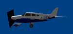
Repaints of 3 different models of Piper PA28 for 2 Aeroclubs in Corsica (France).
All models from Andras NEUMAN on AVSIM. Multi-weeks flightplans on "One Click Hangar". Links to models and flightplans in the readme.txt
| Filename: | Piper_PA28__Aeroclubs_in_Corsica.zip |
| License: | Freeware |
| Added: | 28th August 2022, 16:05:25 |
| Downloads: | 92 |
| Author: | Leon Yoda |
| Size: | 4.35 MB |
| Category: Flight Simulator 2004 - Scenery | |
| FS9 Allakaket 6A8 in Alaska |
|
Images related to this file:
File Description:
Allakaket is on the Koyukuk River in Alaska, 40 miles southwest of Bettles. The population is just over 100, with a school that was opened in 1957 for both Allakaket and the nearby Alatna on the other side of the river. There was a very serious flood in 1964 with almost all of the village being underwater, and this resulted in the establishment of an additional housing area further inland and explains the thinly scattered housing in the original village site. The airfield was established in 1978 and has a gravel runway aligned 5-23 (or 05-23 if you are not American) that is just over 4,500 feet in length. Both the runway and the taxiway are marked with lit cones. The village airfield is served by Wright Air and Warbelows Air, both of them being based in Fairbanks and included in the revised AI for PANN that is included here. There are occasional other larger freight flights as required as there is no road access to the village and the river is too shallow to allow large freight barges; hence the runway length.
A note here about my scenery making. There will not be many more to follow this as I am almost at the end of the photos I either took or found for scenery purposes, plus I expect to move on from FS9 at some point during next year.
| Filename: | FS9_Allakaket_6A8_in_Alaska.zip |
| License: | Freeware, limited distribution |
| Added: | 23rd November 2019, 20:29:35 |
| Downloads: | 123 |
| Author: | Roger Wensley |
| Size: | 3.78 MB |


© 2001-2026 AVSIM Online
All Rights Reserved
Privacy Policy |