
Where Flight Simulation Enthusiasts Gather from Around the World!
AVSIM Library - Search Results

| Category: Flight Simulator X - AFCAD Files | |
| KCPR Casper/Natrona County Airport, Wyoming |

|
File Description:
This scenery updates Casper/Natrona County Airport in Wyoming. Almost every aspect of the airport was revamped and updated and objects added in order to better represent the actual airport. This scenery was created using the awesome scenery tool Airport Design Editor by Scruffyduck Software. Please refer to the readme file for more details and installation instructions.
| Filename: | KCPR_CasperNatrona_County_Airport_Wyoming.zip |
| License: | Freeware |
| Added: | 4th November 2017, 07:17:11 |
| Downloads: | 562 |
| Author: | David Midgett |
| Size: | 2.09 MB |
| Category: Flight Simulator 2004 - Scenery | |
| FS2004 RPMC Cotabato Awang Airport |
|
File Description:
Cotabato Awang Airport is the only airport for Cotabato City located at the southern part of the Philippines. The airport is currently flown by PAL Express, Cebu Pacific and Cebgo. Also, the airport is served as an airbase for the Philippine Air Force for military operations to fight against terrorists in the island. FS2004 only by Paulo Zosa (PFSG)
| Filename: | FS2004_RPMC_Cotabato_Awang_Airport.zip |
| License: | Freeware |
| Added: | 31st May 2020, 20:54:17 |
| Downloads: | 414 |
| Author: | Paulo Zosa |
| Size: | 19.95 MB |
| Category: Flight Simulator X - Scenery | |
| KCXE - Chase City Municipal Airport - Virginia - USA |
|
Images related to this file:
File Description:
This public airport is located two miles west of Chase City, Virginia.
Created with Airport Design Editor by ScruffyDuck Software using current FAA documentation and Google Earth measurements, this package offers a replacement for FSX's stock airport. All these enhancements are as close to the real airport as I can get with stock library objects and custom models.
| Filename: | KCXE__Chase_City_Municipal_Airport__Virginia__USA.zip |
| License: | Freeware |
| Added: | 13th August 2014, 20:51:37 |
| Downloads: | 299 |
| Author: | Wayne Roberts |
| Size: | 301.88 KB |
| Category: Flight Simulator 2004 - AFCAD Files | |
| Sucre SLSU Bolivia |
|
Images related to this file:
File Description:
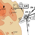
AFCAD file for FS2004 default scenery of Sucre SLSU Juanna A. De Padilla airport in Bolivia.
Brings runway to proper dimensions and adds approach (PAPI) lighting as in the real airport.
High elevation airport (9430 ft.) with surrounding terrain of the Bolivian Andes.
There is no night lighting at this airport. Approach charts included. Recommended mesh terrain: mesh_fermandois003_265585.zip
| Filename: | Sucre_SLSU_Bolivia.zip |
| License: | Freeware, limited distribution |
| Added: | 19th March 2010, 08:55:01 |
| Downloads: | 561 |
| Author: | Kyprianos Biris |
| Size: | 683.9 KB |
| Category: Flight Simulator X - AFCAD Files | |
| Minneapolis-St Paul Intl - KMSP |
|
File Description:
This enhanced airport made with Airport Design Editor (ADE) for Minneapolis-St Paul is 100 percent FSX compliant. Many parking spots have been added and changed to their proper Airline/Cargo/Military/GA Codes and reordered for proper parking for 3rd party AI Flightplans. Additional Fuel Trucks, Airport Vehicle roads, plus many other Airport scenery features have been added.
| Filename: | MinneapolisSt_Paul_Intl__KMSP.zip |
| License: | Freeware, limited distribution |
| Added: | 27th February 2008, 09:36:25 |
| Downloads: | 3,885 |
| Author: | Jim Vile |
| Size: | 53.68 KB |
| Category: Flight Simulator X - Scenery | |
| St. Helena, Ascension, and Tristan da Cunha Islands |
|
Images related to this file:
File Description:
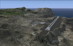
This project was begun to add the new airport (FHSH) to St. Helena Island and eventually was expanded to include a complete remake of Ascension Island (FHAW) and Tristan da Cunha (with an optional airport FHTC) and Gough Island with the actual weather station heliport (FHGH). Tested in both the default FSX/Acceleration and with FTX Global/Vector, accurate coastlines, lakes, road data, and SRTMGL1 (30m) mesh, as well as corrected landclass are provided based on the latest available satellite imagery. Flight plans are provided for the proposed commercial service to St. Helena, and some additional GA and military flights to the island are added as well.
The FSX St. Helena (FHSH) airport was created by aligning master plans for the airport with current satellite data and by studying many of the pictures that have been posted as the airport has taken shape. The official opening of the real airport on May 21, 2016, has been pushed back for more field tests due to challenging crosswinds. The Ascension Island (FHAW) airport was updated after I realized that Ascension could receive commercial service as a result of the new St. Helena airport. The entire airfield is redesigned to allow the volcanic terrain to display properly. The airbase, towns, BBC Atlantic relay station, and numerous satellite dishes, radomes, and wind turbines now appear in their real-world locations. Since I was already in the region, I added the Tristan da Cunha Islands (including Inaccessible, Nightingale and Gough Islands) and the Gough Island weather station maintained by the South African National Antarctic Programme. I also added an optional airport (and flight plans) to Tristan da Cunha (FHTC), which can be easily enabled/disabled. The FHTC airport is placed on the only part of the island that appears to be free of people or farmland, and the area is just long enough to accommodate a pared-down version of the St. Helena airport.
Updates were created or rebuilt in a manner which carefully aligns airport data with current satellite imagery. Scenery was created using Airport Design Editor X v1.67.5684, SBuilderX 3.13, and the FSX Object Placement Tool. Scenery objects were added and modified from stock FSX scenery to resemble as closely as possible the actual airports. The animated flag model is by Dietmar Loleit, the FSX apron lights included are from the set created by Jim Dhaenens, and the animated wind turbines and radomes are from the freeware package by Ray Porter.
| Filename: | St_Helena_Ascension_and_Tristan_da_Cunha_Islands.zip |
| License: | Freeware |
| Added: | 1st May 2016, 11:23:05 |
| Downloads: | 6,081 |
| Author: | Carlyle Sharpe |
| Size: | 10.52 MB |
| Category: Flight Simulator 2004 - Scenery | |
| Union Island TVSU in the Grenadines, eastern Caribbean Version 1.1 |
|
Images related to this file:
File Description:
This is a self-contained version 1.1 that modifies the terrain flattens around the airport. I found that suddenly, and for no apparent reason, the Lesser Antilles mesh and my flattens were at war and creating hills within the airport boundary. If you are not having problems then you do not need this.
Union Island is in the southern tail of the chain of islands known as St Vincent and the Grenadines, between Canouan and Carriacou. Union is another small island, 3.5 miles long and at its widest 1.5 miles wide; the resident population is around 3,000, mostly in the two towns Clifton and Ashton. The airport is at the eastern end of the island, and has been extended into the sea on landfill. The runway is now around 2,480 feet long, aligned 08 (and with the southeast trade winds it is unlikely that you will find yourself using 26) and with a displaced threshold of 530 feet due to the hill to the west. The terminal is adjacent to a rather small apron; there is parking on the grass north of the taxiway. There are connecting flights by SVG to Barbados and the other islands and these are reflected in the AI. The airport has no lighting, and flights are obliged to land and depart in daylight hours only, outside of which the airport is closed.
| Filename: | Union_Island_TVSU_in_the_Grenadines_eastern_Caribb.zip |
| License: | Freeware, limited distribution |
| Added: | 16th June 2013, 18:46:33 |
| Downloads: | 526 |
| Author: | Roger Wensley |
| Size: | 2.02 MB |
| Category: Flight Simulator X - Scenery | |
| 79C - Brennand Airport - Neenah, Wisconsin - USA |
|
File Description:
Well this is my 1st attempt at creating/editing an airport so be gentle. I created all the models in sketchup and used ADE to compile the airport. All you should have to do is unzip it and place it with your other add-on scenery and activate it in FSX.
This is for FSX ONLY. A P3D Version also exists here in the library 79C_Brennand_V1_FOR_P3D_V2.
Brennand Airport (79C) located about 4 miles southwest of Neenah WI. This airport is between KATW and KOSH. Brennand has had new ownership since 2013 and they have made many improvements in that time to 79C. So I went out there and took lots of pictures to create what I have for us now. They have built a new building and hangar which I have added along with all the other building on the airport grounds. The runway has been widened from 20 feet to 30 feet and they added PAPI lights on both runways 18 and 36 all of which I have included. I have changed the grass parking areas to reflect the way they are currently set up. (For fun parking area 8 is in the EAA Chapter 41 hangar (Hangar 11) with the door open so you can taxi out of the hangar. Now just need to figure out how to animate the hangar door).
| Filename: | 79C__Brennand_Airport__Neenah_Wisconsin__USA.zip |
| License: | Freeware |
| Added: | 10th November 2014, 01:13:30 |
| Downloads: | 431 |
| Author: | Jon Verrett |
| Size: | 36.9 MB |
| Category: Flight Simulator 2004 - Aircraft Repaints, Textures and Modifications | |
| British Airways Airbus A380-841 (G-XLEB) |
|
Images related to this file:
File Description:

British Airways (BA) is the flag carrier airline of the United Kingdom and its largest airline based on fleet size, international flights and international destinations. When measured by passengers carried it is second-largest, behind EasyJet. The airline is based in Waterside near its main hub at London Heathrow Airport.
British Airways's livery painted on Project Airbus's Airbus A380-841 model. The textures are saved in 32bit format for quality graphics. Textures are also characterized by HD (High Definition). Its features are idle-reverser animation, animated pack vents and pressurisation outflow valve, detailed textures, accurate paint, dynamic shine & effects, dynamic flexing wings that respond to turbulence, fully independent suspension, trim animation, gear steering, accurate flight dynamics, spoiler animation, reflective cockpit windows, improved wingflex code with input from several new parameters including ground spoilers, fuel load, and angle of attack, transparent navigation light lenses and many more.
Visit our Facebook page "Sky Level Textures" for news, updates and previews on my future repaint projects. Thanks for downloading & Happy flying. TEXTURES ARE ALSO COMPATIBLE WITH FSX.
| Filename: | British_Airways_Airbus_A380841_GXLEB.zip |
| License: | Freeware |
| Added: | 19th February 2014, 19:39:10 |
| Downloads: | 2,694 |
| Author: | Giacomo Tomasini | Sky Level Textures |
| Size: | 29.13 MB |
| Category: Flight Simulator 2004 - Scenery | |
| Mega Airport Memmingen (EDJA/FMM), Germany |
|
Images related to this file:
File Description:
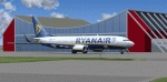
Memmingen Airport (EDJA) is located 100km West of Munich in Southern Germany. Several airlines operate out of the airport including Ryanair, Hapag-Lloyd Express, and Air Berlin. It's a small public airport. One of 4 airports in Bavaria with commercial air service and it has the highest elevation of all of Germany's commercial airports. Prior to 2008-09-25, it was known as Allgäu Airport/Memmingen. The airport not only serves Memmingen and the Allgäu area but also provides a low-cost alternative to Munich Airport.
This scenery is developed for FS2004 and updates the airport with new buildings and textures, along with the correct runway and taxiway dimensions and lighting.
| Filename: | Mega_Airport_Memmingen_EDJAFMM_Germany.zip |
| License: | Freeware, limited distribution |
| Added: | 7th July 2010, 23:19:27 |
| Downloads: | 6,254 |
| Author: | Ben Elsen |
| Size: | 9.49 MB |


© 2001-2026 AVSIM Online
All Rights Reserved
Privacy Policy |