
Where Flight Simulation Enthusiasts Gather from Around the World!
AVSIM Library - Search Results

| Category: Flight Simulator X - AFCAD Files | |
| Richmond Intl - KRIC - Virginia |

|
File Description:
I have given this airport a total makeover designed with the latest version of ADE(v1.37) and made only for the FSX default airport: one file with the Crosswind rwy's activated and in full operation, now activated by ADE where all 3 rwy's will be used for takeoff/landing and one file as the default rwy operation: assigned parking with extra parking, new control tower, extra fuel trucks, lighted helipad, support vehicle roads rebuilt and many other improvements, airport views are from the roof of the control tower (when in tower view) please view the readme before installation
| Filename: | Richmond_Intl__KRIC__Virginia.zip |
| License: | Freeware |
| Added: | 26th March 2009, 00:23:40 |
| Downloads: | 2,890 |
| Author: | Ray Smith |
| Size: | 74.06 KB |
| Category: Navigation and ATC - Navigation | |
| LSZS - Samedan visual approach chart v3 |
|
Images related to this file:
File Description:
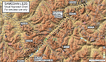
Custom made visual approach chart and pilot's briefing for Engadin (St. Moritz) Samedan LSZS airport in Switzerland, Europe's highest elevation airport (5,600 ft.) situated in the Swiss Alps. This airport is a day VFR operations only and has no instrument approach due to extreme terrain around it. A demanding visual descent into a canyon, in between steep rising terrain, is required to make the visual approaches for both runways with a steep 4.4* degrees final approach portion guided by the PAPI's. Still, executive jets up to Boeing 737(BBJ) size approach the airport often in the winter peak season VFR with these procedures. It is designed as per real operators' pilot briefing for Samedan. Real airport's full pilot briefing document also included. The real airport's excellent briefing (included) intentionally does not contain the maneuvers needed for the approach of jets through the mountains but only reporting points for all and maneuvers for light aircraft only. This gap is what this chart covers. Version 2 chart included better graphics and refined visual procedure for jets and version 3 now includes real pilot's briefing guide.
| Filename: | LSZS__Samedan_visual_approach_chart_v3.zip |
| License: | Freeware, limited distribution |
| Added: | 20th March 2015, 23:35:11 |
| Downloads: | 2,026 |
| Author: | Kyprianos Biris |
| Size: | 7.1 MB |
| Category: Flight Simulator X - Scenery | |
| KPSF - Pittsfield Municipal Airport - Pittsfield, MA |
|
File Description:
Here is an improved version of the stock Pittsfield Municipal Airport. I adjusted and added aprons, roads and
taxiways to more closely match real life. I replaced many default buildings and added additional buildings.
I added more AI parking, static vehicles, aircraft, lightpoles, fences and other filler objects.
Pittsfield Municpal Airport is located in the Berkshire Mountains of western Massachusetts along with several
lakes and the Housatonic River. It's a nice starting point for scenic flights in New England.
| Filename: | KPSF__Pittsfield_Municipal_Airport__Pittsfield_MA.zip |
| License: | Freeware |
| Added: | 1st April 2009, 08:06:10 |
| Downloads: | 726 |
| Author: | Jim Cook |
| Size: | 7.19 KB |
| Category: Flight Simulator 2004 - Scenery | |
| Sumter Municipal Airport KSMS |
|
Images related to this file:
File Description:
FS2004 Scenery - Sumter Municipal Airport (IATA: SMS, ICAO: KSMS, FAA LID: SMS) Sumter, South Carolina, United States, serves Sumter and Sumter County and is owned by the City & County Of Sumter. The airport has more than one runway. The longest is a paved runway extending 5500 feet. The facility is at an elevation of 183 feet at a distance of about 4 miles from Sumter. Created with Instant Scenery. For FSX version, see ksms_fsx.zip. By John B. Loney, Jr.
| Filename: | Sumter_Municipal_Airport_KSMS.zip |
| License: | Freeware, limited distribution |
| Added: | 2nd November 2009, 20:00:23 |
| Downloads: | 203 |
| Author: | John B. Loney, Jr. |
| Size: | 463.24 KB |
| Category: Flight Simulator 2004 - AFCAD Files | |
| Liege-Bierset (EBLG) |
|
File Description:
::: NEW VERSION ::: Replacement AFCAD file for Liege-Bireset airport. File designed to be used with the superb Bernard PAPY31 freeware scenery (http://perso.wanadoo.fr/jean-luc.duclercq/papy31/index.htm), not tested yet for default FS9 airport, but it 'should' work pretty well also. All gates assigned; passengers terminal gates and TNT cargo apron. Note that all the parking positions are not exactly positioned according to real GPS positions, but is matching to its best the available scenery... Enjoy.
| Filename: | LiegeBierset_EBLG.zip |
| License: | Freeware |
| Added: | 24th January 2005, 00:39:26 |
| Downloads: | 1,552 |
| Author: | Jean-Philippe DELWICHE, Bernard PAPY31 |
| Size: | 12.49 KB |
| Category: Flight Simulator X - Scenery | |
| FAOR - Johannesburg Intl Airport, South Africa |
|
Images related to this file:
File Description:
This scenery is a very accurate version for O.R.Tambo Intl airport and created only for FSX: all terminals and gates bought up to date to reflect todays situation, assigned parking as per their website, taxiways and taxi signs updated to the latest charts, extra fuel trucks, support vehicle roads rebuilt and many other scenery improvements and objects added, airport views are from the roof the control tower (when in tower view) please view the readme before installation.
| Filename: | FAOR__Johannesburg_Intl_Airport_South_Africa.zip |
| License: | Freeware, limited distribution |
| Added: | 3rd June 2017, 02:33:51 |
| Downloads: | 38,803 |
| Author: | Ray Smith |
| Size: | 1.66 MB |
| Category: X-Plane - Aircraft Repaints, Textures and Modifications | |
| Eurowings Airbus A320 (Winglets) |
|
Images related to this file:
File Description:
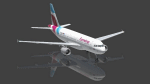
This is an X-Plane Eurowings A320 repaint for use with the payware A320 CFM by Peter Hager. Use the winglet model, this is an ex Air Berlin plane.
Some Information by Wikipedia: Eurowings GmbH is a German low-cost airline headquartered in Düsseldorf and a fully owned subsidiary of the Lufthansa Group. It serves a network of domestic and European destinations as well as some long-haul routes and maintains bases at Berlin Tegel Airport, Cologne Bonn Airport, Düsseldorf Airport, Hamburg Airport, and Vienna International Airport.
Eurowings has gone through a major transformation in recent years. It was part of Lufthansa Regional until October 2014. At that time it began operating on behalf of Germanwings within their network. Since spring 2015, Eurowings has been redeveloped into a low-cost carrier for short- and long-haul flights. By October 2015, it had also started to incorporate Germanwings' route network as part of the merger of the two brands.
| Filename: | Eurowings_Airbus_A320_Winglets.zip |
| License: | Freeware |
| Added: | 29th April 2017, 18:08:05 |
| Downloads: | 393 |
| Author: | Ralf Maylin |
| Size: | 12.91 MB |
| Category: Prepar3D V1-4 - Scenery Design | |
| Implementing Prepar3D SIDS and STARS V1.4 |
|
File Description:
This ZIP-file contains all Information and Examples for creating Standard Instrument Departures (SIDS) and Standard Arrival Routes (STARS) for Lockheed Martin Prepard3D begining from Version 1.2, Version 2 and Version 3. This Capability has been implemented with Version 1.2 but is hardly known by the Flight Simmer Community. This is just a very basic paper on that subject with simple samples. Learn how to create SIDs and STARs with Prepar3D On-board-Tools. Works also with 3rd Party-Addon-Sceneries, find out how! Includes real (!) working Samples for some Alaskan Airports: PACV, PAFA, PAFE, PAGS, PAHO, PAJN, PAKT, PAKW, PAPG, PASI, PAVD, PAWD, PAWG, PAYA. Includes now Approaches for PAVD and PAWD! Get to know that Airport Design Editor can also be used to Design STARs and SIDs!
| Filename: | Implementing_Prepar3D_SIDS_and_STARS_V14.zip |
| License: | Freeware |
| Added: | 25th November 2017, 19:42:40 |
| Downloads: | 281 |
| Author: | Conrad F. Staeheli |
| Size: | 130.83 MB |
| Category: Flight Simulator 2004 - Scenery | |
| Dease Lake CYDL 2010 v1.1 |
|
Images related to this file:
File Description:
Version 1.1 adds the three hazard beacons that define the boundaries of the night circuit, as depicted in the included chart. Many thanks to Lane Street for creating the beacons and giving us permission to include them in the scenery. This scenery is complete and does not require the previous verion. Dease Lake CYDL airport is located about 2 miles south of Dease Lake in stunningly beautiful northwest British Columbia. (The lake directly to the east of the airport is Allan Lake.) Scheduled passenger service to Smithers and Bob Quinn Lake is provided by Northern Thunderbird Air (http://ntair.ca/). CYDL also serves as a base for Pacific Western Helicopters (http://www.pwh.ca/). This version moves the airport slightly to its correct location. All aprons & taxiways have been redone and all default buildings replaced. The little terminal building is photo real. The missing town of Dease Lake and the missing lake south of Allan lake have been added. This scenery was designed for use with Ultimate Terrain and was not tested in the default scenery. It may or may not work in FSX. Previous version had 307 downloads.
| Filename: | Dease_Lake_CYDL_2010_v11.zip |
| License: | Freeware |
| Added: | 6th November 2010, 22:30:24 |
| Downloads: | 793 |
| Author: | Sidney Schwartz & Peter Ham |
| Size: | 1.8 MB |
| Category: Flight Simulator 2004 - AI Flight Plans | |
| Ukraine International Airlines Summer 2005 |
|
File Description:
Ukraine International Airlines Summer 2005 international and domestic flightplans, taken from their website; All repaint available here, but AN24, YK42 and T134 can only be found in Air Ukraine colors. Can be use with MRAI installer.
| Filename: | Ukraine_International_Airlines_Summer_2005.zip |
| License: | Freeware |
| Added: | 5th May 2005, 00:28:46 |
| Downloads: | 1,239 |
| Author: | Christian Muenier |
| Size: | 7.61 KB |


© 2001-2026 AVSIM Online
All Rights Reserved
Privacy Policy |