
Where Flight Simulation Enthusiasts Gather from Around the World!
AVSIM Library - Search Results

| Category: Flight Simulator 2004 - Scenery | |
| Phoenix Deer Valley Airport |

|
File Description:
FS2004 Scenery-Phoenix Deer Valley Municipal Airport (KDVT) serves Phoenix and Maricopa County and is owned by the City Of Phoenix. The airport has more than one runway. The longest is a paved runway extending 8200 feet. The facility is at an elevation of 1476 feet at a distance of about 15 miles from Phoenix. Phoenix Deer Valley Airport is a general aviation reliever airport for Phoenix Sky Harbor International Airport. The airport is home to more than 1,350 based aircraft and had more than 340,000 takeoffs and landings in 2004. A vital component of the City of Phoenix airport system, Deer Valley is the second busiest general aviation airport in the nation. Scenery created with FSDS2, Rwy12, Lago's FSE, with AFCAD2 and Traffic Tools. Contains 438 parking spaces.
| Filename: | Phoenix_Deer_Valley_Airport.zip |
| License: | Freeware |
| Added: | 23rd September 2005, 20:33:47 |
| Downloads: | 2,011 |
| Author: | John B. Loney, Jr. |
| Size: | 1.46 MB |
| Category: Flight Simulator 2004 - Aircraft Repaints, Textures and Modifications | |
| Peau Vava'U Air DC-3 ZK-AMY |
|
File Description:
Peau Vava'U Air DC-3 ZK-AMY"Lady Jane", C/N 13506, built by the Oklahoma City
production plant as C-47A-25-DK 42-93579. Operated early as VH-ASD, VH-CAN and as Pionair ZK-AMY. Today in service with Peau Vava'u Air at Tonga together with the DC-3 ZK-AWP. This company was founded June 1th 2004,operating normal passengers and cargo services between the islands of the Tonga archipielago with his two DC-3s and one CV-580.Listed destinations are 'Eua,Ha'apai,Tongatapu(Fua'amotu) and Vava'u.
In plans Niauafo'ou and Niuatoputapu. Repainted,panel and flight dynamics by Daniel Nole,four tanks conversión by Dave Bitzer and Mark Beaumont. Included Flight plans for FSNav with the main normal destinations of Peau Vava'U Air.
| Filename: | Peau_VavaU_Air_DC3_ZKAMY.zip |
| License: | Freeware |
| Added: | 2nd October 2005, 17:29:41 |
| Downloads: | 331 |
| Author: | Daniel Nole |
| Size: | 7.6 MB |
| Category: Flight Simulator 2004 - Scenery | |
| Chile Pack1 Soaring Scenery |
|
File Description:
FS2002/2004 Chile Pack1 Soaring Scenery
This file add some thermals to default Microsoft scenery for Chile Region:
1.Santiago de Chile City - Lo Castillo Airp.(ICAO-SCLC);
2.Valparaiso City - Quintero Airp.(ICAO-SCER);
3.Arica City - Chacalluta Airp.(ACAO-SCAR);
4.Iquique City - Diego Aracena Airp.(ICAO-SCDA);
5.Antofagasta City - La Chimba Airp.(ICAO-SCMB);
6.Copiapo City - Chamonate Airp.(ICAO-SCHA);
7.Las Tacas City near Coquimbo/La Serena Cities- Las Tacas Airp.(ICAO-SCQT);
8.Linares City near Talca - Linares Airp.(ICAO-SCLN);
9.Concepcion City - Carriel Sur Airp.(ICAO-SCIE);
10.Osorno City - Pampa Alegre Airp.(ICAO-SCOS);
11.Puerto Montt City - El Mirador Airp.(ICAO-SCPV);
12.Moquegua City - Moquegua Airp(ICAO-SPEQ).
It is freeware.
Good Flights and better landings
By Francisco Vargas.
E-mail:[email protected]
| Filename: | Chile_Pack1_Soaring_Scenery.zip |
| License: | Freeware |
| Added: | 11th November 2005, 06:27:57 |
| Downloads: | 1,262 |
| Author: | Francisco Augusto Vargas Carneiro |
| Size: | 268.08 KB |
| Category: Flight Simulator X - Scenery | |
| St. Kitts Island - Federation of Saint Kitts and Nevis |
|
Images related to this file:
File Description:
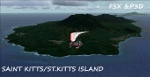
A representation of St. Kitts using photo-real scenery along with hand placed autogen. Robert L. Bradshaw International Airport is an international airport located just northeast of Basseterre, on the island of Saint Kitts, serving the nation of Saint Kitts and Nevis.
New construction started late 2004. Up to 6 wide bodied jets can now be accommodated on the tarmac. The airport can accommodate commercial jumbo jets and handles scheduled non-stop jet flights to Canada and the United States, as well as numerous regional commuter flights from within the Caribbean area. For the best results of this scenery, PWSceneries Volume 5 has to be installed. Features included are custom photo scenery covering the entire island, hand placed autogen, detailed 3D Objects and custom buildings. Works in FSX and P3D.
| Filename: | St_Kitts_Island___Federation_of_Saint_Kitts_and_Ne.zip |
| License: | Freeware |
| Added: | 24th September 2015, 10:57:42 |
| Downloads: | 833 |
| Author: | Kenje Thomas & Jamalje Bassue |
| Size: | 105.56 MB |
| Category: X-Plane - Scenery | |
| WW32 Susi Air Nevere v1.0.0 |
|
Images related to this file:
File Description:
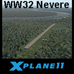
This is an X-Plane 11 scenery for Nevere Airstrip (WW32) in Nevere, Papua, Indonesia. This is one of the destinations for "PT ASI Pujiastuti Aviation", operating as Susi Air, an Indonesia airlines established in late 2004 by Mrs. Susi Pudjiastuti. This scenery was tested and is operational (as of January 08, 2017) in "X-Plane 11 Public Beta #5 64 bit", Windows 10 Home. It was also tested but is partially operational (as of January 08, 2017) in "X-Plane 10.51 64 bit", Windows 10 Home. The XP10.51 mesh presents no river, hence there is no water for the sealane water runway 11/29 to work properly. It will look weird because of the absence of teh river. Despite this issue with the rwy 11/29, the other two runways (10/28 dirty and 02/20 grass) both work nicely and are very much usable.
| Filename: | WW32_Susi_Air_Nevere_v100.zip |
| License: | Freeware |
| Added: | 9th January 2017, 15:02:07 |
| Downloads: | 60 |
| Author: | Rui Mesquita |
| Size: | 2.9 MB |
| Category: Flight Simulator X - Scenery | |
| VYYY Yangon Intl Airport Mingaladon V3.0 |
|
File Description:
Yangon International Airport "MINGALADON" in Burma, Myanmar, will be able to accommodate bigger aircrafts and handle more passengers when work on extending its runway and upgrading its facilities is completed. The completion of the runway extension will enable Boeing 747 and Airbus 380 airplanes to use the airport. The work on extending the runway from 8100 feet to 11,200 feet began October 2004. FPS-friendly version 3.0 with already extended runway, taxiways and new taxisigns. First of all we corrected the airport location to the real one. With Myanmar Air Force area, Helipads and even more parkings for civilian airplanes. This scenery was produced based on pictures of satellites. Many Thanks go to the teams of HOUSE-RP in Burma, FSX Planner, SceneGenX, SBuilder X, Open Ports Scanner, AFXBgDownloader, FSUIPC and Google Earth. This scenery is only for FSX, for FS2004 please download vyyy_v2.zip. By HOUSE-RP, Switzerland and Burma
| Filename: | VYYY_Yangon_Intl_Airport_Mingaladon_V30.zip |
| License: | Freeware, limited distribution |
| Added: | 28th October 2007, 19:21:14 |
| Downloads: | 1,229 |
| Author: | HOUSE-RP, Robby Pauletto |
| Size: | 18.29 KB |
| Category: Flight Simulator 2004 - Aircraft Repaints, Textures and Modifications | |
| Hawaiian International VA Boeing 777-200ER V2 |
|
File Description:
Standard textures designed for the "Hawaiian International" virtual airlines group. Logo, ID numbers and company name are entirely fictive.
This scheme has the unique ability to possess à 100% external night texture done from scratch. 70% of theses night textures are absolutely new and stunning on this model. (Three horrays for Meljet!!!) Thank to Melvin Rafi to design such a great model. (Long live the king!!!) Painted and
optimised for FS-2004. Goes well on FS-2002.
Meljet's awesome 777 Series of aircraft, Version 2 Boeing 777-200ER (Extended Range) By Melvin Rafi (MelJet). This rendition of the 777 has been built in Gmax for FS2002 (works perfect in FS2004) Include "Maintenance Mode", where you can open the engines and look inside, deploy the Ram Air Turbine, open the cockpit window, open the gear bay doors while on the ground - folding wings - flexing wings - full animations - dynamic shine - reflective surfaces - and tons more!
| Filename: | Hawaiian_International_VA_Boeing_777200ER_V2.zip |
| License: | Freeware |
| Added: | 15th January 2004, 22:27:49 |
| Downloads: | 1,567 |
| Author: | Samy Fay, MelJet |
| Size: | 2.36 MB |
| Category: Flight Simulator 2004 - Scenery | |
| OIBJ Jam/Tohid, Iran |
|
File Description:
Googly scenery for OIBJ Jam/Tohid - a small Iranian domestic airport for which
nothing more than a runway is provided in Flight Simulator 2004. These scenery
files add taxiways, aprons, buildings and other airport features so that you
and your "AI" traffic can land, taxi, park and take off in a realistic manner.
The airport is served about twice per week by Fokker jets of Iran Air.
The scenery does not purport to be ultra-accurate. Based on high-detail satellite
imagery from Google Earth, the layout is proportionally correct but the added
airport features, such as buildings, are built from default Microsoft objects
and add-on libraries so will not look like the real thing.
You are not obliged to download and install any additional scenery libraries,
but to enjoy this scenery in its entirety, you may wish to. It will work fine,
with or without.
| Filename: | OIBJ_JamTohid_Iran.zip |
| License: | Freeware |
| Added: | 8th July 2007, 21:19:39 |
| Downloads: | 1,020 |
| Author: | John Hinson |
| Size: | 80.11 KB |
| Category: Flight Simulator 2004 - Scenery | |
| HSMK Rumbek, Sudan |
|
File Description:
Googly scenery for HSMK Rumbek, a small airport serving the city of the same
name, capital of the Buhayrat (or Lakes) state in southern Sudan. The airport
is served daily by Beech 1900 aircraft operating for Delta Connection, a
Kenyan airline.
Flight Simulator 2004 has completely omitted this airport and this scenery
seeks to redress the situation so that you and your "AI" traffic can use the
airport.
The scenery does not purport to be ultra-accurate. Based on high quality
satellite imagery from Google Earth, the layout is proportionally correct but the
added airport features, such as buildings, are built from default Microsoft objects
and add-on libraries so will not look exactly like the real thing.
You are not obliged to download and install any additional scenery libraries,
but to enjoy this scenery in its entirety, you may wish to. It will work fine,
with or without.
| Filename: | HSMK_Rumbek_Sudan.zip |
| License: | Freeware |
| Added: | 19th April 2008, 20:33:09 |
| Downloads: | 754 |
| Author: | John Hinson |
| Size: | 78 KB |
| Category: X-Plane - Scenery | |
| WZ38 Susi Air Kegata Airstrip v1.0.0 |
|
Images related to this file:
File Description:
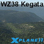
This is an X-Plane 11 scenery for Kegata Airstrip (WZ38) in Kegata, Papua, Indonesia. It is said to be home to the world shortest commercial flight, between Kegata Airstrip (WZ38) and Apowo Airstrip (WX15), duration of 1min and 15sec from take off to landing, and operated by Susi Air. This is one of the destinations for "PT ASI Pujiastuti Aviation", operating as Susi Air, an Indonesia airlines established in late 2004 by Mrs. Susi Pudjiastuti. This scenery was tested and is operational (as of January 07, 2017) in "X-Plane 11 Public Beta #5 64 bit", Windows 10 Home. It was also tested but is NOT operational (as of January 07, 2017) in "X-Plane 10.51 64 bit", Windows 10 Home (terrain mesh issues + exclusion areas from XP11 do not work in XP10 = scenery full of trees and quite bad mesh). Sorry, XP11 only.
| Filename: | WZ38_Susi_Air_Kegata_Airstrip_v100.zip |
| License: | Freeware |
| Added: | 8th January 2017, 23:38:06 |
| Downloads: | 68 |
| Author: | Rui Mesquita |
| Size: | 1.54 MB |


© 2001-2026 AVSIM Online
All Rights Reserved
Privacy Policy |