
Where Flight Simulation Enthusiasts Gather from Around the World!
AVSIM Library - Search Results

| Category: Prepar3D V5 - Scenery | |
| Lokpriya Gopinath Bordoloi International Airport Guwahati VEGT P3Dv5 |

|
Images related to this file:
File Description:
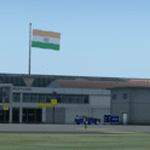
Lokpriya Gopinath Bordoloi Airport (IATA: GAU, ICAO: VEGT), also known as Guwahati Airport and formerly as 'Borjhar Airport', is the primary airport of the North-Eastern states of India. It is the 11th busiest airport in India. It is located at Borjhar, 26 km (16 mi) from Dispur, the capital city of the state of Assam and 28 km (18 mi) from Guwahati and is named after Late Gopinath Bordoloi, a freedom fighter and the first Chief Minister of Assam after India's independence. The airport is managed by Airports Authority of India and also serves as an Indian Air Force base.
Special Thanks to Ron Baruah for his VEGT Terminal Models, MFSG and MisterX for Vehicle Libs, Mayukh Deb for MD Libs and Taxi Lighting, Sriharsha K for Gate Signboards and Lightpoles and many more!
Compatible with Prepar3D v5.
| Filename: | Lokpriya_Gopinath_Bordoloi_International_Airport_G.zip |
| License: | Freeware |
| Added: | 15th June 2021, 18:55:37 |
| Downloads: | 271 |
| Author: | Saurabh Bansal |
| Size: | 257.18 MB |
| Category: X-Plane - Scenery | |
| BR CE - SNIG Iguatu Airport v1.0.0 |
|
Images related to this file:
File Description:

This is an X-Plane 11 and X-Plane 10 scenery package for Tomé da Frota Airport (IATA: IGT, ICAO: SNIG), which is the airport serving the city of Iguatu, state of Ceará, in Brazil.
It includes corrected aprons, ramps, gates, taxiways, lighting system, city buildings, ortho-photoscenery for the airfield area, and (XP11 only) airport ground services (like push back).
With an intense movement of small aircraft Iguatu Airport is of total importance for businessmen who have aircraft or use the air taxi. Sol Aviation flies from/to Fortaleza/SBFZ. Gol and Two airlines announced intention to fly to/from Fortaleza/SBFZ later in 2018.
This scenery was tested and is operational (as of January 26, 2018) in "X-Plane 11.11 64 bit", Windows 10 Home. It was also tested and is also operational (as of January 26, 2018) in "X-Plane 10.51 64 bit", Windows 10 Home.
| Filename: | BR_CE__SNIG_Iguatu_Airport_v100.zip |
| License: | Freeware |
| Added: | 2nd February 2018, 00:11:29 |
| Downloads: | 44 |
| Author: | Rui Mesquita |
| Size: | 8.3 MB |
| Category: X-Plane - Scenery | |
| BR SP SDUB - Ubatuba Airport v1.0.0 |
|
Images related to this file:
File Description:

This is an X-Plane 11 and X-Plane 10 scenery package for the Gastão Madeira Airport (IATA: UBT, ICAO: SDUB), which is the airport serving the city of Ubatuba, in the Brazilian state of São Paulo.
It includes corrected aprons, ramps, gates, taxiways, lighting system, city buildings, ortho-photoscenery for the airfield area, and (XP11 only) airport ground services (like push back).
The airport focuses on general aviation, and does not have regular airline flights. It is administered by DAESP. It is a hard approach and take-off airport, especially when landing on runway 27 or taking off on runway 09.
This scenery was tested and is operational (as of January 16, 2018) in "X-Plane 11.11 64 bit", Windows 10 Home. It was also tested and is also operational (as of January 15, 2018) in "X-Plane 10.51 64 bit", Windows 10 Home.
| Filename: | BR_SP_SDUB__Ubatuba_Airport_v100.zip |
| License: | Freeware |
| Added: | 2nd February 2018, 00:12:08 |
| Downloads: | 83 |
| Author: | Rui Mesquita |
| Size: | 60.24 MB |
| Category: X-Plane - Scenery | |
| BR AP SBAM - Amapa Airport v1.0.0 |
|
Images related to this file:
File Description:
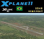
This is an X-Plane 11 and X-Plane 10 scenery package for Amapá Airport (ICAO: SBAM, no IATA code), which is the airport servining the city of Amapá, state Amapá, in Brazil.
It includes corrected aprons, ramps, gates, taxiways, lighting system, ortho-photoscenery for the airfield area, and (XP11 only) airport ground services (like push back).
This is a general aviation airport in the north of the Amazon Rainforest, close to the Brazilian-Frenchg Guyana border. It belongs to the municipality of Amapá, and it is at a distance of 8 km from the city center and 229 km from the state capital, Macapá.
This scenery was tested and is operational (as of January 20, 2018) in "X-Plane 11.11 64 bit", Windows 10 Home. It was also tested and is also operational (as of January 20, 2018) in "X-Plane 10.51 64 bit", Windows 10 Home.
| Filename: | BR_AP_SBAM__Amapa_Airport_v100.zip |
| License: | Freeware |
| Added: | 2nd February 2018, 00:18:13 |
| Downloads: | 56 |
| Author: | Rui Mesquita |
| Size: | 6.55 MB |
| Category: Civil Flight Simulators - Looking Glass Flight Unlimited 3 | |
| High Resolution Region Builder Tool for Elevation |
|
File Description:
GeoTilesViewer25.zip: NEW Version 2.5 11.dec.2002. You will need this tool to apply changes at the elevation structure of a fu3 region. This new version can handle very large region as UK-South.
There are elevation modification uploads on the way for the UK-South region.
To load this updates you will need this tool. The full geotiles.tag file
has 92MB and upload of such a file is not possible. An elevation update needs just 200k
for 1 megatile so it is better to use this tool and the small update files.
You can explore and modify elevation and classification using this tool by
first exporting a map, painting a map with your paint program and then
importing it again. This is an experimental tool and still under construction.
New in Version 2.5 are large region handling, generation of color scale files
an scripts for unattended multiple imports.
| Filename: | High_Resolution_Region_Builder_Tool_for_Elevation.zip |
| License: | Freeware, limited distribution |
| Added: | 12th December 2002, 00:14:20 |
| Downloads: | 196 |
| Author: | André Meystre |
| Size: | 147.14 KB |
| Category: Flight Simulator 2004 - Flight Plans | |
| Around the World by light aircraft - The flight of HG Schmid and HB-YCT, March 2000 |
|
File Description:
On a cold March 2nd, 2000, professional commercial pilot H.G. Schmid took off from Zurich at 11:00 AM local time and so began the first stage of his first of two consecutive circumnavigations of the globe by a light aircraft. This flight was eastwards and on his return to Zurich at the end of the month, Georg took off on the westward circumnavigation. The aircraft used on these adventures was the Rutan-designed "Long-EZ", a variation of the "Vari-EZ". Each day is a separate stage and therefore there is a separate flight for each day, named accordingly. (Some days have two stages). There is a total of nineteen (19) flights. Model of the Rutan is by Olivier Marechal and available from Avsim.com or FlightSim.com. Search for either Olivier's name or the file name, HBYCT_V1.zip. There is also an update, HBYCT_P1.zip.
| Filename: | Around_the_World_by_light_aircraft__The_flight_of_.zip |
| License: | Freeware |
| Added: | 18th April 2006, 21:47:42 |
| Downloads: | 1,004 |
| Author: | Bruce Kennewell |
| Size: | 586.72 KB |
| Category: Flight Simulator 2004 - Aircraft Repaints, Textures and Modifications | |
| YS-11M & M-A of JMSDF 61 sqd |
|
File Description:
These files are for AFG V2.7 YS-11 ONLY:
JMSDF 61 SQD are based at atsugi ( RJTA ) ,ships 41/42/43 are YS-11M series with the cargo door at the rear,while ship 44 is a YS-11M-A with the cargo door at the front,there was more then one colour sceme sported on these aircraft,at one stage they had orange wing tips and orange on the top of the fin tip,these aircaft here do not represent the orange tip scheme.
The details are as correct as can be with the info and pics i had to go on,so please enjoy them,and if anyone as any info that could correct any mistakes,then please let me know.The correct shade of grey,orange pilots suits,JMSDF kanji and sqd badge,curtesy of Esa Kaihlanen.
Repainting by me Alan Cottrill.
| Filename: | YS11M__MA_of_JMSDF_61_sqd.zip |
| License: | Freeware |
| Added: | 28th January 2007, 01:30:25 |
| Downloads: | 910 |
| Author: | Esa Kaihlanen & Alan Cottrill |
| Size: | 22.92 MB |
| Category: Flight Simulator X - AFCAD Files | |
| Redwing Airport (2N6), NJ |
|
File Description:
Located 01 miles S of Jobstown, New Jersey on 53 acres of land, Redwing Airport is a small dual turf strip that hosts both single engine craft and gliders. No services are provided to transient aircraft, you can park over near the hangars (no visible tie downs). The Runway 11/29 edge lights are adjustable low-high in real life but for the sim I've set them at medium. Trees are summer ONLY.
Scenery constructed with use of satellite images/streetview, the author has not been there in person.
This scenery is meant to be used in conjunction with MegaScenery Earth New Jersey/Delaware 002. It is not required, but apron use is minimized to allow satellite scenery to show through as much as possible, and objects are placed based on the MSE textures - lack of it may make scenery look out of place.
| Filename: | Redwing_Airport_2N6_NJ.zip |
| License: | Freeware |
| Added: | 15th October 2010, 15:34:10 |
| Downloads: | 329 |
| Author: | Drew Sikora |
| Size: | 527.92 KB |
| Category: Flight Simulator 2004 - Scenery | |
| Emsdale CNA4 & Emsdale South fields in Ontario, Canada |
|
Images related to this file:
File Description:
Emsdale is on Hwy 11 about midway between North Bay and Lake Simcoe. A mile north of the town is Emsdale airfield CNA4, with two grass runways that are 12/30 2,500 feet long, and 17/35 2,000 feet long. There is only one hangar, no fuel, and in general there does not appear to be a lot of action. "Grass" may be a generous description of the runway surface, particularly for 12/30.
The second field is two miles southwest of Emsdale and privately owned. It has 2,700 feet or so of asphalt runway and a parallel grass runway (which is short at under 800 feet, plus a hangar at the north end!). There are six buildings, between hangars and office or club house and that about sums up all I know about it. If anyone knows more about this field please let me know.
| Filename: | Emsdale_CNA4__Emsdale_South_fields_in_Ontario_Cana.zip |
| License: | Freeware |
| Added: | 3rd February 2010, 15:35:35 |
| Downloads: | 390 |
| Author: | Roger Wensley |
| Size: | 1.91 MB |
| Category: Flight Simulator 2004 - AI Flight Plans | |
| Sioux Falls Aviation Spring 2010 |
|
File Description:
Sioux Falls Aviation (Daedalus Inc) operates out of the Encore FBO at Sioux Falls - Joe Foss Field in South Dakota to destinations throughout South Dakota, North Dakota, Nebraska, Wisconsin, and Minnesota as a feeder service for both DHL and UPS. They operate 22 aircraft including 10 Fairchild Metroliners, 8 Cessna 402Bs, 2 Cessna 414As, one Cessna 404, and one C90. Flights taken from FlightAware for the week of 11-17 April, 2010. DHL flights are NOT included as they are included in the AIG DHL package. Note: If you are using either the Ultimate GA Cessna 402 or World of AI Cessna 402 package, you must decompile the bgl file and remove the flightplans for N1048, N402BP (Sold as salvage on 3-31-10 after crash), N780MB, N3796C, N402SS, N3813, N3729C, N624CA, & N76MD. These aircraft are depicted using "Generic" liveries in the UGA and WoAI packages.
| Filename: | Sioux_Falls_Aviation_Spring_2010.zip |
| License: | Freeware |
| Added: | 13th May 2010, 21:07:38 |
| Downloads: | 537 |
| Author: | Steve Lewis |
| Size: | 3.56 KB |


© 2001-2026 AVSIM Online
All Rights Reserved
Privacy Policy |