
Where Flight Simulation Enthusiasts Gather from Around the World!
AVSIM Library - Search Results

| Category: Flight Simulator 2004 - Scenery | |
| Bosnia and Herzegovina Mesh |

|
File Description:
Containes the mesh for bosnia and herzegovina & 90% of Montenegro . Produced by the SRTM global processor and sampled at 3 arcseconds
| Filename: | Bosnia_and_Herzegovina_Mesh.zip |
| License: | Freeware, limited distribution |
| Added: | 13th November 2003, 23:55:43 |
| Downloads: | 6,038 |
| Author: | Stefan Braunewell |
| Size: | 23.14 MB |
| Category: Flight Simulator 2004 - Scenery | |
| Tehran area SRTM mesh |
|
File Description:
This terrain mesh scenery is centered on Tehran city. Ranging from 34.1°N to 37.5°N and 49.2°E to 54.8°E, it includes Elbourz moutain range as well as Caspian sea shores (28 meters below sea lavel).
Based on SRTM Data (3 arcsec, 90m) and sampled to LOD9 resolution (76m) using Matthew Styles's program "SRTM To BGL v1.04". While only tested with Fs2004, this mesh should also run with FS2002.
SRTM 3 arcsec dataset has numerous and sometimes huge void areas. But thanks to John Child's beautiful and powerful "Blackart" utility it's now easy to patch these areas with lower resolution dataset: I took the coupled interpolation method to merge SRTM 3-arcsec with SRTM 30-arcsec dataset when needed. This gives the best results, as patched areas with 30-arcsec data are blending naturally with surrounding 3-arcsec mesh. Of course the resolution of patched areas is quite poor, but still a bit better than the default LOD5 mesh. However, in exception of Demavend Peak, the SRTM data was quite good for this area and didn't need much patching so that the rendering is allways excellent.
| Filename: | Tehran_area_SRTM_mesh.zip |
| License: | Freeware, limited distribution |
| Added: | 20th June 2004, 14:14:31 |
| Downloads: | 5,581 |
| Author: | Yohann Baptiste |
| Size: | 18.1 MB |
| Category: Flight Simulator 2004 - Scenery | |
| Iran SRTM mesh : West |
|
File Description:
This mesh covers the western part of Iran and some parts of Iraq. Major Iranian cities are: Kermanshah, Khorram Abad, Dezful, Awhaz, Hamadan. Major Iraqi cities are: Al-Kut, As-Sulaimania.
Based on SRTM Data (3 arcsec, 90m) and sampled to LOD9 resolution (76m) using Matthew Styles's program "SRTM To BGL v1.04".
Biggest SRTM "holes" (void data) were patched with SRTM 30-arcsec dataset thanks to John Child's beautiful and powerful "Blackart" utility.
| Filename: | Iran_SRTM_mesh__West.zip |
| License: | Freeware, limited distribution |
| Added: | 24th August 2005, 22:17:45 |
| Downloads: | 3,322 |
| Author: | Yohann Baptiste |
| Size: | 21.25 MB |
| Category: Flight Simulator 2004 - Scenery | |
| Falklands Islands (Malvinas) Mesh |
|
File Description:
This is a terrain mesh scenery for Falklands Islands (Malvinas) moreover there are all PPL (Populated Place Location) and add some object scenery with BGLcomp
SDK.
The Mesh are based on SRTM Data (3 arc/sec), generated with Matthew Styles's program "SRTM To BGL v1.04", sampled to LOD9 resolution (76m) with 10 interpolation passes.
| Filename: | Falklands_Islands_Malvinas_Mesh.zip |
| License: | Freeware |
| Added: | 7th March 2004, 01:31:41 |
| Downloads: | 3,612 |
| Author: | Giovanni Miduri |
| Size: | 4.94 MB |
| Category: Flight Simulator 2004 - Scenery | |
| Macedonia Terrain Mesh 76m |
|
File Description:
Terrain mesh file for Macedonia at LOD9 or 76.4 m resolution. Source file was high resolution 3arc sec SRTM data. Covers between N40.75 E20.25 - N42.50 E23.25. Data voids corrected by merging with the resampled GTOPO30 SRTM data.
| Filename: | Macedonia_Terrain_Mesh_76m.zip |
| License: | Freeware, limited distribution |
| Added: | 8th December 2003, 16:36:59 |
| Downloads: | 3,560 |
| Author: | Hrvoje Kruhek |
| Size: | 6.16 MB |
| Category: Flight Simulator 2004 - Scenery | |
| Cancun Island Mesh (MMUN) |
|
File Description:
Cancun is a Beautiful island localized in the Mexican Caribbean.
| Filename: | Cancun_Island_Mesh__MMUN.zip |
| License: | Freeware |
| Added: | 7th August 2005, 23:50:53 |
| Downloads: | 5,003 |
| Author: | José Luis Águila Boudib. |
| Size: | 109.08 KB |
| Category: Flight Simulator X - Scenery | |
| Greece Mesh Terrain, v1 |
|
Images related to this file:
File Description:
Detailed FSX mesh terrain of Greece and surrounding territories (West Turkey, South Bulgaria, FYRoM, Albania) based on SRTM Data (3 arcsec, 90m) and sampled to LOD9 resolution (76m). For more information visit www.avsim.com/greece/scenery.
| Filename: | Greece_Mesh_Terrain_v1.zip |
| License: | Freeware, limited distribution |
| Added: | 9th June 2010, 14:46:18 |
| Downloads: | 30,476 |
| Author: | Hellas Scenery Team (HST) |
| Size: | 76.58 MB |
| Category: X-Plane - Scenery | |
| WX15 Susi Air Apowo Airstrip v1.0.0 |
|
Images related to this file:
File Description:
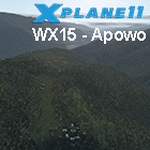
This is an X-Plane 11 scenery for Apowo Airstrip (WX15) in Apowo, Papua, Indonesia.
It is said to be home to the world shortest commercial flight, between Kegata Airstrip (WZ38) and Apowo Airstrip (WX15), duration of 1min and 15sec from take off to landing, and operated by Susi Air. This is one of the destinations for "PT ASI Pujiastuti Aviation", operating as Susi Air, an Indonesia airlines established in late 2004 by Mrs. Susi Pudjiastuti. This scenery was tested and is operational (as of January 07, 2017) in "X-Plane 11 Public Beta #5 64 bit", Windows 10 Home. It was also tested but is NOT operational (as of January 07, 2017) in "X-Plane 10.51 64 bit", Windows 10 Home (terrain mesh issues + exclusion areas from XP11 do not work in XP10 = scenery with quite bad mesh). Sorry, XP11 only.
| Filename: | WX15_Susi_Air_Apowo_Airstrip_v100.zip |
| License: | Freeware |
| Added: | 8th January 2017, 23:37:40 |
| Downloads: | 59 |
| Author: | Rui Mesquita |
| Size: | 1.95 MB |
| Category: Flight Simulator X - AFCAD Files | |
| Robert J. Miller Air Park Airport (KMJX), NJ |
|
File Description:
Located 05 miles SW of Toms River, New Jersey on 232 acres of land, R.J. Miller Air Park is a public asphalt strip 5949' in length. The airport buildings and immediate surrounding area have been included, magnetic variation adjusted, PAPI properly placed, taxiway lines drawn accurately, beacon properly placed, lit winsock and wind tee (both functional). The parking available has been matched to the current configuration of the airport, which is still undergoing renovation. Not included is the under-construction building just to the south of the terminal and the additional large hangar just north of the already-existing one. Taxiway lighting could not be seen in aerial photos - complete liberty on behalf of the author was taken when placing taxiway lights. Helipad is lit at night although the real world pad is not. Tiedown parking is available on the main tarmac in three sections: Southwest, Northeast, and regular Parking which is in the middle. RAMP_GA_SMALL parking spots are for aircraft with wingspans no greater than 40 feet. RAMP_GA_MEDIUM parking spots are for aircraft with wingspans no greater than 60 feet. RAMP_GA parking spots are occupied/blocked by static objects and should not be chosen as a start location (although collision detection with all such objects has been disabled). There are 4 open hangars - three to the Southwest are for RAMP_GA_SMALL aircraft while the Northeast one is for RAMP_GA_MEDIUM aircraft or smaller. All hangar parking spots are labeled DOCK_GA. A hangar on the main tarmac and a hangar on the tarmac to the south and west removed from the airport have attendants that can be called on NAV2 - this appears to be FS9 only. Both hangars have undecorated interiors and no parking spots to start from. There is only one helipad to start on but helicopters can also start in any RAMP_GA_MEDIUM location with no problem. Fuel for aircraft/helicopters is available by stopping next to the fuel pumps (not the fuel tank) at the north end of the main tarmac. The helipad will supply fuel when landed on.
Scenery constructed with use of satellite images/streetview/aerial photos - the author has not been there in person.
This scenery is meant to be used in conjunction with MegaScenery Earth New Jersey/Delaware 002. It is not required, but apron use is minimized to allow satellite scenery to show through as much as possible, and objects are placed based on the MSE textures - lack of it may make scenery look out of place.
| Filename: | Robert_J_Miller_Air_Park_Airport_KMJX_NJ.zip |
| License: | Freeware |
| Added: | 4th August 2011, 21:45:08 |
| Downloads: | 372 |
| Author: | Drew Sikora |
| Size: | 2.22 MB |
| Category: Flight Simulator 2004 - AI Aircraft | |
| Latin American Wings Boeing 737-300 |
|
Images related to this file:
File Description:

Latin American Wings is a new airline from Chile serving domestic and international destinations using a fleet of 5 Boeing 737-300 aircraft. Textures only for the FAIB Boeing 737-300 model. Repaint by Hernan Anibarro.
| Filename: | Latin_American_Wings_Boeing_737300.zip |
| License: | Freeware |
| Added: | 2nd June 2017, 01:27:40 |
| Downloads: | 1,212 |
| Author: | Hernan Anibarro |
| Size: | 2.09 MB |
© 2001-2026 AVSIM Online
All Rights Reserved
Privacy Policy |