
Where Flight Simulation Enthusiasts Gather from Around the World!
AVSIM Library - Search Results

| Category: Flight Simulator 2002 - Scenery | |
| Alderney Airport |

|
File Description:
Small british island located near french coast and British channel island Jersey...
using photorealistic texture personnal macro.scenery includ airport, town and light house
| Filename: | Alderney_Airport.zip |
| License: | Freeware |
| Added: | 27th March 2003, 20:02:57 |
| Downloads: | 1,532 |
| Author: | Christophe Giraud |
| Size: | 1.7 MB |
| Category: Flight Simulator 2004 - Aircraft Repaints, Textures and Modifications | |
| Euroflyer Airways Airbus A320 - 232 |
|
File Description:
FS2004 Aircraft. Euroflyer A320 G-EURC. This aircraft is used on Euroflyers services to Dublin, Jersey and Frankfurt. See www.euroflyer.tk for more info.
| Filename: | Euroflyer_Airways_Airbus_A320__232.zip |
| License: | Freeware |
| Added: | 1st December 2004, 23:23:28 |
| Downloads: | 330 |
| Author: | James White, iFDG |
| Size: | 5.51 MB |
| Category: Flight Simulator 2004 - Scenery | |
| MESH 2010 SurAmerica - Brasil 10 |
|
Images related to this file:
File Description:
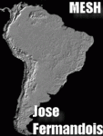
MESH FERMANDOIS 2010 V1.0 / Brasil / index(BR19) / A highly detailed 30m SRTM mesh for South America (FS2004 and FSX)
| Filename: | MESH_2010_SurAmerica__Brasil_10.zip |
| License: | Freeware |
| Added: | 2nd December 2009, 14:59:17 |
| Downloads: | 1,789 |
| Author: | Jose Fermandois |
| Size: | 38.47 MB |
| Category: Flight Simulator 2002 - Scenery | |
| Quebec - New Lake Elevation Corrections |
|
File Description:
The file in this package contains the third update correcting some new lake elevations for Quebec terrain mesh (FS2002) created from SRTM-3 : about 460 lakes between Saguenay and Manicouagan rivers.
| Filename: | Quebec__New_Lake_Elevation_Corrections.zip |
| License: | Freeware, limited distribution |
| Added: | 27th June 2003, 13:16:26 |
| Downloads: | 1,229 |
| Author: | Gilles Gauthier |
| Size: | 457.88 KB |
| Category: Flight Simulator 2004 - Scenery | |
| Ile d'Aix France Photoreal v 2.0 |
|
File Description:
Photo scenery of "Ile d'Aix" v 2.0. Includes no mesh but customized autogen.
V 2.0 provides seasonal and night textures. A new autogen texture is included to meet local construction style.
| Filename: | Ile_dAix_France_Photoreal_v_20.zip |
| License: | Freeware, limited distribution |
| Added: | 11th August 2006, 21:10:53 |
| Downloads: | 2,821 |
| Author: | Alain Nicco |
| Size: | 1.13 MB |
| Category: Flight Simulator X - Scenery | |
| EBAV - Avernas Le Bauduin - Hannut, Belgium |
|
Images related to this file:
File Description:
EBAV - Avernas Ultra light airfield (with new runway) for FSX & Megascenery Belgium photoscenery (or home made photoscenery).
The scenery includes the airfield (for default mesh) and its surroundings autogen (+- 3X3 nm).
| Filename: | EBAV__Avernas_Le_Bauduin__Hannut_Belgium.zip |
| License: | Freeware |
| Added: | 9th May 2014, 20:49:16 |
| Downloads: | 677 |
| Author: | Aime Leclercq |
| Size: | 1.78 MB |
| Category: Flight Simulator 2004 - AFCAD Files | |
| KEWN New Bern Enhanced |
|
File Description:
Enhanced AFCAD2 files for KEWN Craven County Regional Airport, New Bern NC. Includes:
accurate airport layout,
renumber Rwy 13/31 to 14/32,
new RNAV 04 and RNAV 22 approaches,
modified airport terrain for default and UT USA/38m mesh,
additional parking,
new terminal for USAX and DALX.
| Filename: | KEWN_New_Bern_Enhanced.zip |
| License: | Freeware |
| Added: | 10th July 2007, 09:28:50 |
| Downloads: | 402 |
| Author: | Scott Smart |
| Size: | 101.92 KB |
| Category: Flight Simulator 2004 - Aircraft Repaints, Textures and Modifications | |
| Southwest Airlines Boeing 737-700 "New Mexico One" |
|
File Description:
N781WN has been wearing this scheme for over 5 years. It is painted like the New Mexican flag.
| Filename: | Southwest_Airlines_Boeing_737700_New_Mexico_One.zip |
| License: | Freeware |
| Added: | 2nd March 2008, 10:08:46 |
| Downloads: | 387 |
| Author: | Chris Bajrak |
| Size: | 7.97 MB |
| Category: Flight Simulator 2004 - Scenery | |
| Backcountry airfields for 19m terrain mesh in Idaho USA |
|
Images related to this file:
File Description:
These four backcountry fields are for use with the FSGenesis 19m mesh of Idaho, and are Big Creek, Johnson Creek, Dixie, and Sulphur Creek Ranch. They have been revised to fit and almost certainly do not work without the 19m mesh; a quick comparison with Big Creek before and after demonstrates the difference. I also have Ultimate Terrain installed. The three ingredients of terrain mesh, UT main roads, and UT streams, along with their individual margins of error, very often create conficts of space that make a grass runway impossible to site with it's correct length. Given the choice of turning off roads or streams (the terrain mesh cannot be turned off, obviously) I chose streams; the roads are less obviously incorrect, plus it matters not if roads go uphill while a climbing stream is to be avoided. On that basis the original series is reissued here for use with the 19m terrain mesh, on the presumption that you have already downloaded the original series. There are no textures or AI included as they remain the same as the originals, and the new scenery bgl's replace the originals to get the runways and grass etc in the right positions. There will be follow-on fields that are new, and all of the new ones will be only for the 19m mesh.
| Filename: | Backcountry_airfields_for_19m_terrain_mesh_in_Idah.zip |
| License: | Freeware, limited distribution |
| Added: | 29th May 2017, 04:19:43 |
| Downloads: | 125 |
| Author: | Roger Wensley |
| Size: | 2.22 MB |
| Category: Flight Simulator X - Scenery | |
| Paulinia S.P. - Complement to Americana S.P. 4/5 |
|
File Description:
4/5 - This is the complement of Americana to cover all region taht include the lake Praia Azul. This scenery is composed by five parts. Folow instructions on Readme.txt and have a nice visual flight. Is a good idea install the FSX Mesh South America parts F7 and F8 cordinates in the map to have the essential mesh terrain. There is a link to download:
www.ceaero.com.br/meshxsa/dowsa.html
Other pack that you need install if want to see all hangars in SDAI Aeroclube de Americana,
is the STATIC BJECTS LIBRARY found on RWY12 OBJECTS PLACER found in http://www.rwy12.com/rwy12/
| Filename: | Paulinia_SP__Complement_to_Americana_SP_45.zip |
| License: | Freeware |
| Added: | 8th June 2008, 14:09:41 |
| Downloads: | 1,456 |
| Author: | Gilson A. Rocchetti |
| Size: | 71.84 MB |


© 2001-2026 AVSIM Online
All Rights Reserved
Privacy Policy |