
Where Flight Simulation Enthusiasts Gather from Around the World!
AVSIM Library - Search Results

| Category: Flight Simulator X - Scenery | |
| South America Mesh Scenery, MeshX_D8 |

|
File Description:
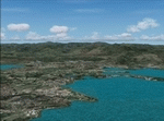
Mesh terrain scenery for the whole continental South America, based on SRTM 90m
dem geotiff files (at: ftp://ftp.glcf.umiacs.umd.edu/glcf/SRTM/Degree_Tiles/),
resampled to 76 meter of horizontal resolution (LOD 9). The new files have
improved the vertical resolution from 16m to 10m, resulting in more details
and accuracy over previous versions. There are 50 files, compatible with FS 9
and FS X, identified in a map by column letter and line number, covering the
contiguous countries and states. Boundaries: N = 28º 7.5' S; S = 33º 45' S;
E = 48º 45' W; W = 56º 15' W;
| Filename: | South_America_Mesh_Scenery_MeshX_D8.zip |
| License: | Freeware |
| Added: | 28th October 2006, 15:07:00 |
| Downloads: | 1,921 |
| Author: | Oséas Dourado and José Lôbo |
| Size: | 28.66 MB |
| Category: Flight Simulator X - Scenery | |
| South America Mesh Scenery, MeshX_E3 |
|
File Description:
Mesh terrain scenery for the whole continental South America, based on SRTM 90m
dem geotiff files (at: ftp://ftp.glcf.umiacs.umd.edu/glcf/SRTM/Degree_Tiles/),
resampled to 76 meter of horizontal resolution (LOD 9). The new files have
improved the vertical resolution from 16m to 10m, resulting in more details
and accuracy over previous versions. There are 50 files, compatible with FS 9
and FS X, identified in a map by column letter and line number, covering the
contiguous countries and states. Boundaries: N = 0º 0' S; S = 5º 37.5' S;
E = 41º 15' W; W = 48º 45' W;
| Filename: | South_America_Mesh_Scenery_MeshX_E3.zip |
| License: | Freeware |
| Added: | 28th October 2006, 05:54:49 |
| Downloads: | 1,609 |
| Author: | Oséas Dourado and José Lôbo |
| Size: | 27.48 MB |
| Category: Flight Simulator 2004 - Scenery | |
| New Caledonia (Landclass and Terrain Mesh) |
|
Images related to this file:
File Description:
FS2004 Landclass and Terrain Mesh--New Caledonia. This is a complete Landclass and Terrain Mesh makeover for New Caledonia and its outlying islands. Andy Weir and Ian Thatcher have graciously allowed me to integrate their Terrain Mesh into this scenery. All known airports have now been added to New Caledonia and the local islands are designed for AI aircraft operation.
| Filename: | New_Caledonia_Landclass_and_Terrain_Mesh.zip |
| License: | Freeware |
| Added: | 18th April 2010, 09:59:48 |
| Downloads: | 1,101 |
| Author: | Charles Reid |
| Size: | 24.88 MB |
| Category: Flight Simulator X - Scenery | |
| KGRI, Central Nebraska Regional Airport USA |
|
Images related to this file:
File Description:
New setup of this airport I came across in one of my virtual flights. It is located three miles northeast of Grand Island, in Hall County, Nebraska.
| Filename: | KGRI_Central_Nebraska_Regional_Airport_USA.zip |
| License: | Freeware |
| Added: | 20th February 2018, 17:49:25 |
| Downloads: | 402 |
| Author: | Tim van Ringen |
| Size: | 3.29 MB |
| Category: Flight Simulator X - Missions | |
| WhaleandDolphinSightseer.zip |
|
File Description:
Beginner helicopter aerial tour. Take passengers out to see some ocean life off the coast of Cape May, New Jersey, USA. Practice your hovering skills. Uses default scenery.
| Filename: | WhaleandDolphinSightseerzip.zip |
| License: | Freeware |
| Added: | 27th June 2019, 23:25:58 |
| Downloads: | 105 |
| Author: | HeloMissionMan |
| Size: | 2.28 MB |
| Category: Flight Simulator 2004 - Aircraft Repaints, Textures and Modifications | |
| East Coast ANG F-16 |
|
File Description:
Four repaints of Hrvoje Kovacevic's F-16 AI aircraft in the colours of the USAF East Coast ANG. Michigan (2), New Jersey, Virginia. Textures only original aircraft required.
| Filename: | East_Coast_ANG_F16.zip |
| License: | Freeware, limited distribution |
| Added: | 27th February 2005, 15:51:11 |
| Downloads: | 294 |
| Author: | Graham King |
| Size: | 195.71 KB |
| Category: Fly! II - Scenery | |
| Robert J. Miller Air Park (KMJX) |
|
File Description:
TerraModels Scenery Development System by Allen Kriesman, Biber Salsa and Steves models were used to create the scenery for Robert J. Miller Air Park (KMJX) - Teterboro, New Jersey.
| Filename: | Robert_J_Miller_Air_Park_KMJX.zip |
| License: | Freeware |
| Added: | 17th January 2006, 04:06:49 |
| Downloads: | 53 |
| Author: | Wayne Roberts |
| Size: | 651.15 KB |
| Category: Flight Simulator 2004 - Scenery | |
| New Jersey Objects: Barnegat Lighthouse and Highpoint Monument |
|
File Description:
Enclosed in this zip file are the object and placement BGL files for the Barengat Lighthouse and HighPoint Monument. The objects are home-made GMAX objects with simple texturing.
| Filename: | New_Jersey_Objects_Barnegat_Lighthouse_and_Highpoi.zip |
| License: | Freeware |
| Added: | 24th July 2011, 19:04:27 |
| Downloads: | 342 |
| Author: | Jim Donlin |
| Size: | 8.76 KB |
| Category: Flight Simulator X - AFCAD Files | |
| KBLM - Monmouth Executive Airport - New Jersey, USA - v2.2 |
|
File Description:
This scenery is meant to be used in conjunction with MegaScenery Earth New Jersey/Delaware 002. It is not required, but apron use is minimized to allow satellite scenery to show through as much as possible, and objects are placed based on the MSE textures - lack of it may make scenery look out of place. This scenery was designed for MSE v1 and is not fully compatible with the newer v2 release of NJ. There will be minor texture mis-alignments with taxiways and some scenery objects.
| Filename: | KBLM__Monmouth_Executive_Airport__New_Jersey_USA__.zip |
| License: | Freeware |
| Added: | 28th October 2013, 18:17:15 |
| Downloads: | 1,046 |
| Author: | Drew Sikora |
| Size: | 1.38 MB |
| Category: Flight Simulator X - Scenery | |
| KAIY - Bader Field - Atlantic City, New Jersey - USA |
|
Images related to this file:
File Description:
FSX Scenery - Bader Field (IATA: AIY, ICAO: KAIY, FAA LID: AIY), also known as Atlantic City Municipal Airport, was a city-owned public-use general aviation airport located in Atlantic City, in Atlantic County, New Jersey, United States. It was approximately one mile from the terminus of U.S. Route 40 and U.S. Route 322. Bader Field permanently closed on September 30, 2006. It was named after the former mayor of Atlantic City Edward L. Bader, who purchased the land for the airfield. This scenery represents the late 1960s to early 1970s. For your flying pleasure by John B. Loney, Jr.
| Filename: | KAIY__Bader_Field__Atlantic_City_New_Jersey__USA.zip |
| License: | Freeware, limited distribution |
| Added: | 14th June 2015, 18:55:28 |
| Downloads: | 412 |
| Author: | John B. Loney, Jr. |
| Size: | 7.52 MB |
© 2001-2026 AVSIM Online
All Rights Reserved
Privacy Policy |