
Where Flight Simulation Enthusiasts Gather from Around the World!
AVSIM Library - Search Results

| Category: Navigation and ATC - Navigation | |
| Cape Lisburne Sectional Chart Chunks Optimized For Moving Map Application |

|
File Description:
Sectional chart chunks made from the August 2009 Sectional charts at the original scale, formatted in the WGS84 lat/lon geographic coordinate system for GPS, moving map application for flight simulation use.
These chart chunks were converted to the JPEG format for compatibility and size. Coverage is the full Sectional area North and South divided into JPEG tiles. They are about 3k x 3k pixels at 2.5mb with coverage of 90nm x 130nm per tile. Included is also the projection files and world files.
Note: This type of map is a equal grid and no further calibration is needed, only the two points referenced in the world file. Example: for users of FSM Moving Map, just mass import, done.
| Filename: | Cape_Lisburne_Sectional_Chart_Chunks_Optimized_For.zip |
| License: | Freeware |
| Added: | 6th March 2010, 00:24:51 |
| Downloads: | 195 |
| Author: | David Myers |
| Size: | 16.96 MB |
| Category: Navigation and ATC - Navigation | |
| Bethel Sectional Chart Chunks |
|
File Description:
Sectional chart chunks made from the August 2009 Sectional charts at the original scale, formatted in the WGS84 lat/lon geographic coordinate system for GPS, moving map application for flight simulation use.
These chart chunks were converted to the JPEG format for compatibility and size. Coverage is the full Sectional area North and South divided into JPEG tiles. They are about 3k x 3k pixels at 2.5mb with coverage of 90nm x 130nm per tile. Included is also the projection files and world files.
Note: This type of map is a equal grid and no further calibration is needed, only the two points referenced in the world file. Example: for users of FSM Moving Map, just mass import, done.
| Filename: | Bethel_Sectional_Chart_Chunks.zip |
| License: | Freeware |
| Added: | 7th March 2010, 20:50:48 |
| Downloads: | 177 |
| Author: | David Myers |
| Size: | 14.67 MB |
| Category: Flight Simulator 2004 - Scenery | |
| Hay River CYHY, 2010 |
|
Images related to this file:
File Description:
First established as a permanent settlement in 1892, Hay River is located on the south shore of Great Slave Lake in the Canadian Northwest Territories. Like the territorial capital city of Yellowknife 115 miles to the north on the opposite shore of the lake, Hay River experiences brutal weather conditions, with an average mid winter temperature of minus 27C (minus 18F).
* Aprons and taxiways completely redone to be more accurate.
* Missing ground and water features added, land class adjusted.
* All default buildings replaced. Custom terminal building and other custom objects.
* Roads and railroads in vicinity of airport redone.
* Buffalo Airways AI traffic and static water bomber aircraft.
| Filename: | Hay_River_CYHY_2010.zip |
| License: | Freeware |
| Added: | 12th March 2010, 10:14:00 |
| Downloads: | 1,947 |
| Author: | Sidney Schwartz & Peter Ham |
| Size: | 13.2 MB |
| Category: Flight Simulator X - AFCAD Files | |
| Haverstraw Heliport (H43), NY |
|
File Description:
This is a public helipad that services the town of Haverstraw, New York. It provides both air freight and charter services for the area. Scenery has been designed based on Google Maps aerial photos, the author has not been to this heliport in person. Trees ringing the heliport are basic Oak models, they are not seasonal objects. This heliport gives you a great excuse to travel far north along the beautiful Hudson River valley from NYC.
Comms are not activated for this heliport, because really what use would you have for them anyways?
This scenery is meant to be used in conjunction with MegaScenery Earth New York 004. It is not required.
| Filename: | Haverstraw_Heliport_H43_NY.zip |
| License: | Freeware |
| Added: | 3rd October 2010, 23:47:07 |
| Downloads: | 237 |
| Author: | Drew Sikora |
| Size: | 1.9 MB |
| Category: Flight Simulator X - Aircraft Repaints, Textures and Modifications | |
| Lockheed Martin F-35A RNLAF 311 "Bald Eagles" |
|
Images related to this file:
File Description:
Lockheed Martin F-35A for FSX by Dino Cattaneo in (yet fictional) RNLAF livery. My sixth paint resembles a future 311 Sqn livery, located at Volkel AB, The netherlands. 311 Squadron is an old occupant of Volkel airbase soil. The squadron logo represents a North-American bald eagle in attack position. The predator bird is know for it's agility. Combine that with the squadrons task and aircraft flown in history (all agile fighters) and you will soon conclude to the squadrons motto; "Ut Aquila Praedans", which translates to "within agility lays our strength". You need the excellent payware Lockheed Martin F-35A by Dino Cattaneo in order to use this repaint. Enjoy!
| Filename: | Lockheed_Martin_F35A_RNLAF_311_Bald_Eagles.zip |
| License: | Freeware |
| Added: | 15th August 2010, 03:27:29 |
| Downloads: | 106 |
| Author: | Rene Spaan |
| Size: | 19.32 MB |
| Category: Flight Simulator 2004 - Scenery | |
| Landsberg-Airbase |
|
File Description:
This AI-Package contains several beautiful airplanes: Bell-UH1D, Hamburger
Flugzeugbau: C-160 Transall, Heinkel: He-111C, Lockheed: T-33A T-Bird,
Martin: B-26 Marauder, Nord Aviation: ND2501 Noratlas and last not least the
North American: Harvard Mk.41 T-6.
Most of these aircraft perform "Touch and Goes" in the local traffic pattern
at Landsberg-Airbase per attached flightplan and some C-160 Transall go IFR to
Hohn (ETNH, homebase of LTG63), Wunstorf (ETNW, homebase of LTG62), to Sarajewo
(LQSA) and Pristina (LYPR).
All the attached outstanding airplanes have been created by well known designers
(see briefing). My part was just to put them together and to generate an almost
reasonable AI-Flightplan.
| Filename: | LandsbergAirbase.zip |
| License: | Freeware |
| Added: | 7th April 2011, 03:00:00 |
| Downloads: | 1,082 |
| Author: | Klaus Jone |
| Size: | 7.3 MB |
| Category: Flight Simulator X - Scenery | |
| TGPY |
|
File Description:
Maurice Bishop International Airport (IATA: GND, ICAO: TGPY), formerly known as Point Salines International Airport, is located in the parish of St. George's. The town of St. George's is about 5 miles (8.0 km) north of the airport and is the capital of the island nation of Grenada. The airport is located on Point Salines, the most southwestern point of the island. It is the most important airport in terms of infrastructure in the northern part of the country and the first in terms of cargo movements.
This file has the right coordenates, with the apron and characteristics of the airport. The runways were resized the gates placed on correct location and number.
| Filename: | TGPY.zip |
| License: | Freeware |
| Added: | 30th April 2011, 00:18:46 |
| Downloads: | 1,954 |
| Author: | Anwar Gonzalez |
| Size: | 7.85 KB |
| Category: Flight Simulator X - Scenery | |
| Duncan Airport (CAM3) - Duncan, British Columbia, Canada V1 |
|
Images related to this file:
File Description:
CAM3 is the local airstrip In the heart of the Cowichan Valley located on the eastern side of Vancouver Island situated near Duncan and North Cowichan communities. A short hop from both Nanaimo (CYCD) and Victoria (CYYJ) this airstrip sits atop a large gravel deposit plateau. Immediately adjacent to this airstrip is an active gravel mining operation. This scenery builds on the default Orbx airstip and adds additional elements to the airstrip and surrounding area. Designed to be compatible only with Orbx PNW scenery. Added are real life elements such as the cafe - burger joint, additional hangers, airport clutter, lighting, custom 3D people, industrial gravel operations, airport fencing, birds and other eye candy.
| Filename: | Duncan_Airport_CAM3__Duncan_British_Columbia_Canad.zip |
| License: | Freeware |
| Added: | 15th January 2012, 08:18:02 |
| Downloads: | 1,543 |
| Author: | Bryan Wallis |
| Size: | 43.44 MB |
| Category: Flight Simulator X - Aircraft Repaints, Textures and Modifications | |
| Jetairfly Boeing 737-8K5 NGX "OO-JAD & OO-JBG" |
|
Images related to this file:
File Description:

Jetairfly repaints for the PMDG 737NG (B737-800 model). Jetairfly is part of the TUI group and operates both scheduled and charter flights to more than 70 destinations in the Mediterranean, Red Sea, Canary Islands, North Africa and the Caribbean.
OO-JBG (c/n 35142), delivered in June 2008, was the last NG before the JAF livery was revised. OO-JAD (c/n 39093), delivered in April 2011, is equipped with a fail-operational autopilot and carbon brakes. Configuration file containing the customer options of the real OO-JAD and OO-JBG included. Note: Textures only, PMDG Simulations B737 NGX add-on required with SP1. Easy install with the PMDG Livery Manager.
| Filename: | Jetairfly_Boeing_7378K5_NGX_OOJAD__OOJBG.zip |
| License: | Freeware, limited distribution |
| Added: | 2nd November 2011, 08:54:12 |
| Downloads: | 2,042 |
| Author: | Sylvain Coolsaet - PMDG |
| Size: | 46.46 MB |
| Category: Flight Simulator 2004 - Scenery | |
| VFR of Lario, Area B2 - Como lake, Italy |
|
Images related to this file:
File Description:
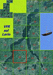
This is the fourth scenery of the "VFR of Lario" project, made with photorealistic terrain (multiseason & night) and with some 3D GMax realistic objects.
Information: Como's lake is in the north of Italy, closed to the Helvetic border. This third scenery covers approximately an area of 7.5x6 kmt, from Nesso/Erno (NW) to Barni (NE), and the ridge east of Monte Bolletto (SW) to Asso/Canzo (SE) and includes some details (GMax) of Pognana Lario NLC pier (fantasy), the A. Volta motorship with the Hydrofoil G. Marconi (both animated). GMax objects as above and other buildings, minor piers and boats together with autogen buildings and trees are fully spreaded on the scenery.
| Filename: | VFR_of_Lario_Area_B2__Como_lake_Italy.zip |
| License: | Freeware |
| Added: | 13th March 2012, 22:06:00 |
| Downloads: | 1,767 |
| Author: | Della Vedova Aldo, Daniele Lanfranchi, Gian Mario Verga, Diego Caligiuri |
| Size: | 11.09 MB |


© 2001-2026 AVSIM Online
All Rights Reserved
Privacy Policy |