
Where Flight Simulation Enthusiasts Gather from Around the World!
AVSIM Library - Search Results

| Category: Flight Simulator 2004 - Scenery | |
| Saglek CYSV in northern Labrador, Newfoundland Canada |

|
Images related to this file:
File Description:
Kangiqsualujjuaq is in northern Quebec on the east side of Ungava Bay, and the rocky coastline stretches north from there for 130 miles before turning sharply to head south as the Atlantic shore of Labrador. On this shore and 120 miles almost due east of Kangiqsualujjuaq is Saglek, once a US radar base as part of the DEW line, and then a Canadian base with a Long Range Radar sited 1,200 feet above the airstrip on the top of the vertical cliff. The airstrip is still in use today as an access to the Torngat Mountains Canadian National Park area further north, with organised summer camps and walks etc and helicopter relays from airstrip to campsites. Saglek closes the gap between my post of Kangiqsualujjuaq and the string of airfields further south on the Labrador coast, such as Nain, Davis Inlet, Hopedale, Makkovik, and Postville etc. These have all been made by Flight Ontario and posted along with the Goose Bay Air Base, which also functions as a civil airport.
| Filename: | Saglek_CYSV_in_northern_Labrador_Newfoundland_Cana.zip |
| License: | Freeware, limited distribution |
| Added: | 17th August 2017, 17:11:29 |
| Downloads: | 165 |
| Author: | Roger Wensley |
| Size: | 3.86 MB |
| Category: Flight Simulator X - Scenery | |
| Barbados Island Scenery V2 |
|
File Description:
UPDATED 01/05/2017
Photoscenery for Barbados island for FSX/P3D
Thank you for downloading my first scenery.
I've decided to make my first scenery of my home island Barbados, am very proud of my work and I hope you enjoy it.
UPDATE:
Fixed the Blendmask
Fixed the watermask
added rivers, port and more to the watermask
Barbados is a sovereign island country in the Lesser Antilles, in the Americas. It is 34 kilometres (21 miles) in length and up to 23 km (14 mi) in width,
covering an area of 432 km2 (167 sq mi). It is situated in the western area of the North Atlantic and 100 km (62 mi) east of the Windward Islands and the Caribbean Sea;[6] therein,
it is about 168 km (104 mi) east of the islands of Saint Vincent and the Grenadines and 400 km (250 mi) north-east of Trinidad and Tobago. Barbados is outside of the principal Atlantic hurricane belt.
Its capital is Bridgetown. Barbados is 1,600 mi (2,600 km) Southeast of Miami.
| Filename: | Barbados_Island_Scenery_V2.zip |
| License: | Freeware |
| Added: | 6th January 2017, 08:36:45 |
| Downloads: | 1,790 |
| Author: | Shakur Jones |
| Size: | 80.48 MB |
| Category: Flight Simulator 2004 - Scenery | |
| CZFM - Fort McPherson - Northwest Territories, Canada |
|
Images related to this file:
File Description:
This is the first of a series of airfields that follow (approximately) that early access route to the Canadian northern shore, the Mackenzie River. At the far northern end of the river and on the eastern side of the delta there is Tuktoyaktuk, then 80 miles south is Inuvik (both already posted). 70 miles south of Inuvik is Fort McPherson, on the east bank of the Peel River, 20 miles west of the junction with the Mackenzie and on the Dempster Highway. The town has a population of around 830, and (as usual in the north!) was the site of a Hudson Bay trading post, the main post for the Mackenzie delta area for over 50 years. The airport is less than 2 miles to the south of the town, and has 3,500 feet of gravel runway. AI is two ga flights and a Buffalo Airways delivery trip that hops north and south from field to field; this will change with further posts. There is no fuel available.
| Filename: | CZFM__Fort_McPherson__Northwest_Territories_Canada.zip |
| License: | Freeware, limited distribution |
| Added: | 4th July 2014, 05:33:03 |
| Downloads: | 289 |
| Author: | Roger Wensley |
| Size: | 2.3 MB |
| Category: Flight Simulator 2004 - Scenery | |
| Hong Kong Kaitak Approaches |
|
File Description:
This file contains all VHHX approaches in use in the 80th's and early 90th's years.
There are four IAF:CH(cheung chau) VOR,Whiskey Intx,Tamot Intx and CC NDB for the NDB approach via SC(Stonecutters) NDB to RWY13.
From the first three IAF:CH vor,Whiskey Intx and TAMOT Intx it's possible to ask the ATC to obtain the clearance to perform the related procedure for the RWY in use 13 or 31.
From the CC NDB IAF it's possible to obtain the clearance to NDB approach to RWY 13 only.
Traffics arriving from South-Southwest fixes(SIKOU,DAGON,IDOSI,ISBAN)normally will ask the approach to the RWY in use CH transition.
Traffics arriving from South-Southeast fixes(DOVAR,AKERO,ELATO,IKATA)normally will ask the approach to the RWY in use WHISKEY transition.
Traffics arriving from North-Northwest fixes(Pingzhou VOR,Sarex) normally will ask the approach TAMOT transition.
Traffics arriving from North-Northeast via LQ (SHILONG NDB) will ask the approach WHISKEY transition if runway in use is RWY31 and approach CH transition if runway in use is RWY 13.
| Filename: | Hong_Kong_Kaitak_Approaches.zip |
| License: | Freeware |
| Added: | 2nd August 2008, 20:19:44 |
| Downloads: | 2,051 |
| Author: | Gianfranco Corrias |
| Size: | 2.74 KB |
| Category: Flight Simulator 2004 - Scenery | |
| Gang Ranch CAY2 in British Columbia Canada |
|
Images related to this file:
File Description:
Gang Ranch is on the eastern side of the Coast Mountains of British Columbia, around 50 miles west of Green Lake and 5 miles west of the Fraser River that runs north-south at that latitude (51 degrees 30 minutes north, in round figures). The airfield is among some farm fields and difficult to spot (this will depend on your personal textures and settings) and the ranch buildings are scattered and a mile or two away, the nearest being the owner's house. The runway is gravel, only 1,800 feet long and aligned 08-26 at 2,150 feet above sea level. There is no lighting. I have posted it as Gang Ranch CAY2, but I suggest that you just add it to your previously created "BC airfields" (if you did that) and avoid the inevitable doubling up of common textures etc. Plus that way you will have just one FS9 library post to do and new airfields will not need yet another posting. Up to you. If you find a defect, email me.
| Filename: | Gang_Ranch_CAY2_in_British_Columbia_Canada.zip |
| License: | Freeware, limited distribution |
| Added: | 19th November 2020, 19:44:55 |
| Downloads: | 101 |
| Author: | Roger Wensley |
| Size: | 8.98 MB |
| Category: Flight Simulator 2004 - Scenery | |
| Miami MIA / KMIA Version 4 |
|
Images related to this file:
File Description:

This is an update to the default Miami Int'l airport. It contains the new American Airlines North Terminal as it appears today. Also included is the new Star Alliance terminal J. Terminal J is very difficult to duplicate exactly, so what you will see is a basic representation with correct size and gates. All terminals have accurate parking assignments per the MIA website. The included AFCAD was extensively reworked to add Runway 8L/26R and associated taxiways. All taxiways and taxiway signs are named correctly, and the included afcad makes ALL RUNWAYS ACTIVE. This scenery was built using Abacus' EZ-Scenery program.
Update:
This update contains the removal of terminals B and C, as the new North Terminal has taken shape. The whole terminal has been rebuilt from scratch to look much more realistic. All gate assignments are correct per AA.com. There is also a brand new afcad file which contains all corrected taxiway signage and taxiways. Cargo ramps are also properly coded for respective airlines. There are several other minor upgrades throughout the airport.
| Filename: | Miami_MIA__KMIA_Version_4.zip |
| License: | Freeware |
| Added: | 26th September 2010, 11:18:20 |
| Downloads: | 9,975 |
| Author: | FRFStudio.net / William Morgan |
| Size: | 13.23 MB |
| Category: Flight Simulator X - Aircraft Repaints, Textures and Modifications | |
| US Navy 'VS-38 "Red Griffins" on the USS Ranger' Lockheed S-3B Viking |
|
Images related to this file:
File Description:
This is a repaint of the Dino Cattaneo's S-3B "Viking". These textures represent a Viking of VS-38, "Red Griffins" as it appeared on the USS Ranger in June, 1989. On April 17, 2004, the squadron was officially disestablished at NAS North Island, CA as the Vikings were eliminated from USN inventory. The textures are those of an artist interpretation and resulting rendition. THESE ARE TEXTURES ONLY! You need Dino Cattaneo's Lockheed S-3B Viking freeware package.
| Filename: | US_Navy_VS38__Red_Griffins_on_the_USS_Ranger_Lockh.zip |
| License: | Freeware, limited distribution |
| Added: | 7th August 2014, 09:52:49 |
| Downloads: | 241 |
| Author: | Russel R. Smith and Dino Cattaneo |
| Size: | 11.35 MB |
| Category: Flight Simulator X - Aircraft Repaints, Textures and Modifications | |
| USN VFA-195 "Dambusters" CAG Boeing F/A-18E |
|
Images related to this file:
File Description:
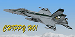
This is a repaint of VFA-195 "Dambusters" CAG for the payware VRS SuperBug F/A-18E.
The Dambusters, formally known as the Tigers earned their name from disabling the heavily defended Hwacheon Dam in North Korea, 1 May 1951. The squadron adopted a shield insignia that featured an eagle's head and a torpedo but changed to a stylized eagle on a green background in the mid 80's. The Dambusters converted to Super Hornets in 2010.
| Filename: | USN_VFA195_Dambusters_CAG_Boeing_FA18E.zip |
| License: | Freeware, limited distribution |
| Added: | 18th November 2013, 14:35:02 |
| Downloads: | 412 |
| Author: | Ben O'Donnell |
| Size: | 7.72 MB |
| Category: Flight Simulator 2004 - Scenery | |
| Seamans Field 9N3 Pa |
|
File Description:
Seamans Field (9N3) is located in the a little north of Factoryville, Pa. Many costom macros were created (using fsds2) for this project. Some of the features include: windsock, beacon, many hangars, many, many trees, the addition of Lake Sheridan (off the end of runway 4). Also included is a custom AFCAD2 file to allow AI traffic at the airport as well as AI aircraft (default and added). Requires Gerrish Greys's tree macros to be installed (trees_v3.zip)
| Filename: | Seamans_Field_9N3_Pa.zip |
| License: | Freeware |
| Added: | 30th June 2004, 04:58:18 |
| Downloads: | 1,688 |
| Author: | Phil Cruikshank |
| Size: | 3.06 MB |
| Category: Flight Simulator 2004 - AFCAD Files | |
| La Crosse, Wisconsin (KLSE) |
|
File Description:
AFCAD for La Crosse Municipal Airport (KLSE) in western Wisconsin. Reflecting current parking configurations at the airport, this AFCAD allows KLSE to handle the volume of commercial and general aviation traffic it sees in the real world. Located on French Island in the Mississippi River, KLSE serves western Wisconsin and south-eastern Minnesota as well as north-east Iowa. Correct parking is assigned for Northwest Airlink and American Eagle feeder service that provides flights to KMSP and KORD.
| Filename: | La_Crosse_Wisconsin_KLSE.zip |
| License: | Freeware, limited distribution |
| Added: | 19th September 2004, 13:23:37 |
| Downloads: | 1,018 |
| Author: | Alan Derrick |
| Size: | 27.04 KB |


© 2001-2026 AVSIM Online
All Rights Reserved
Privacy Policy |