
Where Flight Simulation Enthusiasts Gather from Around the World!
AVSIM Library - Search Results

| Category: Flight Simulator X - Aircraft Repaints, Textures and Modifications | |
| Lufthansa Regional (Lufthansa CityLine) British Aerospace 146 (Avro RJ85) Entire Fleet |

|
Images related to this file:
File Description:
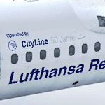
Handpainted renditions of D-AVRG (cn E2266 First flight 02/08/1995) and D-AVRM (cn E2288 First flight 18/05/1996), including all three schemes Lufthansa used: 1.Standart Lufthansa, 2.Lufthansa Regional and 3.Lufthansa Regional "50 years". TEXTURES ONLY!
| Filename: | Lufthansa_Regional_Lufthansa_CityLine_British_Aero.zip |
| License: | Freeware |
| Added: | 14th September 2012, 21:34:48 |
| Downloads: | 2,408 |
| Author: | Johnny Lawrence (Bozo) / Qualitywings |
| Size: | 94.48 MB |
| Category: Flight Simulator X - AI Aircraft | |
| Air Canada Airbus A340-300 |
|
Images related to this file:
File Description:
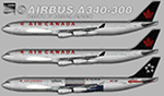
Air Canada Airbus A340-300 for retro AI traffic, with 3 variants, utilizing the payware FSPXAI A340-300 model set. This package includes FSX/P3D DDS textures. Aircraft model and master paint kit by Mitsushi Yutaka and FSPainter, repaint by Michael Pearson.
| Filename: | Air_Canada_Airbus_A340300.zip |
| License: | Freeware |
| Added: | 8th October 2019, 20:01:26 |
| Downloads: | 332 |
| Author: | Michael Pearson |
| Size: | 2.7 MB |
| Category: Flight Simulator X - Scenery | |
| RAF Fiskerton |
|
File Description:
RAF Fiskerton was a Royal Air Force station located north of the Lincolnshire village of Fiskerton, 5.0 miles east of Lincoln, Lincolnshire, England
It was one of many new bomber airfields built in the early part of World War II. The airfield was situated north of the village from where it got its name. It was one of only 15 RAF airfield equipped with FIDO, a fog-clearing system utilizing petrol pumped through pipes alongside the main runway and burned via a sequence of nozzles.
No. 49 Squadron and No. 576 Squadron RAF were stationed at RAF Fiskerton. 49 squadron took part in the Peenemande raid on the research and development centre for the V2 missile. 576 Squadron took part in the raid on Hitler's hideout at Berchtesgaden and in Operation Manna.
Between 1962 and 1992 a Headquarters of the Royal Observer Corps was located within the airfield boundary.
| Filename: | RAF_Fiskerton.zip |
| License: | Freeware |
| Added: | 21st October 2015, 20:30:21 |
| Downloads: | 251 |
| Author: | Terry Boissel |
| Size: | 16.04 KB |
| Category: Prepar3D V1-4 - Scenery | |
| Bolzano Trentino Alto Adige Italy N46°30 'E11°21' |
|
File Description:
Bolzano Trentino Alto Adige Italy N46°30 'E11°21' The city is situated at 264 m altitude in the eastern part of the wide basin originated by the conjunction of the valleys of Isarco, Sarentina and Adige. The basin is bordered to the west by the Mendola mountain range, to the north-west of the Salto plateau (Salten, 1,500 m), to the north-east by a minor peak of the Ritten called Monte Tondo (Hörtenberg), and to the south. east from Monte Pozza (1,619 m) on whose northern side is located the town of Colle, whose name is often improperly used to designate the entire mountain. A small rocky cliff of the latter, called Virgolo, rises vertically close to the city.
The scenery includes the city and the refuge on the rocky cliff of Vergolo. Important VFR point for approaching alle bellezze del trentino e alle sue celebri Dolomiti.
Within the downloaded package you will find readme files for scenery installation. Good fly VFR. Pasquale Marrulli.
| Filename: | Bolzano_Trentino_Alto_Adige_Italy_N4630_E1121.zip |
| License: | Freeware |
| Added: | 27th February 2018, 15:24:46 |
| Downloads: | 286 |
| Author: | Pasquale Marrulli |
| Size: | 3.61 KB |
| Category: Flight Simulator 2004 - Aircraft Repaints, Textures and Modifications | |
| Iran Air Airbus A380 |
|
File Description:
This is a repaint of Mike Stone's great Airbus A380 in Iran Air imaginary livery. These are the texture files only
So you need to download the original file named sa380.zip from the avsim.com (base textures are also included in that file).
I have named this "giant" IR aircraft Alborz which is the name of the mountains located in the north of Iran to the north of
Tehran and is the home to the extinct volcano Damavand, the highest peak/point in Iran(5671m).If you are thinking that Alborz is an Arabic name because of that Al in front of it I should say you are totally wrong for if Albert is an Arabic name then Alborz is too!! Besides, I am sure that you do know well that Iranians are of Aryan ancestory and they speak Persian not Arabic(am I teaching linguistics or history here?!! @;)
Alpha layers are used and textures are formatted in DXT3 so no blurring will appear on the fuselage.
| Filename: | Iran_Air_Airbus_A380.zip |
| License: | Freeware |
| Added: | 9th March 2004, 13:35:59 |
| Downloads: | 1,013 |
| Author: | Pantee Farhangi / Mike Stone |
| Size: | 160.92 KB |
| Category: Flight Simulator 2004 - Scenery | |
| Canadian and Northern USA Winter Flying |
|
File Description:
This is an expanded version of a previous post a year ago, and stretches from east of Quebec City through Quebec, Ontario, and Manitoba, and now also through Saskatchewan, and into Alberta (past Calgary). There is also a northern area roughly centered on Hudson Bay. The exact coverages are given in the notes. All rivers and lakes within the area will "freeze" and allow ski planes to land, or even wheeled planes come to that. And it is not permanent, when you want to go back to floats just "untick" it in the FS library, and it will melt. The area covered crosses into the US too, down to around 45 degrees north, so that means most of Montana, all of North Dakota, half of Minnesota, and some of Wisconsin, Michigan etc. It seemed silly to stop at the border. Ultimate Terrain is highly recommended, so that there will actually be the right lakes and rivers ready to freeze.
| Filename: | Canadian_and_Northern_USA_Winter_Flying.zip |
| License: | Freeware |
| Added: | 26th May 2008, 13:24:29 |
| Downloads: | 669 |
| Author: | Roger Wensley |
| Size: | 354.86 KB |
| Category: Flight Simulator 2004 - Scenery | |
| Calcinate del Pesce, Italy |
|
Images related to this file:
File Description:
Calcinate del Pesce is a small gliders airport placed on Varese lake, approx 25 miles north-west Milan Italy, closed to the Prealpi hills. North of the hills around you can find towers and observer of Campo dei Fiori meteo station. The airport is also base of Elilombarda, helicopter-rescue. Contents: Grass runway placed approx on the real coordinates, with ILS and taxi ways; five different hangars and fast food on the entrance; 10 gliders parked on the ground, several glider boxes all around the airport; a lot of trees around the scenery and lights on parking, gliders and road areas; wind sign, static Cessna, fuel station, people and cars; bird storm floating in the air; complete fences on all the airport perimeter with opening gate; two helicopters on ground and a Coca Cola balloon; small pier in the lake with dinghy; Varese open footbal stadium, close sport building and cathedral (fiction); Campo dei Fiori fantasy scenery with observe and comunication towers
| Filename: | Calcinate_del_Pesce_Italy.zip |
| License: | Freeware |
| Added: | 16th February 2011, 15:34:22 |
| Downloads: | 767 |
| Author: | Aldo Della Vedova |
| Size: | 12.28 MB |
| Category: Flight Simulator 2004 - Scenery | |
| CWCP - Cape Parry - Northwest Territories, Canada |
|
Images related to this file:
File Description:
This is a DEW line Main Station on the shore of the Canadian mainland at the far northern tip of Cape Parry. It is 60 miles north of Paulatuk, which is at the base of the Parry Peninsula, and 120 miles south of Sachs Harbour on Banks Island. The station ceased operations in 1989 and a North Warning System automated station was opened in the same year; the NWS station is not shown in this scenery as I have no information regarding it's location or layout. The runway is just over 5,000 feet of gravel 150 feet wide, aligned 037T at an elevation of 119 feet ASL. There is a large apron with a large hangar and a small shelter building for passengers. There are of course no lights, signage, or windsock. The station is up on the hill at 210 feet ASL. This is one of the more interesting stations in terms of size and complexity.
| Filename: | CWCP__Cape_Parry__Northwest_Territories_Canada.zip |
| License: | Freeware, limited distribution |
| Added: | 25th December 2012, 19:07:24 |
| Downloads: | 302 |
| Author: | Roger Wensley |
| Size: | 1.61 MB |
| Category: Flight Simulator 2004 - Scenery | |
| Maniwaki CYMW in Ontario Canada |
|
Images related to this file:
File Description:
Maniwaki airfield is seven miles south of the town of Maniwaki and some 60 miles north of Ottawa, up the Gatineau River. There is a generous 5,000 feet of runway 03/21 that is 150 feet wide and in bad condition, so bad that there are now almost no markings of any sort (even a centre line, the apron has more paint than the runway!) and the whole lot is going to be redone next summer. The apron is large, and in the summer accomodates two Bombardier CL 415 fire fighting amphibians, which is why there is a large access platform loitering on the apron. There are only five hangars on the field with another one tucked into the trees behind a house. The hangars and the office/cafe building have been modelled specifically for this field. There are further buildings to the north which are not actually on the airfield and which house fire department personnel.
| Filename: | Maniwaki_CYMW_in_Ontario_Canada.zip |
| License: | Freeware, limited distribution |
| Added: | 14th February 2010, 23:12:27 |
| Downloads: | 505 |
| Author: | Roger Wensley |
| Size: | 4.56 MB |
| Category: Flight Simulator 2004 - Scenery | |
| Warnervale, NSW, Australia |
|
File Description:
This version is a major update of this fine little airport
with the permission of Greg Archer, the original author.
Upgrades include the Terminal building, Booking office,
some hangars, lights and trees all featuring photo real textures.
An AFCAD file and AI traffic are now included.
Warnervale NSW, is a small airfield not included in FS2002 or 2004.
It is however a busy little field run by the Central Coast Aero Club
and incorporates the Drop Zone Skydiving Centre, as well as
Joy Flights over the Beautiful Central Coast of NSW.
The field is very close to Aeropelican Airport home of
Aeropelican Airways which has regular services to
Sydney Kingsford Smith International using Twin Otters.
in fact you can see Aeropelican Airstrip 8NM to the
north once you take off from Warnervale.
You can download Aeropelican from this site (aero2004.zip).
Both airfields complement each other, just follow the sail boats north.
Textures required. Airport 2.6, VOD, Nova and Nova Gold.
| Filename: | Warnervale_NSW_Australia.zip |
| License: | Freeware |
| Added: | 4th June 2004, 14:04:15 |
| Downloads: | 1,770 |
| Author: | Clive Marriott |
| Size: | 1.9 MB |


© 2001-2026 AVSIM Online
All Rights Reserved
Privacy Policy |