
Where Flight Simulation Enthusiasts Gather from Around the World!
AVSIM Library - Search Results

| Category: Flight Simulator 2004 - Scenery | |
| CYDA - Dawson City - Yukon Territory, Canada |

|
Images related to this file:
File Description:
Dawson City is in the Yukon Territory, Canada, 140 miles south of Old Crow and about the same north of Whitehorse. The town has a population of just over 1,300 and is on the bank of the Yukon River; it is busy with nearby gold mining and tourism. There are regular flights by Air North, the Yukon airline, and I have included them in the AI along with ConAir and GA. Thanks go to Hernan for his Air North textures. The airport is beside the Klondike Highway that links Dawson City to Whitehorse, a few miles southwest of the town and the river. The runway approaches are steeper than most because of the surrounding hills and the Canada Flight Supplement notes that use is restricted to daylight hours, with some exceptions including emergencies. Runway 20 has right hand circuits. The runway is gravel and just over 5,000 feet long, aligned 02-20. There is a second apron for the activities of ConAir etc in the summer fire-fighting months. The "masts" are actually for fire hose drying; the ends of several 50 feet lengths are attached to a circular holder that is then pulled up to the top of the central pole.
| Filename: | CYDA__Dawson_City__Yukon_Territory_Canada.zip |
| License: | Freeware, limited distribution |
| Added: | 27th December 2014, 20:31:31 |
| Downloads: | 378 |
| Author: | Roger Wensley |
| Size: | 3.96 MB |
| Category: Flight Simulator 2004 - Scenery | |
| Shaktoolik 2C7 in Alaska |
|
Images related to this file:
File Description:
Shaktoolik is a coastal village 35 miles north of Unalakleet, with a fishing population of around 250. It was originally established inland on the Shaktoolik River but moved to the coast in 1933. Due to storms and erosion it was again moved in 1967, to its current location 2 miles further north. Confusingly, what is called "New Shaktoolik 38A" was in fact only "new" in 1967 and has since been replaced by "Shaktoolik 2C7" further north, built on wider land with a longer gravel runway of 4,000 feet. 38A is still visible but unusable, with the sheds being used for other purposes. There are flights from Unalakleet, included in the AI here as a further modification to the Bethel PABE AI. A note here about my scenery making. This is post number 500 and there will not be many more to follow this as I am almost at the end of the photos I either took or found for scenery purposes. There is a limit to what can be located online and I have already been making use of the little there is; eg Unalakleet. So, if you are near an airport (preferably Canadian or Alaskan) and have a camera..... Let me know.
| Filename: | Shaktoolik_2C7_in_Alaska.zip |
| License: | Freeware, limited distribution |
| Added: | 27th July 2019, 21:00:56 |
| Downloads: | 107 |
| Author: | Roger Wensley |
| Size: | 4 MB |
| Category: Flight Simulator 2004 - Scenery | |
| Arctic Runway Signs in the "Northern Domestic Airspace", Canada |
|
Images related to this file:
File Description:
These are scenery bgl's to replace those previously posted for Cape Dorset, Gjoa Haven, Igloolik, and Whale Cove. All of these airfields are within what is marked on the chart as "Northern Domestic Airspace" and their runway signage is not given as a magnetic bearing but as a true bearing. This is because at those latitudes, close to magnetic north, the magnetic field is more vertical than horizontal and magnetic readings become unreliable. Planes report their course as a true course, and fly at a height that reflects their true course instead of their magnetic course. The picture shows the runway sign for Qikiqtarjuaq CYVM (which used to be called Broughton Island) which I am working on right now, and I realised that my training was so far behind me that I had forgotten all of the above. The boundary line of the two air spaces is not a straight line; the furthest south it reaches is on the west coast of Hudson Bay just north of Churchill. To the east it passes through the southern end of Baffin Island, and to the west it is north of the coast at the Alaskan border, and there is an illustration included here.
| Filename: | Arctic_Runway_Signs_in_the_Northern_Domestic_Airsp.zip |
| License: | Freeware, limited distribution |
| Added: | 11th June 2011, 03:06:36 |
| Downloads: | 308 |
| Author: | Roger Wensley |
| Size: | 1.21 MB |
| Category: Flight Simulator 2004 - Scenery | |
| St Andre-Avellin CAA2 in Quebec Canada |
|
Images related to this file:
File Description:
St Andre-Avellin is a new airfield in Quebec Canada, 35 miles east of Ottawa and 10 miles north of the Ottawa River, and just northwest of the village of the same name. There is a 03/21 grass runway that is 2,870 feet long and slopes up towards the north. To show this slope I have not "placed" a grass runway (which would immediately flatten the slope) and anway there is not so much traffic that the grass would be notably marked. Because of the lack of an FS-recognised runway I have not made parking or a traffic file as AI would not work; anyway this airfield with constant activity would not reflect reality. There are no facilities at the airfield except a hangar for the owner and space to park.
| Filename: | St_AndreAvellin_CAA2_in_Quebec_Canada.zip |
| License: | Freeware, limited distribution |
| Added: | 9th April 2011, 20:49:47 |
| Downloads: | 168 |
| Author: | Roger Wensley |
| Size: | 816.9 KB |
| Category: Flight Simulator 2004 - Scenery | |
| Paugan & Mercier Dams on the Gatineau River in Quebec Canada |
|
Images related to this file:
File Description:
This will not work without Ultimate Terrain, as the rivers and lakes just won't be there. The Paugan and Mercier Dams are on the Gatineau River in Quebec, north of Ottawa. Both of them are for power generation, rather than water conservation; the Paugan power generation building sits at the bottom of the sluiceway below the dam and appears far larger than the dam itself; there is a separate overflow sluice system nearby. The Paugan Dam is around 30 miles north up the river from Ottawa and the Mercier a further 70 miles. The Mercier holds back a huge and irregularly shaped volume of water known as the Reservoir Baskatong, with numerous branching arms and islands, and you will recognise where the dam must be long before you see it.
| Filename: | Paugan__Mercier_Dams_on_the_Gatineau_River_in_Queb.zip |
| License: | Freeware, limited distribution |
| Added: | 3rd May 2010, 00:11:21 |
| Downloads: | 273 |
| Author: | Roger Wensley |
| Size: | 421.81 KB |
| Category: Flight Simulator X - AFCAD Files | |
| Buck's Airport (00N), NJ |
|
File Description:
Located 03 miles NE of Bridgeton, New Jersey on 63 acres of land, Buck's Airport is a small turf field privately owned by J. Di Orio and open to the public. The field in FSX has room for 8 small GA aircraft to park on the square of grass north of the greenhouses. Be careful of the trees to the north and south of the runway.
Scenery constructed with use of Google Maps images, the author has not been there in person.
This scenery is meant to be used in conjunction with MegaScenery Earth New Jersey/Delaware 004. It is not required, but apron use is minimized to allow satellite scenery to show through as much as possible - lack of it may make scenery look out of place.
| Filename: | Bucks_Airport_00N_NJ.zip |
| License: | Freeware |
| Added: | 3rd October 2010, 23:47:29 |
| Downloads: | 233 |
| Author: | Drew Sikora |
| Size: | 566.5 KB |
| Category: Flight Simulator X - Missions | |
| Restricted Airspace Mission |
|
File Description:
This is my first attempt at a mission in Flight Simulator X. It's a simple mission following ATC instructions. You must be able to read a map and identify your location visually. I am working on adding a few more effects, but thought the community would enjoy this mission in its present form. I won't spoil the mission by giving too much detail, but your general heading for the flight is 70 to 80 degrees for a landing at Burke Lakefront Airport which is just north of downtown Cleveland. Prominent visual features on the shore of lake erie are the Key Bank skyscraper, Browns Stadium and the Rock Hall of Fame which are all visible in FSX. You will be flying just north of Cleveland Hopkins International Airport.
| Filename: | Restricted_Airspace_Mission.zip |
| License: | Freeware |
| Added: | 26th March 2007, 15:06:30 |
| Downloads: | 2,833 |
| Author: | William Rayer |
| Size: | 2.34 MB |
| Category: Flight Simulator 2004 - Scenery | |
| Alverca AB, LPAR (near Lisbon, Portugal) including AI-Package |
|
File Description:
About 10 NM north of Lisbon City (Portugal) there is this beautiful, close to the Atlantic Ocean located Portuguese Airbase. The Alverca AB scenery goes along well with the Project Lisbon Photoreal PLPv3.2 scenery available at avsim. The included AI-Package contains: USAF Douglas C-47 Dakota and C-64 Skymaster, Breitling Lockheed L-1049 Super Constellation, FAP (Forca Aerea Portuguesa) Lockheed C-130H and T-33A, Lockheed-Martin F-16C, North American F-86F, FAP and GAF (German Air Force) Nord-Aviation Noratlas and the new GAF British-Aerospace Eurofighter Typhoon. The above airplanes perform touch and goes at the local airbase per attched flightplan. This scenery was made with EZ-Scenery. No FSE or other payware is required. Gentlemen, line up and standby for takeoff clearance!
| Filename: | Alverca_AB_LPAR_near_Lisbon_Portugal_including_AIP.zip |
| License: | Freeware, limited distribution |
| Added: | 4th April 2006, 22:14:40 |
| Downloads: | 8,644 |
| Author: | Klaus Jone |
| Size: | 30.16 MB |
| Category: Flight Simulator 2004 - Scenery | |
| Mormon Range, Enterprise, Beryl (UT82), Utah, Photo-Scenery |
|
Images related to this file:
File Description:
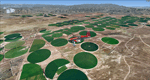
Mormon Range, Enterprise, Beryl (UT82), Utah, Photo-Scenery (FS9 & FSX)
This scenery covers the area of just north of St. George (KSGU) north along the Mormon Range and Enterprise to Beryl (UT82). It completes the southwestern corner of Utah and paves our way into Nevada. High resolution versions of this scenery for FS9 and FSX (much sharper, but larger and multiple downloads)are available at www.blueskyscenery.com/CNY_South2West6.html . The screenies are taken from the high-res versions, so expect this version to be slightly more blurry.
Thanks to Joop Mak for providing a custom AFCADs that correct airport layouts so that they align with the photo-textures! They are available at www.blueskyscenery.com/AFCADs.html . YourDonation@Work: Dedicated to Jean Pierre, Konrad and Juan.
| Filename: | Mormon_Range_Enterprise_Beryl_UT82_Utah_PhotoScene.zip |
| License: | Freeware, limited distribution |
| Added: | 27th March 2010, 11:38:48 |
| Downloads: | 1,367 |
| Author: | Gottfried Razek, blueskyscenery.com |
| Size: | 97.45 MB |
| Category: Flight Simulator 2004 - Aircraft Repaints, Textures and Modifications | |
| RAF Avro 685 York C1 LV633 ASCALON |
|
File Description:
The third prototype became Winston Churchill's personal flying conference room. It was luxuriously fitted out and had square windows instead of the characteristic row of circular ones. Delivered on April 30, 1943, to RAF A&AEE, it was transferred to No. 24 Squadron on May 28, 1943, and named "ASCALON" after St. George's sword. The Prime Minister used it to fly to allied conferences at Moscow (1943), Cairo (1943), Teheran (1943) and Yalta (1945). On another occasion, it served as the personal aircraft of King George VI during his tour of North Africa in 1943. On June 10, 1954 it was struck off charge and finally broken up at North Coates, Lincolnshire. Gmax exterior model and paintkit by Manfred Jahn, FDE by Paul Edwards, repainted by Hans Hermann, Virtual Birds
Factory.
| Filename: | RAF_Avro_685_York_C1_LV633_ASCALON.zip |
| License: | Freeware |
| Added: | 23rd April 2007, 13:44:20 |
| Downloads: | 425 |
| Author: | Manfred Jahn, Paul Edwards, Hans Hermann, |
| Size: | 986.31 KB |


© 2001-2026 AVSIM Online
All Rights Reserved
Privacy Policy |