
Where Flight Simulation Enthusiasts Gather from Around the World!
AVSIM Library - Search Results

| Category: Flight Simulator X - Scenery | |
| KYKM Yakima Washington Airport for FSX |

|
Images related to this file:
File Description:
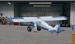
Welcome to beautiful Yakima Washington, and KYKM/McAllister Airport. For 35 years CubCrafters has been pushing the envelope
for the Piper Cub. Here in Alaska the cub is the most prized bush plane around.Be sure to stop by the factory and see what
they are working on in the hangar. Visit the McAllister Museum of Aviation, and then grab a quick bite to eat at "Reno's on
the Runway".
All runways and taxiways conform to the current FAA Airport Diagram (copy included). Some hold shorts at Runway 22 have been adjusted to conform to FSX requirements.
All the structures are new.
Thanks to Jim Dhaenens for the ASR9 radar!
| Filename: | KYKM_Yakima_Washington_Airport_for_FSX.zip |
| License: | Freeware, limited distribution |
| Added: | 26th April 2020, 02:30:36 |
| Downloads: | 365 |
| Author: | Brett Delana |
| Size: | 5.64 MB |
| Category: Flight Simulator 2004 - Original Aircraft | |
| Fairchild C-119 Flying Boxcar |
|
File Description:
With the kind permission of Daisuke Yamamoto, this package is a rework of his wonderful model of the Fairchild C-119 "Flying Boxcar." Included is his original paint scheme and I have included two more, one for "Bush Flying Unlimited" and the other for my friend Bob Arthur, "Reddog's Air Service;" both sets rendered in 32-bit hi-res format with no mip-maps.
The configuration files have been reworked by the talented Mr. Herb Morse and Brian Gladden to provide flight characteristics as close as possible to the real thing.
Thank you Mr. Yamamoto for providing the flight community with such a wonderful model of a classic workhorse.
| Filename: | Fairchild_C119_Flying_Boxcar.zip |
| License: | Freeware, limited distribution |
| Added: | 15th November 2003, 11:41:46 |
| Downloads: | 32,085 |
| Author: | Daisuke Yamamoto, Heather Sherman, Herb Morse, Brian Gladden |
| Size: | 11.31 MB |
| Category: Flight Simulator X - AFCAD Files | |
| Hammonton Municipal Airport (N81) NJ |
|
File Description:
Located 03 miles NE of Hammonton, New Jersey on 107 acres of land, Hammonton Municipal Airport is a public asphalt strip 3601' in length. It has recently been renovated with all-new taxiways and aprons and this update is depicted in this version with the big change being the extension of the main apron to join the previously-separated north and south tarmacs. The airport's magnetic variation, traffic pattern height, and PAPI glide slope and location have also all been accurately adjusted. All tie down parking locations are located on either the North or South tarmacs. Parking spots marked as RAMP_GA are occupied by static aircraft/objects and should not be chosen to start in (although all static objects have collision disabled). North parking spots can accommodate wingspans up to 50' while South parking spots should only be used by aircraft with wingspans of 40' or less. The one DOCK_GA location in the hangar start that can accommodate aircraft with wingspans up to 45'. The helicopter start location will place you on the North tarmac in front of the main hangar. Fuel is available by stopping on the concrete area on the North tarmac or by the fuel truck on the South tarmac in front of the hangars. Please see the ReadMe for known issues regarding AI aircraft parking.
Scenery constructed with use of satellite images/streetview/aerial photos - the author has not been there in person.
This scenery is meant to be used in conjunction with MegaScenery Earth New Jersey/Delaware 003. It is not required, but apron use is minimized to allow satellite scenery to show through as much as possible, and objects are placed based on the MSE textures - lack of it may make scenery look out of place.
| Filename: | Hammonton_Municipal_Airport_N81_NJ.zip |
| License: | Freeware |
| Added: | 5th June 2011, 06:22:53 |
| Downloads: | 202 |
| Author: | Drew Sikora |
| Size: | 897.82 KB |
| Category: Flight Simulator 2004 - Scenery | |
| 71AK - Bluff Park Farm, plus others |
|
Images related to this file:
File Description:
Bluff Park Farm 71AK is on the northern side of Knik Arm, opposite Birchwood on the southern side. Wasilla Creek Airpark 05AK is just under 5 miles northeast of Wolf Lake. Memory Lake 5AK8 is 3 miles north of the town of Wasilla. The others, which are all in with the Wasilla Creek Airpark scenery, are scattered around and are mostly included in this list because of FS9 to UT altitude anomalies. Where there is a hangar or another building this as been added, but where there are no buildings I have just made the elevation adjustments so that there is no ridiculous "runway-in-a-hole" situation visible near one of the other airfields that I have made in the area. This post includes, in total, 71AK, 05AK, 5AK8, 3AK2, 05AK, 5AK5, 16AK, 34AK, 59AK, and AK65.
| Filename: | 71AK__Bluff_Park_Farm_plus_others.zip |
| License: | Freeware, limited distribution |
| Added: | 26th October 2014, 02:05:06 |
| Downloads: | 215 |
| Author: | Roger Wensley |
| Size: | 4.74 MB |
| Category: Flight Simulator X - Scenery | |
| EGHA Compton Abbas |
|
File Description:
All additional Buildings were placed using default objects.
AI traffic uses default aircraft which was scheduled by hand using the TrafficDatabaseBuilder from the SDK tools provided by FSX Deluxe.
Any additional roads and modified Landclass & water features were created using FSX-KML.
This package adds the apron , Hangars, clubhouse and the fueling station has been moved to the correct spot between the hangars.
Some of the local roads have been added to allow road access to the airfield.
The main wooded areas have been added to the North and south of the airfield and cropland defined surrounding the immediate area although FSX insists on putting trees on some steeper slopes.
I have also included 3 of the villages nearby , Compton Abbas, Ashmore and Fontmell Magna .
It also provides parking spots and ATC interaction along with some AI traffic.
Hope you like it :)
| Filename: | EGHA_Compton_Abbas.zip |
| License: | Freeware, limited distribution |
| Added: | 1st October 2007, 17:08:37 |
| Downloads: | 1,887 |
| Author: | Len Hickman |
| Size: | 17.45 KB |
| Category: Flight Simulator 2004 - Aircraft Repaints, Textures and Modifications | |
| Hawaii Pacific Air ATL.98 Carvair |
|
File Description:
These textures represent Aviation Traders' ATL.98 Carvair #20 N5459X and #21 N5459M in the livery of Hawaii Pacific Air. Hawaii Pacific Air owned them only less than 2 years (mid 1990-early 1992) after which they were stored at Honolulu, HI, for over 3 years. They moved ownership several times before Airline Marketing Consultants bought them with the aim to ferry them to South Africa. This whole time they retained their Hawaii Pacific Air colours. In the end only N5459M moved to South Africa where, registered 9J-PAA, she is still airworthy, flying for Phoebus Apollo. N5459X stayed in North America. She, too, is still airworthy, flying for Brooks Fuel as N898AT. These are textures only. You will require Jon Walton's freeware Aviation Traders ATL.98 Carvair (jwat98.zip or jwat98_2k2.zip). Repaints, based on Jon Walton's original textures, by Maarten Brouwer.
| Filename: | Hawaii_Pacific_Air_ATL98_Carvair.zip |
| License: | Freeware, limited distribution |
| Added: | 16th August 2006, 19:55:02 |
| Downloads: | 373 |
| Author: | Maarten Brouwer |
| Size: | 1.31 MB |
| Category: Strike Fighters: Project 1 - Mods, Utilities and Patches | |
| Vietnam Tomcats |
|
File Description:
This campaign is a fictional event and the premise is as follows:
Vietnam 1975:
After almost a 3 year lull in hostilities, North Vietnam has invaded South Vietnam.
South Vietnam's request for assistance is not completely denied by the U.S. Congress (as it was historically). Carrier units stationed in the Area are cleared to assist the South Vietnamese in any way possible. Their mission is to control the immediate skies and help personnel evacuate quickly.
Three Squadrons, VF-21, VF-103 and VF 143 flying the Navy’s newest fighter plane, The F-14A Tomcat, will participate in this operation.
This is a Navy and USMC campaign only. There are no USAF units (exception long range B-52s) taking part in this operation.You need the F-14A plane installed and the latest Weapons pack. Brought to you by MK2aw
| Filename: | Vietnam_Tomcats.zip |
| License: | Freeware |
| Added: | 4th January 2005, 06:28:58 |
| Downloads: | 1,016 |
| Author: | Alex Aguila |
| Size: | 8.17 KB |
| Category: Fly! II - TerraScene | |
| Cape Hatteras (Carolinas Project) TerraScene Project Pack |
|
Images related to this file:
File Description:
Re-upload. This TerraScene 2.1 Project pack covers all of global tile 201,154 and the western half of 202,154. Picking up the NC coastline at Atlantic Beach, it continues north through Morehead City, New Bern, Bayboro, Cherry Point and the Pamlico River. To the east, it continues out over Pamlico sound to Cape Lookout, then proceeds north to Cape Hatteras, including Ocracoke, Buxton, and Avon. This pack includes updated Tiger Census (2000) shapefile data, adding new water areas, new highways, and other details. All scenery data files are included: USGS data, shapefiles, and complete custom water masks. Requires TerraScene 2.1 and Fly!II patched to v230 or later.
| Filename: | Cape_Hatteras_Carolinas_Project_TerraScene_Project.zip |
| License: | Freeware |
| Added: | 21st May 2010, 02:35:26 |
| Downloads: | 261 |
| Author: | Randall Rocke |
| Size: | 44.67 MB |
| Category: Flight Simulator X - Scenery | |
| Hope Airfield - CYHE (FSX) |
|
File Description:
Nestled in deep wilderness at the base of the Cascade Mountains, Hope sits on a wide sweeping curve of the Fraser River. Fly north of Hope and follow the Fraser River through the Fraser Canyon. Fly west through the pass to Harrison Hot Springs. This scenery was compiled from satellite images and photographs of the area. Acreages north of the field have been re-done. The lumber operation to the northeast is all new. All scenery objects are sourced from FSX Deluxe. Incidentally, Hope is the longest grass airstrip in Canada. You have a lot of room for a soft landing. VANCOUVER PLUS is required for this scenery to work.
| Filename: | Hope_Airfield__CYHE_FSX.zip |
| License: | Freeware, limited distribution |
| Added: | 16th April 2009, 05:05:06 |
| Downloads: | 688 |
| Author: | Will Jones |
| Size: | 560.21 KB |
| Category: Flight Simulator X - Scenery | |
| DL_NFI.zip |
|
File Description:
The Scenery includes a Fotoreal orientation of the "Nordfriesischen Inseln" in the north of Germany (North Sea) including the island Helgoland for the FSX.
The Scenery is based on Google Earth Satellite images.
Islands:
Sylt, Amrum, Föhr, Lageness, Hooge, Pellworm, Nordstrand and Helgoland .
Textures are partially with LOD 14 (2,4 m/pix) . The island Sylt is in LOD 13 (4.7 m/pix) .
Shore lines are included for Sylt (West coast) und Amrum (West coast).
In addition 6 Objects:
- Lighthouse from Hörnum (Sylt)
- Lighthouse from Kampen ( Sylt)
- Lighthouse from Amrum
- A ballon on the beach of Kampen (Sylt).
- Sheeps on the little island auf Hooge ( who can find them ?)
| Filename: | DL_NFIzip.zip |
| License: | Freeware |
| Added: | 4th October 2008, 20:36:37 |
| Downloads: | 7,287 |
| Author: | Dietmar Loleit |
| Size: | 12.65 MB |


© 2001-2026 AVSIM Online
All Rights Reserved
Privacy Policy |