
Where Flight Simulation Enthusiasts Gather from Around the World!
AVSIM Library - Search Results

| Category: Flight Simulator 2004 - AI Flight Plans | |
| Sorted default FS9 flight plans & GA flight plans sorted by ICAO/country |

|
File Description:
The Master_GA_sorted_country contains: some 20,436 flight plans that have been adopted from Reggie Fields' sorted aircraft registration collections. The following is from his readme file (included folder), "FS2004 General Aviation AI traffic with more correct registration numbers for the originating country. This file is a modification of the FS2004 default GA traffic designed to minimize the number of small single engine aircraft landing at the worlds major commercial airports. This will prevent a lot of go-around orders to commercial jets based on the length of time it takes a C172 to clear a 10,000 ft runway. This file makes commercial AI traffic flow much better than the MS default while retaining the GA aircraft in the airspace." Like Reggie Fields' files, all are free to use and redistribute but can not be sold. AC#defaultfp_sorted_ICAO folder contains all individual default aircraft in seperate files and their FS9 default flight plans are sorted by ICAO. A second folder contains a file for each country with the mentioned GA flight plans sorted by ICAO. This should be of an aide to those of us who wish to put more correct AI aircraft into a region or country. Copy/paste should be easier, this way, when building on each countries' aviation/flights. All files are text (.txt) files (ASCII.) They have no @ and TTOOLS by Lee Swordy is recommended.
| Filename: | Sorted_default_FS9_flight_plans__GA_flight_plans_s.zip |
| License: | Freeware |
| Added: | 10th May 2004, 14:48:30 |
| Downloads: | 2,983 |
| Author: | Rick Connolly |
| Size: | 5.57 MB |
| Category: Flight Simulator X - AFCAD Files | |
| KMSY - Louis Armstrong International, New Orleans, USA (Default with new terminal model) |
|
Images related to this file:
File Description:

This is part of the eighth round of airports issued by Alpha India Group. AIG Ground aims to create high quality Afcads for both FS2004 and for FSX default and Add On Scenery airports. Our airports are created drawing on the best available resources and aim to simulate the real world airport as closely as possible but also to ensure good levels of traffic with realistic parking and good flow of traffic around the airport.
Please read and follow installation instructions in the Readme file carefully, as these do vary.
Visit us at www.alpha-india.net for more information.
| Filename: | KMSY__Louis_Armstrong_International_New_Orleans_US.zip |
| License: | Freeware |
| Added: | 14th February 2010, 14:59:06 |
| Downloads: | 2,419 |
| Author: | Patrick Finch & Alpha India Group |
| Size: | 1.49 MB |
| Category: Fly! II - Scenery | |
| Boise Air Terminal [Cowan Field] (KBOI) |
|
File Description:
TerraModels Scenery Development System by Allen Kriesman was used to create the scenery for Boise Air Terminal [Cowan Field] (KBOI), Idaho. Biber Salsa and Steves models were also used to create this scenery.
| Filename: | Boise_Air_Terminal_Cowan_Field_KBOI.zip |
| License: | Freeware |
| Added: | 19th June 2006, 02:06:23 |
| Downloads: | 104 |
| Author: | Wayne Roberts |
| Size: | 918.42 KB |
| Category: X-Plane - Scenery | |
| Ballooning Farm (near Ketchikan, AK) |
|
File Description:
Ballooning Farm Scenery-
The Ballooning Farm is an fictitious scenery near Ketchikan Alaska, USA. A little cabin, with small airfield. The scenery is for X-Plane Version 8.6.
The Author is Peter Noti.
| Filename: | Ballooning_Farm_near_Ketchikan_AK.zip |
| License: | Freeware |
| Added: | 17th August 2007, 10:02:56 |
| Downloads: | 134 |
| Author: | Peter Noti |
| Size: | 2.14 MB |
| Category: Flight Simulator 2004 - Scenery | |
| Malaga - Costa del Sol (SpainVFR Demo) |
|
File Description:
Photographic scenery of Malaga (Spain), including port and airport (LEMG). 25 x 20 km. This scenery is part of a commercial photographic scenery of all Andalucia (South of Spain). For FS 2002 / 2004.
| Filename: | Malaga__Costa_del_Sol_SpainVFR__Demo.zip |
| License: | Freeware, limited distribution |
| Added: | 1st December 2003, 02:39:56 |
| Downloads: | 12,414 |
| Author: | www.SpainVFR.com |
| Size: | 10.45 MB |
| Category: Flight Simulator 2004 - Scenery Design | |
| WBGT/WBTM Long Banga, Tanjung Manis, Malaysia |
|
Images related to this file:
File Description:
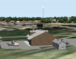
Googly scenery for WBGT Long Banga, Tanjung Manis (sometimes also referred to
under the ICAO code WBTM) - a small domestic airport in Malaysia that it seems
Microsoft forgot to provide in in Flight Simulator 2004. These scenery
files create the airport and add taxiways, aprons, buildings and other airport
features, so that you and your "AI" traffic can land, taxi, park and take off in
a realistic manner. Also added is the missing TMS non-directional beacon at
this airport (on frequency 264.0).
The airport serves the township of Sarikei, capital of the Sarekei district in
the Sarekei Division (are you following this?) of Sarawak in Eastern Malaysia.
Flights are provided by MASwings, a subsidiary of Malaysian Airlines, with De
Havilland Twin Otter aircraft calling here a few times per week.
The scenery does not purport to be ultra-accurate. Based on high-detail satellite
imagery from Google Earth, the layout is proportionally correct but the added
airport features, such as buildings, are built from default Microsoft objects
and add-on libraries so will not look exactly like the real thing.
You are not obliged to download and install any additional scenery libraries,
but to enjoy this scenery in its entirety, you may wish to. It will work fine,
with or without.
[File re-uploaded at request of AVSIM]
| Filename: | WBGTWBTM_Long_Banga_Tanjung_Manis_Malaysia.zip |
| License: | Freeware |
| Added: | 23rd May 2010, 01:23:38 |
| Downloads: | 964 |
| Author: | John Hinson |
| Size: | 51.04 KB |
| Category: Flight Simulator 2004 - Scenery | |
| HLLQ El Beida/Labraq |
|
Images related to this file:
File Description:
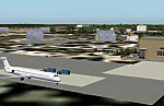
Googly scenery for HLLQ El Beida/Labraq - a joint civilian and military airport
near the north coast of Libya that is poorly provided for in Flight Simulator
2004. These scenery files add taxiways, aprons, buildings and other airport
features, so that you and your "AI" traffic can land, taxi, park and take off
in a realistic manner.
The city of Al Beida, or Al Bayda' or El Beda or Al Baidhah (depending on who
you are) has achieved its own airport status by using the end of a dead runway
at Labraq Air Base. In turn the airbase has contracted to use the opposite end
of the runway as its base of activity. The city is served by jets of Libyan
Airways and turboprop craft of Air One Nine and Ghadames Air Transport.
The scenery does not purport to be ultra-accurate. Based on high-detail satellite
imagery from Google Earth, the layout is proportionally correct but the added
airport features, such as buildings, are built from default Microsoft objects
and add-on libraries so will not look like the real thing.
You are not obliged to download and install any additional scenery libraries,
but to enjoy this scenery in its entirety, you may wish to. It will work fine,
with or without. [File re-uploaded at request of AVSIM]
| Filename: | HLLQ_El_BeidaLabraq.zip |
| License: | Freeware |
| Added: | 28th May 2010, 20:42:26 |
| Downloads: | 1,286 |
| Author: | John Hinson |
| Size: | 73.79 KB |
| Category: Flight Simulator 2004 - Scenery | |
| FTTN Am-Timan, Chad |
|
File Description:
Googly scenery for Am-Timan (ICAO: FTTN, ICAO: ANC), also known as Am
Timan, Am Timane, Am Timmane, Umm Timman - take your pick! It is a small
airport serving a small city of the same name in South-Eastern Chad,
almost exactly centred in the continent of Africa.
The airport was upgraded in 1971 by the French Foreign Legion to allow
military transport craft to land, but it still retains a sand/dirt
strip. The airport is served today by a couple of flights a week using
Fokker Fellowship jets of Toumai Air Tchad.
The entire area is very dry and sandy but for some reason it is depicted
in Flight Simulator as green and lush. Microsoft have only provided a runway
at this airport and this scenery seeks to redress the situation so that you
and your "AI" traffic can use the airport realistically.
The scenery does not purport to be ultra-accurate. Based on high quality
satellite imagery from Google Earth, the layout is proportionally correct but the
added airport features, such as buildings, are built from default Microsoft objects
and add-on libraries so will not look exactly like the real thing.
You are not obliged to download and install any additional scenery libraries,
but to enjoy this scenery in its entirety, you may wish to. It will work fine,
with or without.
| Filename: | FTTN_AmTiman_Chad.zip |
| License: | Freeware |
| Added: | 24th December 2008, 13:31:36 |
| Downloads: | 883 |
| Author: | John Hinson |
| Size: | 83.66 KB |
| Category: Flight Simulator 2004 - Scenery | |
| MRAO Turtuguero, Costa Rica |
|
Images related to this file:
File Description:
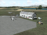
Googly scenery for MRAO Turtuguero, Costa Rica - another one that Microsoft
forgot in FS2004. It is a small domestic airport located on a long spit of
land that almost seems like an island. Turtuguero is just a village but the
airport also serves the lush Tortuguero National Park (rain falls all the
year round here) which draws thousands of visitors each year. The airport
is served daily by DHC-6 Twin Otters of Nature Air.
These scenery files create the airport and add taxiways, aprons, buildings and other airport features, so that you and your "AI" traffic can land, taxi, park and take
off in a realistic manner.The scenery does not purport to be ultra-accurate. Based on less-than-perfect satellite imagery from Google Earth, the layout is as good as I can get it, but some imagination has been used as I cannot tell what buildings exist. The
buildings and other features I have provided are built from default Microsoft
objects and add-on libraries so will not look exactly like the real thing.
You are not obliged to download and install any additional scenery libraries,
but to enjoy this scenery in its entirety, you may wish to. It will work fine,
with or without. [File re-uploaded at request of AVSIM]
| Filename: | MRAO_Turtuguero_Costa_Rica.zip |
| License: | Freeware |
| Added: | 28th May 2010, 20:40:00 |
| Downloads: | 1,174 |
| Author: | John Hinson |
| Size: | 65.12 KB |
| Category: Flight Simulator 2004 - Scenery | |
| SKMD Medellin/Enrique Olaya Herrera, Colombia |
|
File Description:
Googly scenery for Medellin/Enrique Olaya Herrera (ICAO: SKMD, IATA: EOH). This
centrally located airport, named after the 1930 president of Colombia, was once
the only airport for the city of Medellin but most international flights are now
concentrated on the new international airport inconveniently situated 24 miles
away. Nevertheless the airport is very busy with domestic, charter and private
traffic and is regularly served by scheduled services of Aerolínea de Antioquia,
AIRES, Easyfly and SATENA. There are many charter operators based or serving
serving this airport, including Aexpa, Heliandes, Sarpa, Helicol and TAC; these
are mostly smaller aircraft or helicopter operations.
Remarkably for such an important airport, Microsoft have only provided a runway
at this airport in Flight Simulator 2004 and this scenery seeks to redress the
situation so that you and your "AI" traffic can use the airport realistically.
The scenery does not purport to be ultra-accurate. Based on high quality
satellite imagery from Google Earth, the layout is proportionally correct but the
added airport features, such as buildings, are built from default Microsoft objects
and add-on libraries so will not look exactly like the real thing.
You are not obliged to download and install any additional scenery libraries,
but to enjoy this scenery in its entirety, you may wish to. It will work fine,
with or without.
| Filename: | SKMD_MedellinEnrique_Olaya_Herrera_Colombia.zip |
| License: | Freeware |
| Added: | 6th December 2008, 10:22:40 |
| Downloads: | 2,564 |
| Author: | John Hinson |
| Size: | 388 KB |


© 2001-2026 AVSIM Online
All Rights Reserved
Privacy Policy |