
Where Flight Simulation Enthusiasts Gather from Around the World!
AVSIM Library - Search Results

| Category: Flight Simulator 2004 - Scenery | |
| LELC Murcia/San Javier, Spain |

|
File Description:
Googly scenery for LELC San Javier, Spain, a medium-sized airport on the Costa
Cálida 17 miles south of Murcia. The airport sees daily scheduled traffic
operated by Canadair Regional Jets and Dash 8 turboprops of Air Nostrum but a
large proportion of the airport's traffic is derived from tourist charter
traffic from operators such as Air Berlin, Easyjet, LTU International and
Ryanair and the airport can accept aircraft as large as the Boeing 767. The
north end of the airport is home to the Spanish Air Force Academy.
Flight Simulator 2004 has made little provision for traffic with facilities only
for general aviation aircraft and this scenery seeks to redress the situation.
The scenery does not purport to be ultra-accurate. Based on high quality
satellite imagery from Google Earth, the layout is proportionally correct but the
added airport features, such as buildings, are built from default Microsoft objects
and add-on libraries so will not look exactly like the real thing.
You are not obliged to download and install any additional scenery libraries,
but to enjoy this scenery in its entirety, you may wish to. It will work fine,
with or without.
| Filename: | LELC_MurciaSan_Javier_Spain.zip |
| License: | Freeware |
| Added: | 6th April 2008, 20:35:29 |
| Downloads: | 3,169 |
| Author: | John hinson |
| Size: | 20.51 KB |
| Category: Flight Simulator 2004 - Scenery | |
| HTMS Moshi |
|
File Description:
Googly scenery for Moshi (ICAO: HTMS), a small airport serving the town of the same name
located in the lower slopes of Africa's highest mountain - Mount Kilamanjaro.
The town boasts good quality education and medical facilities, and industry
includes production of fizzy drinks, beer, flour, animal feed and furniture,
but surprisingly little tourism activity has been developed here so much of
the traffic at this airport is unscheduled and charter work using smaller
aircraft.
Microsoft have only provided wrongly-positioned runways at this airport in
Flight Simulator 2004 and this scenery seeks to redress the situation
so that you and your "AI" traffic can use the airport.
The scenery does not purport to be ultra-accurate. Based on high quality
satellite imagery from Google Earth, the layout is proportionally correct but the
added airport features, such as buildings, are built from default Microsoft objects
and add-on libraries so will not look exactly like the real thing.
You are not obliged to download and install any additional scenery libraries,
but to enjoy this scenery in its entirety, you may wish to. It will work fine,
with or without.
| Filename: | HTMS_Moshi.zip |
| License: | Freeware |
| Added: | 12th October 2008, 10:22:59 |
| Downloads: | 1,079 |
| Author: | John Hinson |
| Size: | 61.84 KB |
| Category: Flight Simulator 2004 - Scenery | |
| VABP Bhopal/Bairagarh, India |
|
Images related to this file:
File Description:
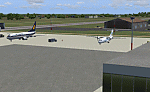
Googly scenery for VABP Bhopal/Bairagarh, India - an enhancement to the
airport provided in Flight Simulator 2004 which is incorrect in many respects.
These scenery files enlarge the apron to a realistic size to accept scheduled
traffic, remove spurious taxiways (they were actually perimeter tracks!), and
add buildings and other airport features so that you and your "AI" traffic
can land, taxi, park and take off in a realistic manner.
This small domestic airport is served by Boeing and Airbus jets of Indian
Airlines and Jet Airways together with local flights operated by ATRs of Air
Deccan.
The scenery does not purport to be ultra-accurate. Based on high-detail satellite
imagery from Google Earth, the layout is proportionally correct but the added
airport features, such as buildings, are built from default Microsoft objects
and add-on libraries so will not look like the real thing.
You are not obliged to download and install any additional scenery libraries,
but to enjoy this scenery in its entirety, you may wish to. It will work fine,
with or without.
[File re-uploaded at request of AVSIM]
| Filename: | VABP_BhopalBairagarh_India.zip |
| License: | Freeware |
| Added: | 7th May 2010, 22:34:06 |
| Downloads: | 1,625 |
| Author: | John Hinson |
| Size: | 64.37 KB |
| Category: Flight Simulator 2004 - Scenery | |
| Houn, Libyan (HLON/HUQ) |
|
File Description:
Googly scenery for HLON Hon, Libya, a small domestic airport serving the oasis town (which is correctly spelt Houn) about 250 miles south-east of Tripoli. It is the capital of the Al Jufrah region. Although the airport holds ICAO and IATA status, as far as I can establish there are
currently no scheduled services to this airport, so present-day traffic is limited to the occasional charter, cargo or private flight. Flight Simulator 2004 has made no provision for traffic with only a runway provided and this scenery seeks to redress the situation so that you and your "AI" traffic can use the airport. The scenery does not purport to be ultra-accurate. Based on high quality satellite imagery from Google Earth, the layout is proportionally correct but the
added airport features, such as buildings, are built from default Microsoft objects
and add-on libraries so will not look exactly like the real thing. You are not obliged to download and install any additional scenery libraries, but to enjoy this scenery in its entirety, you may wish to. It will work fine, with or without.
| Filename: | Houn_Libyan_HLONHUQ.zip |
| License: | Freeware |
| Added: | 18th April 2008, 09:51:02 |
| Downloads: | 842 |
| Author: | John Hinson |
| Size: | 65.71 KB |
| Category: Flight Simulator 2004 - Scenery | |
| DTTG Gabes, Tunisia |
|
File Description:
Googly scenery for Gabes (ICAO: DTTG), a somewhat nondescript airport
shoe-horned into one of Tunisia's largest industrial cities. Famed for
its beaches, the city hosts cement, chemical and brick factories and an
oil refinery, resulting in poor levels of air pollution. The airport is
a joint military and civilian operation although military traffic appears
to be mostly helicopter activity and the civilian traffic consists of an
ATR of Sevenair calling in once in a blue moon.
Microsoft have only provided a runway at this airport in Flight Simulator
2004 and this scenery seeks to redress the situation so that you and your
"AI" traffic can use the airport realistically.
The scenery does not purport to be ultra-accurate. Based on high quality
satellite imagery from Google Earth, the layout is proportionally correct but the
added airport features, such as buildings, are built from default Microsoft objects
and add-on libraries so will not look exactly like the real thing.
You are not obliged to download and install any additional scenery libraries,
but to enjoy this scenery in its entirety, you may wish to. It will work fine,
with or without.
| Filename: | DTTG_Gabes_Tunisia.zip |
| License: | Freeware |
| Added: | 14th October 2008, 13:18:33 |
| Downloads: | 757 |
| Author: | John Hinson |
| Size: | 83.15 KB |
| Category: Flight Simulator 2004 - Scenery | |
| HEMM Mersa Matruh, Egypt |
|
File Description:
Googly scenery for HEMM Mersa Matruh - a large Air Base near the north coast of
Egypt. Marsa Matruh, as the town should be spelt, is a seaport 150 miles west of
Alexandria but its main function today is that of a holiday resort for the
residents of Cairo. It does not have an airport of its own, but uses a small
corner of the Air Base for civilian flights. Microsoft Flight Simulator has
made no provision for any traffic at this airport and this scenery seeks to
redress the situation.
Scheduled flights are operated by Egyptair Express using Embraer 170 jets,
but other airlines call here from time to time, such as Air Sinai and Midwest
Airlines.
The scenery does not purport to be ultra-accurate. Based on high quality
satellite imagery from Google Earth, the layout is proportionally correct but the
added airport features, such as buildings, are built from default Microsoft objects
and add-on libraries so will not look exactly like the real thing.
You are not obliged to download and install any additional scenery libraries,
but to enjoy this scenery in its entirety, you may wish to. It will work fine,
with or without.
| Filename: | HEMM_Mersa_Matruh_Egypt.zip |
| License: | Freeware |
| Added: | 18th February 2008, 17:32:10 |
| Downloads: | 1,988 |
| Author: | John Hinson |
| Size: | 114.6 KB |
| Category: Flight Simulator 2004 - Scenery | |
| MYER Rock Sound International, Eleuthera Island, Bahamas |
|
File Description:
Googly scenery for Rock Sound International (ICAO: MYER), a grand-sounding but
quiet airport located on Eleuthera Island, Bahamas. Eleuthera is a long
and thin island east of Nassau and has three commercial airports, the busiest
being Governor's Harbour. Rock Sound is at the southern end and is served twice
daily by Dash 8 turboprops of Bahamasair, along with occasional flights by
operators such as Southern Air Charter. The airport has seen busier days and
was once even served from Europe by Alitalia.
Microsoft have only provided general aviation facilities at this airport in
Flight Simulator 2004 and this scenery seeks to redress the situation
so that you and your "AI" traffic can use the airport realistically.
The scenery does not purport to be ultra-accurate. Based on high quality
satellite imagery from Google Earth, the layout is proportionally correct but the
added airport features, such as buildings, are built from default Microsoft objects
and add-on libraries so will not look exactly like the real thing.
You are not obliged to download and install any additional scenery libraries,
but to enjoy this scenery in its entirety, you may wish to. It will work fine,
with or without.
| Filename: | MYER_Rock_Sound_International_Eleuthera_Island_Bah.zip |
| License: | Freeware |
| Added: | 13th October 2008, 11:01:56 |
| Downloads: | 1,467 |
| Author: | John Hinson |
| Size: | 61.42 KB |
| Category: Flight Simulator 2004 - Scenery | |
| FNGI N'giva/Ondjiva Pereira, Angola |
|
File Description:
Googly scenery for N'giva - Ondjiva Pereira (ICAO: FNGI, IATA: NGV), an airport
serving Ondjiva, one of Angola's larger cities. Until relatively recently it
possessed little more than a dirt runway but recent expansion has seen the
commissioning of a longer asphalt runway and a terminal area. Today, the airport
sees passenger and cargo flights from airlines such as Air Gemini, Angola
Airlines, Savanair and Sonair utilising a variety of aircraft from the little
Let 410 turboprop through to Boeing 737 jets.
Microsoft have only provided the dirt runway at this airport in Flight Simulator
2004 and this scenery seeks to redress the situation so that you and your
"AI" traffic can use the airport realistically.
The scenery does not purport to be ultra-accurate. Based on high quality
satellite imagery from Google Earth, the layout is proportionally correct but the
added airport features, such as buildings, are built from default Microsoft objects
and add-on libraries so will not look exactly like the real thing.
You are not obliged to download and install any additional scenery libraries,
but to enjoy this scenery in its entirety, you may wish to. It will work fine,
with or without.
| Filename: | FNGI_NgivaOndjiva_Pereira_Angola.zip |
| License: | Freeware |
| Added: | 15th October 2008, 12:40:17 |
| Downloads: | 1,608 |
| Author: | John Hinson |
| Size: | 73.94 KB |
| Category: Flight Simulator 2004 - Flight Plans | |
| PMDG SIDSTARS Cycle 0613 Collection |
|
File Description:
Procedures based on FAA Digital Aeronautical Information CDROM and/or Terry Yingling. This collection includes 43 locations (+ - indicates added since last cycle):
KABQ KATL KAUS KBNA KBWI KCMH KDAL KDEN KDFW +KDTW +KEWR KFLL KGEG KHOU KIAH KJFK KLAS KLAX
KMCI KMCO KMDW +KMEM +KMSP KMSY KOAK KONT KORD KPDX KPHL KPHX KRDU KRNO KSAN KSAT KSEA KSFO
KSJC KSLC KSMF KSNA KSTL KTPA KTUS
Procedures for KSFO & KOAK have been updated to incorporate more realistic departure and arrival
routes bases on user input and actual flight tracks from flightaware.com
See each procedure file for additional information specific to each location. Procedures that
are edited based on Terry Yingling's earlier distributions are appropriately commented and those
that I have developed based on FAA NACO Digital Terminal Procedures data include expanded text
headers with SID & STAR Charts and IAP list.
| Filename: | PMDG_SIDSTARS_Cycle_0613_Collection.zip |
| License: | Freeware, limited distribution |
| Added: | 21st December 2006, 22:04:58 |
| Downloads: | 1,094 |
| Author: | Dan Downs |
| Size: | 222.63 KB |
| Category: Flight Simulator 2004 - Flight Plans | |
| PMDG SIDSTARS Cycle 0703 Collection |
|
File Description:
PMDG SIDSTARS Cycle 0703 (15Mar-12Apr) Procedures based on FAA Digital Aeronautical Information CDROM and/or Terry Yingling. This collection includes 50 locations (+ - indicates added since last cycle; * - indicates major rework): KABQ KATL KAUS KBNA KBOS KBWI *KCLT KCMH KDAL KDCA KDEN KDFW KDTW KEWR KFLL KGEG KHOU KIAD KIAH *KJFK KLAS +KLGA KLAX KMCI KMCO KMDW KMEM KMIA KMSP KMSY KOAK KONT KORD KPDX KPHL KPHX KRDU KRNO KSAN KSAT *KSEA KSFO KSJC KSLC KSMF KSNA KSTL KTPA KTUS +PANC. The FAA has issued major changes to KCLT (7 new RNAV SIDs & 1 new RNAV STAR), and KDEN had changes to 5 SIDs. Other changes of note include KLAX deleted 2 STARS & 1 SID and KORD deleted 2 STARs and replaced them with two new RNAV STARs. All changes are listed in the enclosed file "Cycle 0703 Revisions.htm"
| Filename: | PMDG_SIDSTARS_Cycle_0703_Collection.zip |
| License: | Freeware, limited distribution |
| Added: | 14th March 2007, 20:46:56 |
| Downloads: | 1,727 |
| Author: | Dan Downs |
| Size: | 286.79 KB |


© 2001-2026 AVSIM Online
All Rights Reserved
Privacy Policy |