
Where Flight Simulation Enthusiasts Gather from Around the World!
AVSIM Library - Search Results

| Category: Flight Simulator 2004 - Scenery | |
| FS2004 Charleston Air Force Base 1957-1962 |

|
File Description:
Charleston AFB/Municipal Airport Scenery, 1957-1962. With Custom Hangars by Dan French, David Wooster's F-86L ai and repaints of the C-121C by Ken Lawson and Frank Gonzalez. Separate Military Traffic files for 1957, 1959 and 1962. Intended primarily for use in the California Classics world created by Tom Gibson and the CalClassics Community. By Al Von Pingel & Ken Lawson.
| Filename: | FS2004_Charleston_Air_Force_Base_19571962.zip |
| License: | Freeware |
| Added: | 25th April 2021, 15:14:20 |
| Downloads: | 162 |
| Author: | Al Von Pingel and Ken Lawson |
| Size: | 17.82 MB |
| Category: Flight Simulator 2004 - Scenery | |
| OIII 1960 Tehran Mehrabad Intl |
|
File Description:
We have produced this scenery to provide taxiways and details
as they were around 1960 in Tehran.
I have also included new parking to allow the AI aircraft to taxi
correctly at the new (old!) airport.
| Filename: | OIII_1960_Tehran_Mehrabad_Intl.zip |
| License: | Freeware |
| Added: | 6th January 2009, 09:13:19 |
| Downloads: | 3,069 |
| Author: | Wolfgang Gersch and Jaap de Baare |
| Size: | 730.81 KB |
| Category: Flight Simulator 2004 - Scenery | |
| "Himalayan Peaks" LOD10 Mesh, Volume 3 - Namcha Barwa |
|
File Description:
Highly detailed terrain mesh of the Namcha Barwa area, N29°-31° E94°-96°. The files in this package are based on Shuttle Radar (SRTM) Version 2 data but with many of the void areas, especially the most significant sections, filled with elevation data generated from topographic maps by Jonathan de Ferranti. While Jonathan's work is unrelated to flight simulation he kindly gave me permission to compile his data for use in FS. The result is a wonderful improvement in detail and accuracy over any existing mesh file, freeware or commercial, based on SRTM or DTED data alone. Due to the large area of the Himalayas I've compiled the source data as two separate series: the "Himalayan Peaks" series covers prominent mountains and ranges in higher detail and locally overrides any existing LOD9 terrain mesh. In addition, a LOD9 "base mesh" series covering the entire Himalayas will be available for those who do not yet have an add-on terrain mesh of these beautiful mountains.
| Filename: | Himalayan_Peaks_LOD10_Mesh_Volume_3__Namcha_Barwa.zip |
| License: | Freeware, limited distribution |
| Added: | 18th February 2006, 23:15:17 |
| Downloads: | 12,196 |
| Author: | Holger Sandmann and Jonathan de Ferranti |
| Size: | 15.09 MB |
| Category: Flight Simulator 2004 - Scenery | |
| "Himalayan Peaks" LOD10 Mesh, Volume 5 - Garhwal |
|
File Description:
Highly detailed terrain mesh of the Garhwal area, N30°-32° E78°-81°. The files in this package are based on Shuttle Radar (SRTM) Version 2 data but with many of the void areas, especially the most significant sections, filled with elevation data generated from topographic maps by Jonathan de Ferranti. While Jonathan's work is unrelated to flight simulation he kindly gave me permission to compile his data for use in FS. The result is a wonderful improvement in detail and accuracy over any existing mesh file, freeware or commercial, based on SRTM or DTED data alone. Due to the large area of the Himalayas I've compiled the source data as two separate series: the "Himalayan Peaks" series covers prominent mountains and ranges in higher detail and locally overrides any existing LOD9 terrain mesh. In addition, a LOD9 "base mesh" series covering the entire Himalayas will be available for those who do not yet have an add-on terrain mesh of these beautiful mountains.
| Filename: | Himalayan_Peaks_LOD10_Mesh_Volume_5__Garhwal.zip |
| License: | Freeware, limited distribution |
| Added: | 18th February 2006, 23:16:47 |
| Downloads: | 10,142 |
| Author: | Holger Sandmann and Jonathan de Ferranti |
| Size: | 27.72 MB |
| Category: Flight Simulator 2004 - Scenery | |
| New York La Guardia Airport 1959 |
|
File Description:
We've produced this scenery to provide new GMAX terminals, taxiways, buildings and details as they were around 1959 for La Guardia airport in New York City (USA). A new terminal was built in the early 1960's, opening in 1964. La Guardia was the major domestic airport in New York City. Other airports included Idlewild (now Kennedy) which handled both domestic and international flights, and Newark (in New Jersey). Jaap created the Pan American 5 sided hangar and Marine Air Terminal, while Tom created the rest. Thanks to Brady Fowler for most of the pictures used in this project.
| Filename: | New_York_La_Guardia_Airport_1959.zip |
| License: | Freeware, limited distribution |
| Added: | 6th May 2008, 02:45:21 |
| Downloads: | 4,669 |
| Author: | Tom Gibson and Jaap de Baare |
| Size: | 2.04 MB |
| Category: Flight Simulator X - Scenery | |
| Hawes Aerial Operations Facility |
|
Images related to this file:
File Description:
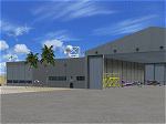
Hawes Aerial Operations Facility is a reimagined version of an abandoned World War II auxiliary airstrip formerly known as Hawes AAF Aux #1. It was built in the mojave desert, just east of Edwards AFB (then Muroc AAF) during WWII as one of 4 satellite fields for Victorville AAF. After the war, Hawes as used as a private civilian airfield until it's closure in the early 1960's. It is now reborn in FSX as a UAV base by Nevada Systems. Due to it's location in the Mojave desert and the presence of many thermals in FSX, it was also used in production of the Aeroworks ARX-1 civilian glider concept. This scenery uses many custom macros as well as default macros from the Acceleration Expansion Pack, which is required for best performance. Scenery and custom macros by Joshua B. Nyhus and Jason L. Terry
| Filename: | Hawes_Aerial_Operations_Facility.zip |
| License: | Freeware |
| Added: | 7th December 2012, 15:58:27 |
| Downloads: | 541 |
| Author: | Jason L Terry and Josh Nyhus |
| Size: | 5.91 MB |
| Category: Flight Simulator X - Aircraft Repaints, Textures and Modifications | |
| C-130J-30, 815th AS, Flying Jennies, Keesler AFB, Mississippi |
|
File Description:
This is a repaint of Captain Sim's excellent C-130. These textures represent a C-130J-30 that is from the 815th Airlift Squadron,"Flying Jennies" which is part of the 403rd WG currently based at the Keesler AFB, Mississippi. THESE ARE TEXTURES ONLY! You need the "Captain Sim C-130 for FSX payware base package and package II.
| Filename: | C130J30_815th_AS_Flying_Jennies_Keesler_AFB_Missis.zip |
| License: | Freeware, limited distribution |
| Added: | 4th January 2009, 01:16:49 |
| Downloads: | 790 |
| Author: | Russel R. Smith and Captain Sim |
| Size: | 3.12 MB |
| Category: Flight Simulator 2002 - Helicopters | |
| Fire Fighting Bell 205 w/ Water Drop |
|
File Description:
fs2002 Bell 205 fire fighting helicopter, repainted in the colors of th Seminole County Sheriff Dept.
Great water drop effect, a new panel with various features, HUD, ACSGPS, Alti-callout and more. Features a uniques set of sounds for the alti-callout.
| Filename: | Fire_Fighting_Bell_205__w_Water_Drop.zip |
| License: | Freeware |
| Added: | 2nd December 2002, 20:10:13 |
| Downloads: | 3,027 |
| Author: | Helicopter by L. Rogers and J. Moore. Repaint and panel by D. Levin |
| Size: | 4.76 MB |
| Category: Flight Simulator X - Scenery | |
| LJLJ - Jozef Puchnik International Airport - Ljubljana, Slovenia |
|
Images related to this file:
File Description:
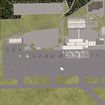
Decent representation of Slovenian airport named after Jozef Pucnik,
located near the village Spodnji Brnik, some 15 miles north of Slovenia's capital Ljubljana.
The scenery is packed with many features: custom landclass in the walley underlying the approach paths to both runways(12 and 30),
custom airport layout as found after last reconstruction of aprons and taxiways, corrected approaches (so IFR AI traffic in case of a missed approach to runway 30 is no longer turning right crashing into the 8000ft mountains just North of the airport). All airport buildings are placed into their correct
locations and shapes, even if only default generic buildings and library objects were used.
You will also notice airport has 3 runways(AFCAD on steroids),when there is actually
only one in reality and only one is also visible in the simulation.
This was done in order to enable different categories of AI aircraft using different intersections
for departure and the only way possible to recreate this was to use overlayed runways of different lenght.
There are also some surprises hidden in the scenery, but we will leave them for you to discover.
Music titles used in the scenery are published with kind permission of the author, Mr.Slavko Avsenik.
Released as freeware but with limited distribution.
LJLJ2012 by SST - Slovenia Scenery Team
| Filename: | LJLJ__Jozef_Puchnik_International_Airport__Ljublja.zip |
| License: | Freeware, limited distribution |
| Added: | 10th June 2012, 15:30:05 |
| Downloads: | 3,476 |
| Author: | SST - Slovenia Scenery Team |
| Size: | 11.35 MB |
| Category: Flight Simulator 2004 - Scenery | |
| Graskop Airfield, South Africa |
|
Images related to this file:
File Description:
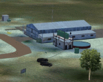
Graskop Airfield does not appear in the default FS2004, neither is the town included which is a pity as the airfield lies right on the edge of a gorge where bungee jumping and even a Gorge-lift (elevator) or a slide across the gorge can be enjoyed by the adrenaline junkies. Added to this, the airfield (and town of Graskop) is merely 10km from the world famous God's Window (also featured in the film, "The Gods must be Crazy").
This package will add a custom (Gmax & Sketchup) made Graskop Airfield, Mpumalanga, South Africa with photoreal textures and ground textures. The included Landclass file will also add the town.
The small airfield has been recreated with custom true to life models and photoreal textures. While being a very small airfield with only one hangar and a large antenna tower, the importance of the airfield far outweighs its size. The airfield plays a vital role in the fight against wildfires as there are water bombers based at the airfield during critical times. In real life the runway is quite challenging, being sloped quite significantly and very narrow, with a one-way-in one-way-out landing and takeoff procedure. Due to the limits within flightsim, the slope could not be replicated but all the other challenges are there.
The asphalt runway is aligned 15/33 and only 800m long by 8.5m wide and sits at an elevation of 4 854ft.
| Filename: | Graskop_Airfield_South_Africa.zip |
| License: | Freeware, limited distribution |
| Added: | 3rd September 2021, 00:55:30 |
| Downloads: | 165 |
| Author: | Kobus van Wyk & Morne van Wyk |
| Size: | 4.13 MB |


© 2001-2026 AVSIM Online
All Rights Reserved
Privacy Policy |