
Where Flight Simulation Enthusiasts Gather from Around the World!
AVSIM Library - Search Results

| Category: Online ATC - Software | |
| VAT-Spy adding airports in ASIA |

|
File Description:
VATSpy addition covers areas:
1) Airports by ICAO code: O
OA - Afghanistan
OB - Bahrain
OE - Saudi Arabia
OI - Iran<
OJ - Jordan
OK - Kuwait
OL - Lebanon
OM - United Arab Emirates
OO - Oman
OP - Pakistan
OR - Iraq
OS - Syria
OT - Qatar
OY - Yemen
2) Airports by ICAO code: R
RC - Taiwan
RJ RO - Japan
RK - South Korea
3) Airports by ICAO code: V
VA VE VI VO - India
VA - Mumbai Center (VABF)
VE - Kolkata Center (VECF)
VI - Delhi Center (VIDF)
VO - Chennai Center (VOMF)
VC - Sri Lanka
VD - Cambodia
VG - Bangladesh
VH - Hong Kong
VL - Laos
VM - Macau
VN - Nepal
VQ - Bhutan
VR - Maldives
VT - Thailand
VV - Vietnam
VY - Myanmar (Burma
4) Airports by ICAO code: Z
Mainland China
ZB -
ZG -
ZH -
ZJ -
ZL -
ZP -
ZS -
ZU -
ZW -
ZY -
ZK - North Korea
ZM - Mongolia
| Filename: | VATSpy_adding_airports_in_ASIA.zip |
| License: | Freeware |
| Added: | 1st July 2014, 15:16:36 |
| Downloads: | 157 |
| Author: | Porutchikov Fedor |
| Size: | 1.06 MB |
| Category: Flight Simulator 2004 - Scenery | |
| The Grenadines Islands Airports V1.1 for use with Antilles 2004 |
|
Images related to this file:
File Description:
This is a self-contained version V1.1 of the airports in the Grenadines chain of islands that I have already posted, modified for use with the Antilles 2004 scenery. I originally made them for stock FS9. The list is Hewanora, Saint Vincent, Bequia, Mustique, Canouan, Union Island, Carriacou, and Maurice Bishop International at the southern end of Grenada. The notes for V1.1 contain some information that should have been included in the first posting. The replacement scenery bgl's include some fixes to Antilles 2004 sea levels where the sea was climbing a hill, additional town landclass for the area close to the airport in Grenada as St Georges now stretches out along the coast, and some revisions to my airports where I found that installing on a second computer gave a slightly different and unsatisfactory result, in particular TVSB on Bequia.
| Filename: | The_Grenadines_Islands_Airports_V11_for_use_with_A.zip |
| License: | Freeware, limited distribution |
| Added: | 7th July 2013, 05:28:12 |
| Downloads: | 572 |
| Author: | Roger Wensley |
| Size: | 17.05 MB |
| Category: Flight Simulator 2004 - Scenery | |
| Siofok Kiliti-Sagvar LHSK |
|
File Description:
Freeware Scenery of Siófok Kiliti-Ságvár airport.This airport is used for general aviation, at Lake Balaton, has grass runway. Only for Flight simulator 2004.
This scenery itself has a large addition to the default LHSK, which only has a runway, this addon has a correct afcad with taxiways, and apron. Also a quite correct, airport with objects,hangars,cars,people,etc…Also added the ILS, and PAPI for runway 33, as in real.I have also included a landclass to change the default „fields” at the place of the city, into a city. This scenery, was made for an aerobatic event ont he IVAO network, so an aerobatic box is also added, above the Lake Balaton. You can remove this box at anytime, via the instructions below. Hope you enjoy this scenery, and will have fun with it.
| Filename: | Siofok_KilitiSagvar_LHSK.zip |
| License: | Freeware, limited distribution |
| Added: | 27th February 2006, 00:36:24 |
| Downloads: | 705 |
| Author: | David Zoltan |
| Size: | 1.3 MB |
| Category: Flight Simulator 2004 - Scenery | |
| The Greater Toronto Area Part 1 |
|
File Description:
Part 1 of Flight Ontario's scenery for the Greater Toronto Area and Southern Ontario.
Over a year in the making, this scenery for Fs 2002 and Fs 2004 is bounded by Detroit in the west, Kingston in the east, Huntsville in the north and Buffalo in the south and features:
* all-season scenery
* custom water textures
* completely modelled Toronto Airports...CYTZ (Toronto Island) and CYZD
(Downsview-home to Bombardier Aerospace and the Canadair Regional Jet
and Dash-8, and the Toronto Aerospace Museum)
* custom autogen for the GTA
* Custom landclass for southern Ontario
* custom shorelines (western Lake Ontario, Kingston area, Lake
Couchiching...Severn River...Sparrow Lake area, and the Muskoka Lake
area)
* prominent features around Hamilton include the Burlington Skyway and
Lift Bridge and steel mills
* the Welland Canal is featured with lift bridges, bascule bridge and
fixed link bridge from Pt Weller to Pt Colborne
* the Niagara area includes the Minolta Tower, and 3 hydro generating
plants with reservoirs
* compatibility with SimFlyers CYYZ
This scenery is downloadable in two parts and both parts are essential
| Filename: | The_Greater_Toronto_Area__Part_1.zip |
| License: | Freeware |
| Added: | 9th April 2004, 12:40:02 |
| Downloads: | 37,177 |
| Author: | Flight Ontario |
| Size: | 62.09 MB |
| Category: Flight Simulator X - Scenery | |
| "IKAROS" Airport |
|
Images related to this file:
File Description:
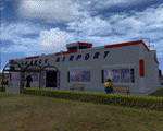
"IKAROS" Airport for FSX SP2
"IKAROS" airport is a private strip, 105km NW of Athens located in the Kopaida plains between the towns of Aliartos, Kastro and Orchomenos and west of Yliki lake. It is a pure general aviation field and the small terminal offers some services and facilities for the convenience of visiting aviators and passengers. The scenery includes a region and landclass bgl for a large area of the Kopaida plains around the airport. Most objects used are custom objects designed from pictures of the real thing. Moving road traffic as well as custom GA traffic are also included.
Note: If you downloaded this file before 10th of March 2011 21:30 GMT then you may wish to re-download. The original file had the hold short lines on the taxiway the wrong way around. The new file will work in your install by just overwriting the old one.
| Filename: | IKAROS_Airport.zip |
| License: | Freeware |
| Added: | 10th March 2011, 22:20:44 |
| Downloads: | 2,346 |
| Author: | Vassilios Dimoulas |
| Size: | 8.96 MB |
| Category: Flight Simulator 2004 - Scenery | |
| FS2004 Ernest Harmon Air Force Base and Stephenville Airport CYJT |
|
File Description:
FS2004 Scenery--Ernest Harmon Air Force Base and Stephenville Airport (CYJT), Newfoundland, 1957-62. Originally built to facilitate the transport of US aircraft to Europe during the Second World War, during the Cold War Harmon was the biggest US base outside the USA. Like nearby Gander it was a vital refuelling point for transatlantic crossings, but also an important part of the defences against the threat of Soviet bombers carrying muclear weapons attacking the USA via the North Pole. F-89 Scorpions and then F-102 Delta Daggers were based there, and this download includes F-89s especially made for this scenery by David Wooster. It also has custom landclass adjustments by Al Von Pingel and many custom buildings by Dan French. Flight plans are provided for 1957, 1959 and 1962, doing much to recreate this significant Cold War base as it really was. By Al Von Pingel, Dan French and Ken Lawson.
| Filename: | FS2004_Ernest_Harmon_Air_Force_Base_and_Stephenvil.zip |
| License: | Freeware |
| Added: | 10th October 2021, 17:08:19 |
| Downloads: | 212 |
| Author: | Al Von Pingel, Dan French and Ken Lawson |
| Size: | 23.96 MB |
| Category: Flight Simulator 2002 - Miscellaneous Files | |
| Los Angeles Terminal Area Chart |
|
File Description:
The rendition of Los Angeles´ KLAX airport is one of the most detailed in FS2002 and a great starting point to explore the West Coast. The library hosts a few awesome landclass and mesh files for this area that offer an "as real as it gets" VFR experience if used with this chart. The 1:250.000 scaled chart is scanned in high resolution (8400*4700 pixel). It covers a much smaller area, but offers considerably more detail than the LA sectional. You may use this chart "as is" without any other software, but it will develop its full potential if used as moving map with SimSystem´s FSFlightMax or FSGarmin. It wouldn´t have been possible to offer this chart without Richard Harvey and his love to flightsimming, so please consider this file to be "donationware" and make a however small contribution to the Richard Harvey Endowed Scholarship.
| Filename: | Los_Angeles_Terminal_Area_Chart.zip |
| License: | Check within download |
| Added: | 30th March 2003, 15:27:19 |
| Downloads: | 1,472 |
| Author: | Uwe Rademacher |
| Size: | 28.03 MB |
| Category: Flight Simulator X - AFCAD Files | |
| PASD - Sand Point, Alaska |
|
Images related to this file:
File Description:
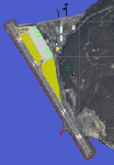
The airport of Sand Point (PASD) has been extended since Microsoft has modeled it and even after the upgrade through Scenery Solution's Ultimate Terrain X Alaska has been produced. This AFCAD is built on the UTX version of the airport and is intended to be used in this environment only.
The file considers the extended runway, VASI4 at both ends with 3.6 deg glideslope and the necessary new water-polygon. Due to the specific coastline bitmaps used by UTX I had to change to Microsoft's default ones being accessible through the wonderful tool Airport Design Editor X. Some additional landclass in the airport's vicinity and three (default) buildings close to the apron are completing the changes. I did not touch the easterly landing stage (or whatever it could have been) even if Google suggests that it disappeared meanwhile except some remaining piles in the water - it's just looking nice. ;-)
| Filename: | PASD__Sand_Point_Alaska.zip |
| License: | Freeware |
| Added: | 17th October 2013, 18:55:00 |
| Downloads: | 377 |
| Author: | Axel Birsul |
| Size: | 646.25 KB |
| Category: Flight Simulator 2004 - Scenery | |
| Arviat CYEK in Nunavut, Canada |
|
Images related to this file:
File Description:
Arviat is a small town on the west coast of Hudson Bay in Nunavut, around 90 miles south of Whale Cove, 130 miles south of Rankin Inlet, and 160 miles north of Churchill. The airfield is just south of the town, and the 4,000 feet of gravel runway is aligned 149T/329T; these are true bearings and not magnetic as Arviat is just inside the Northern Domestic Airspace zone. There is 100LL fuel available in drums, with 2 hours prior notice. The visiting AI airline is Calm Air, plus a cargo delivery by Buffalo Air. As a town of 2,200 people is too large to model I have used a landclass with autogeneration. The result includes some trees, which is not realistic, but there was no way out. There is a special note in the instructions regarding Flight Ontario replacement textures and "glowing" gravel aprons.
| Filename: | Arviat_CYEK_in_Nunavut_Canada.zip |
| License: | Freeware, limited distribution |
| Added: | 6th January 2012, 16:13:45 |
| Downloads: | 507 |
| Author: | Roger Wensley |
| Size: | 2.19 MB |
| Category: Flight Simulator 2004 - Scenery | |
| Baker Lake CYBK in Nunavut, Canada |
|
Images related to this file:
File Description:
Baker Lake is the only Nunavut community that is not next to the sea. It is, as you might have guessed, on the shore of Baker Lake and 160 miles west and a bit north of Rankin Inlet on the shore of Hudson Bay (a recent post by Sid and Pete). The Hudson Bay Company opened a trading post there in 1916 and the town slowly developed, though as recently as 1946 the population was still only 32. These days the airfield is the support field for several nearby mines and there are now nearly 1,800 folks in Baker Lake using the stores, schools, churches, hospital, etc. The runway is almost 4,200' of 100' wide gravel and lighted; the alignment is 162T and 342T as this is in northern domestic airspace and bearings are given as 'true" and not "magnetic". Both JETA and 100LL fuel is available. The town is to the northeast of the airfield and is made up of a landclass without autogeneration, as this would mean a bunch of trees that would be, to say the least, unrealistic.
| Filename: | Baker_Lake_CYBK_in_Nunavut_Canada.zip |
| License: | Freeware, limited distribution |
| Added: | 23rd November 2011, 09:21:56 |
| Downloads: | 515 |
| Author: | Roger Wensley |
| Size: | 2.45 MB |


© 2001-2026 AVSIM Online
All Rights Reserved
Privacy Policy |