
Where Flight Simulation Enthusiasts Gather from Around the World!
AVSIM Library - Search Results

| Category: X-Plane - Scenery | |
| WXPJ Susi Air Puncak Jaya Mining Airstrip v1.0.0 |

|
Images related to this file:
File Description:
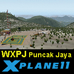
This is an X-Plane 11 scenery for Puncak Jaya Mining Airstrip (WXPJ) in the Puncak Jaya mountain region of Papua, Indonesia. This is a fictitious airfield, located in a high altitute mining location in Papua. At 4884 metres (16024 ft) above sea level, the Puncak Jaya peak, next to the mining location, is the highest mountain in Indonesia, on the island of New Guinea (which consists of the Indonesian West Papua region plus Papua New Guinea). This fictitious airfield may serve as a high altitute mining location challenge while flying the airstrips in Papua, as one of the destinations for "PT ASI Pujiastuti Aviation", operating as Susi Air, an Indonesia airlines established in late 2004 by Mrs. Susi Pudjiastuti. This scenery was tested and is operational (as of January 20, 2017) in "X-Plane 11 Public Beta #6 64 bit", Windows 10 Home. It was also tested and is partially operational (as of January 20, 2017) in "X-Plane 10.51 64 bit", Windows 10 Home. The issue with XP10 is the mesh again: there is no mine mesh, just a whole. The feel is very different from XP11, but it is still operational in XP10 to fly in and out.
| Filename: | WXPJ_Susi_Air_Puncak_Jaya_Mining_Airstrip_v100.zip |
| License: | Freeware |
| Added: | 21st January 2017, 18:42:35 |
| Downloads: | 58 |
| Author: | Rui Mesquita |
| Size: | 2.2 MB |
| Category: Flight Simulator X - Flight Plans | |
| Flying For Furs.....A Danger in the Mountain Gorges, Ravines, and Canyons of The Canadian West... |
|
File Description:
Joshua Buckhorn is getting ready for his trip into the Canadian Wester Fur Route. As a trader of furs and FBO owner things up here in North Washington
are hard in this year of 1949. Just 5 years ago he was flying a huge B-17 over Germany. Now a new life has brought him into the dangers on Bush Flying.
As always before these flights, new oil and spark plugs must be placed in the plane, tyres must be just right and the fuel tanks got to be full to the top.
It is 5:45 AM and a big breakfast is a must before the flight, eggs, grits, potatoes, ham, bacon and NO beans since the gas they produce will disrupt the fligh. And don´t forget the "P" Bottle.----I hope you know how to balance a plane with all those furs and hides you will acquire in this trip full of danger in approaches and take offs from, indeed, very dangerous fields. ( Bonus you get 4 new airports for future flights if the business pays off)..:)
| Filename: | Flying_For_FursA_Danger_in_the_Mountain_Gorges_Rav.zip |
| License: | Freeware, limited distribution |
| Added: | 22nd August 2008, 23:09:46 |
| Downloads: | 1,078 |
| Author: | Gera Godoy Canova |
| Size: | 365.52 KB |
| Category: Flight Simulator 2004 - Flight Plans | |
| World Challenge Suriana |
|
File Description:
Suriana a beautiful country to do the next challenge in. Here you find yourself flying over rivers to make a landing and flying though the mountain region. Most flight can be done with a Extra 300s but to enjoy the beauty of this country take a Cessna,Baron,or piper. I have added maps and some very useful information about some of the airfields you will be flying into. There are only 8 airfields that you will be flying into, but only five of them are dirt landing strips. This is part of the eastern challenge three country swing going into Brazil.
| Filename: | World_Challenge_Suriana.zip |
| License: | Freeware |
| Added: | 1st July 2007, 00:00:41 |
| Downloads: | 171 |
| Author: | Hosea Robertson |
| Size: | 222.17 KB |
| Category: Flight Simulator 2004 - Scenery | |
| LeVersoud v1 LFLG |
|
File Description:
Nestled in the beautiful Gresivaudan valley, Le Versoud airpark is 10 Km ENE of Grenoble (France) and boasts quick access to the high tech industries in the area. It is the main stop for all pilots who enjoy mountain flying and serves as a base for glider pilots as well.
There are two runways of 900 m, one grass and one asphalt.
The scenery offered here is an exact photorealistic reproduction of the air park right down to the nozzles on the fuel pump and road signs!
It also includes the official visual landing chart and aid for complete installation.
| Filename: | LeVersoud_v1_LFLG.zip |
| License: | Freeware |
| Added: | 31st May 2004, 03:22:56 |
| Downloads: | 4,120 |
| Author: | Jean Ambros |
| Size: | 4.39 MB |
| Category: Flight Simulator 2002 - AFCAD Files | |
| Big Bear Lake, CA USA (L35) |
|
File Description:
This AFCAD file & VP update increases the number of parking/gate spaces from 6 to 18. This file also adds tower, ATIS, clearance, approach/departure, and ground control frequencies. Big Bear Lake City is a small sized municipal airport it is perfect for general aviation aircraft and learjets. . Located in the mountains just east of Los Angeles California, at an altitude of 6748 ft. Big Bear Lake is a ski resort in the winter and a mountain biking resort in the summer. Also included with this .zip file are two EditVoicepack (VP) updates for Big Bear City - L35.
| Filename: | Big_Bear_Lake_CA_USA_L35.zip |
| License: | Freeware, limited distribution |
| Added: | 17th December 2002, 13:23:51 |
| Downloads: | 1,014 |
| Author: | Joshiese |
| Size: | 25.81 KB |
| Category: Flight Simulator 2004 - Aircraft Repaints, Textures and Modifications | |
| Swiss International Air Lines Airbus A340-642 |
|
File Description:
This is the Commercial Level Simulations A340-600 in the colours of Swiss International Air Lines. Their predecessor Swissair was one of the launch customers for the A340-600, yet they couldn't take up any of the aircraft they ordered due to their bankruptcy. This particular A340 is registered as HB-JMN (following the registration sequence of the A340-300s Swiss has in real life) and is named after the Swiss mountain Fletschhorn. This is a textures only pack. For more information on how to install and to purchase the CLS A340-600, please read the included readme.
| Filename: | Swiss_International_Air_Lines_Airbus_A340642.zip |
| License: | Freeware, limited distribution |
| Added: | 30th March 2006, 23:58:53 |
| Downloads: | 2,916 |
| Author: | Richard Di Biase, Commercial Level Simulations |
| Size: | 5.47 MB |
| Category: Flight Simulator 2004 - Scenery | |
| LTFD - Edremit Korfez Airport |
|
File Description:
Edremit is a district in the coasts of Aegean Sea, linking to Balýkesir province, in the Marmara region of TURKEY.
Korfez Airport(LTFD) is located in between Kaz mountains and the gulf of Erdemit.
Edremit was founded in BC 1443 with the name of Adramyteion.Here was the most important settlement at that time.
Geographical characteristics of Edremit are determined by Kazdaðý
(Goose Mountain) which enclose the location in north direction.
The South part of Kazdaðý that commands the Gulf is ripped by innumerable deep valleys.The streams sourced from Kazdaðý give life to Edremit Gulf by passing canyons, flowing over waterfalls.
| Filename: | LTFD__Edremit_Korfez_Airport.zip |
| License: | Freeware |
| Added: | 22nd April 2008, 17:36:45 |
| Downloads: | 1,254 |
| Author: | Gökhan Bayrakdar |
| Size: | 7.19 MB |
| Category: Flight Simulator X - AFCAD Files | |
| SABA ADE Update |
|
File Description:
This is an update of Saba Island airport for FSX made with ADE by Jon Masterson. The airport has been raised to its real world height and moved seawards so that take off from R30 is not aimed straight at the mountain. Parking spaces have been added to enable AI and other default FSX scenery objects have also been added. At 396m the runway is probably the shortest commercial runway in the world and presents a challenge to all pilots to make a precision touchdown. Happy landings! Open zip to a temporary folder - installation_readme.txt within zip.
| Filename: | SABA__ADE_Update.zip |
| License: | Freeware |
| Added: | 10th June 2008, 16:01:53 |
| Downloads: | 827 |
| Author: | Colin Dietrich |
| Size: | 1.35 MB |
| Category: Flight Simulator 2004 - Aircraft Repaints, Textures and Modifications | |
| Yeti Airlines BAe Jetstream 41 |
|
File Description:
Yeti Airlines BJ41 aircraft repaint and flightplan for Just Flight's TRAFFIC program. You must also have the Commuter airline addon pack. Yeti Airlines is Nepal's market leader in domestic airline industry of the country and has more than 60% of the total market share as of January 2007. It has the widest domestic flight network and flies to almost all destinations in Nepal. The airline has served much to the isolated population of Nepal living in far-flung mountain areas by providing the only means of transportation. They have also received permission for international operation in the year 2007.
| Filename: | Yeti_Airlines_BAe_Jetstream_41.zip |
| License: | Freeware |
| Added: | 8th October 2008, 15:20:41 |
| Downloads: | 212 |
| Author: | John O'Leary |
| Size: | 348.95 KB |
| Category: Flight Simulator 2004 - Scenery | |
| Turangi Airfield, New Zealand. NZTN. (to fit Turangi Photoreal area scenery, by Robin Corn) |
|
File Description:
Welcome to Turangi Airfield, 1nm North of the township of Turangi, at the southern end of the
beautiful Lake Taupo, in the central North Island of New Zealand.
The airfield is home to the Turangi Aero Club, and is served by Mountain Air, undertaking tourist flights
around the National Park and central North Island volcanoes, and flights to the Chateau and skifields
at Mount Ruapehu.
This scenery is built to fit into the freeware "Turangi" photoreal area scenery by Robin Corn, freely available
from avsim.com, filename...... godzoneturangi.zip . Requires some EZ Scenery Object sets (see INSTALL instructions for details).
| Filename: | Turangi_Airfield_New_Zealand_NZTN_to_fit_Turangi_P.zip |
| License: | Freeware, limited distribution |
| Added: | 7th November 2008, 22:48:37 |
| Downloads: | 664 |
| Author: | Lawrie Roache |
| Size: | 3.01 MB |
© 2001-2026 AVSIM Online
All Rights Reserved
Privacy Policy |